out and about - 2018
09 March 2018 .............. Around Penrhosfeilw Common
It was a rather grey day, but I had a good walk around the coast of the Penrhyn Mawr peninsula - which I think is also known as the Range - and I found various features in the cliffs that I didn`t know existed even though I have been there before, so it was quite interesting from that point of view.
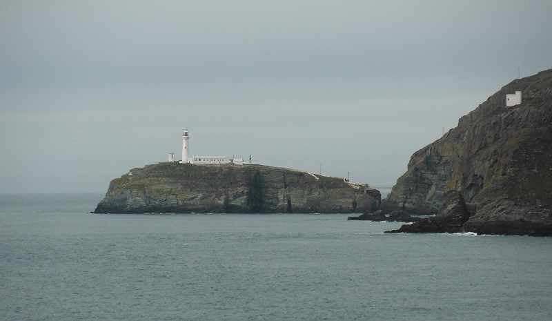
From the car park a well defined path leads northwest, eventually getting to the coastline at the beginning of Abraham`s Bosom - and that classic view across to South Stack -
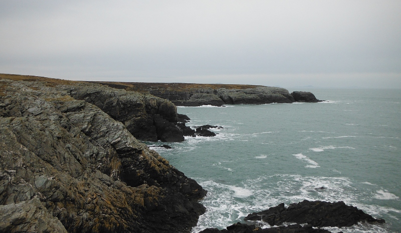
Starting to head along the coast in what is I supppose you could say was an anti-clockwise direction, and on a bit of a point looking down the coast to the south - it is a super bit of coastline, with cliffs and caves and stacks and deep gashes into the cliffs -
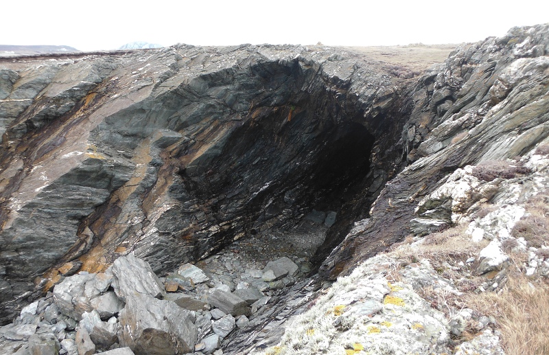
Looking down in to a very big cave, unfortunately now cut off from the sea by the huge chunks of rock that have fallen off the cliffs - in amongst the boulders there is a huge block of polystyrene - presumably from Holyhead Marina.
It would be good to abseil down into the inlet, get a rope round the block, and get a number of people to haul it up.
It has been a while since I did any SRT - getting down would be okay, I wonder if I could prusik or jumar back up again now with a dodgy hip joint.
I did wonder about it when I was there, but couldn`t see anything that could be used for a belay, the rocks are all leaning over and pointing towards the drop.
Maybe it could be reached from a small boat at a Springs high tide.
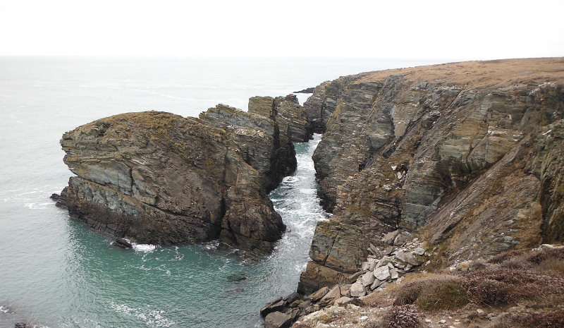
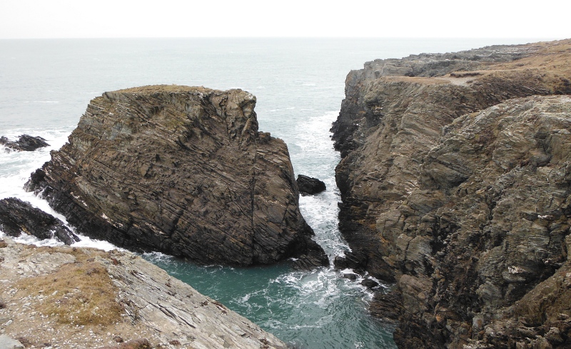
Looking down on the three stacks in a line that form a hidden passage along the bottom of the cliffs - the ends of the hidden passage dry out at lower tide levels, but the middle section has water in it at all tide levels.
One of the features that you can`t see from the cliff top path is the amazing folding of the rocks at the back of the hidden passage, you can only see them if you are down there in a boat, looking up at the cliffs.
A bit further along, another stack - and this is one of the features that I didn`t know existed, even though I paddled along that bit of the coast several times.
This would have been close to high tide a couple of days before Neaps, so not a big tide - it was predicted to be 4.5 metres at Holyhead. I wonder if you could paddle through the gap during a much higher Springs tide with a tide height of 5.5 or 6 metres.
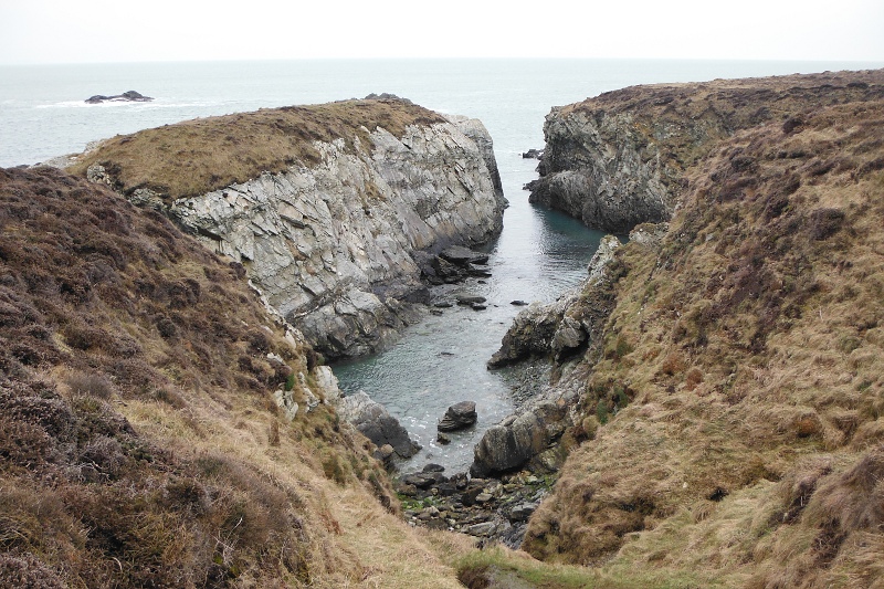
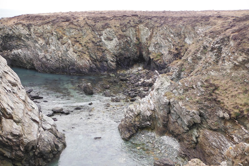
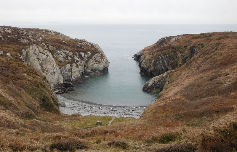
Further along, and a deep inlet with a small beach at the end - another feature I didn`t know existed -
This is the deep inlet at the back of Penrhyn Mawr - it dries out below about a 4 metre tide height -
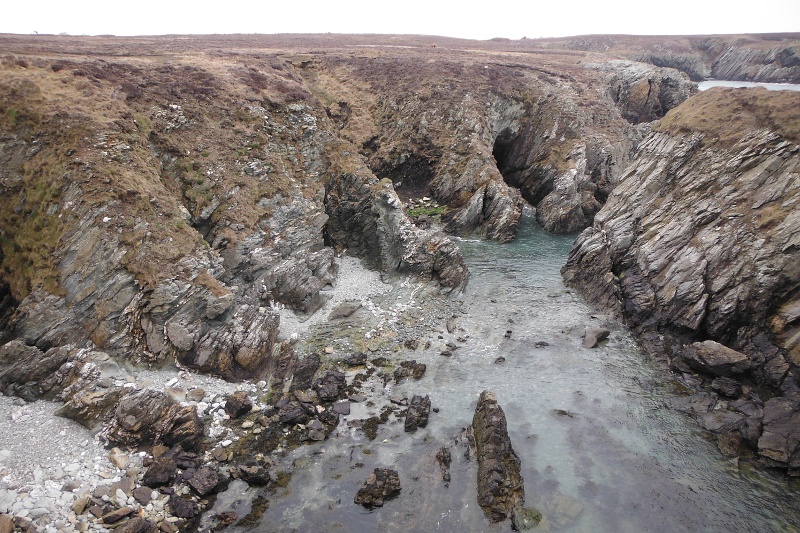
There is quite a strange recent event with this inlet - up until sometime in January, there was a distinct stoney beach on one side of the inlet, but now it has all gone, leaving behind surprisingly jaggy rocks and boulders - not very nice - here are a couple of views looking down to where the beach used to be -
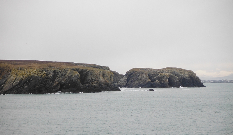
Past Penrhyn Mawr now, and the view is opening up to the south - particularily across to Dinas Stack, the site of a prehistoric hill fort -
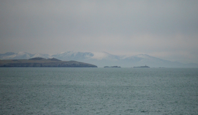
A bit further away to the south, and a good view of Rhoscolyn Head and the various islands around there, including Maen-y-frân and Ynysoedd Gwylanod, with the snow covered summits of the Nanttle Ridge away at the back -
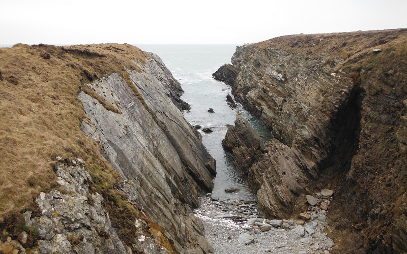
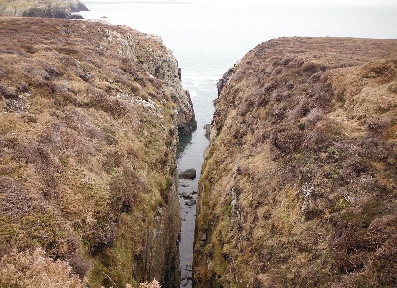
A bit further along the coast now, and a quite surprising very narrow gash cuts right into the cliffs -
This was as far as I went - Porth Ruffydd - a good landing place at all tide levels.
I only discovered this when I was digging around on Google whilst writing up this blog, but there was a lifeboat station in this bay up until 1953 - it would have been a good place for one, sheltered, and accessible at all tide levels.
It perhaps explains why, if you see it at low tide tide, there is an obvious man-made path through the boulders at the entrance to the bay.
A bit of a footnote - also thanks to Google I discovered a few other things about this area - firstly, that this whole flat peninsula is called Penrhosfeilw Common, it is owned by Anglesey Council, and is leased to the RSPB.
Secondly, the whole area is part of the Holy Island Coast Special Area of Conservation and Special Protection Area, and is a site of Special Scientific Interest.
From the BMC website I also found out that there is an exclusion agreement from 01 February until 31 July due to nesting birds - I didn`t know it was used by climbers at all. I didn`t see any signs that suggested you shouldn`t be walking around the cliff top paths - if it is a legal Common then presumably there is a right of access over it, and it is a good section of the coastal path.
website design by ron-t
website hosting by netnerd.com
© 2025 Ron Turner
![]()
![]()