out and about - 2018
14 January 2018 .............. Limeslade Bay to Langland Bay
The sunshine didn`t last, and later on in the afternoon there was a thin layer of high altitude cloud which made for some rather grey lighting.
However I wasn`t going to waste the fact that it wasn`t raining, so I headed off along the coastal path that goes round the side of the hills well above the sea - it is a good well made path with a super outlook over the Bristol Channel, and runs between Limeslade Bay and Langlands Bay.
Somewhere quite far along the path, there was a good blow hole in the rocks where the rough sea was causing some good blasts out of the hole.
I went most of the way to Langland Bay, but not the whole way, and came back over the path across the top of the hills - it is quite rough and muddy in places, and very slippy when wet, almost dangerously so at one end - however it wasn`t too bad on this occasion.
I can`t work it out from either my map or from various websites - but the hill may be called Rams Tor - or else the name Rams Tor refers to some sea cliffs down below the coastal path.
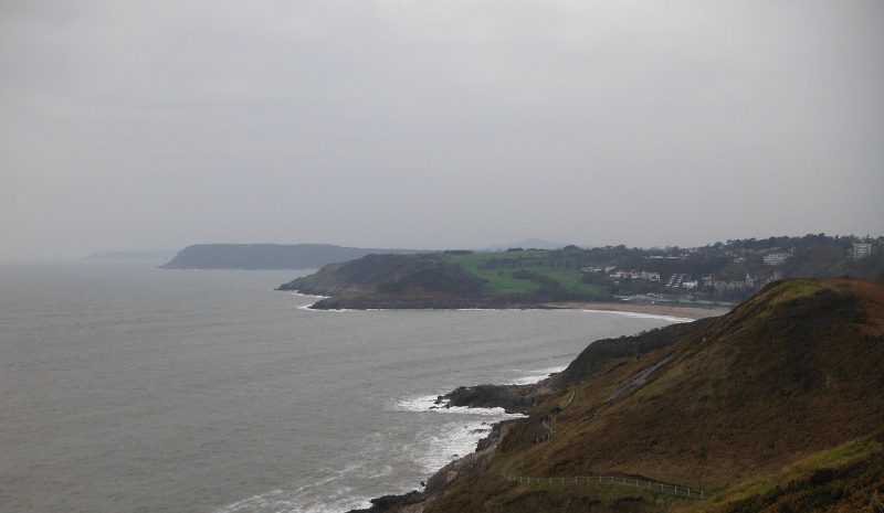
I can`t remember, but I think I must be on the higher top at this point looking out past Langland Bay and away along the south coast of Gower - the first pair of headlands just beyond Langland Bay are Snaple Point and Whiteshell Point.
The second more distant headland is I think Pwlldu Head, and away in the distance the faint headland would be Oxwich Point.
You can see down to the coastal path as it winds its way around the hillside - the line of posts mark its route.
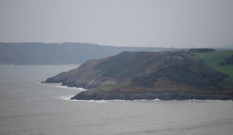
Here is a closer view of Snaple Point and Whiteshell Point - it is quite a useful picture because it shows the next bit of the coastal path between Langland Bay and Caswell Bay.
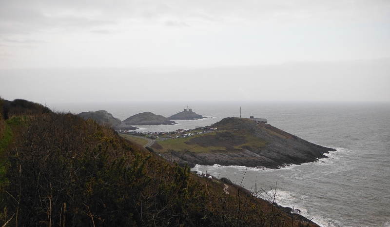
I am over the top of the higher hill, and heading back towards Limeslade Bay now, and a bit of a view along the hillside to the outcrop with the coastguard station on it, and beyond Bracelet Bay the chain of summits that lead out to Mumbles Lighthouse.
It is a good section of the coastal path and was a worthwhile hour out.
website design by ron-t
website hosting by netnerd.com
© 2025 Ron Turner
![]()
![]()