out and about - 2017
23 April 2017 ............ Penmaen Mawr quarry
I have wanted to go up Penmaen Mawr for a wee while now, since I started to confuse myself about the quarry.
Some websites claim that Penmaen Mawr used to be 1500 feet high, and that quarrying has reduced the height by 500 feet.
Yet way back in time I was told by relatives who lived on Anglesey that the sort of nipple of rock that sticks up above the rest of the summit was deliberately left there because it was the original highest point of Penmaen Mawr.
Now it would appear that these two claims are incompatible - and I have been curious to find out what the real situation is.
So this webpage is a report on my trip up to the quarry - it was a beautiful day, the weather forecast was promising snow and gales starting on the next day, so I reckoned that this was as good a day as any.
The only slight snag with the weather was that the very bright sunshine has made some of the photographs rather contrasty because of the big differences between light and shade.
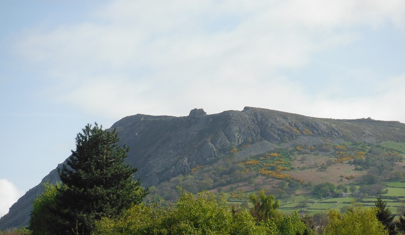
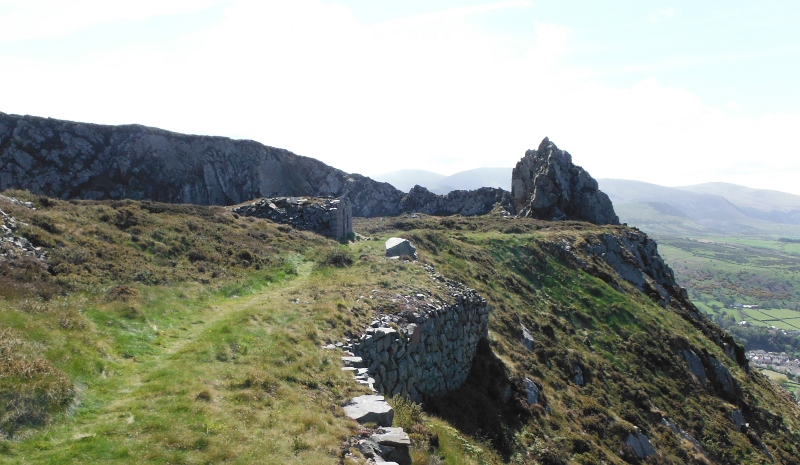
Heading along the road into Llanfairfechan, and at one point you can look up at Penmaen Mawr, you can see the edge of the quarry, and you can see that big fang of rock sticking up above the rest of the hill.
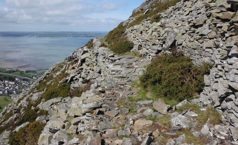
Getting up there is a bit of a trek, you obviously can`t climb straight up, so you have to follow various paths up through the trees, then round to the shallower slopes along the west end of Penmaen Mawr.
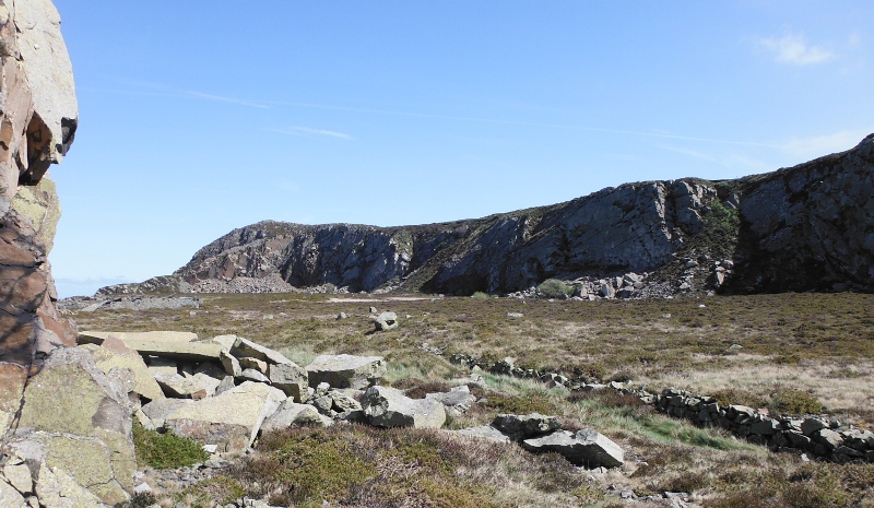
Once well up, there is a high level path which contours round the west end of Penmaen Mawr, and eventually brings you up onto the top tier of the quarry.
It appears that the path was created by the quarry as a way up, there are several places where you are walking along just above built walls that hold up the path.
Here is a fairly typical bit of it -
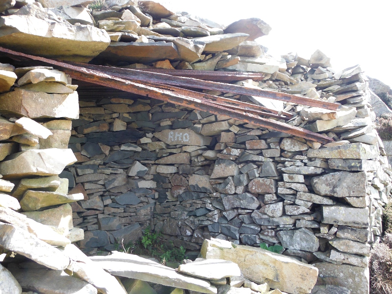
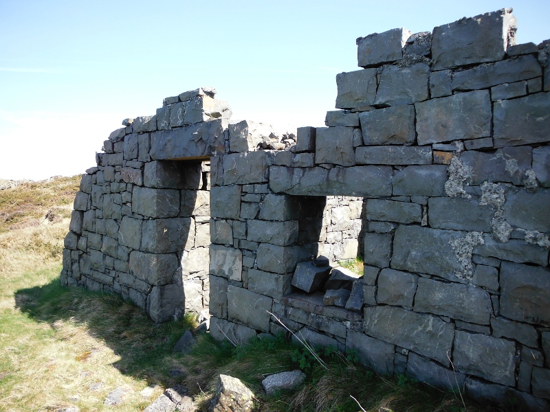
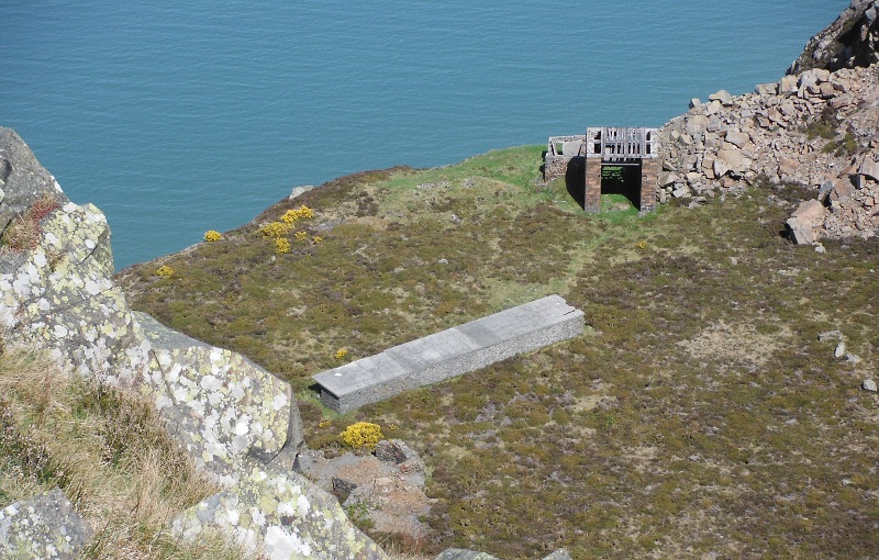
And the remains of a shelter - presumably built for shelter when they were blasting.
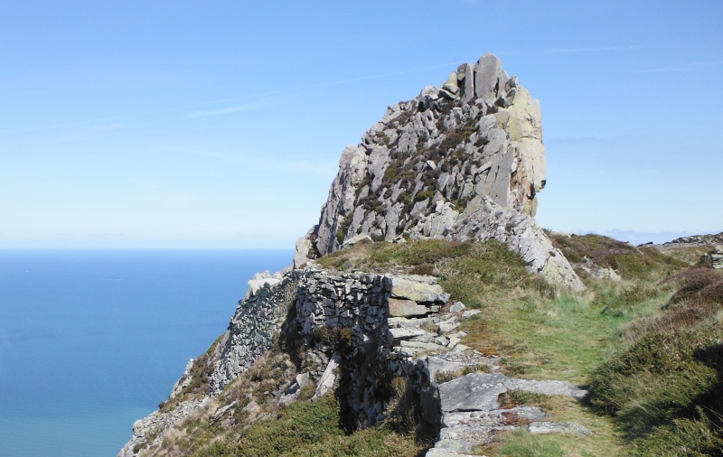
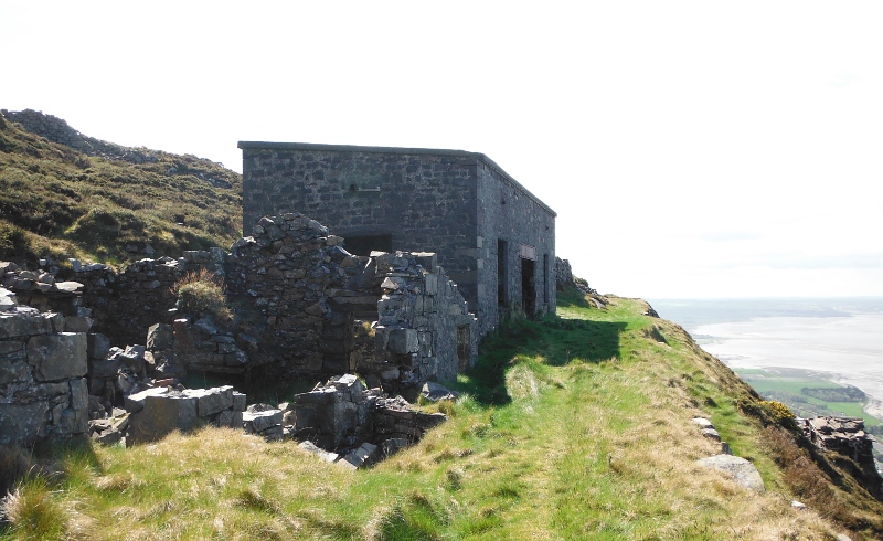
As you get to the top tier of the quarry, the fang of rock is the first thing that greets you - apart from the fact that I don`t seem to have pointed my camera in the right direction, you don`t really get any idea of how big it is from this picture - it is a lot bigger than it looks here.
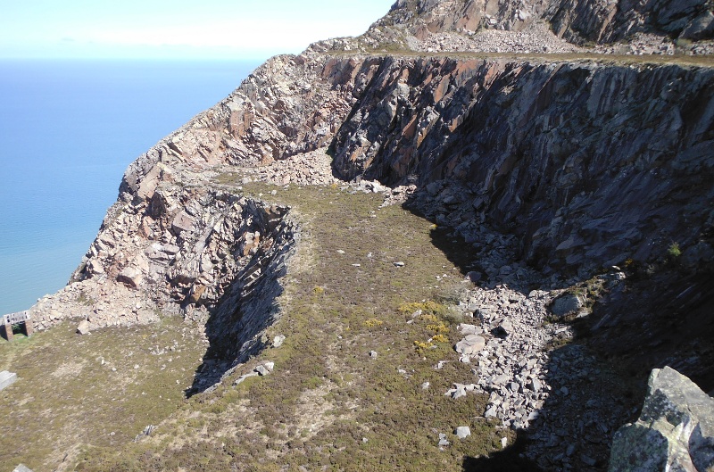
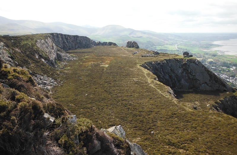
The second thing that greets you is the huge area of the quarry floor - very flat. with the quarry crags along the back wall.
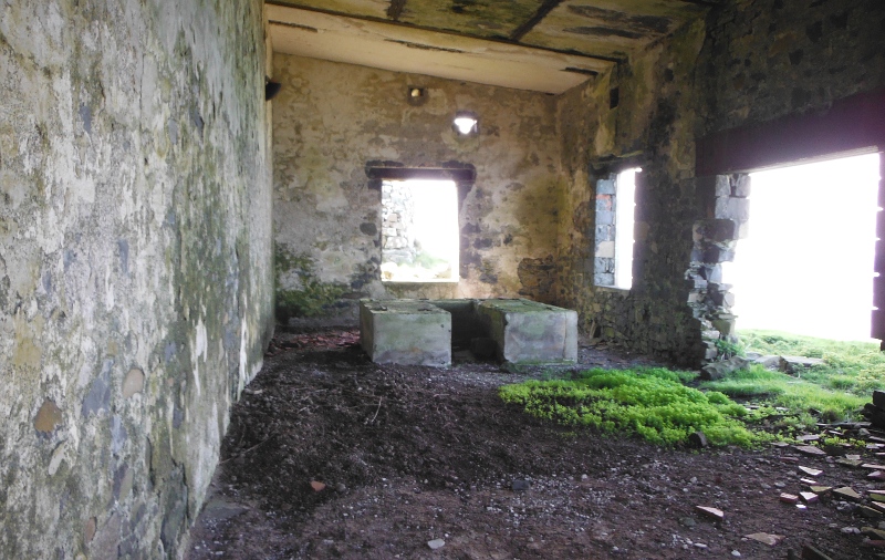
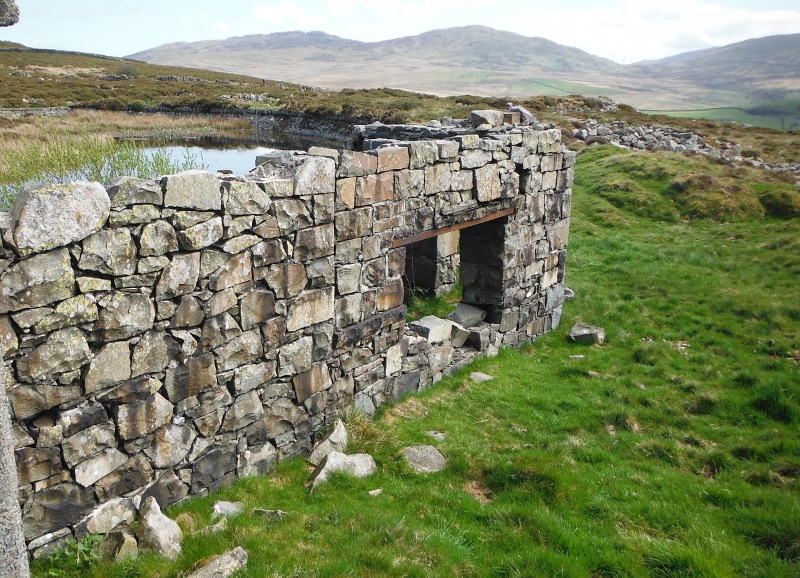
Away across the flat quarry floor you meet some of the quarry buildings - here is the remains of one - and the noticeable thing is the very high quality of the masonry work.
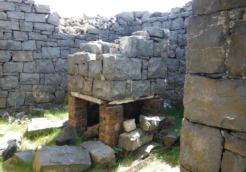
Inside one of the buildings is a what I think is some sort of fireplace, the stones above the bricks are obviously forming a chimney.
Would it have had some industrial purpose, or was it there so the workers could heat up their bacon butties ?
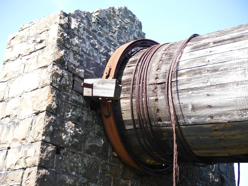
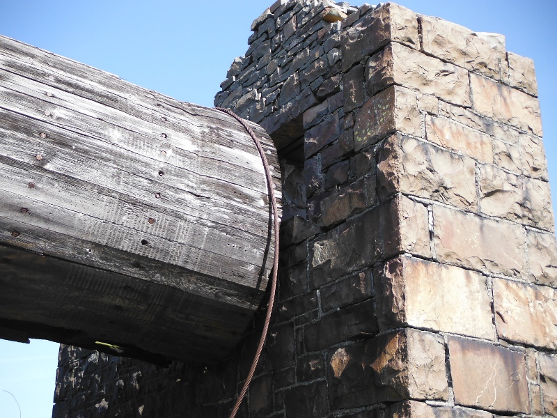
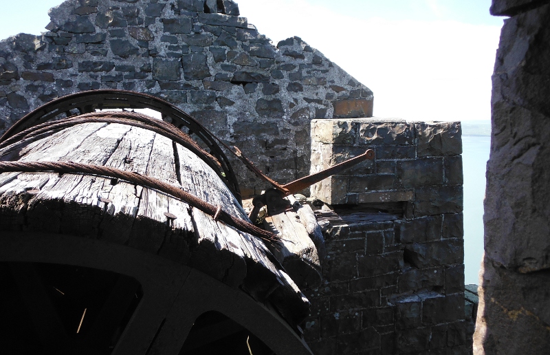
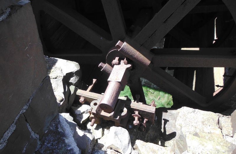
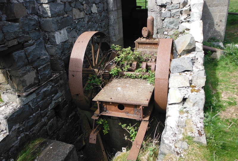
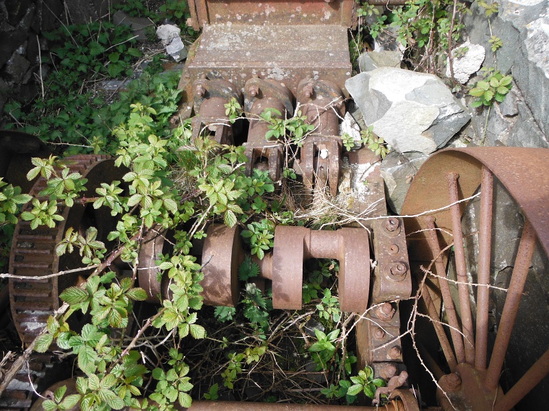
A bit further along, and probably the most interesting of the man-made structures still standing - a winch.
Again, very nice masonry work.
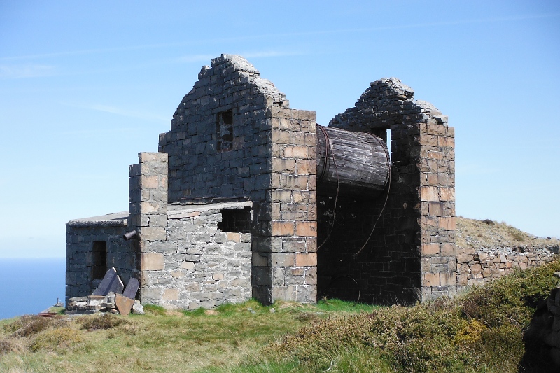
The stone work may be good, but I don`t think that the engineering of the winch is as good as the winch I saw at Llanberis quarry.
This is one end of the drum, and the passive end of the brake -
The other end of the drum -
The brake lever -
Inside the drum -
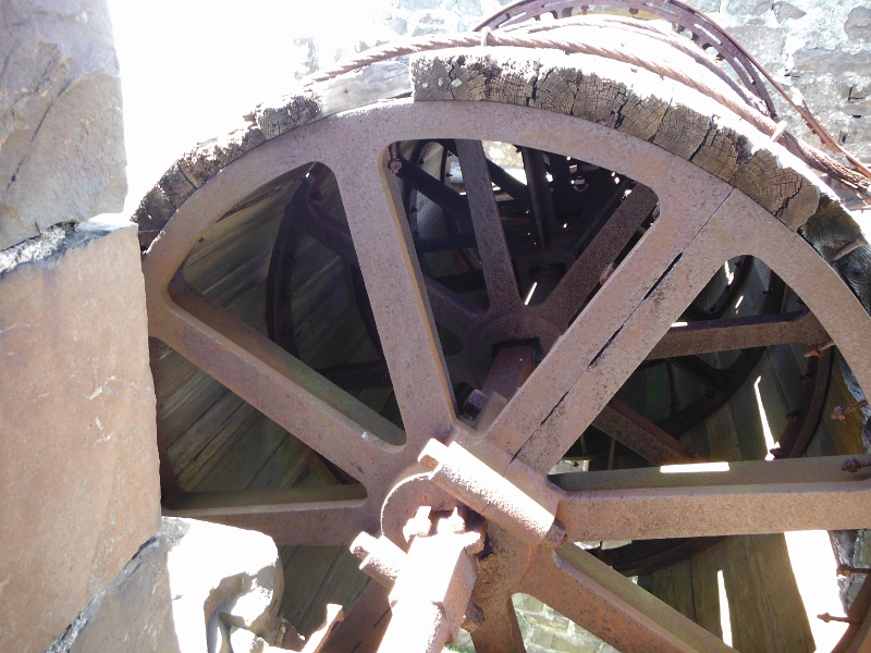
What`s left of one of the bearings - although there are parts of it missing, it just doesn`t have the quality of the bearings of the Llanberis winch.
The winch is right above the drop down, and they had to built a walkway to get round it. I wonder if it had a hand rail, or if they didn`t bother with such niceties in those days.
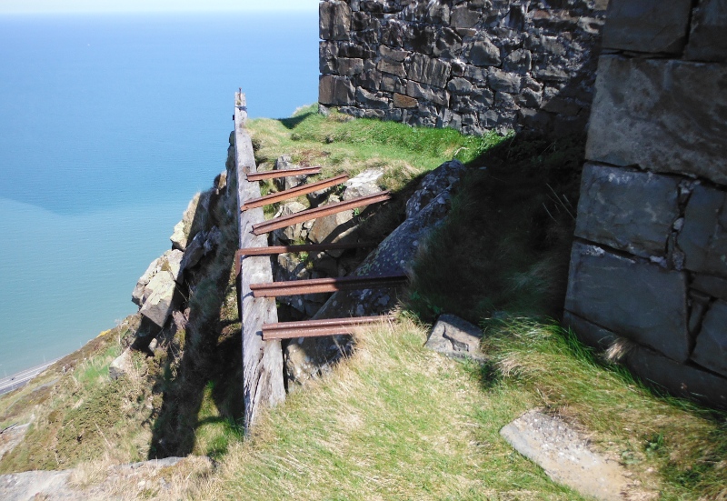
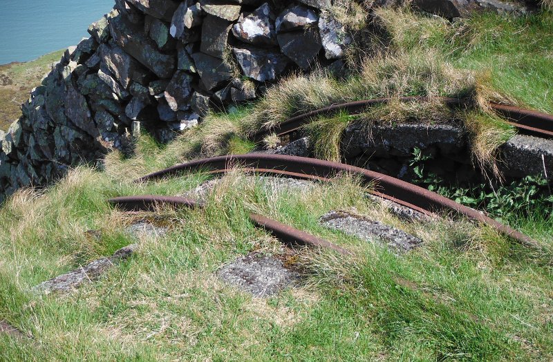
Another difference from the Llanberis winch - the Llanberis winch used triangular shaped trolleys on the incline, so that the top of the trolley was level.
They obviously didn`t do that here, as the rails are bent round the hillside - so the trolley would start off flat at the top, then as it went down it was steeply inclined.
Looking back along the edge of the top tier to the fang of rock -
Heading further along now, and two lower tiers of the quarry are now revealed.
A couple of buildings away down on the lowest tier - there didn`t appear to be any kind of walkway or staircase between the tiers, I guess the workers were good at climbing or scrambling up and down.
Further along, and another view of the lower tiers -
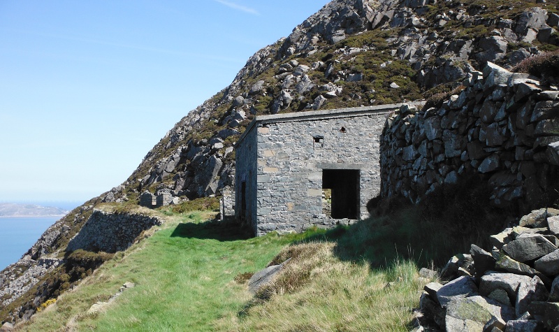
Right round at the far end of the top tier now and along a well worn path to some more buildings - mostly pretty ruined now, but what must have been the power house is still in good condition.
Looking back -
The small white bar on the wall in the above picture was the support for two electrical insulators - I don`t know if these were for an incoming mains cable which came away up the hill, or whether the electricity was generated inside the power house, and these insulators carried the power away to be used around the quarry.
But which ever it was, there was some quite heavy machinery inside the power house.
There is a bit of a path which continues on round the side of the hill, I don`t know where it ends up.
I didn`t go that way, I followed the remains of another path that climbed up above the power station, and eventually gets up to a bit of a hilltop.
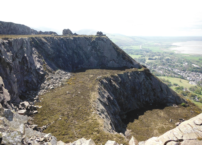
Part of the way up, and a look back at the top tier of the quarry, with the fang of rock sticking up away at the far end, and the winch house perched right on the edge of the incline.
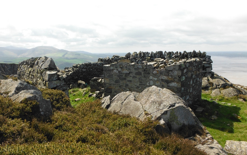
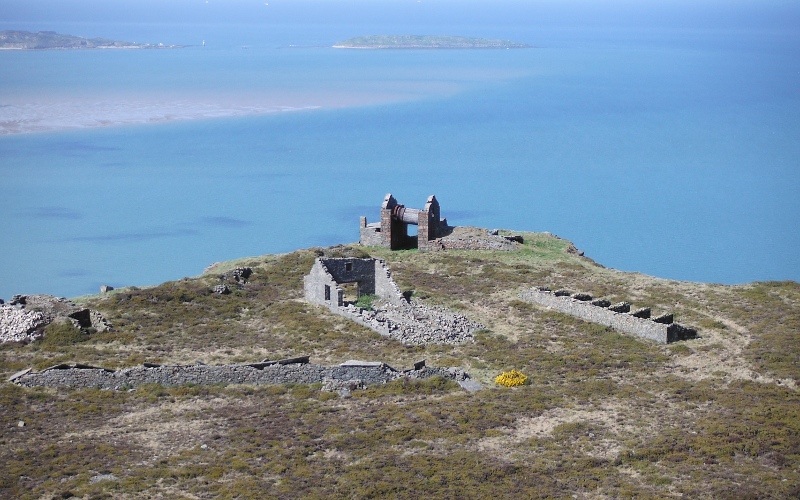
Up at the top of this hill, and another building - was it a look-out point for something, maybe it had nothing to do with the quarry.
Now this is looking away to the east - and it was looking at this view that it finally dawned on me - there are two quarries on Penmaen Mawr, and they are quite separate - there is several hundred metres of hillside between them.
So have I been a bit slow ?
The quarry you see when you are looking up from Llanfairfechan is a very old quarry, that obviously hasn`t worked for a long time, and is the one I have just described in all the above pictures.
The quarry you see from Penmaenmawr has gone on working much more recently - looks like another visit is called for.
I thought about heading across the hillside to get to the top of this other quarry, but soon gave up the idea.
About 95% of Penmaen Mawr is covered with gorse - not the type of gorse that you see all over the place with bright yellow flowers.
The gorse on Penmaen Mawr is much lower - it varies between about 200mm high and about 700mm high, it is very dense, and very spikey, and a total nightmare to go through if you are not on a path.
And the few paths are dissappearing under it.
So I turned away and headed around the top of the crags at the back of the upper tier - sometimes through grass, mostly fighting the gorse.
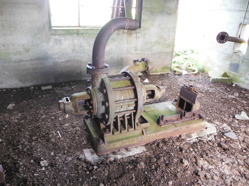
Eventually I came to what must have been a reservoir for the quarry, with two pump-houses.
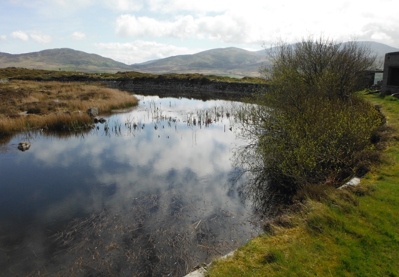
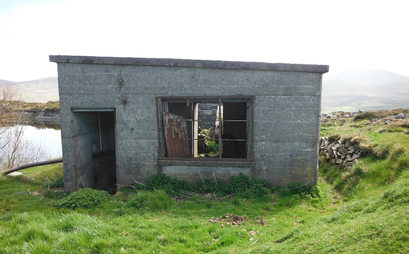
The older pump-house is built of stone, and it looks like it has been extended at some time during its life.
The newer pumphouse is made of concrete poured in situ -
The older pump-house contains the remains of a three cylinder piston pump - they don`t make them like that anymore !
I love the crankshaft - pity about all the brambles.
The newer pump-house contains the remains of what looks like a centrifugal pump, although I am not sure what it was driven by.
Time to head away, and I am up on the rim of the quarry looking down on the top tier - the winch and the other building looking a long way away.
Interesting to note how the building has fallen down - both walls have fallen very specifically eastwards.
Were they blown down by a gale, or were they demolished because somebody wanted the dressed granite.
If so, how did they take it away - because one of the things that became quite clear having been right round the quarry is that there is no road or track of any kind into this quarry.
And I didn`t even see how a big cross country vehicle like a four wheel drive tractor could ever get to the quarry - they couldn`t have come from either end, and they couldn`t have come into the middle somehow.
So it suggests that this quarry never had any kind of wheeled machinery in it, unless they could climb up the hill with it in little bits.
Strange to think that this whole quarry was created solely by man power.
Maybe that`s why it closed, it just became totally uneconomic relying only on man power.
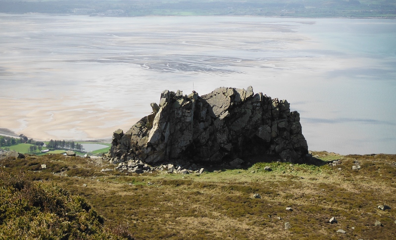
And the final picture, looking across to the fang of rock - it is clear that if I was told that it was left because it was the original highest point, then that information was wrong - it is lower than the hillside at the back of the quarry.
However the conversation was something like 60 years ago, so I can`t claim to have an accurate memory of their exact words.
But it does appear that it must have had some significance, because otherwise it would have been flattened like the rest of the hillside.
Well I seem to have now got just as many questions as I had before I went up the hill.
Is it possible that it was the other quarry that was responsible for removing so much of the original height of Penmaen Mawr - if in fact it did happen as some websites claim.
Why was the fang of rock left ?
The thought did occur to me that maybe it was left because it was the highest point of Penmaen Mawr as seen from down at sea level, in Llanfairfechan, for example.
Maybe this was a bit of a con by the quarry owners to hide just how much of Penmaen Mawr was dissappearing into a big hole.
And that would tie in with what I was told - it was left not because it was the highest point of Penmaen Mawr, but because it was the highest point that people were used to seeing.
My curiousity goes on.
website design by ron-t
website hosting by netnerd.com
© 2025 Ron Turner
![]()
![]()