out and about - 2016
09 September 2016 ............ The river Ayr and Ayr harbour
As I said in my first post about Ayr, the river Ayr fairly divides up Ayr, and it also divides up the harbour. I found it all to be quite an interesting area.
The original harbour to the north of the river continues to be a quite busy harbour, and there is ongoing development of the whole area.
Unfortunately, as it is an official port, it suffers from the restrictions on access that all official ports suffer from, and it isn`t really a good idea to wander around taking photographs.
However the original harbour area to the south of the river has largely been taken over by housing, so there are virtually no areas that have restricted access, and the breakwater is part of that.
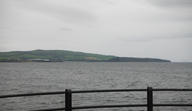
The breakwater is a good vantage point for views in all directions - this is looking across the bay towards the Heads of Ayr and Brown Carrick Hill with the radio towers on it.
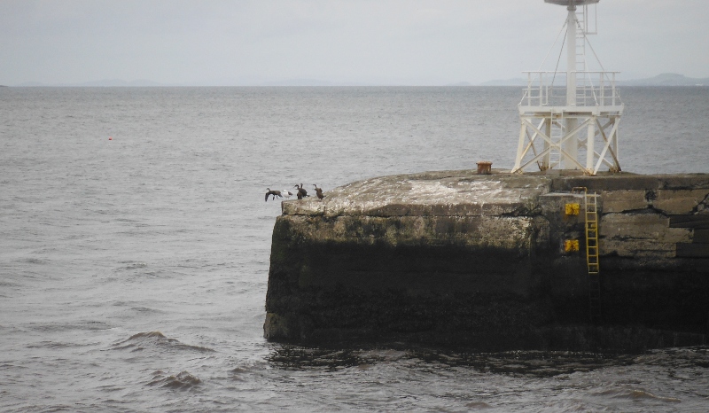
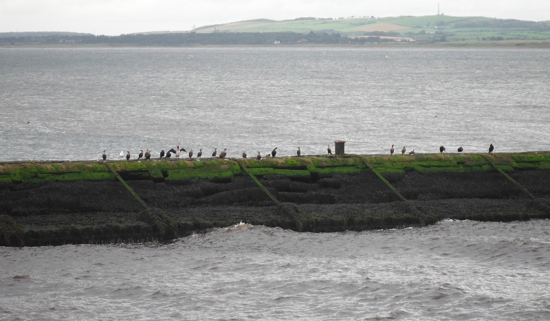
On the other side of the breakwater there is another somewhat smaller free standing breakwater, and the cormorants find it a good place to congregrate.
You maybe can`t get access to it, but from the breakwater you get a good view across the river and into the port area on the north side of the river. There was a lot going on when I was there.
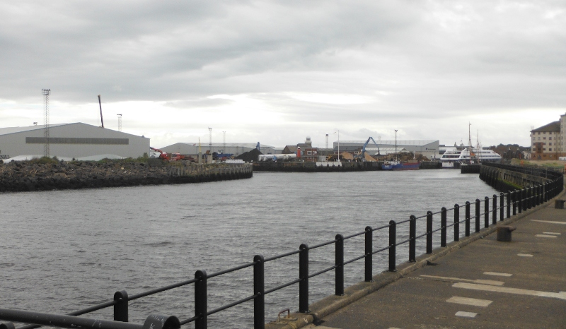
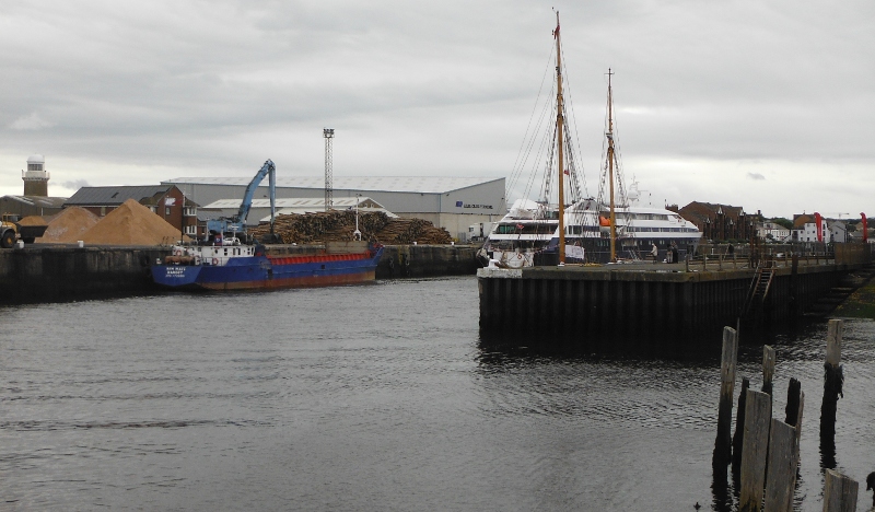
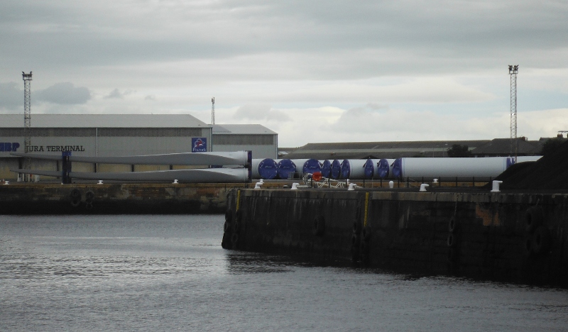
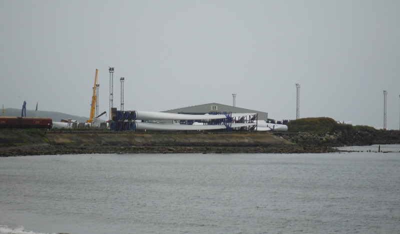
Ayr harbour seems to have established itself as a hub for wind turbine parts that are being imported from I think Europe somewhere, and are destined for the various wind farm sites that seem to proliferate inland from the Ayrshire coast.
They are big - there is no doubt about that - and they seem to be taking up a lot of port area.
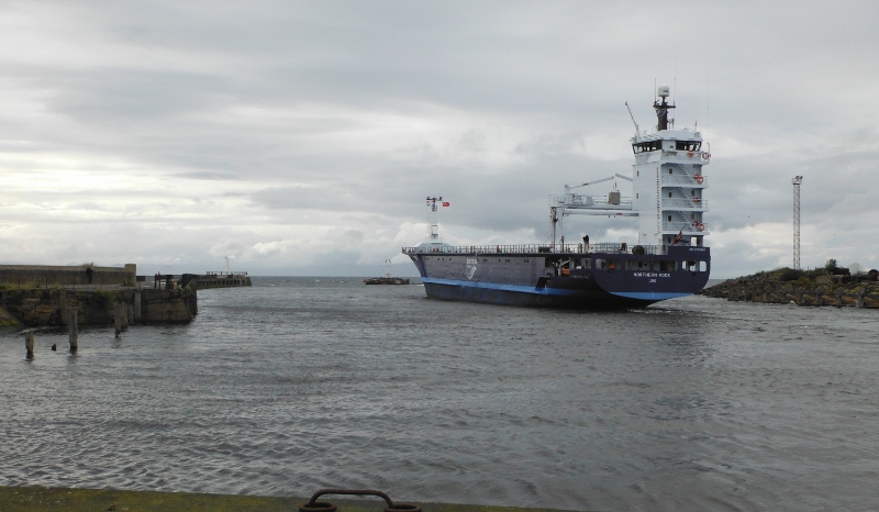
The gap between the two breakwaters isn`t that wide - here is quite a large ship heading out through the gap - quite an interesting challenge, as there was a strong wind and quite a big sea blowing across the gap, so these were going to hit the ship side-on as it emerged out beyond the bigger breakwater on the left, and blow it onto the smaller breakwater on the right.
The pilot boat was right behind, but just out of shot.
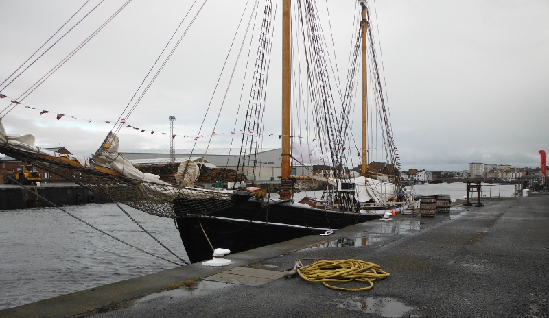
Alongside the south side of the river there was a tall ship tied up -
Attached to the fence there was a sign about the ship -
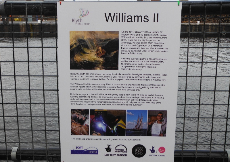
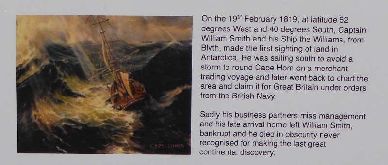
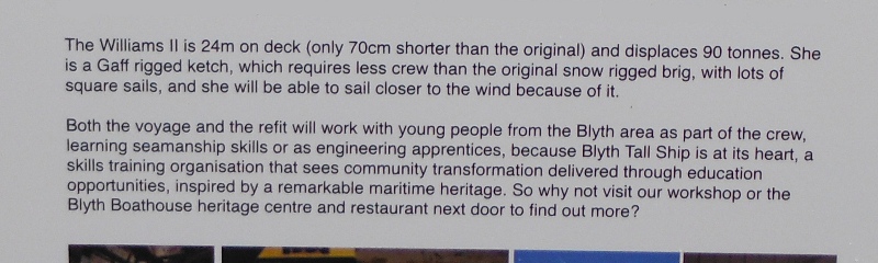
The text is actually quite interesting about the discovery of Antartica, and it is too small to read in the above photo, so here it is expanded across two pictures.
There isn`t any clue on the sign as to why the Williams II was in Ayr harbour - the sign suggests it should be in Blythe.
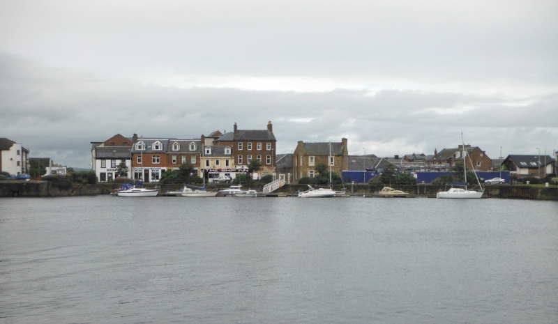
Further up the riverside and looking across to what is the only evidence I saw in Ayr of a marina.
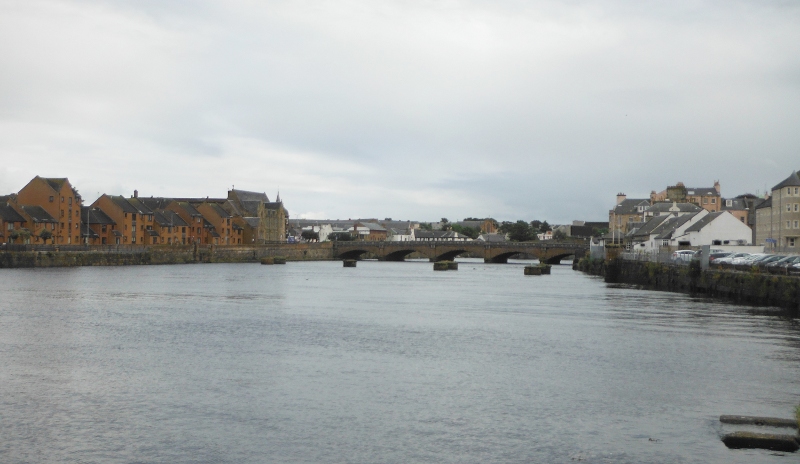
The river Ayr fairly divides the town, and this is looking up river towards the first of many bridges -
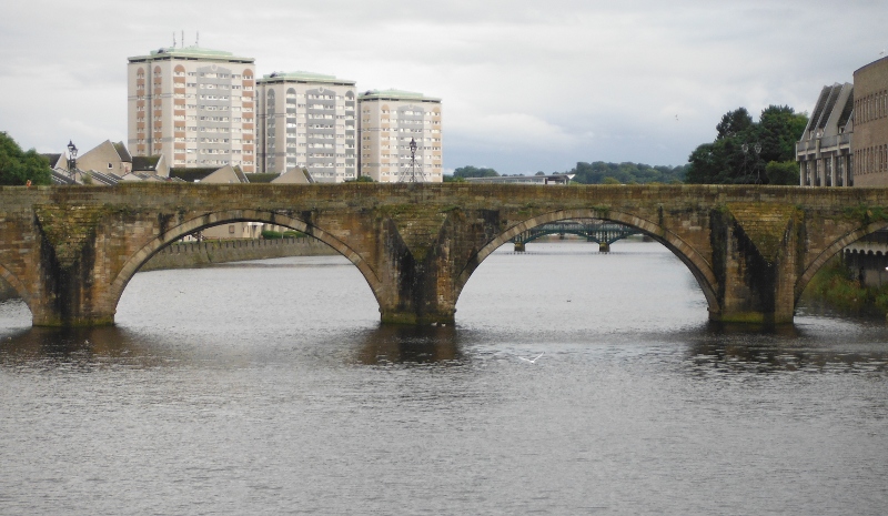
Standing on that first bridge, and a whole series of more bridges can just be seen -
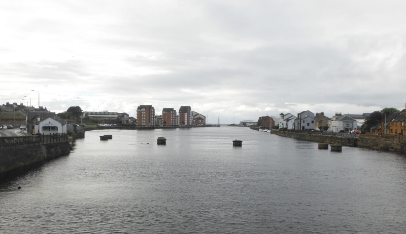
Standing on that first bridge, and looking back down the river to the harbour area - sad to say, it doesn`t look like that at low tide.
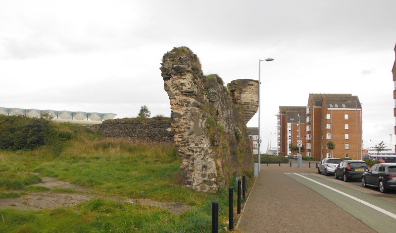
Heading back down the riverside now, and there is the remains of the most amazing wall - imagine building a wall that leans over like that - it was obviously built like that because of the existence of the little tower in the far corner.
I have no idea what the wall was part of - was it part of a building, or was it a seawall ? There is nothing to suggest what it was for. But it is quite amazing it is still standing.
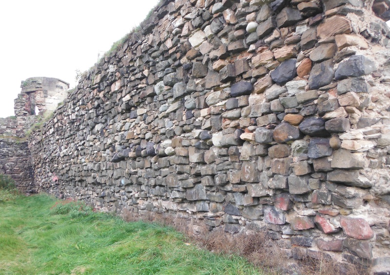
The inside of the wall -
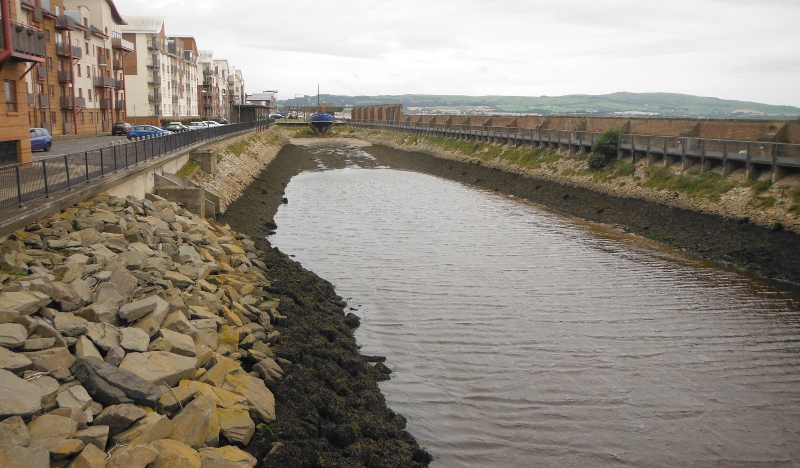
Because much of the original harbour area to the south of the river is now housing, it hasn`t been fully developed as a functioning port, so there is wee bit of industrial archaeology to be had - first of all, what was once a dry dock - it is surprisingingly long, and would have held quite large ships.
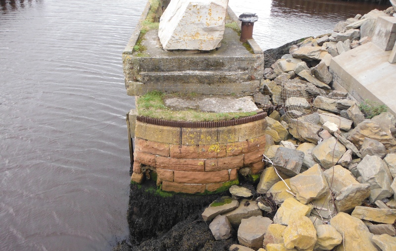
The only remnant that I could see of the original dry dock gate mechanism -
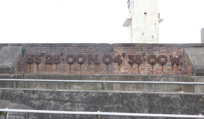
And last, and definitely not least - who needs GPS - there is a sign on the wall telling you where you are.
Five five degrees two eight decimal zero zero minutes north, zero four degrees three eight decimal zero zero minutes west.
website design by ron-t
website hosting by netnerd.com
© 2025 Ron Turner
![]()
![]()