out and about - 2016
05 April 2016 .............. Port Eynon to The Knave
Having now done most of the Coastal Path from Ogmore along to and a bit beyond Llantwit Major, I thought it was time to go elsewhere, so I headed down to Port Eynon at the south west corner of the Gower peninsula.
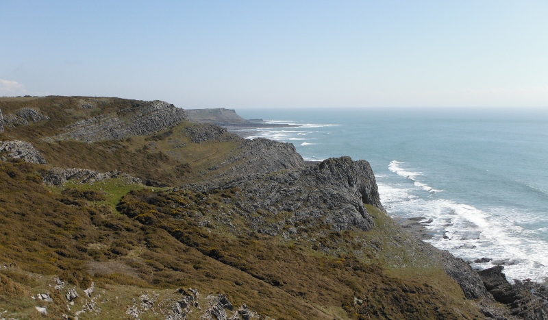
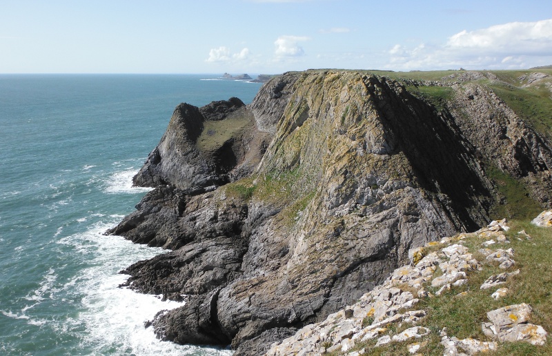
I headed off along the coastal path, and up to the headland above Port Eynon Point, for my first view along the coast.
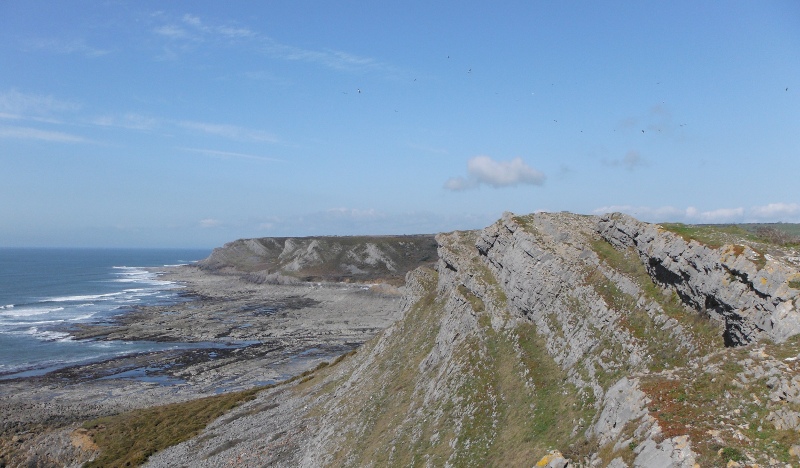
Down the far side, and along the path round the quite large bay, and the first of the numerous spurs approaches.
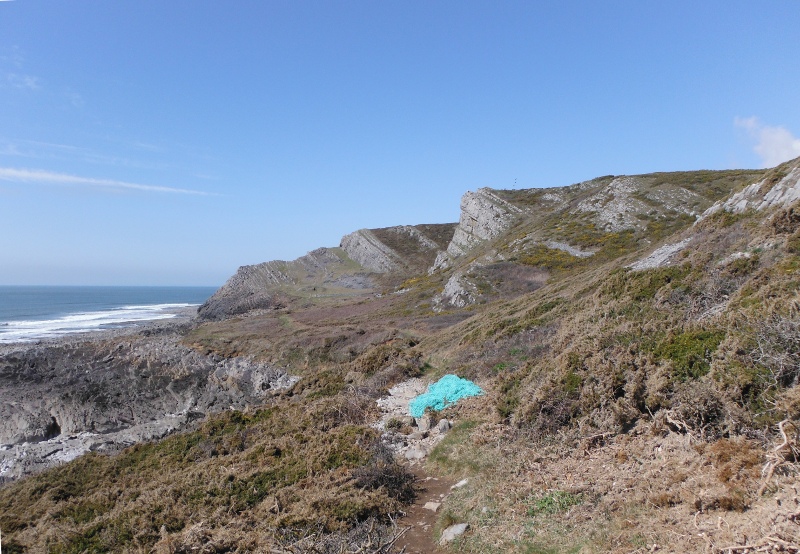
Now there is a confusion factor comes into play somewhere along here - because the official coastal path heads off up a long hill, onto the flat land above all the cliffs, and well back from the cliffs, and provides easy walking on a wide flat grass path.
There is another path which heads along the cliffs, sometimes over the spurs, sometimes around the front of them, and this path gets increasingly more challenging as you head west, and in the end it doesn`t really exist as a defined path.
This path isn`t shown on the 1:50,000 OS Landranger maps.
It was this lower path that I followed, so any paths in the following photographs are of this lower path, not the official high level coastal path.
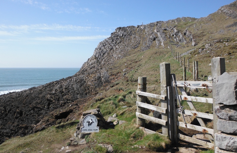
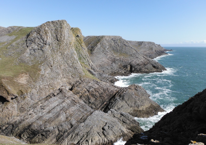
Things start to get a bit more interesting at the start of the section called Long Hole Cliff.
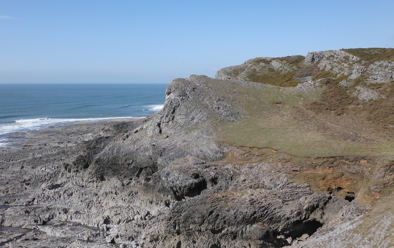
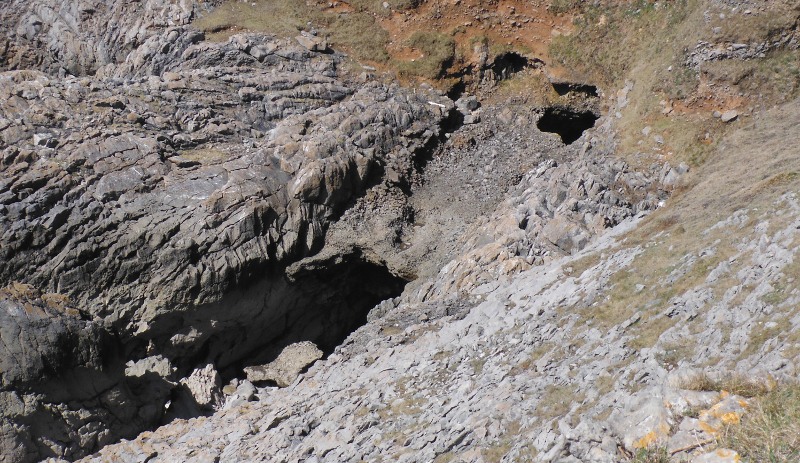
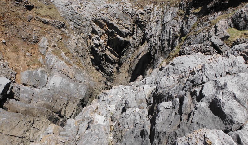
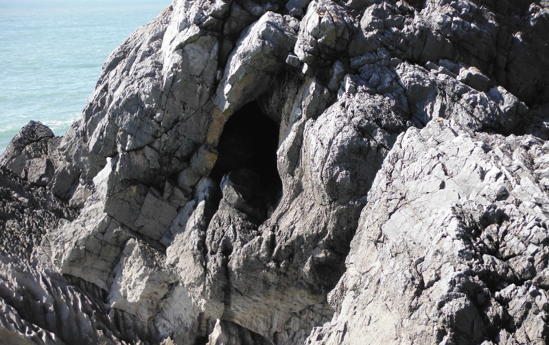
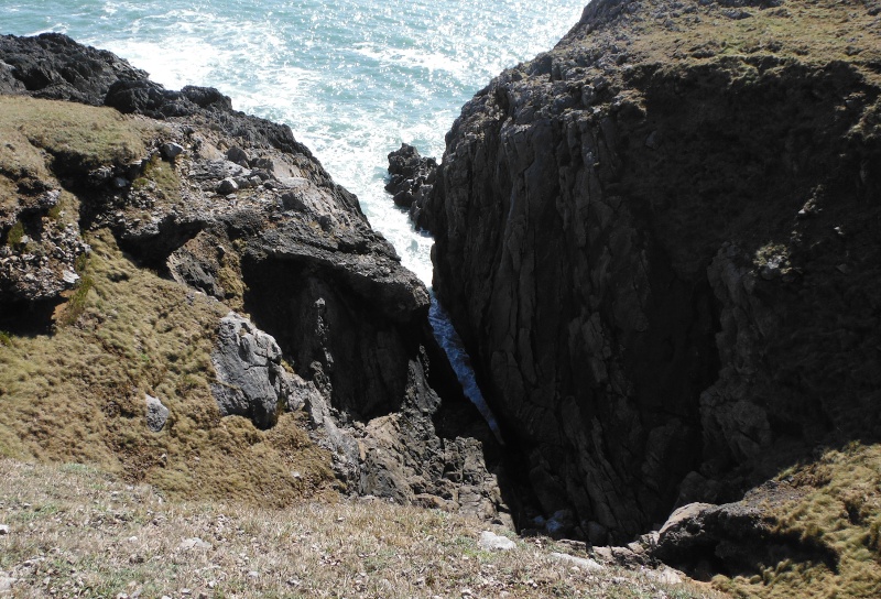
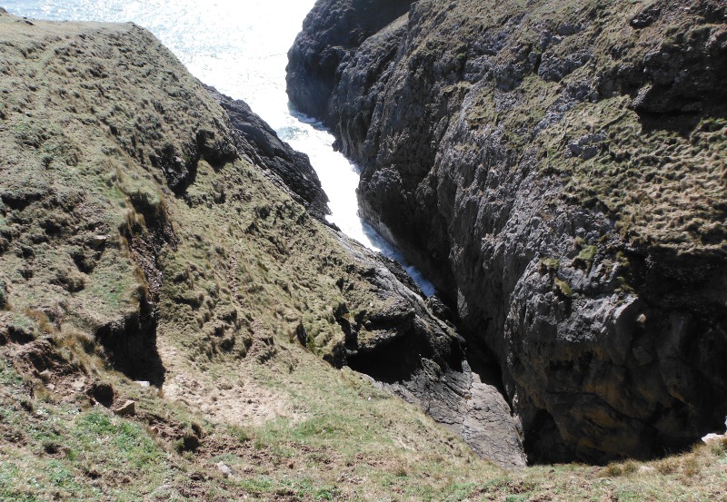
Further along this path, and the coastline is getting more rugged, and you come to a significant gash in the coastline - if you look down into the gash, you can see a cave, and an upper hole.
Here is a better view of the cave -
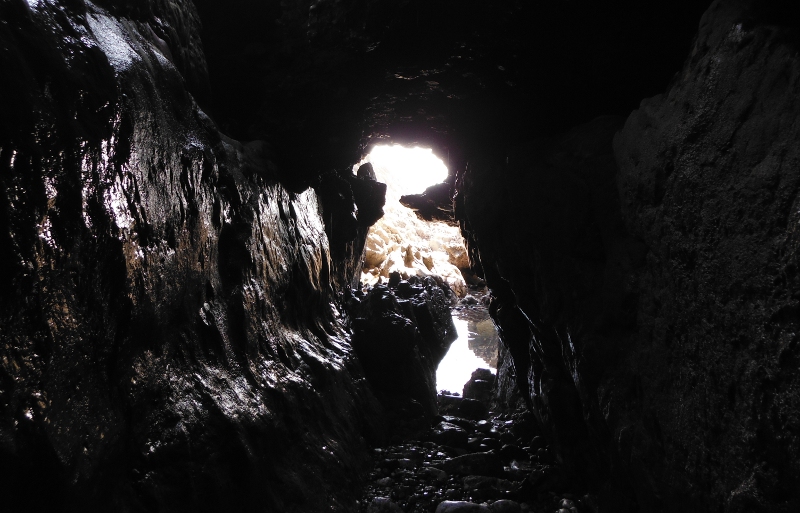
It was a bit of a challenge, but I did eventually get down and into the cave - it was a good thing it was low tide.
It is quite a deep cave, and about halfway in there is a big boulder pile - if you can climb up over these boulders you could get further in to a much narrower section. I climbed up, but it was quite wet, more boulders, and it didn`t really look very inviting, so I gave it a miss.
I took these pictures at the boulder pile.
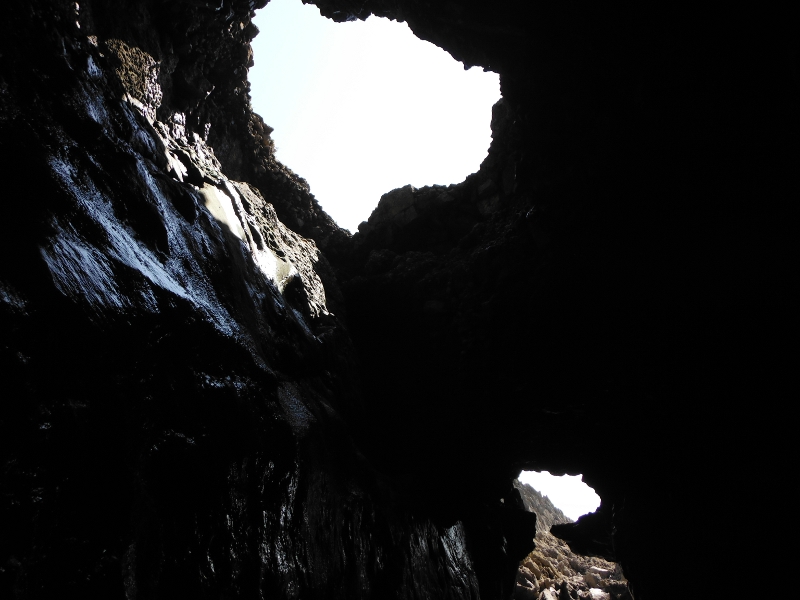
Looking up at the upper hole -
I subsequently discovered another way into the cave, if you don`t mind a rather difficult move above a significant drop.
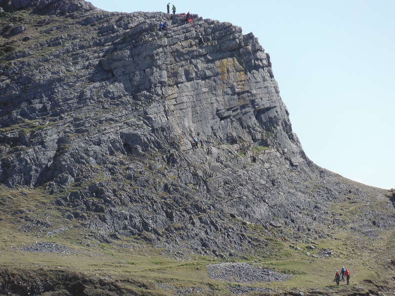
Back out in daylight again, and heading towards the next spur - you can see the path going round the base of the spur, but I fancied climbing up it, so negotiated my way up through the gorse to the top.
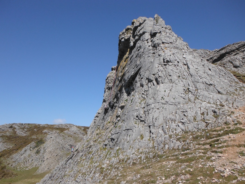
You can just see a couple of climbers at the top.
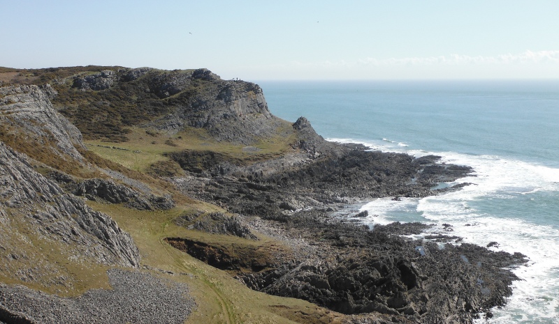
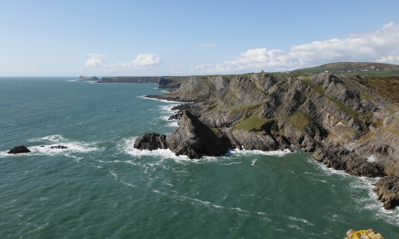
Good views from up on top of the spur - this is looking back along the coast towards the headland above Port Eynon Point.
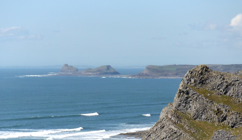
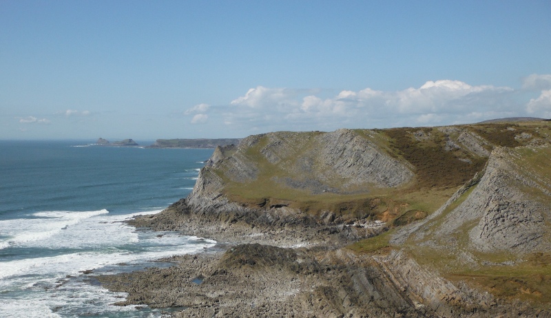
Looking further along the coast, and a first view of Worms Head in the distance.
Here is a long focus view of Worm Head - the tide was coming in, so the causeway across to Inner Head is on the point of dissappearing. It dries out for about 4 hours at low tide, and is then covered for the next 8 hours or so.
After taking these pictures, I headed down the far side of the spur, and ground to a halt - the side of the spur was covered in gorse, and I couldn`t find anyway through it, so I had to come back up and over the top, and down the side that I had gone up. Then followed the path round.
And this is what the climbers were up to - El Capitan eat your heart out !
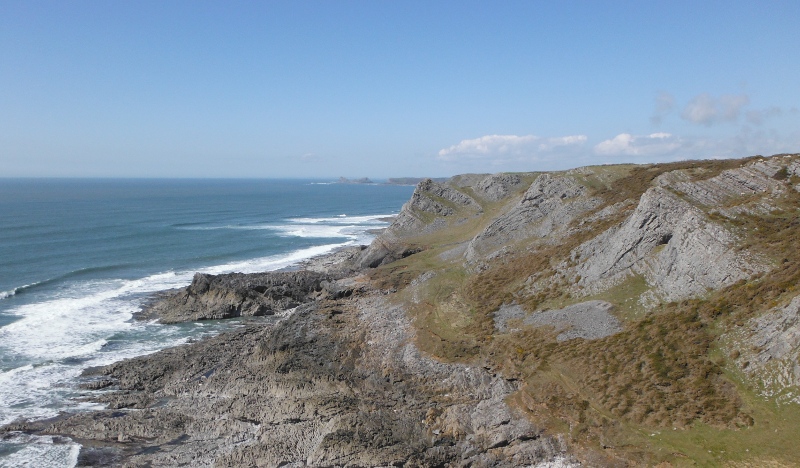
Further along the coast, and looking back -
Looking back along the coast from up on the next spur.
And looking forward -
Up on the next spur, and looking futher along the coast - it is getting noticeably more rugged now - and now the path meets a problem.
In the lower part of this picture, just to the right of centre, there is a green line along the cliff, with an obvious chunk of stone that has dropped down from above.
Well that green line is the path.
Hmmm!
It was just as scary as it looks - I started along it by clinging onto the cliff, but that actually made it more difficult. I soon found out that the easiest way to do it was to have faith in my feet, and just brass neck it by walking normally.
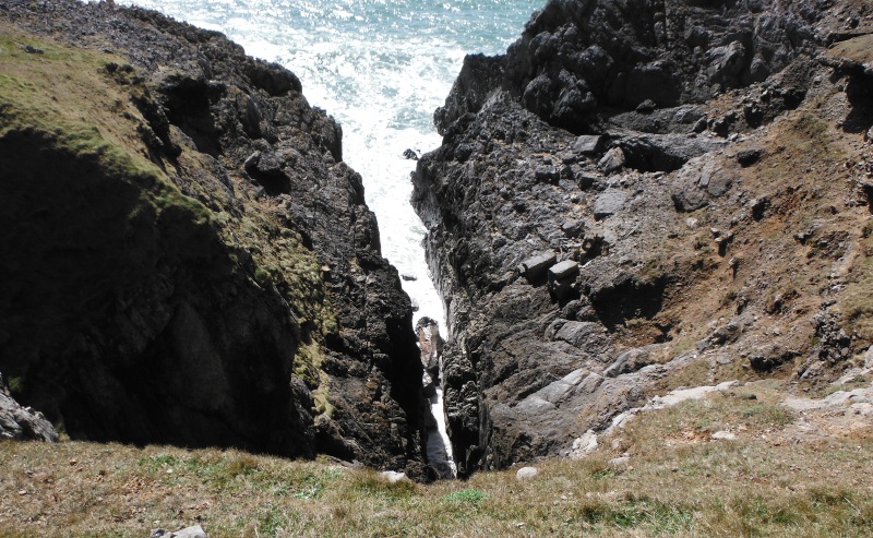
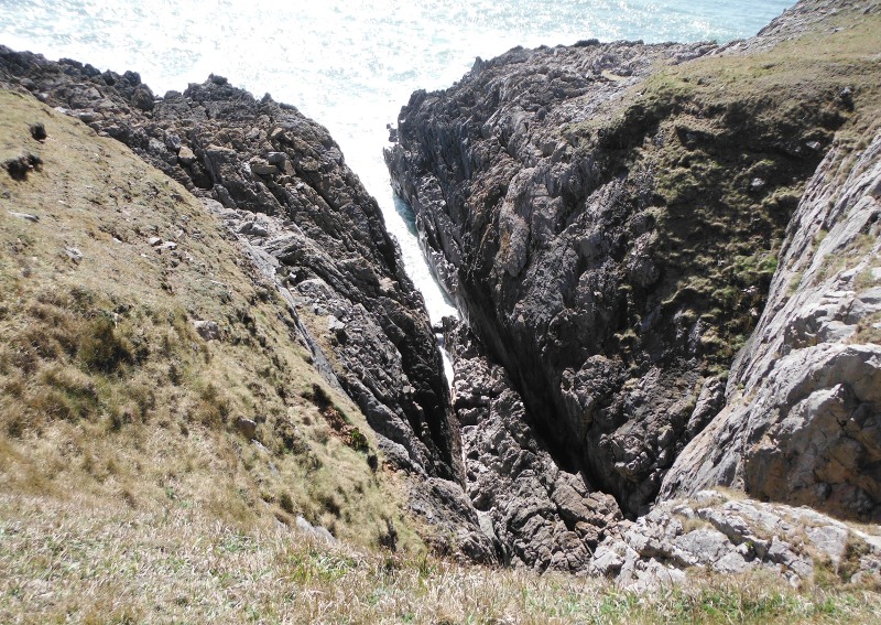
Safely round the spur, and you come to an amazingly deep and long gash into the coast. I climbed down a bit to see if to could see if I could see down into it, but it didn`t matter how far down I went, I still couldn`t see down to the bottom, though I could hear the sea crashing into it.
At the inner end of the gash there is a cave which is way above sea level.
On the opposite side of the gash, again, away above sea level, there is another cave.
Finally, this is looking down into the gash, from somewhere above the first cave.
Over the next few kilometres there are several more of these gashes into the coast - I am not sure, but I think that maybe this one is what is identified by the name Blackhole Gut that is shown on the OS Landranger map.
I wonder if anyone has produced a much larger scale map of this bit of the coast, it would be fascinating. I find it very difficult to identify what the various names on the Landranger map actually refer to.
Up on the next spur now, and looking along the coast - it is getting more and more rugged, and the path is not at all obvious, so I was pretty well finding my own way.
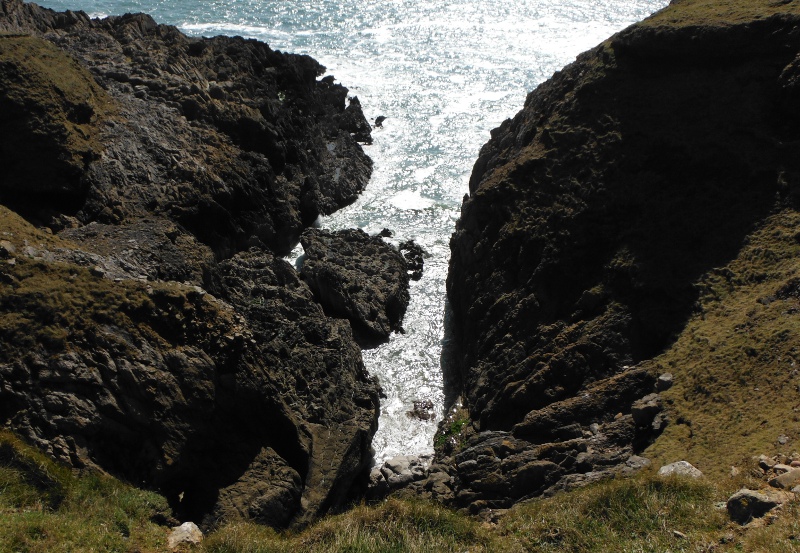
Another deep gash into the cliffs.
And another -
Eventually I came to a much wider gap in the cliffs which is almost a bay, and over the other side there are some more climbers on another face - is this the one that is called Juniper Wall ? I don`t know.
I didn`t like the look of a possible route round the base of the wall, the rocks looked quite steep, and I couldn`t see a possible route over them onto the grass slope where the climber is standing, so I headed up the grassy side of the spur.
As it turned out, this was maybe just as well, as I subsequently found out that the grass slope stopped quite soon, and then there was a lot more bare rock round the other side.
It may well be possible to get round over these two sections of bare rock, maybe they are not as steep as they look, and climbers obviously go round them.
Up and over the spur, and another one of the deep gashes.
There was no way round the next spur, so it was up and over again. This is looking further along the coast, and there is no way round the next spur either.
So down and up onto the next spur, and this is looking across to the next spur. Now there is an obvious path that heads around the base of the rock face, and up to the coll, so it appeared to be a route that went on around the spur.
So I headed off to it, around the end of yet another deep gash in the cliffs.
The path of course heads round the spur just above this gash on quite steeply sloping ground, so you wouldn`t need to afraid of heights.
Then it is a bit of a scramble up to the coll - and - oh dear - it`s a dead end. There was no possibility of going any further, it was a straight drop down into the sea.
However it was a good vantage point for some pictures - first of all, looking up at the huge wall above me -
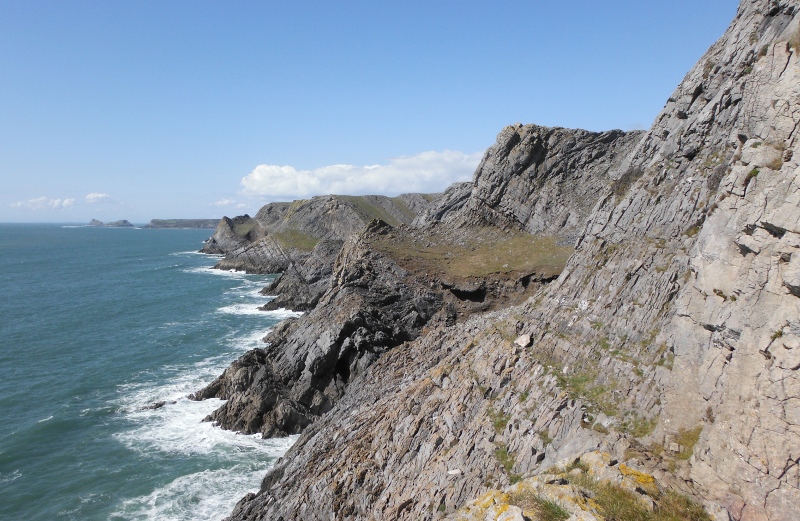
and looking further up the coast - no sign of grass - just masses of bare rock -
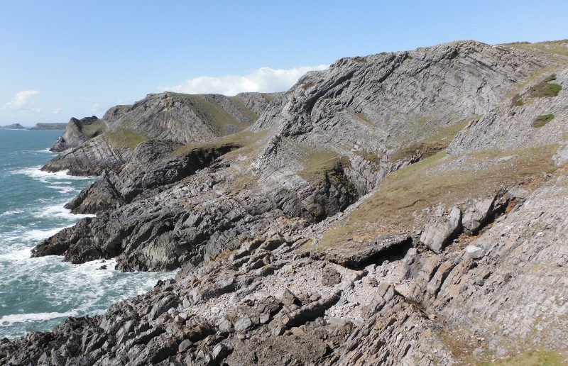
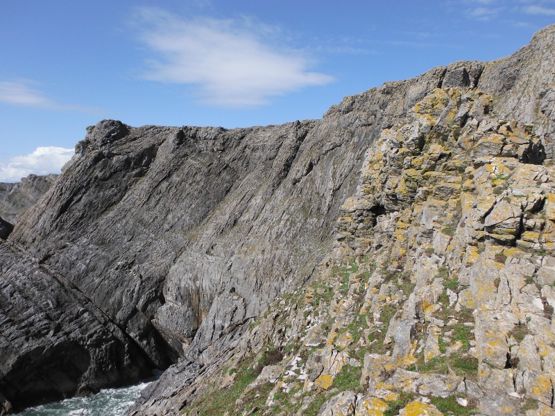
There was also a rather good view looking back along the coast, because it shows off the layers of rock that run right along all these spurs.
I think, but again, I am not sure, that you can see Paviland Cave just to the right of centre. Now that is the spur that I decided not to try and get round - I wonder if you did go round, you could get down to the cave.
Having met a dead end, I had to go back down the way I had come - it is a bit scary trying to scramble down something when just below you there is a major drop.
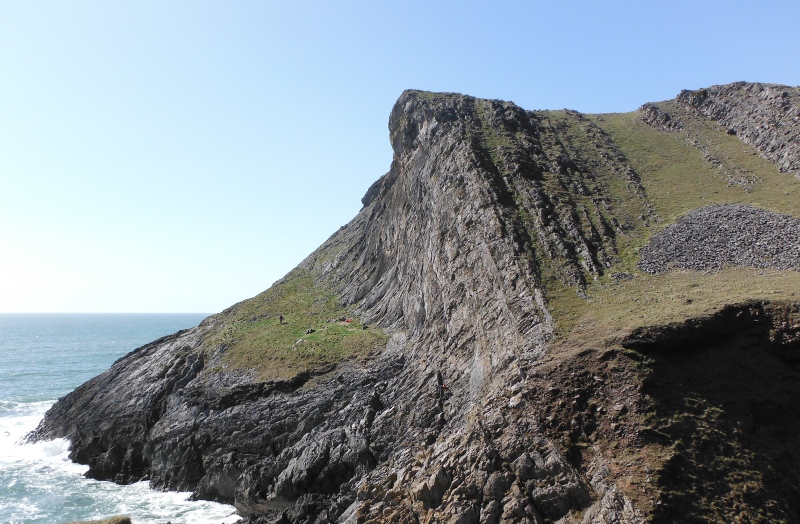
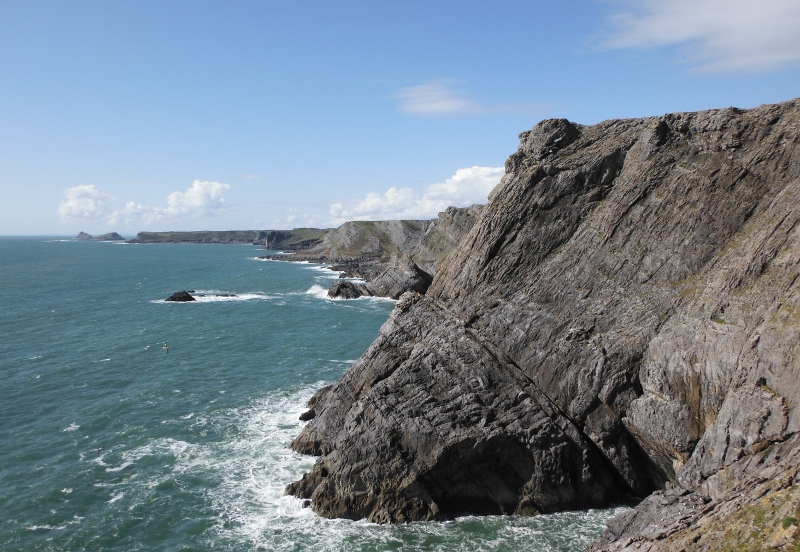
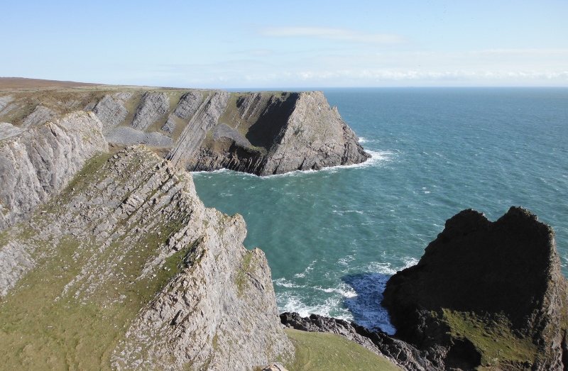
Up on top of the rock wall now, and looking further along the coast - in the foreground the triangular rock is The Knave, then another couple of headlands, and then the headland with the vertical faces that drop down into the sea is Thurba, which is the last headland before Mewslade Bay.
This was a good place for a stop and a tea break, and I was wondering whether to go on or not. I would have liked to have done the whole coast right up to Thurba, but the afternoon was wearing on, and I had to go all the way back to Port Eynon.
So in the end I went around the coast and up onto the headland above The Knave - this is looking back - that triangular face is the end of the huge rock wall that blocked my path earlier, and that is The Knave that is down below me.
That was as far as I went, I was running out of steam. I didn`t dare go back along the coast the way I had come, so I went back along the official coastal path.
It is a good path, rather featureless, but with nice open views out across the sea to Devon, but you don`t see the cliffs at all, so it got a bit tedious, and it was a long way back to Port Eynon.
But what a super bit of coastline.
website design by ron-t
website hosting by netnerd.com
© 2025 Ron Turner
![]()
![]()