out and about - 2016
21 March 2016 .............. Ogmore to Nash Point
After my sea kayaking trip along the coast from Ogmore to not quite Nash Point at high tide, I wondered what it would be like at low tide, so I went to visit various sections of it - on foot this time.
There is no doubt that it is a stunning bit of coastline, with huge sandstone cliffs that go all the way from Ogmore along past Nash Point and past Llantwit Major, with few breaks.
Some bits aren`t really worth the effort, but the section of the coastal path that goes from Ogmore to Nash Point must be one of the most rewarding bits of the Wales Coastal Path.
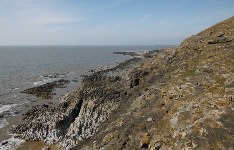
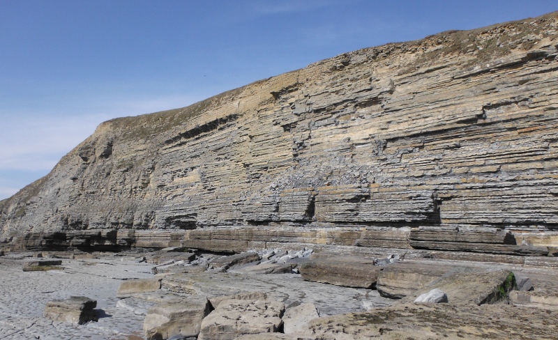
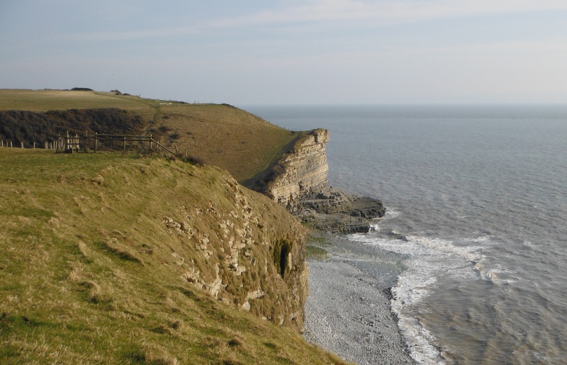
This is looking east, taken not far from Ogmore along the cliffs towards Dunraven Bay - this picture was taken about half an hour after low water.
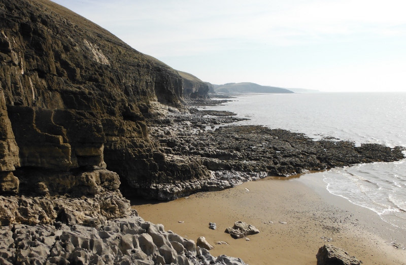
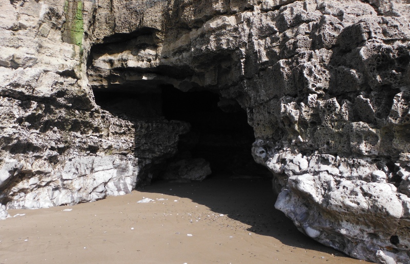
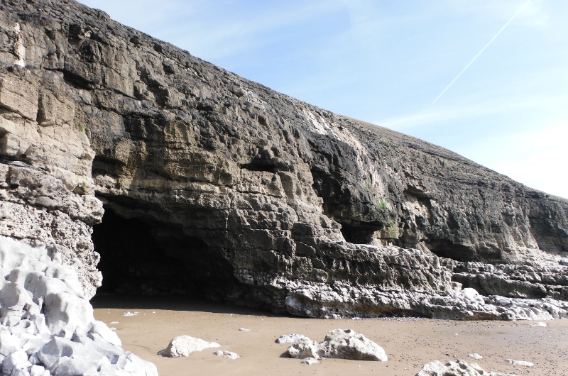
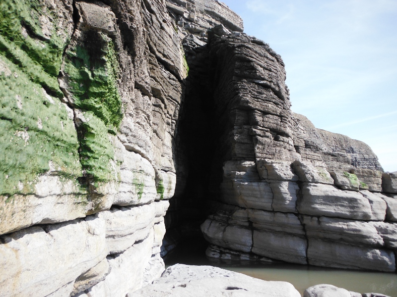
It is quite a difficult climb down to get down to the beach, but worth the effort, as the low tide has exposed a very good cave.
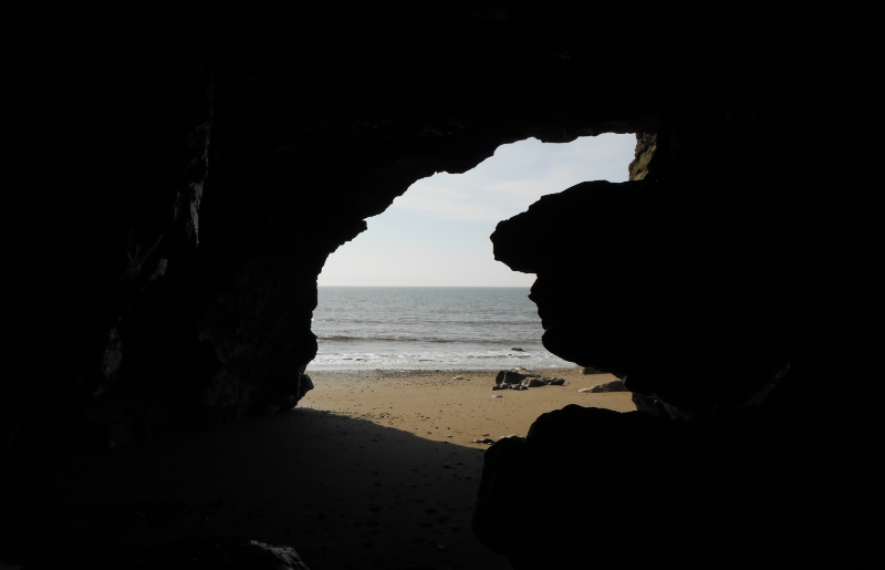
You can get right in to the cave - this is looking back out.
Now there may well be more caves further along, but it is very slow working your way along, and you don`t have much time before the tide comes in again. You only get the shore right at low tide, and the chances of getting cut off by the tide and drowning are quite high - by the time the tide has come in, there is nowhere to escape from the water.
In my favour was the fact that there was a high pressure sitting over us, so the sea levels were pushed down a bit. If it is a low pressure the sea would be higher, and there might not be any shore at all, even at low tide.
Anyway, I didn`t get too far before coming back.
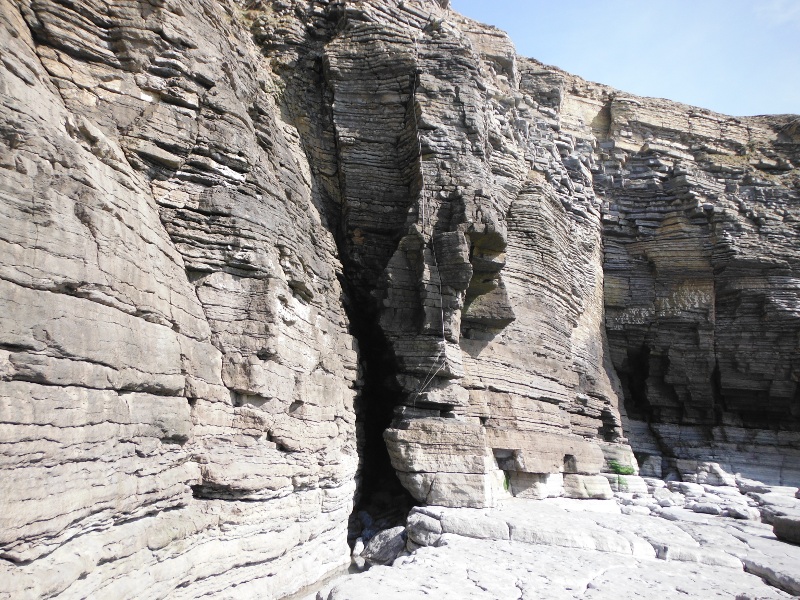
However I realised that the buttress at the far side of this first cave would provide a good bit of scrambling all the way up to the top of the cliff - it was indeed good scrambling, and I did it twice.
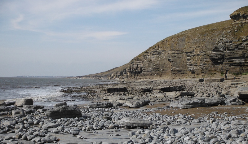
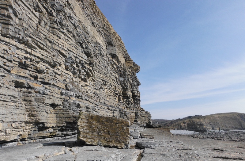
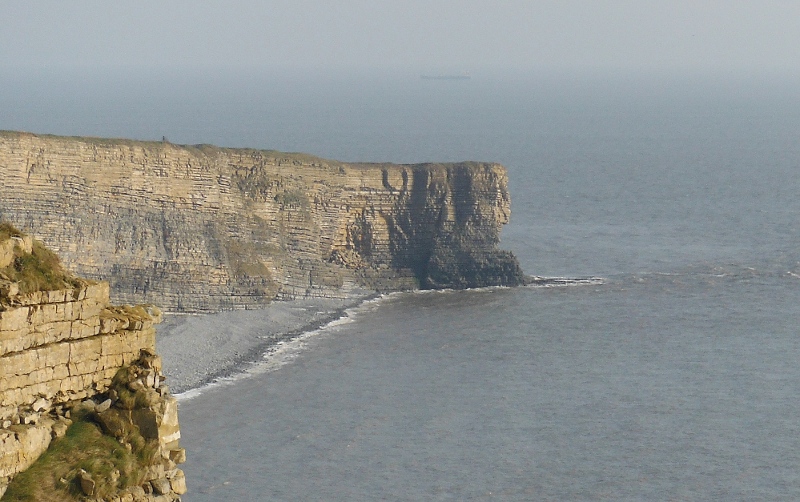
I am now on a wide ledge well up the cliff, and there is a good view of the amazing limestone pavement that runs along this bit of the coast.
It is funny to think that in 5 hours time, the tide will have risen by 7 metres - almost up to the pavement.
Here is another view of it, taken from well up the steep grassy slope above the cliff.
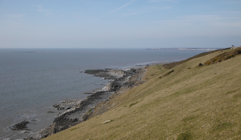
A final picture before heading away, this is looking along the coast to the east, along towards Dunraven Bay, my next stop.
---------------------------
I headed along the road to Dunraven Bay - at least the OS map calls it Dunraven Bay - there is a big sign in the car park that calls it Southerndown. According to the OS map, Southerndown is the village up the road.
Dunraven Bay at most tide levels has a stoney beach, the sand only appears at low tide. This is looking across the beach to the east.
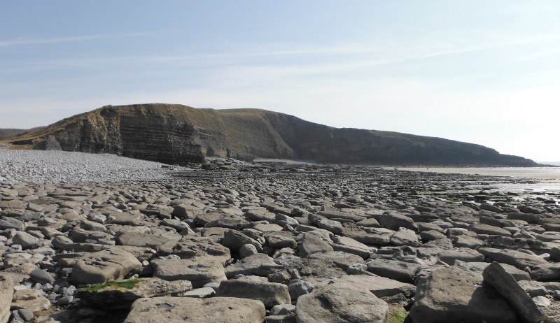
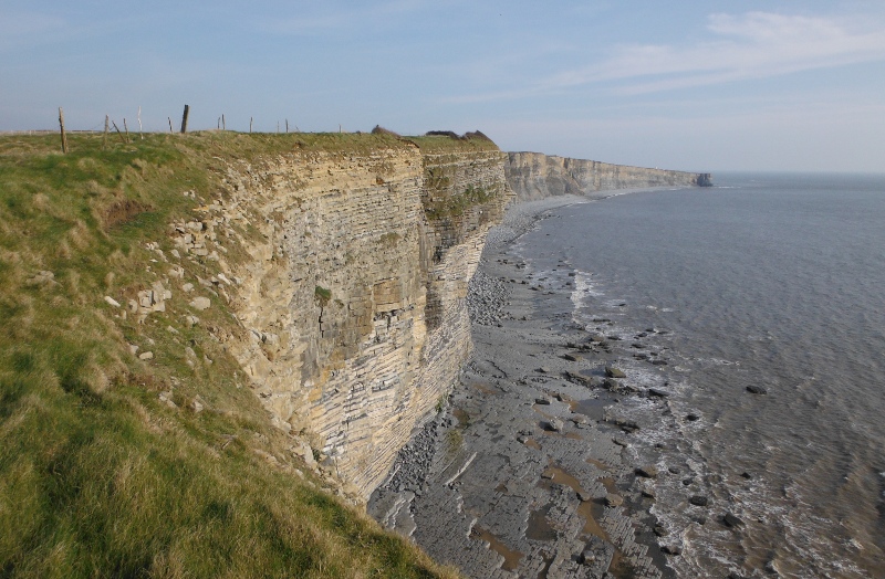
The cliffs to the west are much more impressive -
Along a bit the cliff face curves around a bit into a sort of bay, and there are some good chimneys.
This was as far as I could go, the tide was by now threatening my return - I think this would be approaching mid tide level.
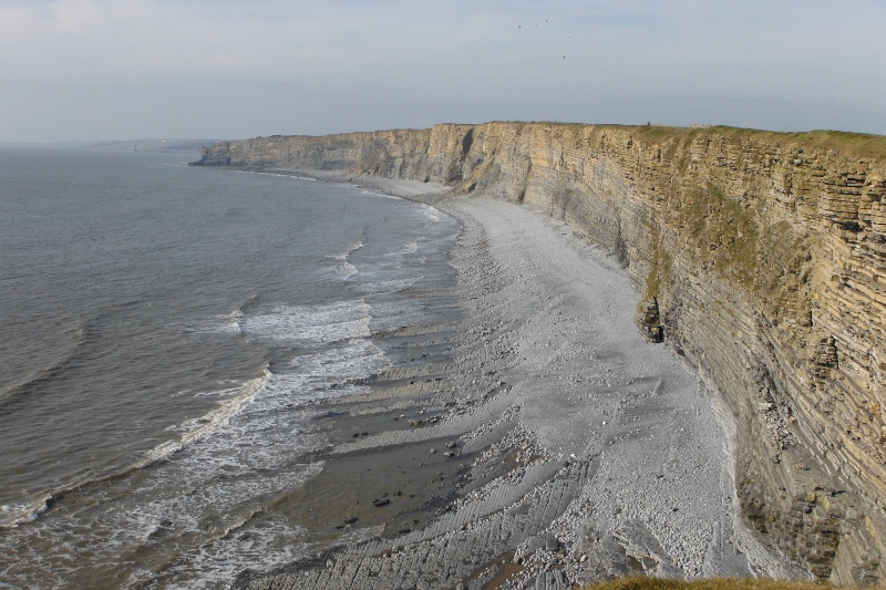
Nearly back at Dunraven Bay, and another view of the amazing cliffs.
---------------------------
I wouldn`t now be able to do much exploration of the coast at low tide levels, since the tide was now too far in. So I headed along to Marcross and down the lighthouse road, and then headed northwest along the coastal path along the cliff tops.
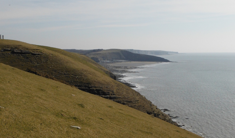
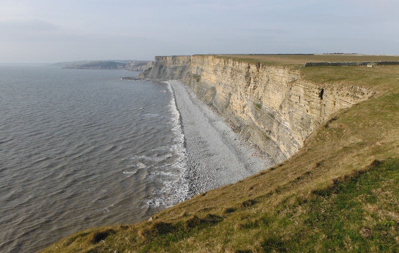
This is taken standing on to top of Nash Point, looking northwest towards the headland that marked the end of my kayaking trip.
It is a great walk if you like exposure and don`t mind the heights. This is now on the far headland in the previous picture looking southeast back to Nash Point. Look at the overhang in the foreground part of the cliff.
This headland is actually one of two headlands side by side, separated by a valley, a river, and a scruffy stoney beach. So I climbed down to the river and up the other headland, and this is the view looking along the cliffs to the northwest.
More cliffs !
I think Dunraven Bay is hidden from view behind the distant headland with the trees on it.
It was time to head back, so this is looking back to the other headland across the valley and the river.
Heading back along the clifftops towards Nash Point, and look at the big bite in the headland - I wonder how long that will last ?
website design by ron-t
website hosting by netnerd.com
© 2025 Ron Turner
![]()
![]()