out and about - 2016
19 January 2016 .............. Nash Point
Nash Point is a sort of headland that lies to the west of Llantwit Major, it has the same sandstone cliffs that dominate most of the coastline along the south coast of the Vale of Glamorgan from Ogmore-by-Sea along to and beyond Llantwit Major.
It was a beautiful cold, clear, and sunny day, and I headed out from the car park down from Marcross along towards the lighthouse.
The coastal path runs along here, so there isn`t any problem with access to this bit of the coast.
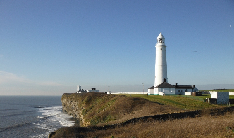
The lighthouse isn`t right on Nash Point, it is a bit to the south east of it, I think this may be Nash Point -
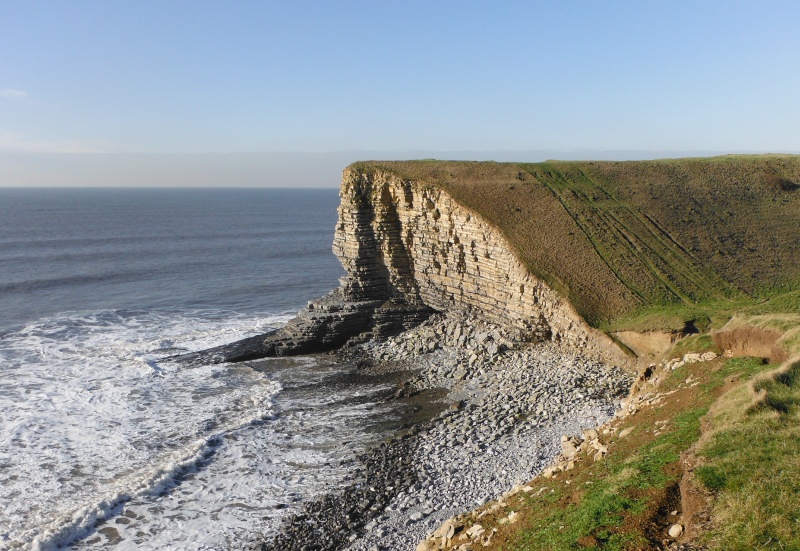
It is a good clifftop walk if you head up and past this headland, and head westwards in the direction of Ogmore-by-Sea. However the lighthouse is in the opposite direction, this is looking eastwards towards the lighthouse.
This is not a place to let small children and dogs run around !
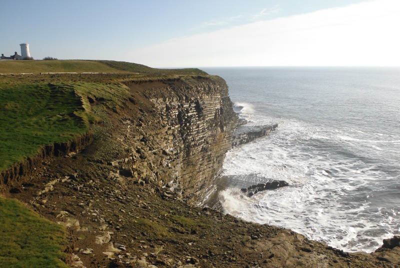
Further along towards the lighthouse, and this picture is deceptive - the old lighthouse appears to be perched right on the cliff edge - in fact it isn`t, it is several tens of metres away from it. Pictures can lie !
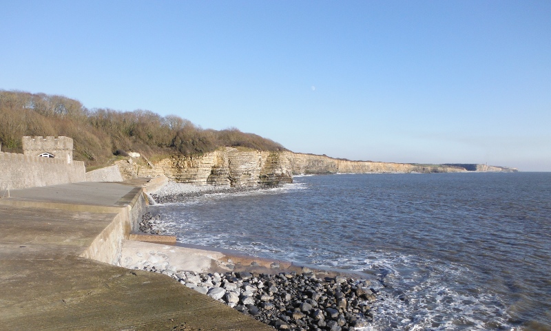
If you look right down at the bottom of the cliff you can see where somebody somewhere has tried to stop the cliff base eroding by building a stone wall.
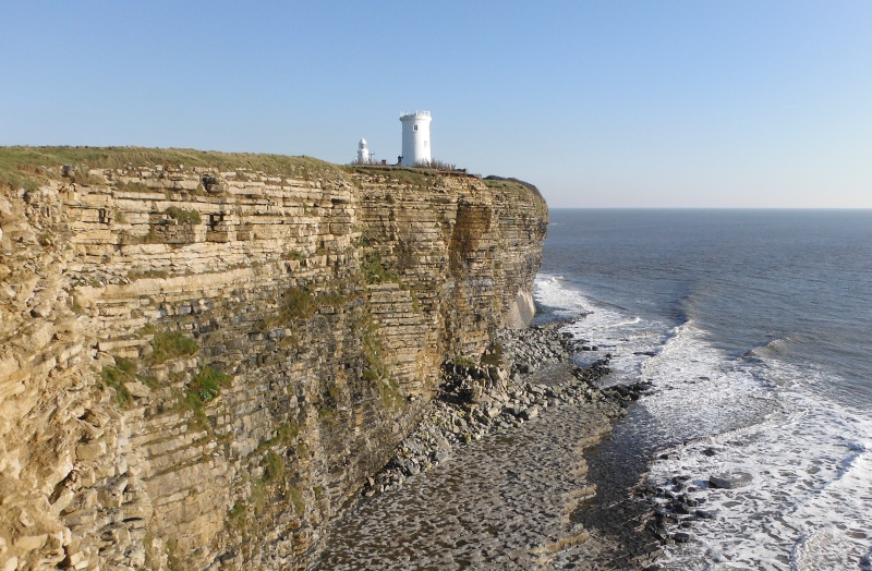
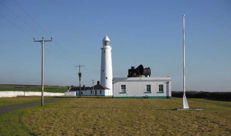
Walking through the grounds of the lighthouses, and looking towards the newer lighthouse.
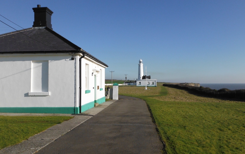
The newer lighthouse again, and look at the size of those air horns on the roof of the building.
Things start to go downhill as you head towards the end of the grounds of the lighthouse, as you have to go through a very wet bit of ground to get across the wall. And I mean wet - the water is running through it, so it is splash splash.
However once past that, just briefly, the path improves, and you can look back at the cliffs.
And that was the end of the picture taking for a long time - the path turns into a disaster.
The path drops down into a sort of trench between the fields and a sort of natural wild hedge along the cliff top - it was incredibly wet, nothing but mud, and very slippy. It was a considerable effort to stay upright, and absolutely horrible to walk along.
And it is like that all the way to St Donat`s.
To add to my misery, there was no view at all, because of the natural hedge.
It was totally foul, and I will not be going near it again unless there is a long hot dry spell !
It is the worst bit of coastal path I have ever been on, but at last I got to St Donat`s, and could get a tea break on the nice dry concrete.
This is looking further along past St Donat`s towards Llantwit Major, which is somewhere along those cliffs, but I am not sure where.
I didn`t go back along the path, I just couldn`t face it, however St Donat`s is rather dominated by a quite large college campus, and judging by all the keep-out signs, they don`t like visitors.
After a lot of head scratching, trial and error, and looking at my map, I found that if I continued along the coastal path through the trees for another half kilometre or so, there was a right of way up through a field and up on to the public road.
So I walked back along the road to Marcross, and back down to the car park.
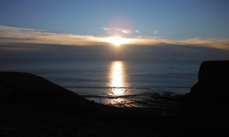
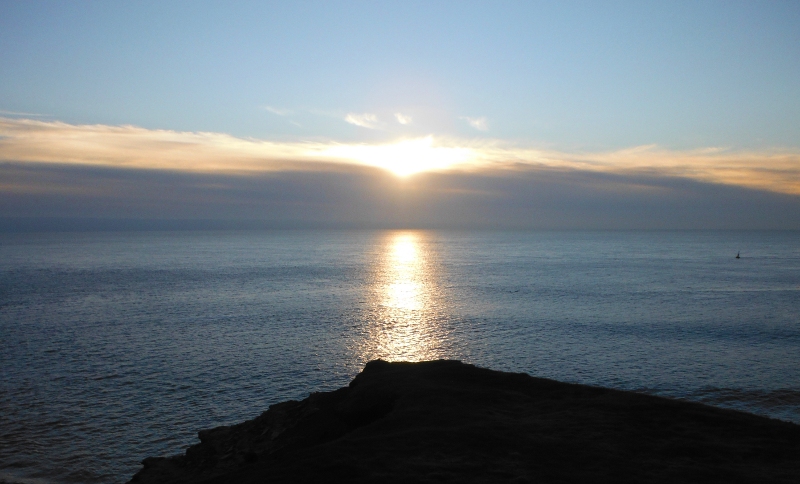
A bit of a dissappointing afternoon out, but by the time I got back the sun was beginning to set behind a large bank of cloud, so we had a sort of pseudo sunset.
website design by ron-t
website hosting by netnerd.com
© 2025 Ron Turner
![]()
![]()