out and about - 2015
09 April 2015 .............. Ogmore-by-Sea to Dunraven bay
This was a very pleasant afternoon walking along part of the Glamorgan coast, between Ogmore-by-Sea and Dunraven Bay - it is quite a good bit of coastline, because for much of the time you are - or can be - high above some quite large cliffs.
At lower tide levels, you can get right down below the cliffs.
I have described it here in terms of going from Ogmore-by-Sea to Dunraven Bay, but in fact I didn`t do it that way, I started in the middle, headed west towards Ogmore-by-Sea, then turned and came back, and went right along to Dunraven Bay, then back to my starting point.
So the tide levels in the various pictures are a bit out of sequence.
The village of Ogmore-by Sea is high up, well away from the coastline, but there is a big car park down by The Flats, where the Afon Ogwr joins the sea.
The good news is that there is a slipway, now I can`t say too much about it because I only saw it very briefly the next day - but it is there, so may be a useable launching point for a sea kayak.
There is a lot of beach around The Flats at low tide, this is a sort of view of them, taken from a bit further along the coast - I didn`t go right round to The Flats.
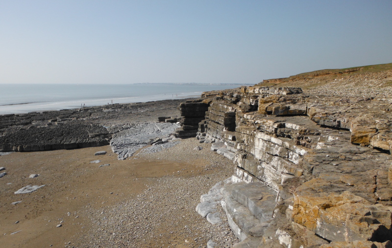
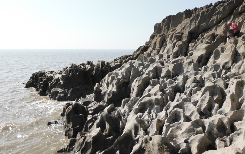
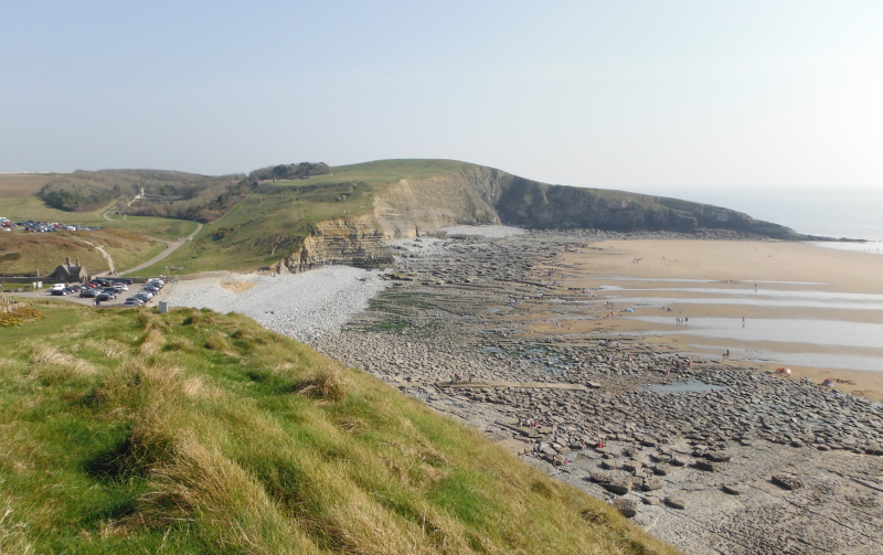
As you head away from The Flats, the coastline gradually gets more interesting, and you soon come to a sort of long wide raised ledge - it is about 12 to 15 metres above the beach, and is deeply disected by some slots, and some of the time you are walking over the top of caves.
This is a view looking along the ledge from the east end -
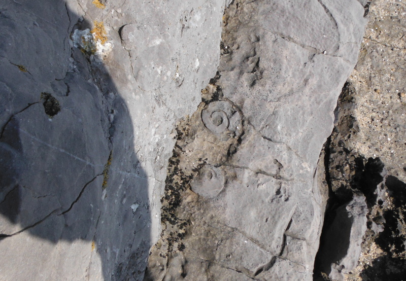
At one point somewhere along the ledge, I came across these two fossils of some kind of curly sea creature - the fossils would be roughly 25 - 35 mm`s across.
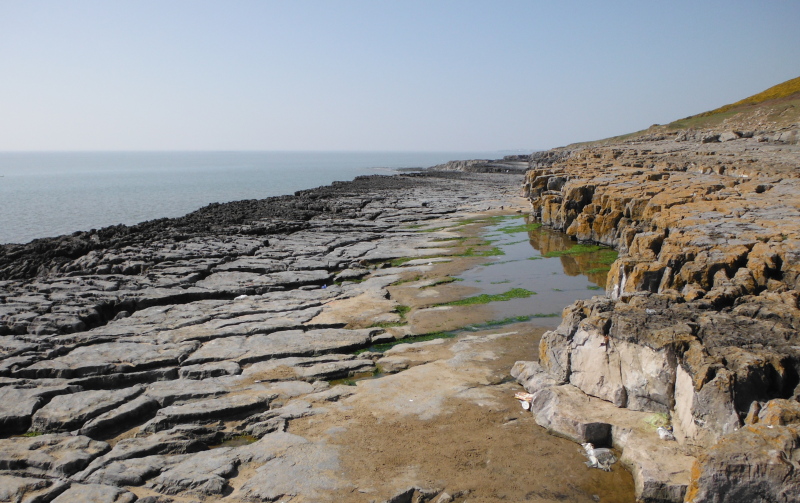
At low tide, you get along the beach below the ledge - this is looking into one of the caves - this one went a long way in, you are only seeing a part of it here.
I think that these caves and along the bottom of the ledge is used for bouldering - low tide only, of course.
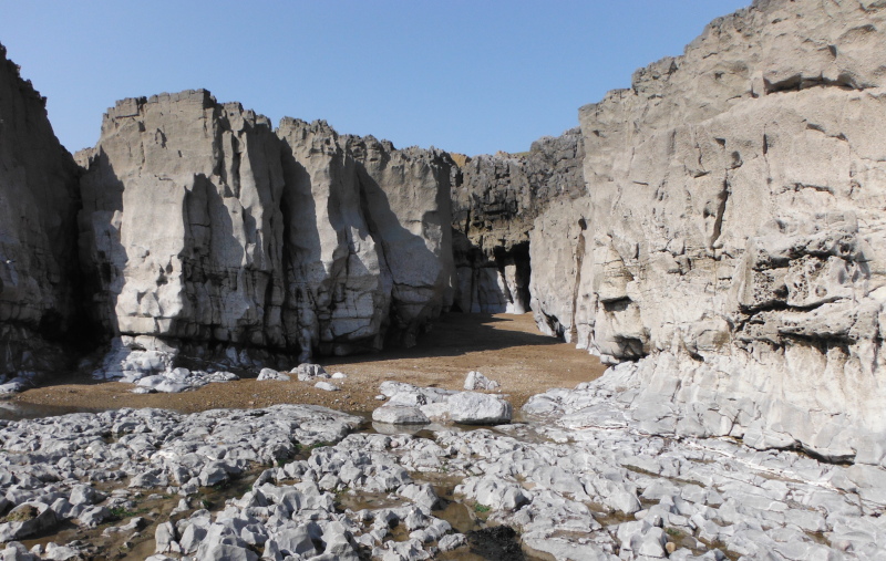
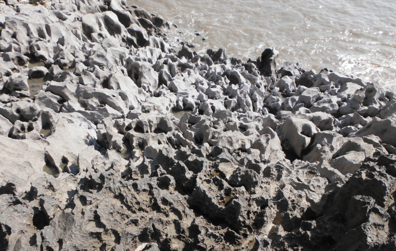
Along most of the ledge, you can`t climb down, but right along at the east end, you can climb down over some incredible rock formations - imagine what those rocks would do to a boat if a wave dumped it on the rocks !
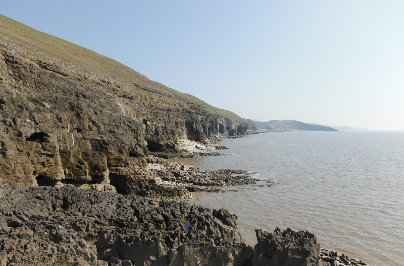
The end of the ledge marks the start of a stretch of some much higher cliffs, which I believe have some high grade but somewhat underused climbing routes, collectively known as Ogmore.
The path is high above the cliffs, and you can`t really see much of the cliffs, but here is a view of them taken from the end of the ledge.
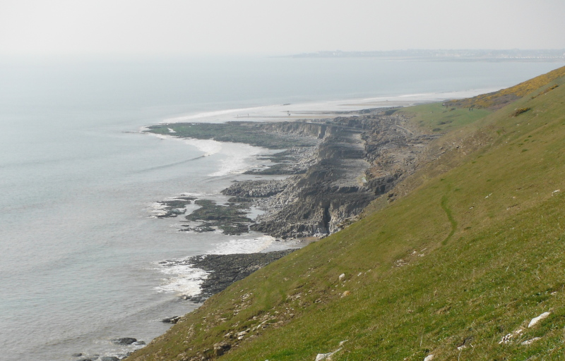
A wee bit along the path, and you can look back at the ledge - it is the strange looking flat area just to the right of the middle of the picture.
And as you can see, the path isn`t for the faint-hearted either.
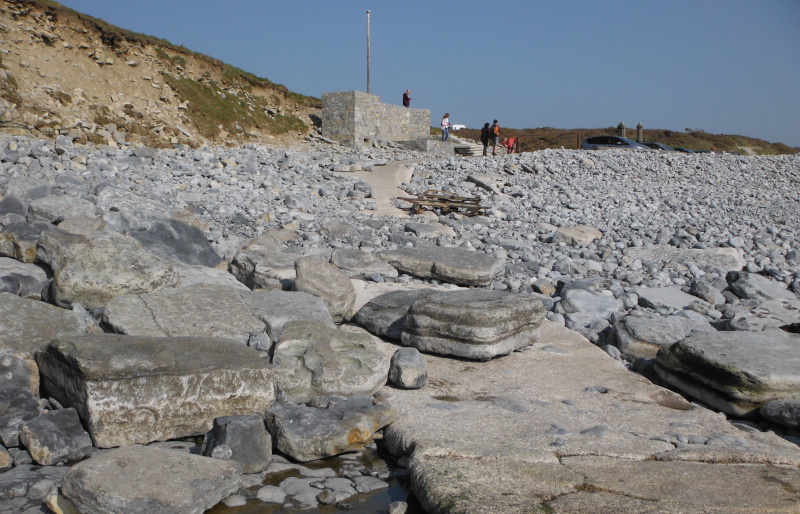
Eventually you drop down to Dunraven Bay, which is a mecca for tourists, with acres of sandy beach at low tides.
The good news is that Dunraven Bay has a slipway - the bad news is that it is unuseable - previous storms have dumped loads of boulders over the upper part of it, so it is impassable to anything with wheels.
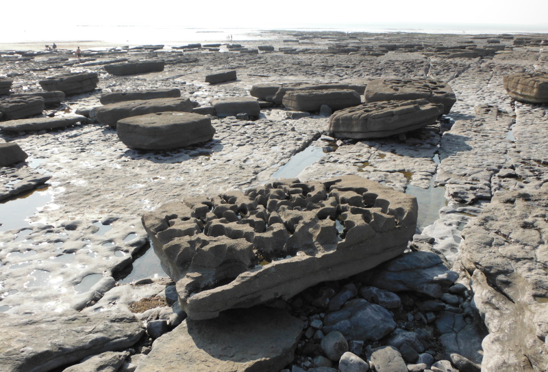
Above the sandy beach, there is a large area of flat rock, and it has the most amazing big sandstone blocks on it - they must a weigh a ton or two each, but that doesn`t seem to be a problem for the sea to play draughts with them.
And then it was back to my starting point, and all in all, it is a rather good bit of coastline.
website design by ron-t
website hosting by netnerd.com
© 2025 Ron Turner
![]()
![]()