out and about - 2015
26 February 2015 .............. Ramsey Sound
Ramsey Sound is the channel between Ramsey Island and Pen Dal-aderyn, the headland which is the most westerly point of the Welsh mainland.
The Pembroke Coastal Path goes right round Pen Dal-aderyn, and is accessible from St Justinian`s and from Porth Clais.
I had a particular reason to go there, which was to have a look at The Bitches - in case you are not familiar with them, The Bitches are a line of rocks sticking up out of the sea halfway through Ramsey Sound, they project out from the east side of Ramsey Island and go about a third of the way across to Pen Dal-aderyn.
They are famous in the kayaking world, because the very strong tidal current through Ramsey Sound is obstructed by The Bitches, and you get some quite wild white water features which provide some classic play potential for playboats, old school river-running playboats, and sea kayaks - though not neccessarily at the same time.
The Bitches are the Welsh equivalent of the Falls of Lora, in that they provide quite a rare feature in tidal streams - static waves. Most tidal streams produce dynamic waves, which behave quite differently from static waves.
The only other place that I know of that provides a static wave from a tidal current is the Swellies in the Menai Straits - the Swellies can produce a fabulous play and surfing wave, but it is a bit inconsistent, and the Swellies are in a very different type of environment from either the Falls of Lora or The Bitches.
There may well be others, but so far I haven`t met them - Skooks is a bit too far away for a day trip !
Anyway, after all that, because of my interest in them, there are a lot of pictures of The Bitches in this web page - if photographs of a line of rocks aren`t your thing, then that is a bit tough.
However I also found that the Pembroke Coastal Path from St Justinian`s to Porth Clais is a fabulous walk - there aren`t many dramatic cliffs, but some great views in every direction.
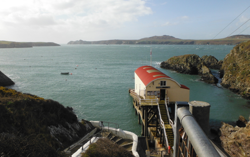
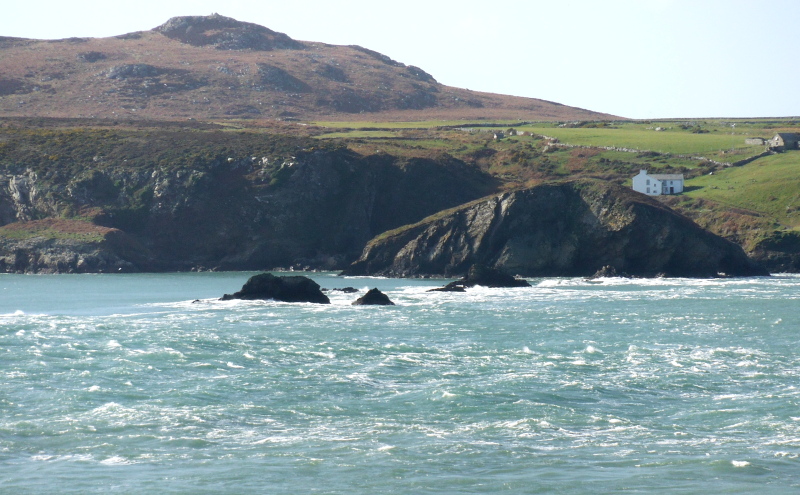
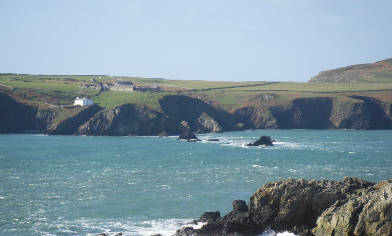
Looking down on St Justinian`s lifeboat station - this lifeboat station is now too small for the current generation of lifeboats, and a new station is being built just along the coast.
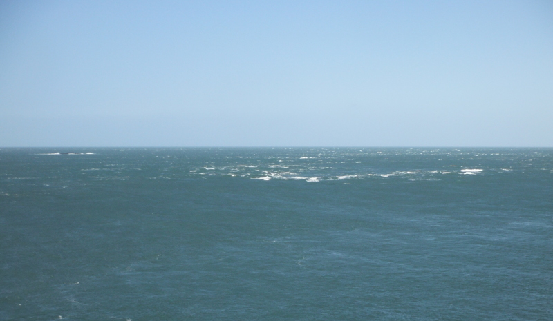
My first sight of the Bitches away across Ramsey Sound - perhaps a bit of additional information might be useful here - the tidal currents through Ramsey Sound are characterised by the fact that slack water is 2 or 3 hours after high and low water - so whilst this picture was taken somewhere around high tide, the strong north flowing "flood" tide continued for another couple of hours.
Along the coastal path a bit, and looking back towards St Justinian`s - you can just see part of the current lifeboat station, below the house.
Away in the distance you can also just see an island - I am not sure exactly where I was when I took this picture, but I think the island is probably Carreg-trai.
It would be a good bit of coastline for sea-kayaking - here are a few of the features -
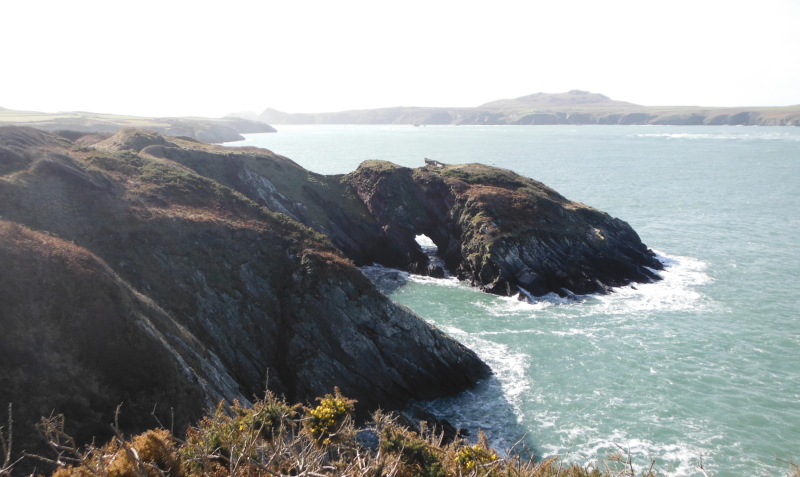
Getting a bit closer to The Bitches now, and the tide has dropped a bit - but still with the north going tidal flow.
Further along the coastal path, The Bitches are getting a bit nearer, but I `m beginning to look along them a bit, so not such a useful view.
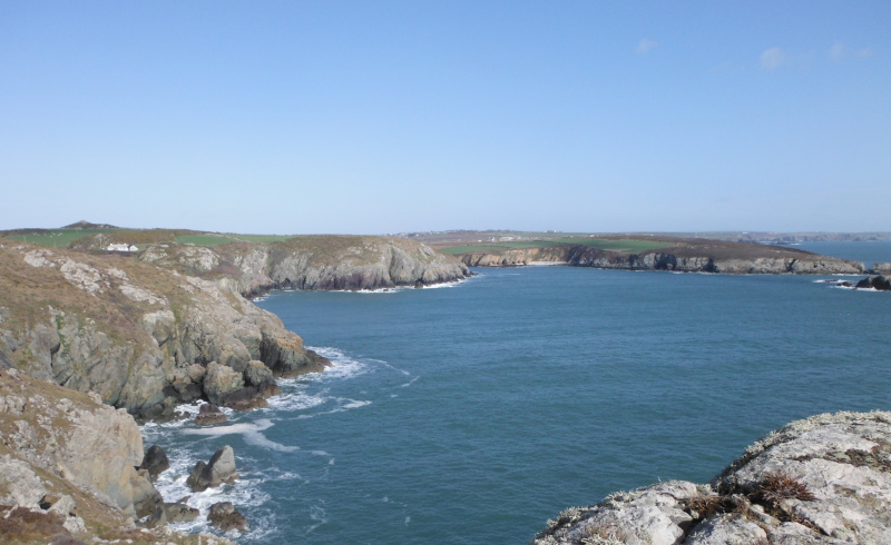
Looking up Ramsey Sound, and there is a distinct tide race somewhere up beyond St Justinian`s.
Further along the path, and The Bitches are getting a bit nearer -
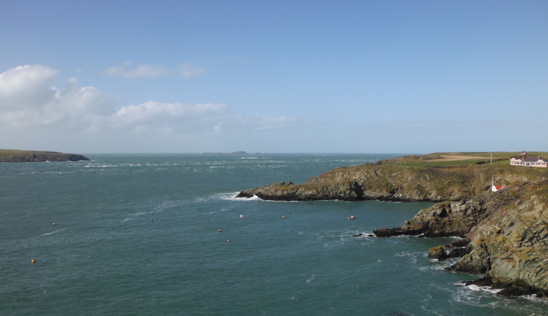
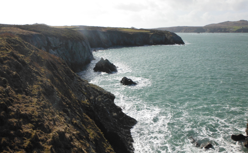
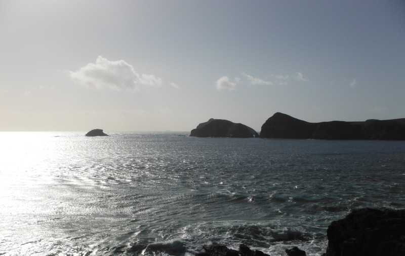
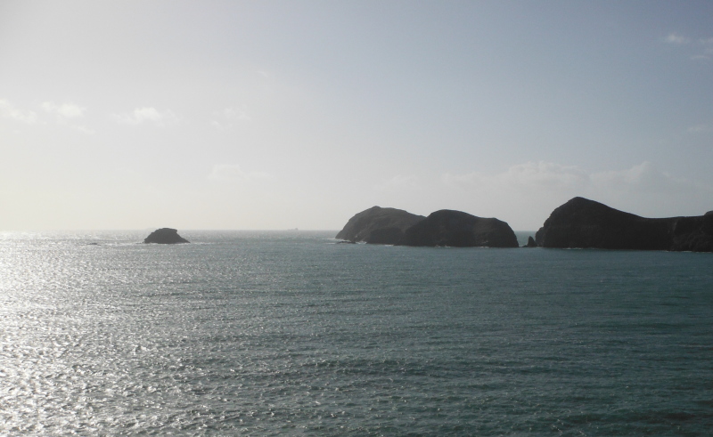
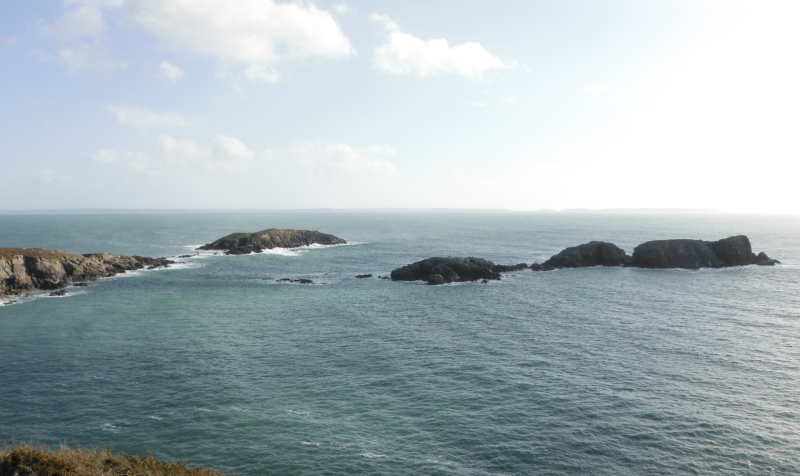
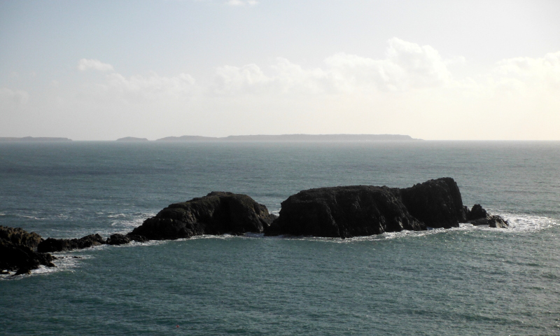
I think I am now past Pen Dal-aderyn, the most westerly point of Wales, and beginning to get some good views across to the southern end of Ramsey Island.
There are a few islands down at the bottom of Ramsey Island, the main ones are Ynys Canter, Ynys Bery, and the smaller Ynys Eilun.
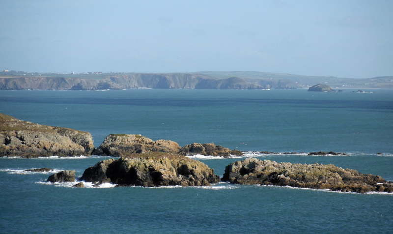
I love this type of photograph, where you loose the colour, but gain so much from the amazing lighting that you really only get from the sea.
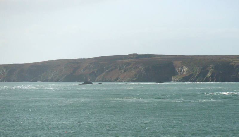
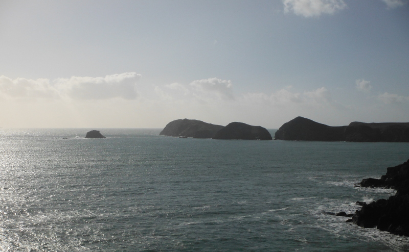
If you look very closely at the second and third pictures, you can just see what I think are Grassholm Island and The Smalls, they lie 7 kms and 26 kms respectively to the west of Skomer Island.

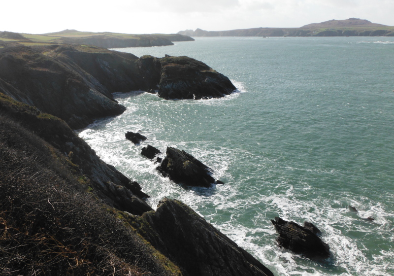
Looking back up to The Bitches from the other side - the tide has dropped some more, but still the north going flow continues.
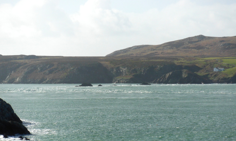
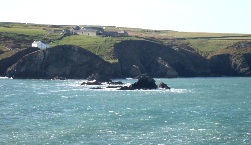
Further round the coastal path, and getting a view into Porthlysg Bay.
Out at the entrance to the bay is a rocky island Carreg yr Esgob -

Another view of Carreg yr Esgob -
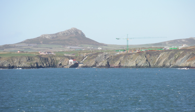
Looking across the tail of Carreg yr Esgob right across to Newgale - over to the right, at the back of the picture, is Newgale Sands.
In front of them is Black Scar and Green Scar, then the two headlands Dinas Fach and Dinas Fawr are further along - I have got some other pictures of these, taken from near Newgale, in a previous web page.
Somewhere in the middle of the picture, in amongst all those cliffs there is a narrow channel that ends in Solva, and further to the left lie the two headlands Gewni and Ystafelloedd.
It looks like another good bit of coastline for sea kayaking.
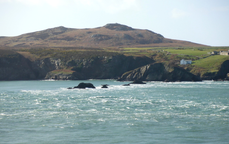
Looking out over the main body of Carreg yr Esgob to Skomer Island.
I continued around the coastal path until I was on the last "summit" before dropping down into Porth Clais, and then turned.
Heading back now, and a last view across to the islands at the south end of Ramsey Island - that looks like another place that is calling out for a visit by sea kayak.
It looks like the north going tidal stream has finally stopped. Now it was quite windy, so I am not sure how much of the white water around The Bitches is due to wind and waves, and how much it is due to a south going tidal stream.
Well back towards St Justinian`s, and from here you can just see where the new lifeboat station is being built - an amazing place to start building a lifeboat station - they are going to have some major civil engineering challenges there.
Well that`s it - what a fabulous bit of the Pembroke Coastal Path, and lots of useful information gained about The Bitches.
website design by ron-t
website hosting by netnerd.com
© 2025 Ron Turner
![]()
![]()