out and about - 2014
12 May 2014 .............. Dinorwic Quarry
After a trip to Llanberis I had some time to spare, so went for a walk up through Dinorwic Quarry.
It turned out to be quite a fascinating walk - I started from the end of the track at the far end of Llyn Peris - there is a public footpath right up and through the quarry to Dinorwig - I don`t know at the moment if you can also get access from Llanberis itself.
Dinorwic Quarry operated for I think about 220 years, and ceased operating in 1969 - so there isn`t too much evidence left of how the quarry worked - most of the metal was quickly stripped out for scrap, and there isn`t much left of many of the buildings.
However there are some bits and pieces left which gave an insight into what went on.
Heading up the track, the first thing I came across was this building, which I think was some kind of winch house - it looks as if it was originally an open building build with larger blocks, then another shell was built on top of it later on.
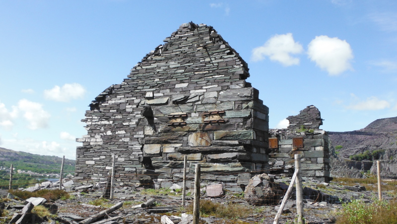
I am guessing it was a winch house, because directly opposite it is an incline that heads off up the hill, although it is not the best example of an incline
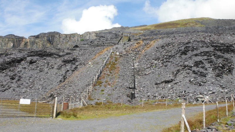
There are several of these inclines, and some of them were quite striking bits of civil engeering - here is another one which is a good example of what they did -
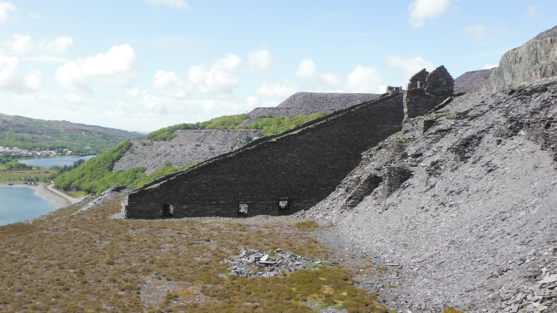
Here is another one showing signs of subsidence -
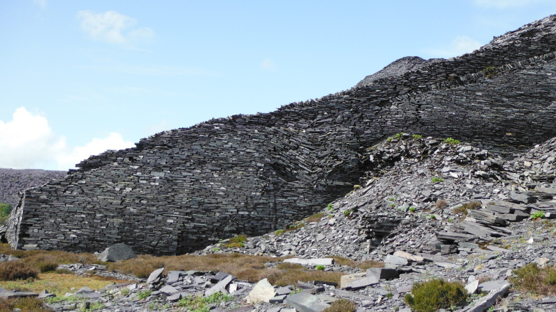
Most of the inclines had passageways through them - I think this one isn`t going last much longer -
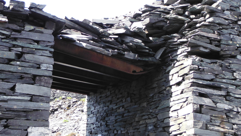
This was the only one of these that I saw - a different way of creating the passageway -
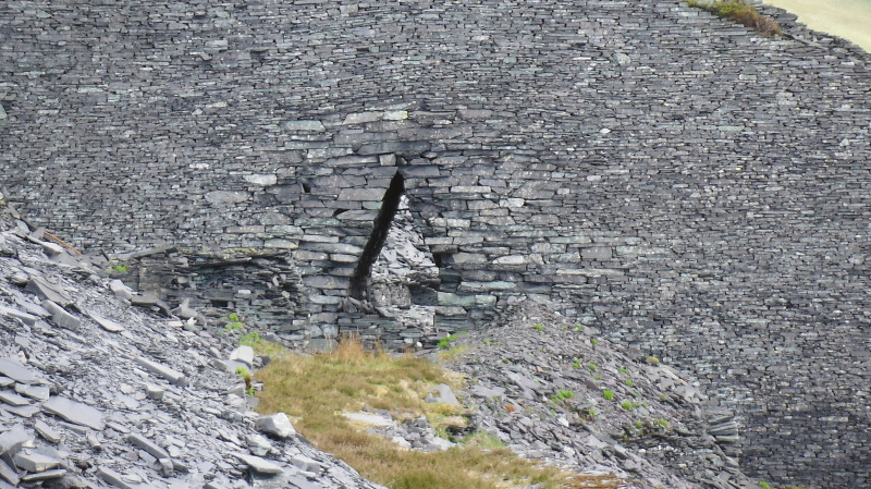
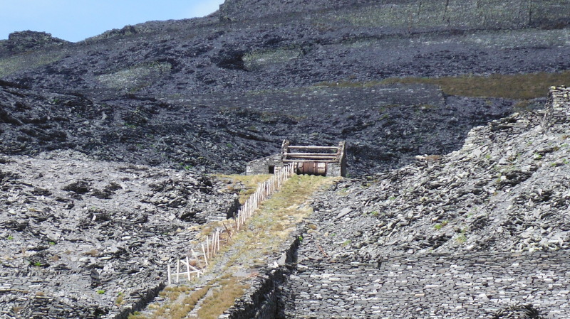
Some of the inclines used the weight of a fully laden buggy going down the incline to pull empty buggies back up the incline - there were two railways side by side on the incline, and each railway had its own cable, with the two cables being wound in opposite directions on the same drum up at the top of the incline.
So as the loaded buggy travelled down, its cable unwound, and the other cable wound up, and pulled the empty buggies back up.
Here is the remains of one of these drums up at the top of an incline - I was right down at the bottom of the incline, and this is maximum zoom on my camera, so it is not as clear as it could be.
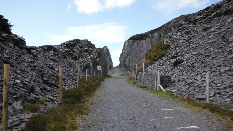
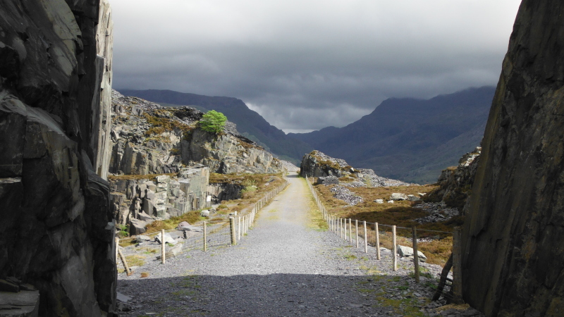
After quite a lot of zig-zag climbing, the track levels out - here it is , and as you can see, it is fenced on both sides to keep you from wandering off the track.
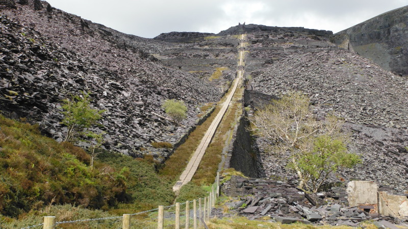
Further along the track, there is another incline, with quite an interesting feature - the two lines of concrete slabs running right up the incline.
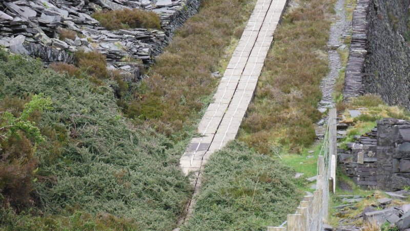
Here is a closer view of the bottom end of the slab, and it looks like the concrete slabs actually supported two lightning conductors - I guess there must have been quite a risk of lightning running down the steel cables and causing havoc to both equipment and people at the bottom end.
It is surprising that the conductors are still there.
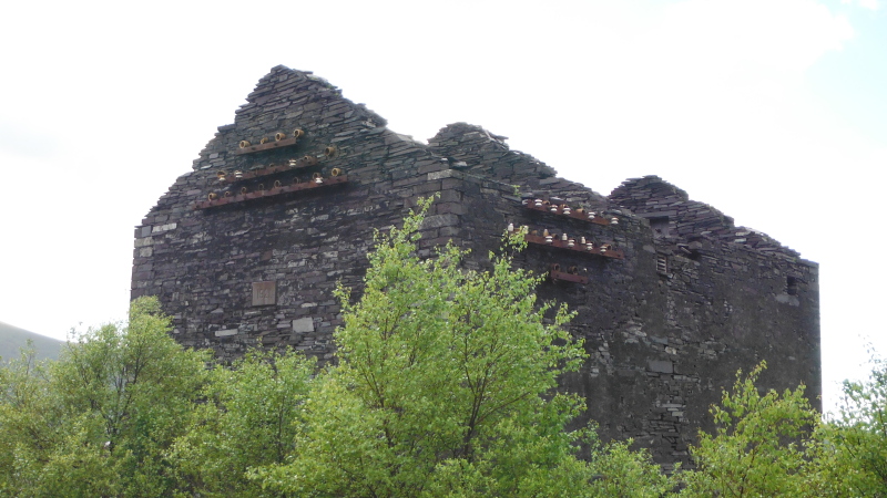
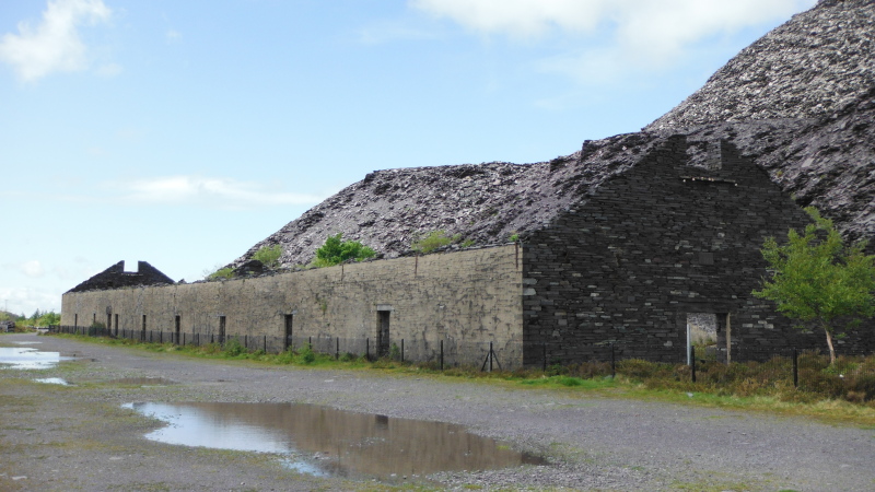
Further along, there is a large flat area - the first building I think must have been a power station, judging by all the insulators around the walls.
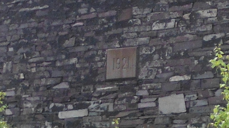
According to the date plaque on the gable end, it was built in 1921.
This is the other building on this big flat area - I assume that this was a workshop where the slate blocks were cut, and the roofing slates were produced.
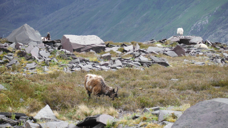
That was as far as I went in the time available to me, so I headed back, past some of the local inhabitants of the quarry -
Looking back along the top part of the track, still in sunshine, whereas up the Pass of Llanberis towards Pen-y-pass it was by now looking very dark and threatening -
-------------------------------
One of the benefits of the path up through the quarry is the fact that you get an excellent view across to the north west side of the Snowdon block.
This was taken quite early on, whilst the weather was still quite good across the Snowdon block - just left of centre is of course the Crib Goch ridge, and the picture shows off a couple of things.
Firstly, you can see quite well how the glaciated bowl Cwm Uchaf sits just below Crib Goch, which is where Llyn Glas lies.
The other interesting thing is the massive scar running horizontally just below Cwm Uchaf - it hasn`t really shown like that on my previous pictures taken from the Glyders.
Can you imagine the size of the boulder that the glacier must have been carrying, to create a scar like that !
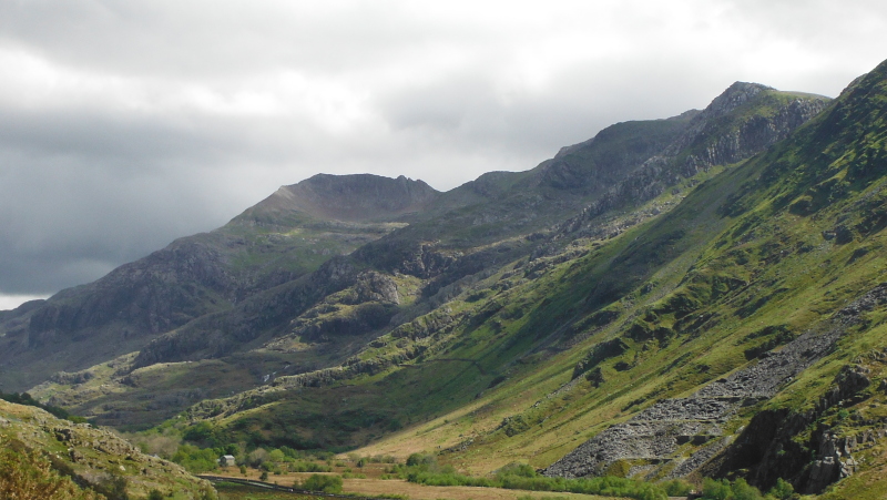
Higher up the path, and Garnedd Ugain comes into view, and you can see that the weather is on the downhill, with the start of the cloud on Garnedd Ugain.
Just below Garnedd Ugain, in deep shade, is the ridge running down from Gyrn Lâs, and just in front of it catching the sun is the Llechog buttress.
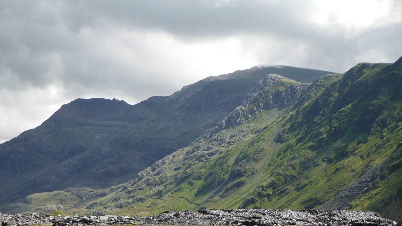
From further up the track, on the flat area around the power station and the workshop, you can see a bit further down the north ridge of Snowdon - and down the ridge from Llechog buttress lies the twin peaks of Tryfan - not perhaps as spectacular as the Tryfan to the north of the Glyders, but quite distinctive all the same.
Behind Tryfan lies the ridge to the north west of Snowdon - Clogwyn Du`r Arddu - or Cloggy to its friends - at least I think that it is Cloggy - Cloggy is a very highly rated climbing area.
Off to the right of Cloggy is the coll Bwlch Cwm Brwynog which is just hidden from view, and over to the right of the picture Moel Cynghorion just makes an appearance.
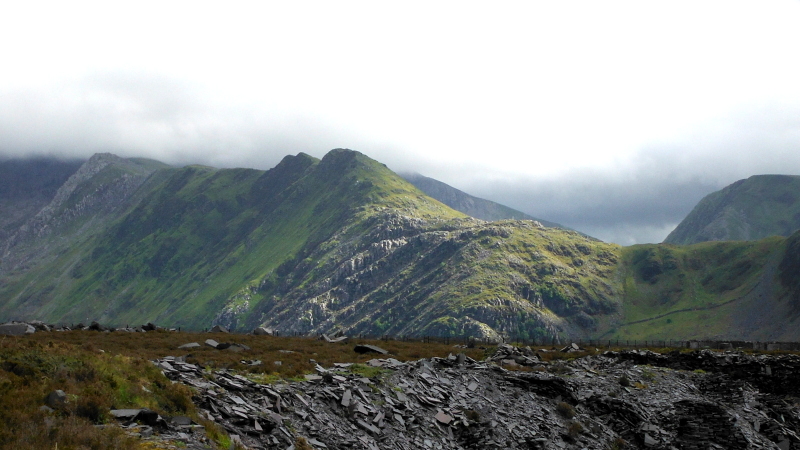
A wider view reveals more of Moel Cynghorion, and also Foel Goch and Foel Gron.
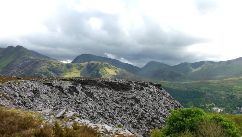
Finally, looking sort of westish from the upper part of the track, looking down on the power station that sits beside Llyn Peris, and across Llyn Peris towards Llanberis in the distance.
The big rocky crag to the left of the picture is another climbing area.
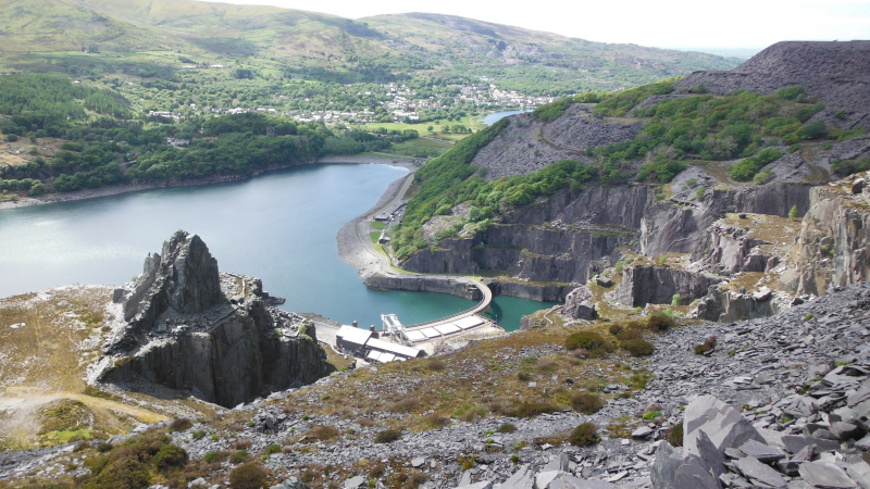
So quite apart from the industrial archeology of the quarry itself, the walk through the quarry provided some good views of the Snowdon area.
-------------------------------
The walk had another highlight as well - as I was walking along the top part of the track I met a climber above one of the big holes in the quarry, and we had a bit of a conversation about climbing - I didn`t know it, but Dinorwic Quarry is world famous for its rock climbing.
The discussion had a bit more of interest when I found that he was very much into bolting and sport climbing.
Considering my commments about bolting after my trip to Great Orme, I hope the conversation wasn`t too inamicable !
-------------------------------
So that was my trip up through Dinorwic Quarry - I don`t think I have seen even a quarter of it, and it would be worth a longer trip, with better footwear.
Searching around on the web, I find there is quite a lot of stuff about Dinorwic Quarry, its history, and its use for climbing.
The National Slate Museum for Wales is based in one of the former workshop buildings at the foot of the quarry, and is accessed from Llanberis itself.
Their website is at "www.museumwales.ac.uk/slate", and there is free entry to the museum.
If you are interested in the history of the slate quarrying industry, another website worth looking at is "www.penmorfa.com/Slate" - it has dozens of photographs taken when Dinorwic Quarry was still working.
Quite a good overview of climbing in Dinorwic Quarry is provided by "www.ukclimbing.com/articles/page.php?id=3682"
www.ukclimbing.com/articles/page.php?id=3682
However there are loads more websites worth looking at as well.
-------------------------------
PS - some texts refer to it as Dinorwig Quarry, and some refer to it as Dinorwic Quarry - I don`t know which is correct - maybe they both are.