out and about - 2013
30 March 2013 .............. Porth Dafarch to Abraham`s Bosom
NB - This page is a composite, made out of several different trips to different bits of this section of the coast. You may have seen some of the photographs in earlier blog entries.
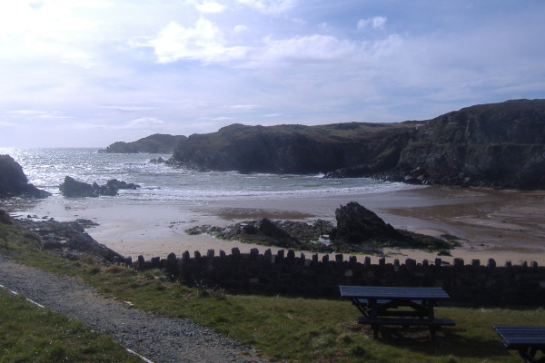
Porth Dafarch is a few kilometres up the back road between Trearddur and Holyhead, it is an attractive beach well used by watersports participants. It provides access to a quite dramatic stretch of coastline the whole way from Trearddur almost up to Holyhead, including Dinas Stack, Penrhyn Mawr, South Stack, and North Stack.
It is the easiest place from which to access the tide races at Penrhyn Mawr. It is a long narrow flat beach, and seems to pick up the surf.
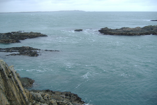
Here it is, looking out to sea.
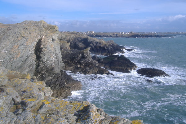
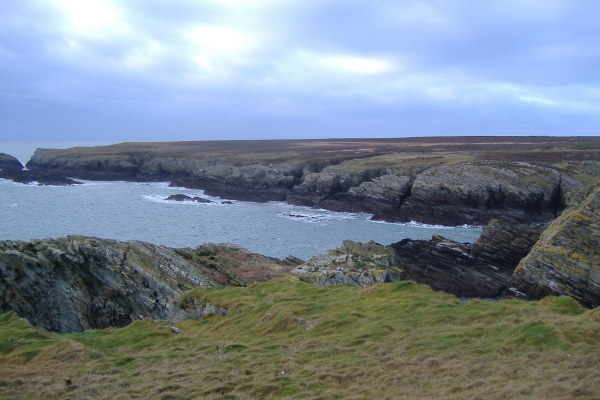
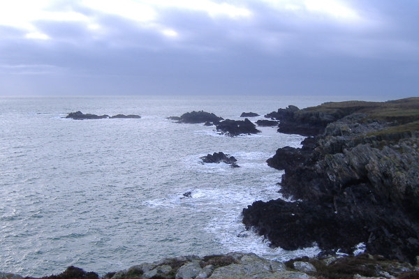
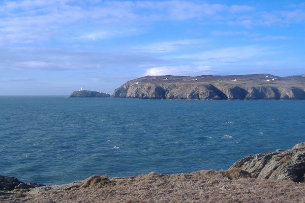
If you head out along the coastal path to the east, after a few hundred metres you are up on a headland, and you get a view of the coastline down to and past Trearddur, eventually out to Rhoscolyn Head and Rhoscolyn Beacon. It is quite a rugged bit of coastline, and would be an interesting paddle.
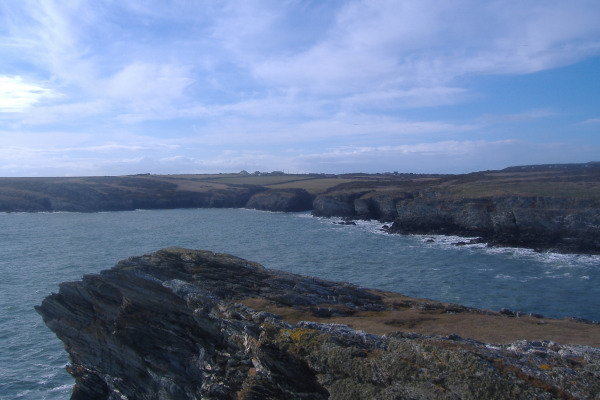
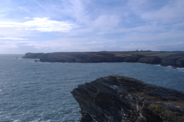
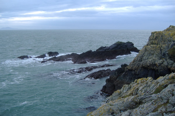
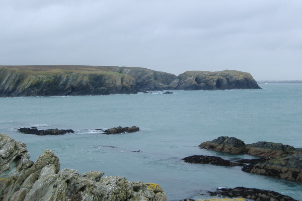
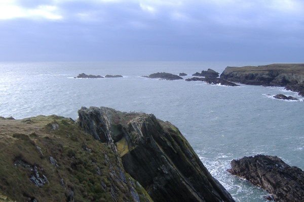
The same headland gives a good view across the mouth of Porth Dafarch to the start of the coastline that this web page is about. The first picture is the coastline immediately out from Porth Dafarch, the second picture is looking a bit further round, looking out to two headlands, the further one being Dinas Stack. As you can see, the pictures are looking across the top of a large undercut fin of rock that sticks out of the side of the headland - it is probably 30 - 40 metres high.
Almost as soon as you are out of the west side of the bay containing Porth Dafarch, the view of the coastline out to the west starts to open up.
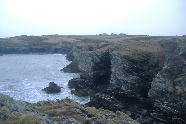
The next headland stands out nicely.
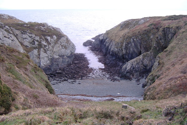
After following the coastal path for a while you come across a narrow stoney beach with a long narrow entrance tucked into the corner of this bit of the coastline. The OS map doesn`t show it, but I think it is known as Porth Rhydau, or sometimes Coppermine Cove. I don`t seem to have taken any pictures of it, but you can land there without to much difficulty, and could climb up the back to get onto the coastal path.
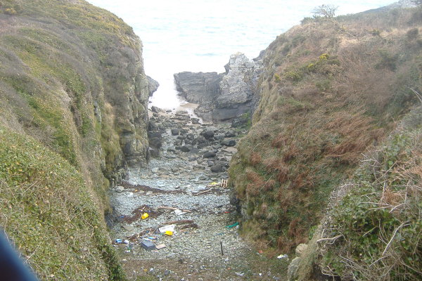
After a small headland, there is another stoney beach, narrower than Porth Rhydau, and full of rubbish, so not the most attractive place.
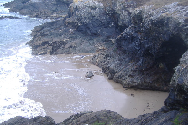
There is then an odd bit of coastline, the quite high rocks/cliffs descend into a sandy beach at low tides.
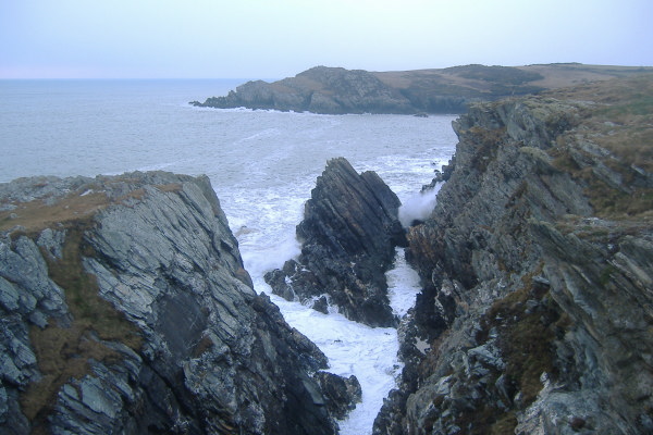
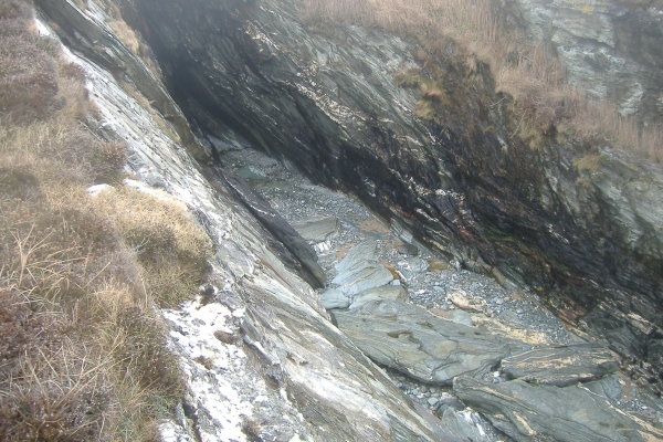
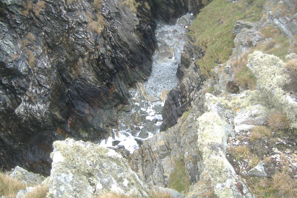
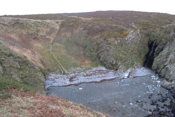
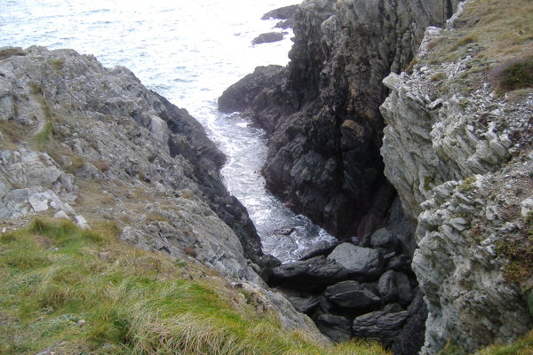
Over the next few hundred metres there are several of the deep cuts into the cliffs that seem to be so common on Anglesey.
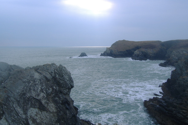
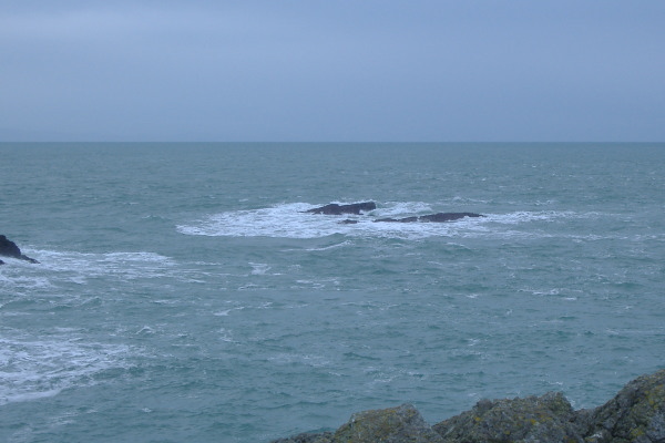
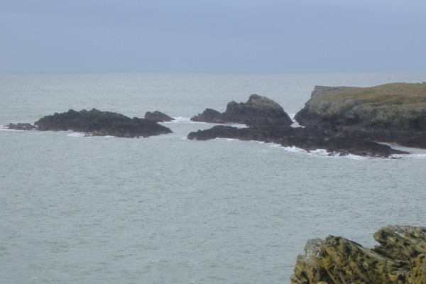
You eventually come to a headland, and just out from this headland, there is a shoal of rocks that may provide a bit of rock play at lowish tide levels.
From this headland you get a good view across to Gul Rock just off the side of Dinas Stack. It is worth noting that a few metres away from Gul Rock there is another rock which could catch you out.
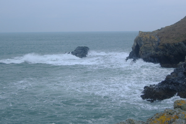
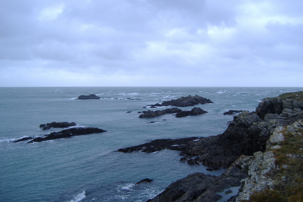
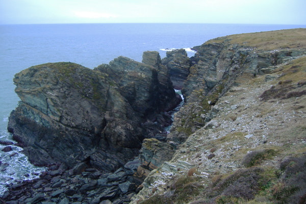
Looking back from the headland towards Porth Dafarch, you get a good view of the ruggedness of this coastline.
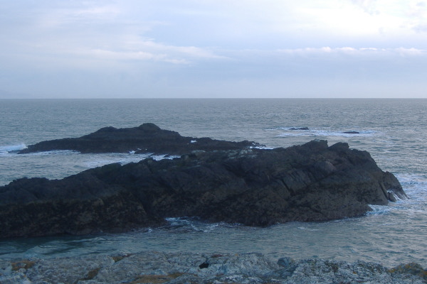
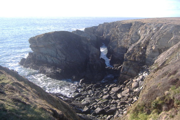
Dinas Stack is quite a fascinating feature - although it is known as Dinas Stack, it is a bit of puzzle as to whether it is a stack, or whether it is a headland. It would be an island with a deep curved gash between the mainland and Dinas Stack, except there is a ridge of boulders that have fallen of the cliff. You can just see the end of the gash in the above picture.
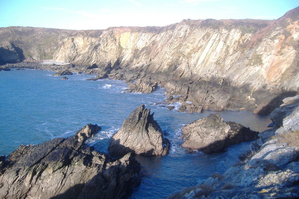
From further round the coast, you can look back at Dinas Stack and better see the ridge of rocks that tie them together. It looks like there are some interesting rock formations around the north west side of Dinas Stack.
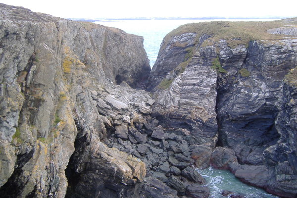
I tried to get down to the ridge of boulders, but I couldn`t see any way down the cliffs above the ridge without a rope. You could abseil down a rope, but could see absolutely nowhere above the cliffs that you could use as a belay point. I expect it has been done though.
From the top of the big gash between Dinas Stack and the mainland, you can look across to Dinas Stack, and in one corner there is a large hole through the rocks. The first picture was taken during a Springs low tide, and the second picture was taken at a Neaps mid tide. You can`t really see it in this second picture, but the swell was exploding through it.
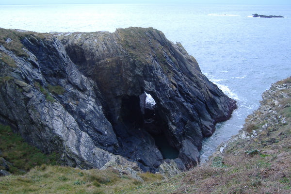
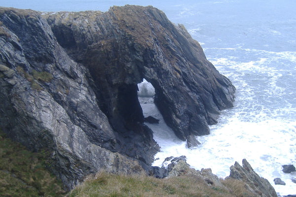
I discovered from a sea trip out to Penrhyn Mawr that this hole is actually the end part of quite a large arch.
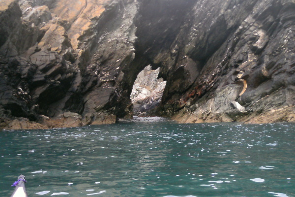
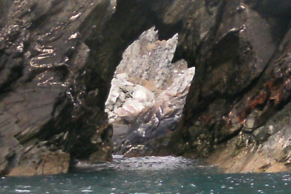
At higher tides in the right conditions it is possible to paddle through the hole as long as you can squeeze past the boulder, but watch out for the effects of swell which would be deadly, especially around the boulder - timing is everything.
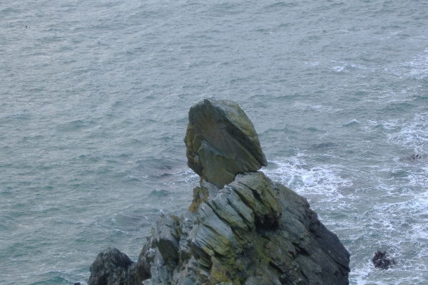
A bit along from Dinas Stack there is another bit of nature`s rock sculpting - a large boulder sitting on top of a ridge of rock. It`s very impressive.
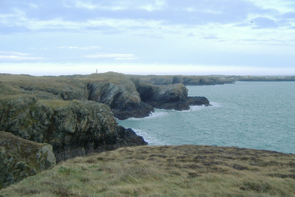
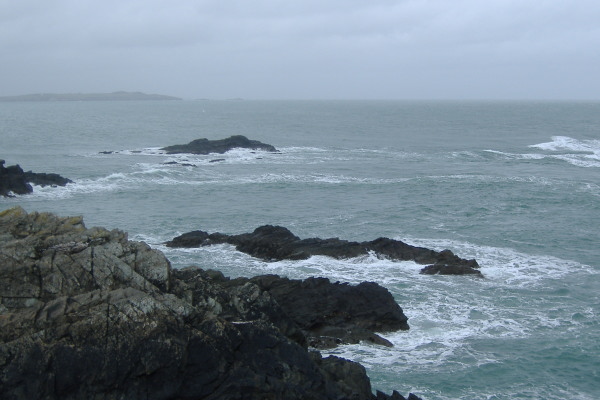
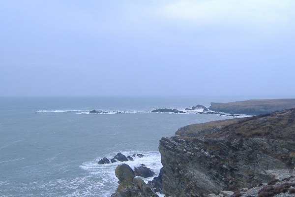
As you work your way round this bit of coastline, you begin to see north west and north up towards Penrhyn Mawr. This bit of coastline isn`t just as spectacular as it is around Dinas Stack and its associated headlands, however it is by no means tame, it is still quite wild, with no places to land.
You also begin to view the rocks that contribute to the tide races at Penrhyn Mawr.
However before you get there, there is another very useful coastal feature - the coastline curves round and heads inland, and reveals another beach, Porth Ruffydd. The beach itself is maybe about 100 metres wide, but the entrance is a much narrower passage through the rocks on either side. Again, these pictures were taken pretty much on a Springs low tide, so you can see that there is good access to the beach at all tide levels.
In an emergency, you could evacuate from Porth Ruffydd - it would be a bit of a struggle to get sea kayaks up the steps, then there is a long flat walk up to the car park at SH 805 216. You are never going to use it for routine access, but it might be possible in an emergency.
There are only a few places between Porth Dafarch and Soldiers Point beside Holyhead breakwater that you can you land - some of them are backed by cliffs and you can`t get off the water from them. So Porth Ruffydd is a useful one to know about.
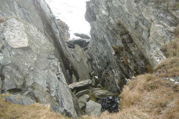
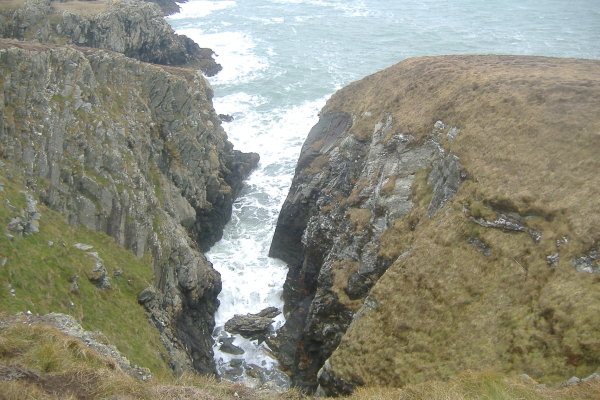
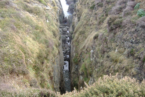
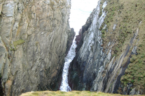
As you head up the coastline towards Penrhyn Mawr, it is still a rugged coastline, and it has very deep and sometimes quite narrow slots deep into the rock. Here are three of them, in no particular order.
Time to move on to Penrhyn Mawr and it`s famous tide races on the flood tide. Here is a view of Penrhyn Mawr as you head up the coastline -
and here is a closer view where a shaft of sunlight has somewhat confused the autoexposure on the camera to produce a nice effect.
Beyond the outermost of the main rocks at Penrhyn Mawr there are two small rocks that appear at low tide level - they are known as the Fangs, and could catch out the unwary. Here are two views of them. The nearer of the two is actually quite a bit longer than what you see in these pictures, it stretches out towards the main outer rock. You only ever see it when there is a deep wave trough and a low low tide.
Penrhyn Mawr looks a little different during a flood tide - here is a general view -
Looking back, this shows the inner and the outer races. I am not certain of this, but I think that the white water on the extreme right of the picture is caused by the Fangs.
A bit nearer the shore, there is another way through the rocks, that doesn`t really have a race, just some interesting dynamic water.
There is a fourth way through the rocks during the flood tide, which looks to be a useful chicken run. This long focus picture shows it close to the shore, this is near low tide.
However this slot has two stings in its tail.
The first is that as the tide level drops, some rocks right in the middle increasingly interrupt any swell through the channel, and you get quite a big wave over the rocks. These rocks dry out at Spring low tides.
The second is that, although it doesn`t show in this picture, just beyond the channel, you are chucked out into quite a confused bit of water, and you are going to have to negotiate through this, and around another rock which is exposed to the swell.
So it is not the simplest of chicken runs.
On my most recent trip on the coastal path around the Penrhyn Mawr coastline during an ebb current close to Springs, there was no evidence of any kind of tidal currents. All the disturbance in the water was from the wind.
This picture was taken on a different day from further back along the coastline, when there was a strong east wind - Penrhyn Mawr was looking wild.
The white water to the left of Tide Rip Rock is I think caused by the Fangs - every now and then there would be enough of a wave trough that I could just catch a glimpse of one of them. It looks like the Fangs are quite a bit further out from Tide Rip Rock that what they appear to be when you are up on the cliffs overlooking Penrhyn Mawr.
The other thing I noticed was that the channel beside the headland would have been quite tricky - even from so far away I could see the swell exploding at the far end.
A useful feature to know about at Penrhyn Mawr is that at high tides, you can paddle in through a narrow slot and land on a very sheltered stoney beach. It is surrounded by cliffs, so you can`t get off the water there, but it`s handy for a pit stop.
As you head round from Penrhyn Mawr, the ruggedness of the coastline continues unabated. Somewhere along the way there are three rock pinnacles - at Springs lows they are pretty much high and dry, at higher tide levels they may well provide some play time. I couldn`t decide which photo shows them best, so I`ve shown both of them, shot on different days.
At high enough tide levels, you can paddle right through behind the three pinnacles.
As you head on round, the coastline curves round and takes you towards Abraham`s Bosom, the last refuge before South Stack.
You don`t want to let Abraham clutch you too close to his Bosom, there are some very sharp jaggy rocks in there, and at higher tide levels they are sitting just below the surface quietly waiting for you -
Rock + Composite = Hole !!!
There are various small stoney beaches in Abraham`s bosom, but a lower tides they are blocked by boulders. You might be able to land on them at higher tides, but I don`t think there is any chance of getting off the water there, those cliffs will not allow it - next stop is Holyhead.
Right at the back of Abraham`s Bosom there are two beaches with flights of wooden steps up from them - one of them is a private beach, and there is no public access up the steps. The other one is a public beach, you can use this one, the steps will eventually take you up to the public road, but I wouldn`t want to be trying to get a sea kayak up there.
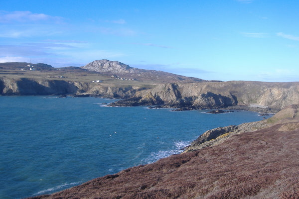
That is as far as I`ve been so far along that bit of the coastal path, however you do get a fine view looking across Abraham`s Bosom to South Stack.
website design by ron-t
website hosting by netnerd.com
© 2025 Ron Turner
![]()
![]()