Exploring the Craighall Gorge
Introduction
As someone who has done a lot of river paddling, I tend to be curious about rivers, and their potential for paddling. The description of the river Ericht in the SCA river guide suggests that there is nothing of interest in the Craighall gorge, and it should not be paddled.
This aroused my curiosity, as gorge sections can be quite good fun to paddle through. So I decided that the only way to find out about it was to go and see it for myself.
On two separate days I tried to go up, and down, the gorge - but I never made it right through. It is a stunning gorge, with a very big sting in the middle.
My desciptions tend towards seeing the gorge in terms of its paddling potential.
Craighall gorge
The Craighall gorge is certainly a very impressive sight - for those not familiar with it, it is the deepest gorge in Scotland, the river Ericht which runs through it is roughly 100 metres below the top of the gorge. It is almost impossible to see much of the river from the top, partly because of the shape of the gorge, and partly because you are looking down on a canopy of trees which grow down at the bottom. You can see a wee bit more in winter, when the trees have lost their leaves. For much of the length of the gorge, the walls are bare vertical rock from top to bottom.
In some places it is up to 50-70 metres wide, in other places, just a few metres wide.
Depending on which website you read, it is either a conservation area or an SSI - maybe it is both, so it needs to be treated with respect.
The river Ericht has its own micro-environment down at the bottom of the gorge - sometimes it has wider bits with rocky or grassy beaches, in some places the walls close right in and the river is within a gorge within the main gorge. There are pools, drops, and rapids in no particular order. At one point there is a raised beach which backs onto a vertical cliff face - at the bottom of this face, the river has in the past cut a deep, quite long cave which you can just about walk in, so the cliff is hanging above air.
The only way to really see the gorge is to go into it.
Exploring the gorge
In May 2010, the river Ericht had dropped down to a height of 0.6 metres at the SEPA measuring station at Craighall. This is an unusually low level - the Ericht has a large mountaineous catchment area - it extends right across from Ben Vrackie above Pitlochry to Glas Maol in the east side of the Glenshee ski area, and it needs a long dry spell before the river gets this low.
On the first day, I tried to go up the gorge, but failed. A few days later, the level had dropped a bit more, to 0.55 metres. So I took a gamble that if I got stuck, I could get back up again, and tried to go down the gorge. However in the webpage I descibe them the other way round, as it is more logical to describe the gorge from the top down.
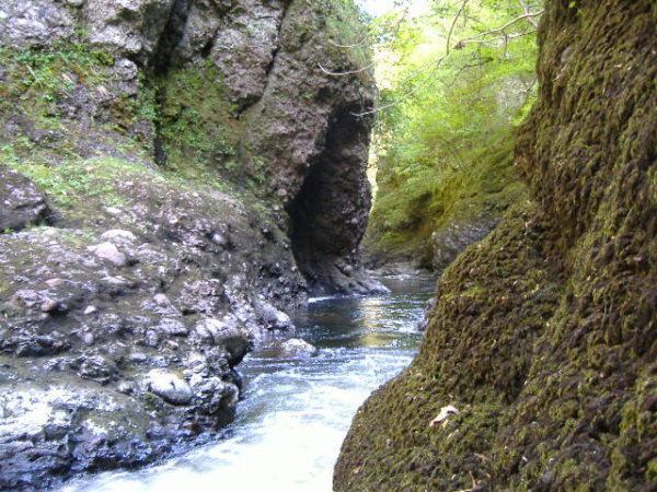
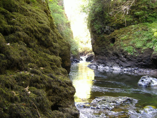
The gorge starts very quickly, and it is very obvious that you are going into a committing gorge - here is the Ericht just before it goes into the gorge.
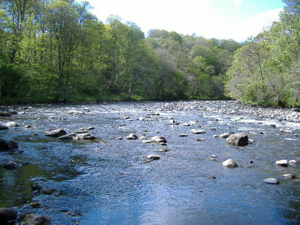
Turning round, the start of the gorge is in the far corner -
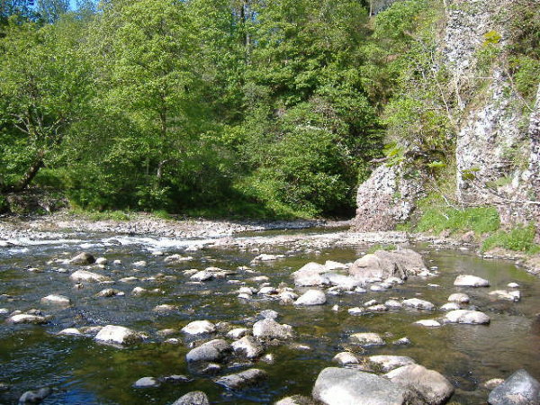
Very quickly you are in the gorge, and there is no going back -
Looking further down, with the vertical side of the gorge in the background -
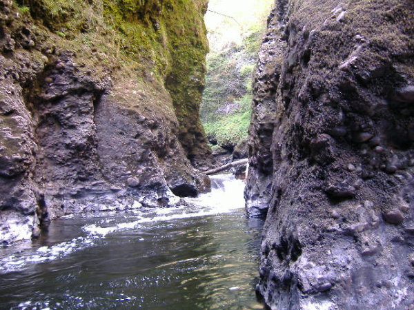
The first hundred metres or so have some nice wee rapids -
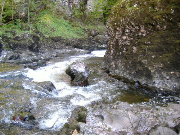
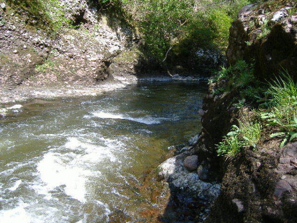
and some more gorgey bits -
Here is an interesting bit - way into the gorge you come across this - as well as a rather nice ramp in the river, the car ramp is actually bolted down onto the rocks. And there is a large steel spike driven into the rock. The rocky bit that I`m standing on is actually in an alcove in the rock face - so there is 100 metres of rock above my head. At high levels this would be a significant undercut.
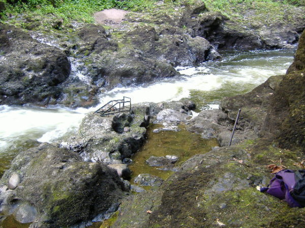
The car ramp and the spike may be a bit of a problem for paddlers at higher levels, or they may be submerged, I don`t know which.
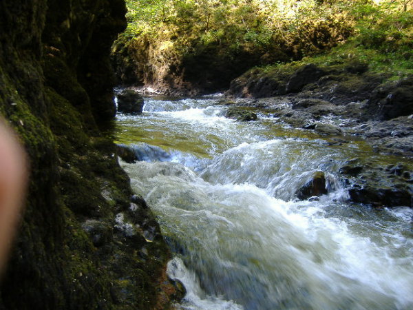
After the fun bits, there is a long flat portion - may be 100 - 150 metres or so in length, which is pure gorge. The white bit in the photo isn`t daylight, it`s the rock wall of the gorge -
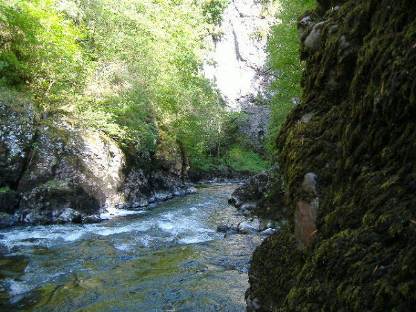
At the end of this gorge section, the walls of the gorge widen out quite a bit, and a big slab of rock right across the gorge forms a dam - at this river level the dam is 2 to 3 metres high.
On either side of this dam, there are vertical walls of rock maybe about 100 metres high that would put a Yosemite big wall to shame.
There are two deep slots that cut right through this dam, and at low levels the river flows through these slots, not over the top.
The first slot is straight in front of the river, and is something like a metre wide or less.
The second slot curves round in a sort of semicircle, against the gorge wall, river left. The later part of the outer edge of the slot is the start of a long horizontal ledge a few metres wide. When I was there there was a tree trunk stuck vertically in this slot.
At this level, the slots are of course the same 2 or 3 metres or so deep as the dam is high. It is an easy climb up from the river level onto the dam beside the first slot, as long as you don`t get washed into the slot - the slots have vertical sides, and once in them there would be no escape.
At higher levels, the water level behind the dam will quickly rise, so that the water is coming over the dam, the top of the dam will be under water, and there will be a very unpleasant 3 metre drop in to a seething mass of very fast water pushing down the gorge towards another drop that I still haven`t seen yet. At higher levels, you are looking at grade 5/6.
The long horizontal ledge might - might - provide an escape route past the grade 5/6, but you would have a big seal launch straight into a very fast current, and it is only at a few very specific levels that you could get onto it.
Now of course I should have a picture of all this - but I don`t - by this point I was standing on the dam freaking out about the fact that I was totally stuck - I couldn`t go on because the down river side of the dam is a vertical rock face, and I couldn`t go back because I was way past the point of no return, and there was no way I could swim back up the previous gorge section.
The infamous portage ledge was not available to me, because it was 3 metres above the water level in the second slot. Even if I could have got onto it, I don`t think I could have got down off the far end, as it is too high above the river. However I did eventually escape from spending the rest of my life on that slab of rock.
The other day
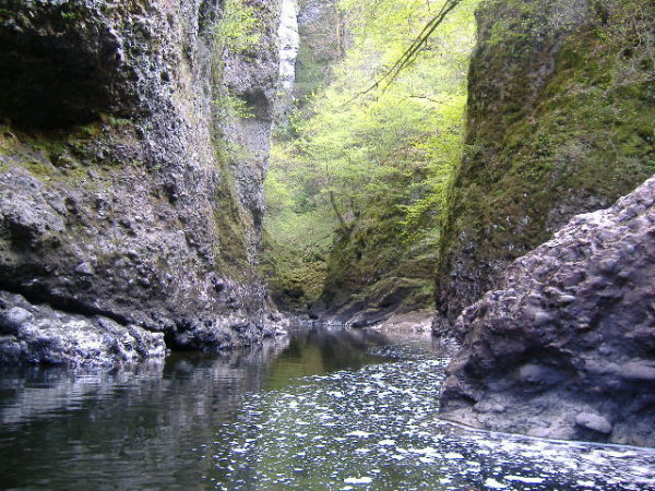
A few days before my trip down the gorge, I had tried to get up the gorge from the bottom end, I did get some way in - and the bottom end of the gorge is just as impressive as the top end -
and
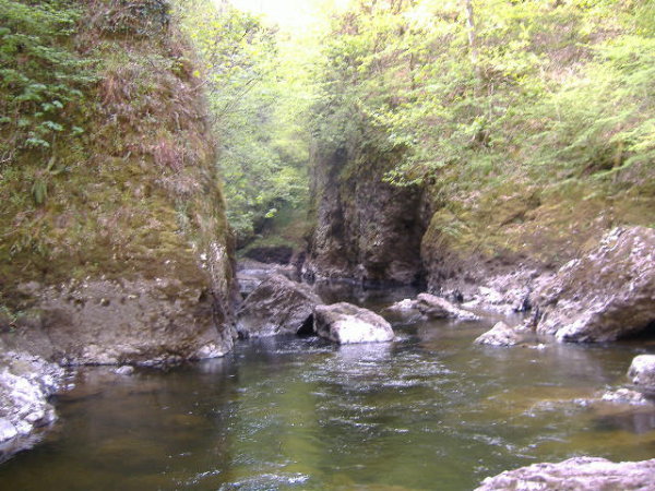
It was a bit slow trying to go upstream, and eventually I came to a halt at a clean drop of about 1.2 metres or so, and there was no way I could get up it. The drop itself is clean and straightforward, however just below it there is an alcove in the rock river right, and a lot of water was flowing into this alcove, and none was flowing out. So there may be a sump/siphon there.
Finally, here`s the end of the narrow bit of the gorge, looking up river -
Downstream of this you are still in the Craighall gorge for another 400/500 metres or so, but it is much wider, and after a flat boulder section, the river is a typical stoney grade 2-ish river.
Maybe one day
Despite these two attempts, I never did get to the middle section of the gorge, so I have no idea what it is like - which is a shame, as it is a superb gorge. For now I`ve moved across to the other side of the country, so I don`t know when or if I could try again.
I expect that at higher levels, many of the features that I have seen and photographed will be gone, and much of it will be washed out - especially behind the dam, where the river level will rise quite quickly, and back-up back up the gorge.
It is a stunning gorge, perhaps made more so because of its inaccessability.
Maybe one day I`ll get through it.
website design by ron-t
website hosting by netnerd.com
© 2025 Ron Turner
![]()
![]()