The river Tay in spate
Wow - it was big !
On 26 January 2008, the Tay was in full spate - 5.8 metres high - that`s 19 feet in old units.
I had been watching the rainfall radar on the previous day, and it showed that a mass of cloud produced heavy rain that covered the whole of the Tay catchment area all day, so it was pretty certain that the Tay was going to rise quite a bit. Looking on the internet on Saturday morning, from various sites I could see that the Tay was up to 5.4 metres, and still rising at all four of the SEPA monitoring stations on the Tay, so Loch Tay was still rising, and pushing water into the Tay. However nearly all the tributaries were dropping, including the Dochart, the Lyon, the Garry, the Tilt, the Tummel, and the Braan. The Isla was steady, and the Ericht was still rising.
I ran the river in the early afternoon, which, just by chance, coincided with the peak in the level of the Tay, which was 5.8 metres at Ballathie.
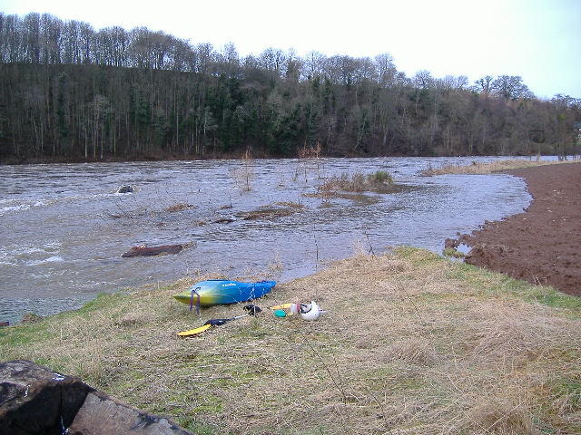
I wasn`t the only boat on the river, a group set off quite a while before I got on the river, so effectively I was solo.
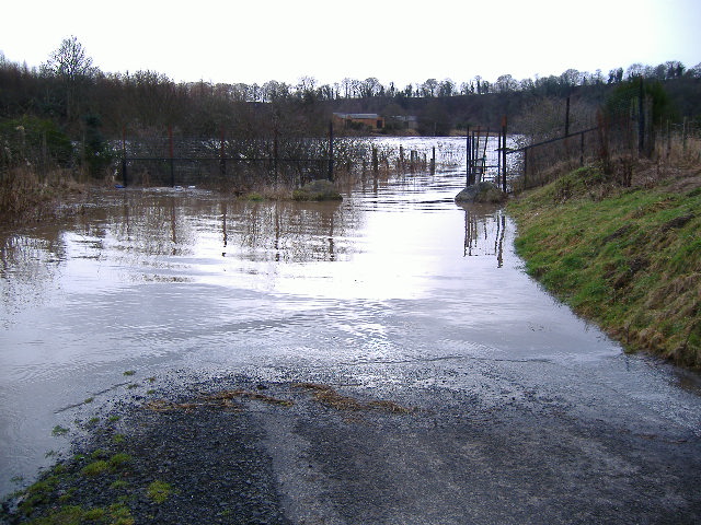
Lots of photos - some of them taken from on foot before I ran the river, some of them taken on the way down. And it was nice that the gate had been left open, so that we could use the carpark.
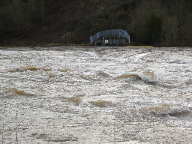
Linn
I would have had considerable difficulty paddling up to the Linn, so I didn`t try. So I couldn`t get anywhere near the main current on the river left side of the Linn. However I could see bits of the Linn from the track that runs up to the hotel - some of the track was under water.
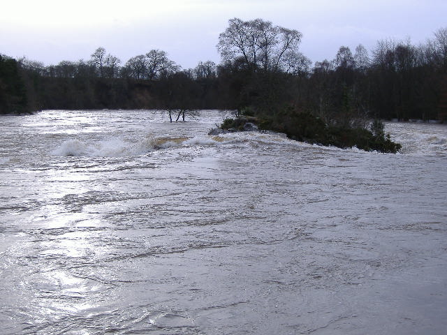
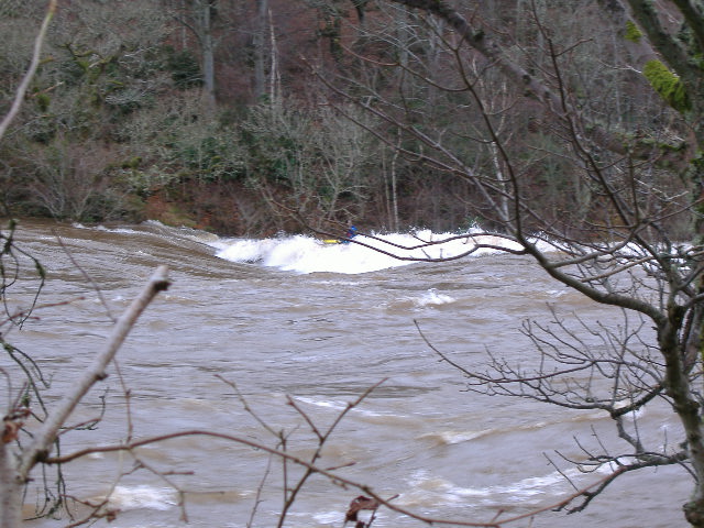
Now you know the two high rocky islands in the middle of the Linn ?
Well they weren`t so high today !
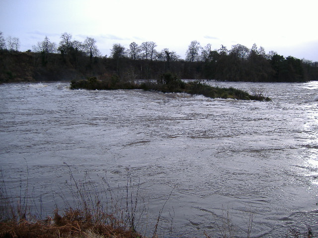
The river right island had a huge pressure wave piled up against it, with a long ramp down to the left of the island, ending in what was probably a large hole - I couldn`t see how large it was.
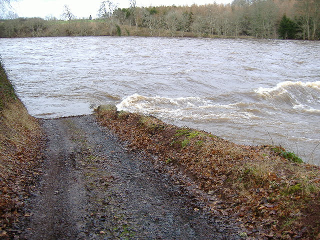
Linn bypass
The Linn bypass was a big volume river in its own right, the top half would be a typical grade 2/3 river in flood - no eddies, into the trees, big volume, waves, and very fast flowing.
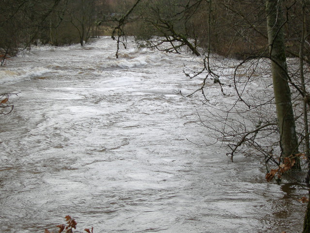
However the bottom end was a death trap - there was a very strong current flowing straight into the trees - there is no way anyone could survive if they got washed into the trees, and it would be very difficult to get out of the main current in order to avoid them. This photo shows what is usually the first exit, and at lower levels, a straightforward turn to the left will get you into it. However in this photo, the main, and very strong, current is flowing from left to right, and as you can see, straight into the trees - that left turn would get you nowhere except into the trees side-on.

Don`t try to use the Linn bypass at this sort of level.
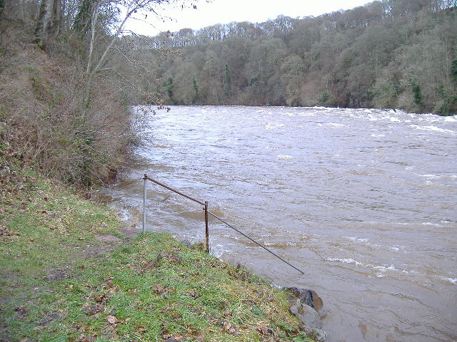
Weir
At this level, the weir has dissappeared beneath a series of stoppers and waves. This is what it looks like at this level, viewed from the left bank. Unfortunately, you can`t really see the size of the stoppers.
The chicken run river left has gone, because the wall is under water. I sneaked down the side of the weir by paddling through the field.
Rapid down to Hell Hole corner
Fairly rough in places, I needed to deviate round the bigger stuff quite often, but basically came down left of centre.
Hell Hole corner
Before I ran the river, I walked along to Hell Hole corner from Stanley Mills. I could see two routes which lessened the exposure to the rougher water. The first was about 4 or 5 metres out from the river right bank - it wasn`t as calm as the chicken run at lower levels, but would have been okay.
The second one was to come down towards Hell Hole corner left of centre, then as the river started to straighten out again, to cut across to the right, and avoid a large train of huge waves left of centre, just below Hell Hole corner.
Well it could have been a good route, if it had worked. Unfortunately it didn`t - whether it was the fact there was quite a strong diagonal current washing me left again, or maybe I didn`t try hard enough, but I ended up going right down thorough the train of waves - all a bit scary. It is very intimidating when you are in the trough, and you are looking right up at a huge wave towering above you. However I survived !
Just a last comment - the chicken run that forms when the river is 2 metres lower isn`t such a good option at this level, for several reasons. The first is that the eddy just above the line of rocks is hardly there at this level, because the road is part of the river, it is very small, and isn`t really flowing upstream like any self-respecting eddy should be.
Secondly, there isn`t a neat entrance to the chicken run, there is a messy wave in the way. And lastly, you can`t sneak round the corner close to the shore, you have to stay further out - maybe about 4 or 5 metres from the bank. But it would still be easier than coming down further out.
This photo is looking upstream, where the road dissappears into the river, and where, at lower levels, there is a a good eddy, and an easier start to the chicken run.
This photo is looking upstream just below Hell Hole corner, and shows the relatively quieter water on the river right side of the river.
I tried to take some pictures of the wave train just below Hell Hole corner, but they were just too far away for the photograph to give any idea of the size of the waves.
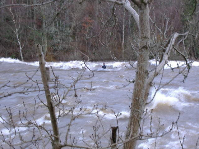
Thistlebrig
Thistlebrig is not surprisingly washed out at this level, and is quite rough over a lot of the river left side. There was a b-i-g wave on the river left side, followed by a second one quite a bit further down. This is the first wave - you can just see a paddler sitting at the far side of it.
After I had run the river and had just got off, someone in a slalom boat managed to get on the second wave - sorry about the quality of this photo, I just had to grab the picture whilst he was on the wave.
Getting out at Thistlebrig at this level isn`t just as straightforward as it usually is. The large eddy river right when the river is 2 metres lower isn`t there, all there is is a much smaller eddy, that is right in the trees, so is a bit harder to get into. However once you are out of your boat, there is no bank to climb up, because the river is less than a metre from the top of the bank.
I started to walk down the path on top of the dyke to have a look at the wave below Thistlebrig, however gave up, because the water coming down the lade was flowing across the top of the dyke, and into the river.
Final comments
One of the things that was very obvious on this trip was that a short playboat was completely out of place on the Tay at this level. The people who were getting the most out of the river were in slalom boats - much longer and faster than playboats.
Reflecting on what went wrong at Hell Hole corner, I came to the conclusion that I should have anticipated that there would be a strong diagonal current at the end of Hell Hole corner - although the river was bending round to the right, the very fast moving water would be trying to go straight on, which meant that my intended route actually required me to paddle across this diagonal current, and I didn`t succeed.
Fortunately, it was a large train of waves that I was trying to avoid, rather than a man-eating hole, otherwise .......
I guess also that the diagonal current formed by the water trying to go straight on would build up a high pressure area on the river left side. Once the river had straightened out, the high pressure area ended, and the wave train formed below it, just like wave trains that form after rocky restrictions in a river.
website design by ron-t
website hosting by netnerd.com
© 2025 Ron Turner
![]()
![]()