Glen Beag
Glen Beag is just along the road from Glenelg, and you can drive as far as Balvraid, at NG 847 166. OS Landranger sheet 33.
It provides access to a few rivers, some of which should be paddle-able.
Abhainn a Ghlinne Bhig
This is the largest and lowest of them, and should provide the best paddling. About 3km`s in length.
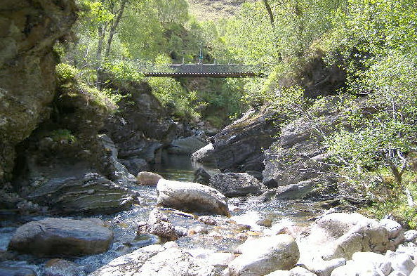
You will need to hoof it up the track from Balvraid, up and over the hill, down the other side, passed a footbridge over the river, and along to where the track and the river diverge - the river goes off to the right, the track goes off to the left. This is at NG 872 158.
It isn`t really worth trying to go much further, as the river goes under a deer fence just up from there, and there is a large hanging wooden barrage over the river.
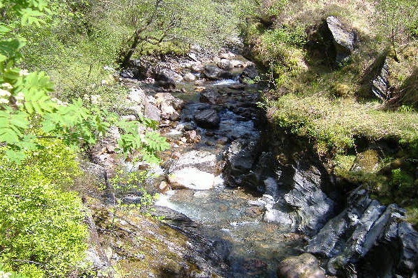
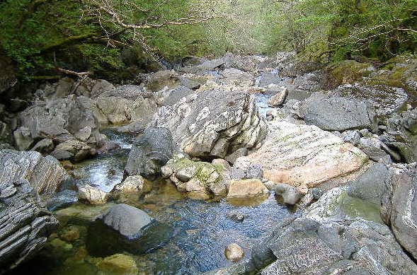
From there downwards, the river starts of at grade 2. There is a small gorgey section, then more grade 2, then another gorge, with a very nice grade 3-ish run down into it, and a footbridge over the top of it. At a very low level, the gorge is quite flat, however as the river level rises, this will change, as there is a large boulder halfway down the gorge - at low levels, the river squeezes past it, at higher levels, it will form a bit of a dam. so water will pile up behind it, and you`ll get a pourover and probably a stopper.
The other thing to be aware of in this gorge is undercuts - at the start of the gorge there is an overhanging rock river right, which will form a significant underwater undercut at higher levels. Just below the bridge, there is another undercut river left. So I guess that the best route would be to start the gorge river left, and under the bridge, cross over to the river right. This should get you away from the undercuts, and also provide the best way down past the boulder. However make your own decision about it.
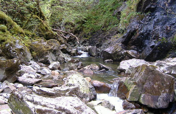
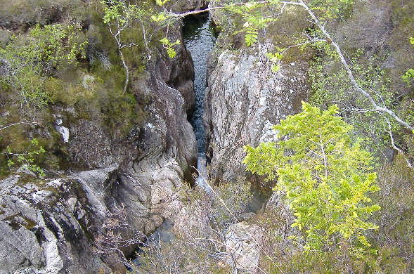
Here`s a view looking down into the gorge.
And this is looking upstream at the run down into the gorge.
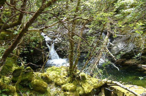
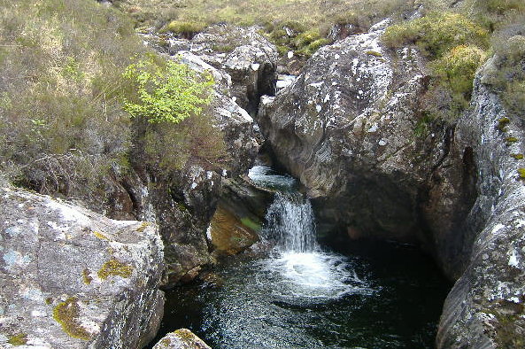
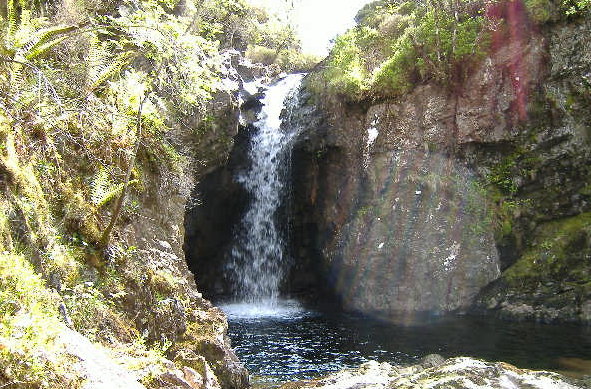
After the gorge, there is more grade 2, until eventually you come to a waterfall - I think it is the only waterfall on the river. It`s about a 2 metre drop, with a lovely plunge pool at the bottom - not runnable at low levels because of a boulder right at the top, but should be okay at higher levels.
BUT - I`m not sure if it would be safe to run it - there is a tree lying right across the pool, and the chances of missing it are pretty small. It`s a real shame - a really nice waterfall, and I don`t think it is runnable. You should be able to portage river left.
Here`s what it looks like - the tree is not very clear in this picture, it is a bit to the right of centre.
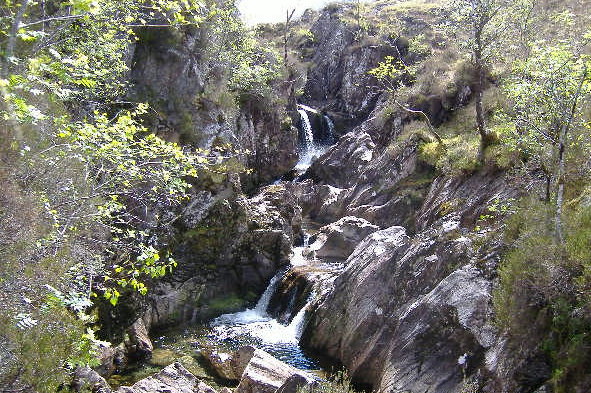
The other thing that is significant about this waterfall is that it marks the start of a completely different kind of river, as it is the start of a gorge - a real gorge, nothing like the last one. The run down into the gorge is gentle enough to start with, but quickly gets harder. After the run down, the river squeezes through a narrow gap, this picture is looking up at it - this was as far up the gorge as I could get, without getting wet.
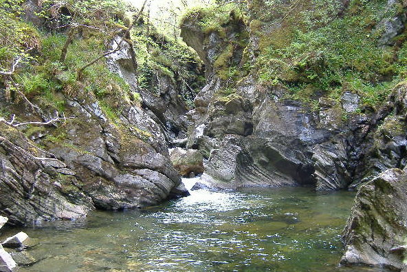
Thereafter, the river is full of boulders - in some cases, quite large ones, and there is a gradient all the way through the gorge. So it`s not a casual paddle. I`m a bit hesitant about trying to grade it - if the gorge is just runnable, then it would maybe be continuous grade 4 or so. At higher levels, it`s going to become a lot harder - a lot of very fast route picking will be required. Here are typical views of what it is like. I think there is more of a gradient than what these pictures suggest.
At the end of the gorge, the river goes back to its more normal grade 2, back down to Balvraid.
Allt Mhic a Phearsain
I saw this one from up a mountain, looking down on it from above - it is a small river that starts at the back of Beinn Sgritheall - the thing that attracted my attention was the fact that it had a constant gradient for about 1.5 Km`s. Apart from one possible gorgey section, it is an open small boulder river all the way down. It is probably only a grade 2, but it would be a great run down with enough water.
The run-off from the mountains is steep, and the catchment area is very small, so you would need to catch it right after a few hours of heavy rain.
However it`s going to be one long trek to get to it, so I`m not sure that anyone would ever do it.
Maybe an inflatable kayak which turns into a backpack ?
Allt Ghleann Aoidhdailean
I found this quite by accident - it is a small river that drops into a fabulous gorge - sadly it is not going to be paddle-able. One of the waterfalls would splat you straight into a rock wall, and another waterfall is in a deep slot too narrow for a kayak. But it is so scenic, here`s the pictures anyway.
Here is the start of it. The water has cut an almost circular path through the rocks.
A bit further down.
Trying to look down the slot, I didn`t dare go any nearer the edge, it was a sheer drop.
The last waterfall.
website design by ron-t
website hosting by netnerd.com
© 2025 Ron Turner
![]()
![]()