ron-t kayaking blog
22 July 2016 ............ Creag Island and Pladda Island
An afternoon trip across part of the Firth of Lorne, from Ganavan to Creag Island and Pladda Island.
These islands are two of the group of islands that lie to the east of Lismore - they are two separate islands at most tide levels, but at Springs low tides, a ridge of rock joins them.
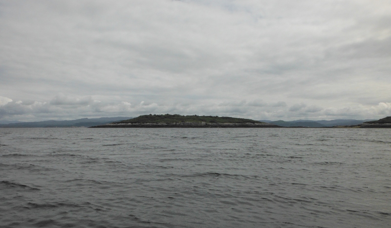
It was a good enough day weatherwise, but there was a bit of a wind from the south flowing against the later stages of the Springs ebb tide, so it was fairly choppy all the way over.
It was very obvious as I was heading over that the wind was blowing me quite fast sideways to the north, but the ebb current was trying to carry me south - so they actually balanced out in terms of my progress, but I could see the quite fast sideways water flow under the boat.
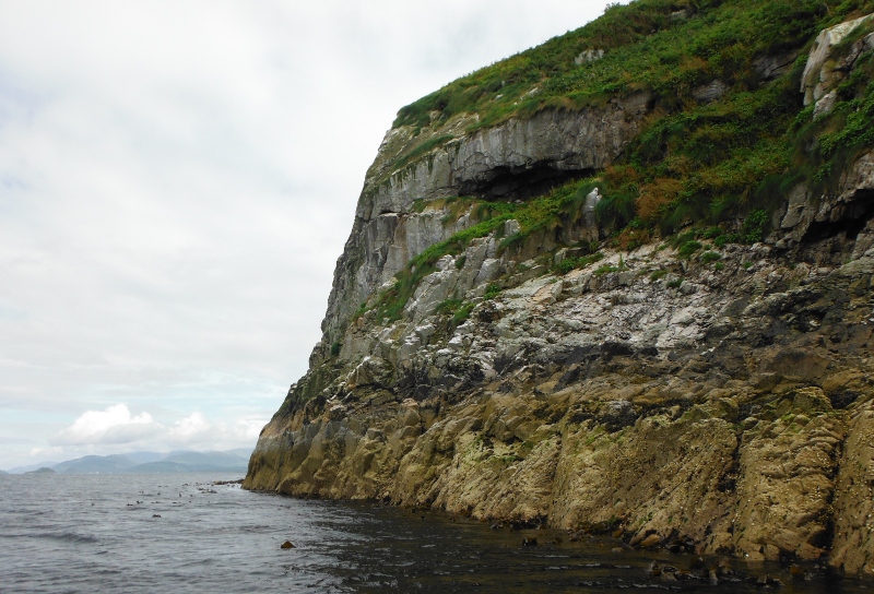
Round the far side of Creag Island now and some shelter, and the first chance to take any pictures - and a bit of a cliff on Creag Island.
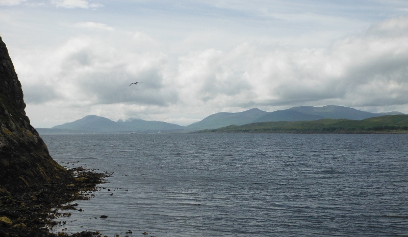
Past the cliffs, and into some lower rocky sections, and plenty of seaweed covered rocks to land on. This is looking away down past the bottom end of Lismore, Eilean Musdile and its lighthouse, and on to the mountains on Mull.
It was very lucky timing - all the way across to the islands, Dùn da Ghaiothe had been in cloud. Just as I landed, the cloud cleared off the summit, and I could get this picture - ten minutes later the cloud came back down, and I don`t think I ever saw it again.
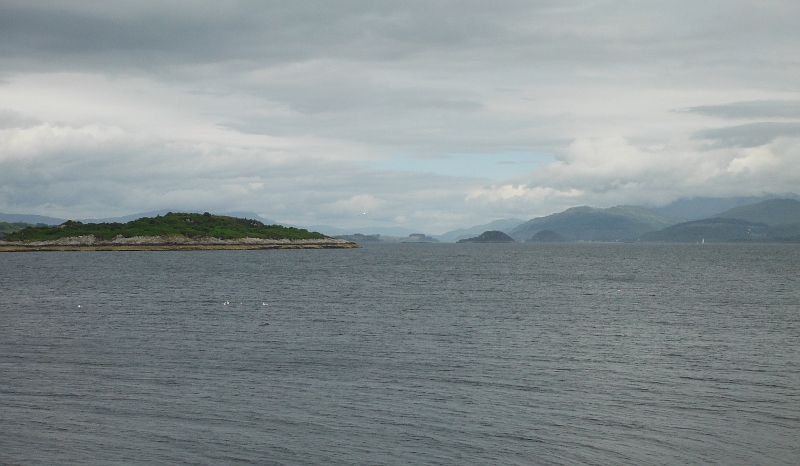
Round in the other direction, and looking away up to the top end of Lismore and towards Appin - there are two quite distinct high islands in this picture - I am not sure, but I think the nearer one is Eilean Dubh, and the further away one will be Shuna Island.
Round a bit to the right, and I think we are looking into the valley that holds Loch Creran - so probably the block of hills in cloud is up towards the corbett Creach Bheinn, and also the munro Beinn Sgulaird.
The mountains away to the back are somewhere up towards Glencoe, but probably not as far as Glencoe itself.
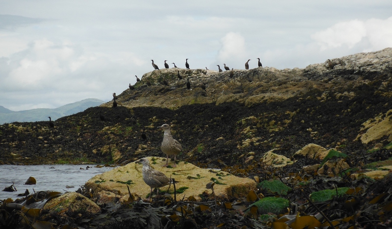
There was plenty of wildlife to be seen around Creag Island and Pladda Island - here is quite a respectable cormorant colony.
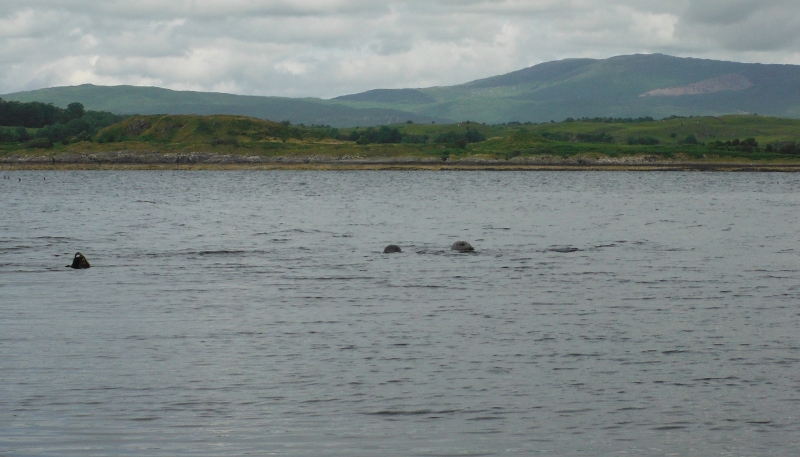
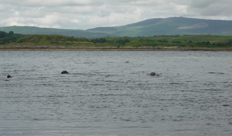
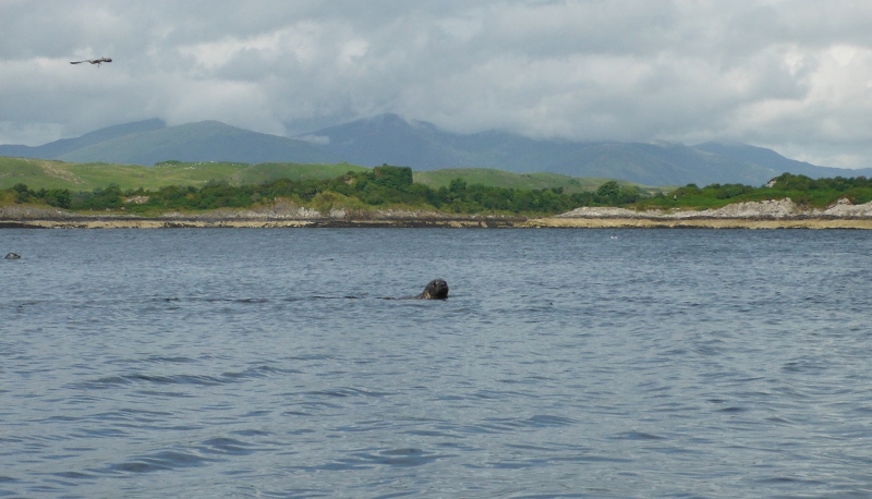
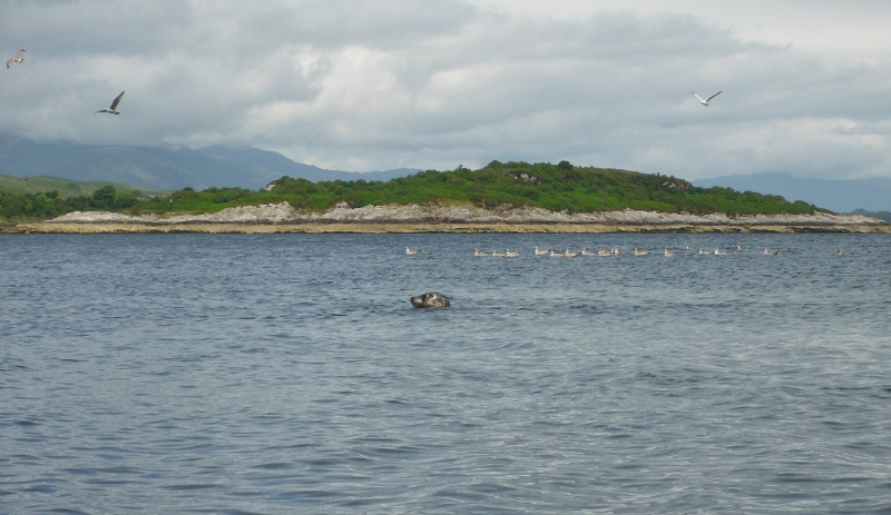
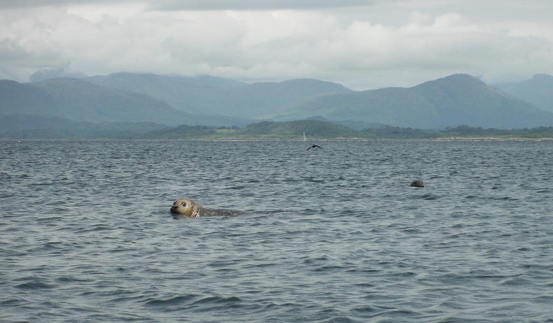
All round the islands there were a surpring number of seals - here are a few pictures of those of them that allowed themselves to be photographed. Seals are very variable, some almost seem to pose for the camera, and others are gone even before the camera is out of its case.
After a while I headed over to another island - although I am not sure that it really qualifies as an island - at low tide it is a respectable size, but at high tide it would be just a small rocky hump. I think it must be the one that is shown as Cams Rock on the OS map.
Plenty of seals there as well, and I think they were a bit less twitchy.
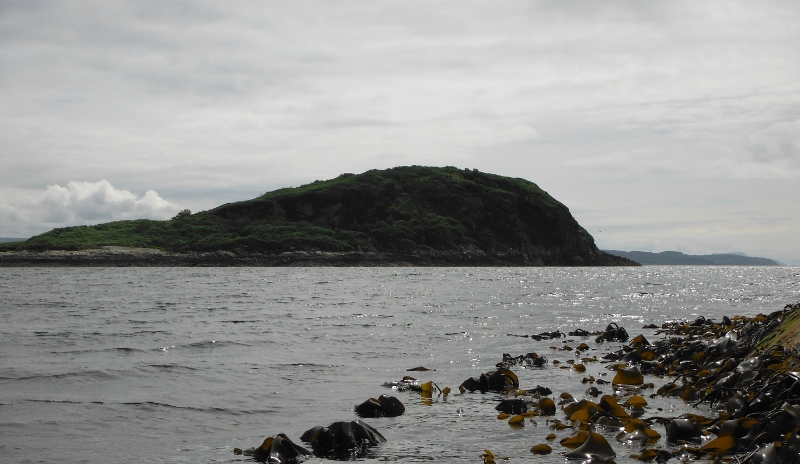
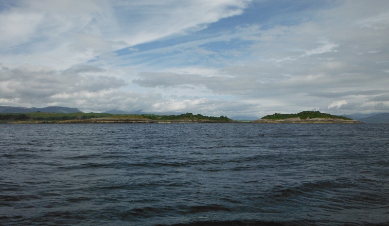
This is looking back over to Creag Island, which is quite lumpy. Away in the distance Scarba has just managed to squeeze itself into the far right hand side of the picture.
In contrast, Pladda Island is very flat. It seems to be an odd characteristic of the Firth of Lorne that some islands are completely flat, and others are high and lumpy, and they are all mixed up.
You can just see the rocky ridge that connects Pladda Island and Creag Island at low tides.
Round in the other direction, and another of the two islands that lie beside Lismore, Eilean na Cloiche and Eilean Dubh. Although they are almost two islands, they are actually connected by a shingle bank at most tide levels - it might get covered at very high tides, I am not sure.
Eilean nan Gamhna is yet another island in this group which is the closest one to Lismore, but I don`t seem to have taken a picture of it.
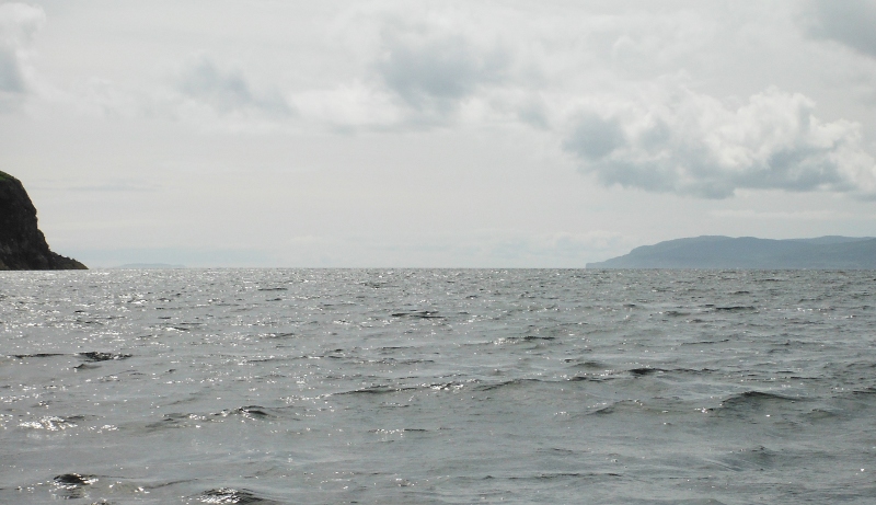
Here is my attempt to take a photo looking right down the Firth of Lorne - the cliff on Creag Island is on the left, and the east coast of Mull is on the right. The Garvellachs are just visible away in the distance.
I was out on the open water and fighting against the wind trying to take this picture, so it is quite surprising that I got anything.
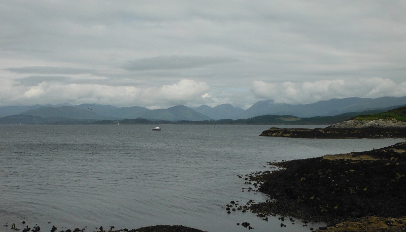
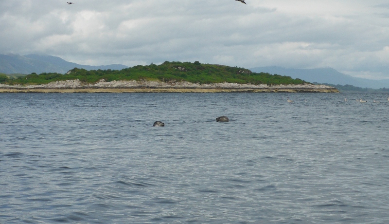
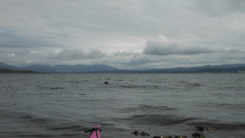
I am back at the northeast corner of Pladda Island now, and looking back across towards the Dunstaffnage area and into Ardmucknish Bay - and another seal pops up to say goodbye.
I didn`t want to stay any longer around the islands, I wanted to head back across before the flood tide got going - it would have been a hard ferry glide to get back across if both the Springs flood tide and the south wind were united in trying to push me north.
website design by ron-t
website hosting by netnerd.com
© 2025 Ron Turner
![]()
![]()