ron-t kayaking blog
04 June 2016 ............ Ganavan to Eilean Musdile
This was a day that didn`t go according to plan A - thank goodness !
The plan was to spend the day walking or cycling, then head back to the Falls of Lora for the evening Springs flood tide.
Around lunchtime I was out at Ganavan, and went for a walk up the line of hills to the north of Ganavan - up on the first hill, I am getting a good view out to the west across to Lismore and Mull.
And the doubts started - I have had two good evenings at the Falls of Lora - it is a superb day to be out on the sea, and you can play at the Falls of Lora in virtually any weather.
Time for a change of plan - I looked across to the lighthouse on Eilean Musdile - plan B had arrived.
Actually the conditions weren`t just as good as they might have been, there was quite a bit of wind coming down from the northwest, and it was the last of the ebb tide, so no major worries, but enough of a sea to keep me occupied.
Out past the ship, and maybe about a kilometre from the lighthouse the wind dropped - just like that - and the sea calmed down substantially.
I don`t know if the wind did suddenly drop, or if I got into a sheltered area, protected by Lismore. But it was some change in the sea conditions.
Then I had to stop and wait - there was a small ship coming down the side of Lismore, and we were on a collision course.
As I was sitting there - a fin and a body suddenly surfaced off to my side - I assume it was a dolphin, it was bigger then a porpoise.
As I sat there it appeared again - about 20 metres in front of my bow ! Incredible.
It appeared once more away off to the other side, and that was the last time I saw it.
Sorry, it was all too quick for taking photos.
As the ship passed it was clear that it wasn`t a cargo vessel or a passenger ferry or some kind of industrial vessel - I wondered if it was some kind of marine research boat, and was it tracking the dolphin or dolphins - there may have been more than one.
Do research boats follow dolphins around ? I have no idea.
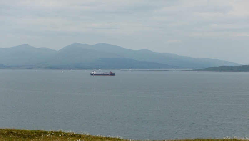
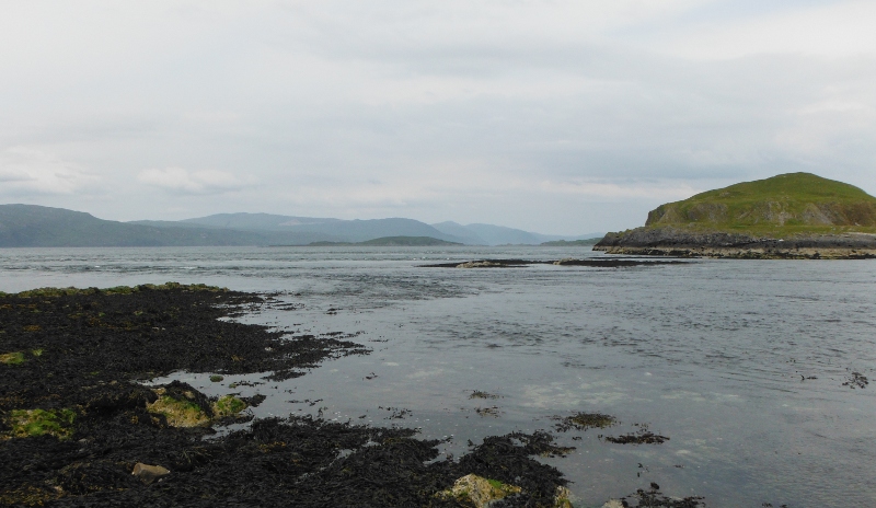
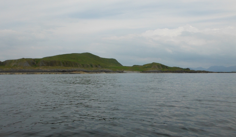
Time to take a picture - looking towards the lighthouse on Eilean Musdile, with a closer view of Dun da Ghaoithe on Mull than I had from the Falls of Lora.
You can just see the ship heading around the south end of Eilean Musdile.
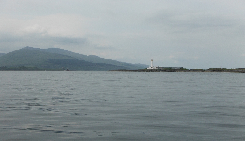
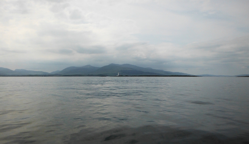
Further in now, and a closer view of the lighthouse.
I headed round the south end of the island, and started up the west side - there was a bit of a race running just as I turned the corner, but it didn`t cause me any grief. I wonder if it gets more significant later in the flood tide cycle - the Tidal Atlas NP 218 shows the ebb current flowing eastwards through the Sound of Mull and turning down into the Firth of Lorne, then quite a strong flood current flowing up the Firth of Lorne between Mull and the mainland, which current turns and flows westwards through the Sound of Mull.
So there is the possibility of races around the bottom end of the island.
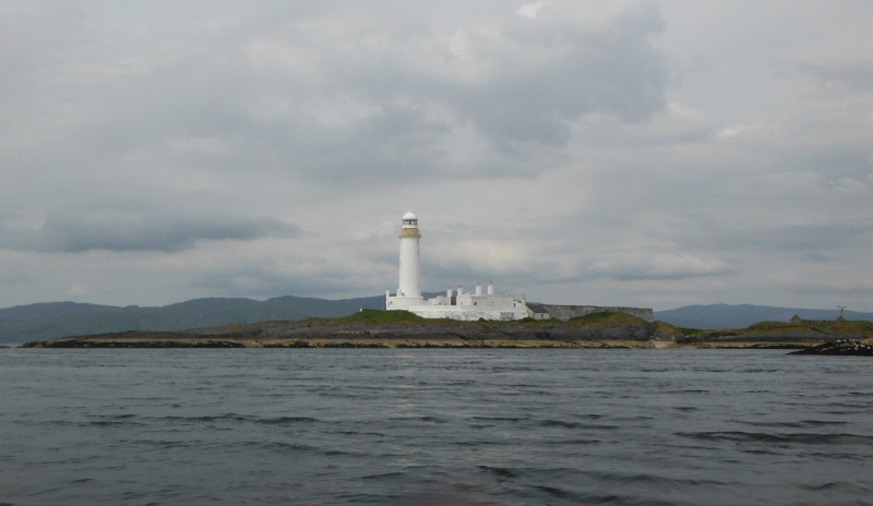
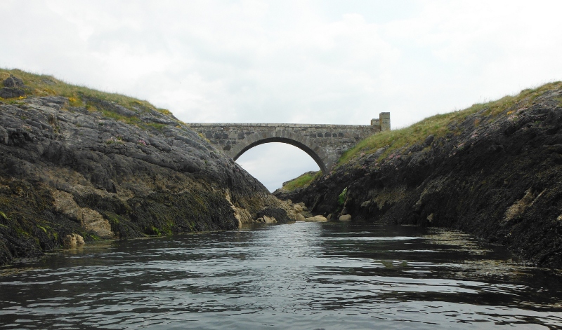
You could say that Eilean Musdile is actually two islands - they certainly are at high tides, and there is a very fine looking stone bridge joining them.
I have a recollection that I saw a walled garden on the northern half of the island, so it was probably built for the lighthouse keepers to get to their garden.
Up at the north end of Eilean Musdile now, and I am out of my boat looking across the gap between Eilean Musdile and Lismore, and right up to Bernera Island and up into Loch Linnhe.
There was quite a strong current flowing through the various channels, but paddleable up through.
Looking across another race over to the south east corner of Kingairloch.
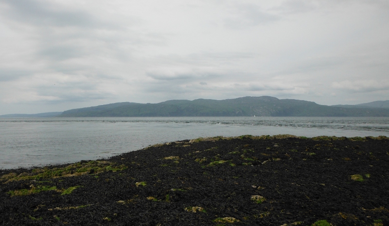
Looking back across to the mainland - on the left you are looking into Loch Etive, with Ben Cruachan dominating the mountains around Loch Etive.
Ganavan is hiding behind the ship, you can just make out Little Ganavan to the right of the ship, and Oban is a wee bit clearer over on the right.
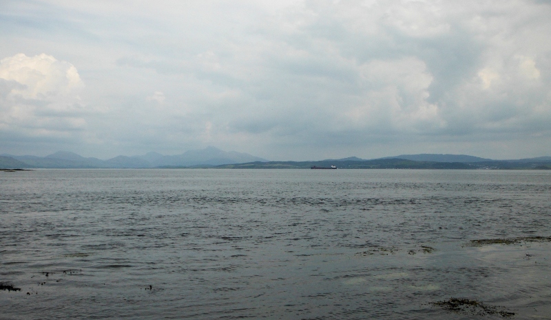
Heading back now, and once away from Eilean Musdile you get quite a good view down the Firth of Lorne - not good visibility I am afraid - I think it is Scarba that is faint but clearly visible, and across a bit to the right I assume that the low lying island is actually the Garvellachs. I think I am fighting against the curve of the worlds surface here, because the Garvellachs certainly aren`t low lying.
Looking north to the south end of Lismore - looks like a nice beach there. I wonder if there are still access issues on Lismore or if they have gone.
Well back towards the ship now, and time for a look back at Eilean Musdile - the gap between Eilean Musdile and Lismore is well flooded now.
And so back to Ganavan. I am well pleased to have done that - I think it is the longest open crossing I have ever done, it is about 8½ kilometres from Ganavan to the lighthouse, and with the paddle up the far side of Eilean Musdile that would make it a return trip of about 18 kilometres.
Not bad for an impulse afternoon trip.
-----------------------
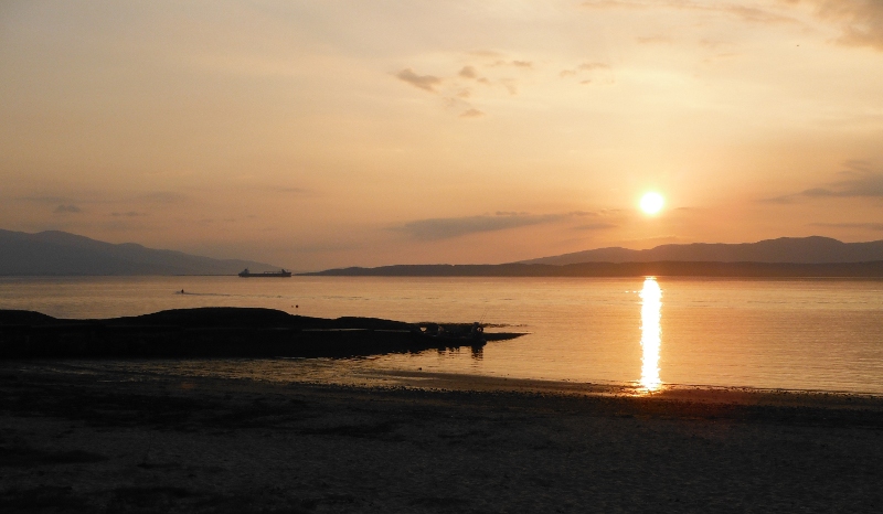
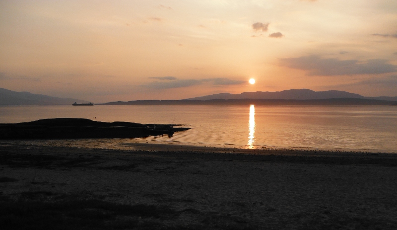
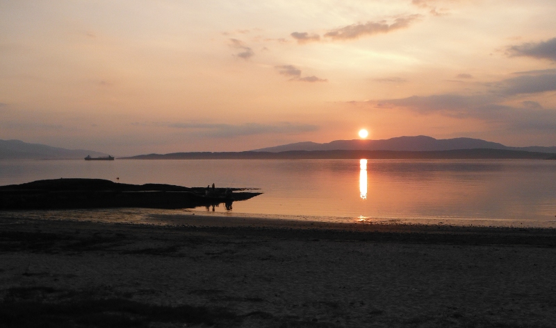
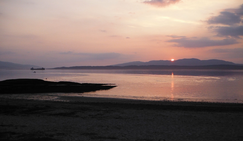
The story hasn`t quite ended yet - I was in no hurry to leave Ganavan, and once I was all packed and eaten and whatever, I sat and watched a fabulous sunset as the sun sun slowly dropped over Lismore and Kingairloch - the ship and Eilean Musdile are nicely silhouetted against the amber lighting.
website design by ron-t
website hosting by netnerd.com
© 2025 Ron Turner
![]()
![]()