ron-t kayaking blog
11 July 2014 ............ Cemaes to Carmel Head - part 2
This is part 2 of the blog about my trip out from Cemaes that started as a visit to Middle Mouse, and ended up with me going all the way to Carmel Head.
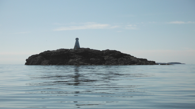
Getting close to West Mouse, with just the far end of the Skerries in the background.
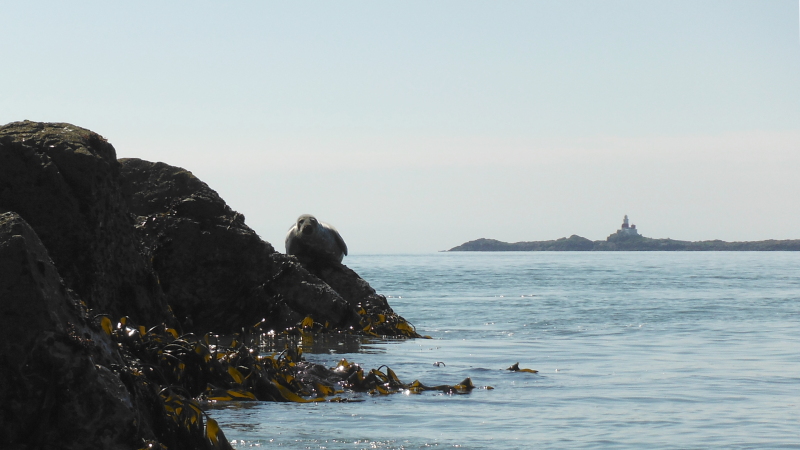
Just on the corner of West Mouse, there was a massive seal sitting up on the rocks - and it just stared at me with total disdain - I don`t suppose that West Mouse gets many visitors.
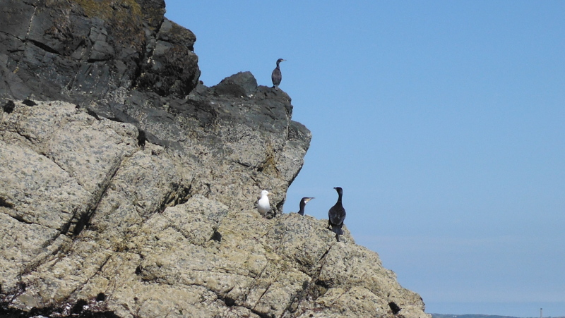
There isn`t much bird life on West Mouse, nothing like Middle Mouse - but there were a few cormorants.
Like the Harry Furlough`s Rocks, West Mouse was quite a bit bigger than what I had expected, although I think it will shrink quite a lot at high tide.
I even found a low lying area of seaweed covered rocks on which to land for a quick break - and it was a quick break, because I soon found that some intermittent swell was determined to wash me off the rocks.
So what to do now - going out to the Skerries was a tempting thought, however I could see what looked like banks of fog lying between me and Holyhead Mountain, and out beyond Middle Mouse.
Having had one trip back from the Skerries in the fog, I didn`t fancy doing it again, so instead opted to head on to Carmel Head.
Heading away from West Mouse and looking back -
Despite the flood tide, it wasn`t too much of a hassle to get out to Carmel Head - I don`t think that I have ever seen this bit of coastline with such a long slack water period, and with the flood tide taking so long to get going.
Normally slack water along the north coast is anything but slack - with whirlpoools, eddies, and an agitated sea as the tide changes.
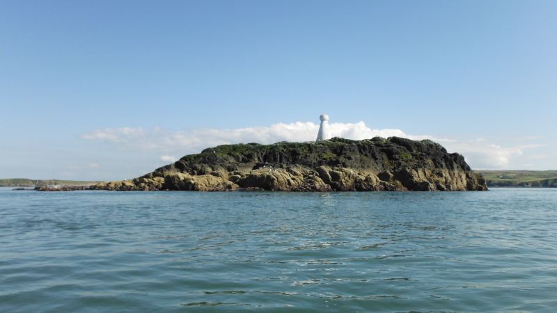
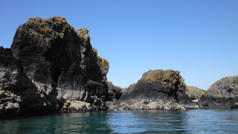
Carmel Head has some fascinating rock formations - I believe that Carmel Head is composed mainly of Precambrian Gneisses - the precambrian rocks were forced up and over much younger rocks, and Carmel Head has the oldest rocks in Wales.
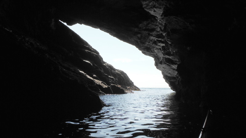
This is one of the deep slots into Carmel Head - it starts off quite wide -
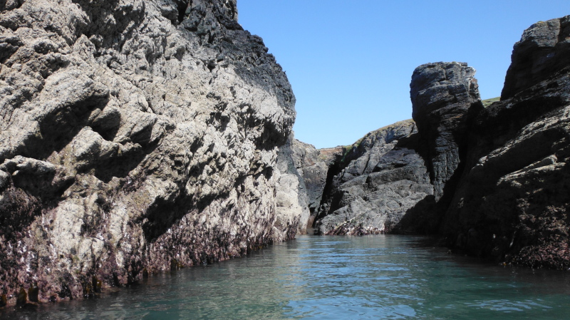
then narrows down to a thin passage which was negotiable
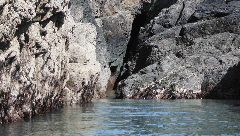
and ends in a cave a couple of metres above the low water level.
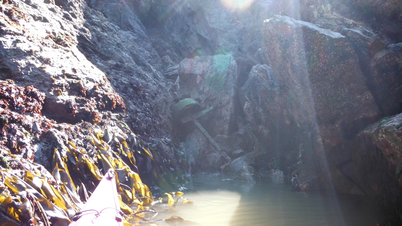
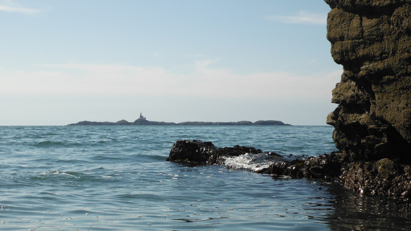
Tucked away in a corner just above the low water mark is a relic of the copper mine that once existed at Carmel Head - some of the buildings are still there up on the flat area just inland from the sea.
Sorry if it is a not-very-good picture - I was looking straight into the sun at a corner in deep shade.
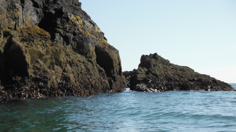
A wee bit further along, and there is another long inlet - at high levels you could land here, but a low tide levels it is all a bit rocky.
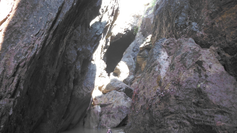
Further along, and there is a fine cave, and even at low tide you can get a long way in.
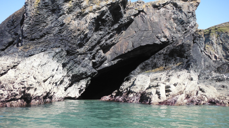
I`m surprised how well this photograph has come out, I was a long way in.
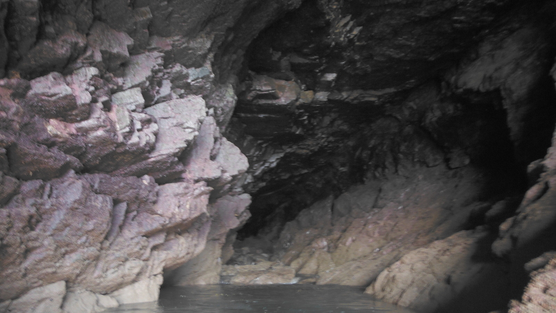
Looking out -
The entrance to the cave has the most excellent outlook -
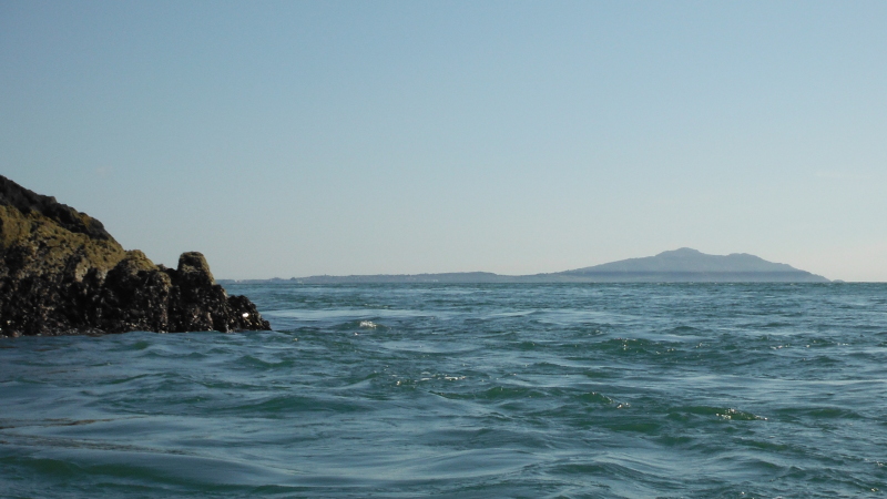
Right round Carmel Head now, looking down to Holyhead Mountain - and you can see the low lying something that I thought looked like fog when I was out at West Mouse.
Heading back now, and I found a little passageway that I hadn`t noticed on the way out - so I got another wee bit of rock hopping, with a sharp right turn at the far end, turning into the incoming waves.
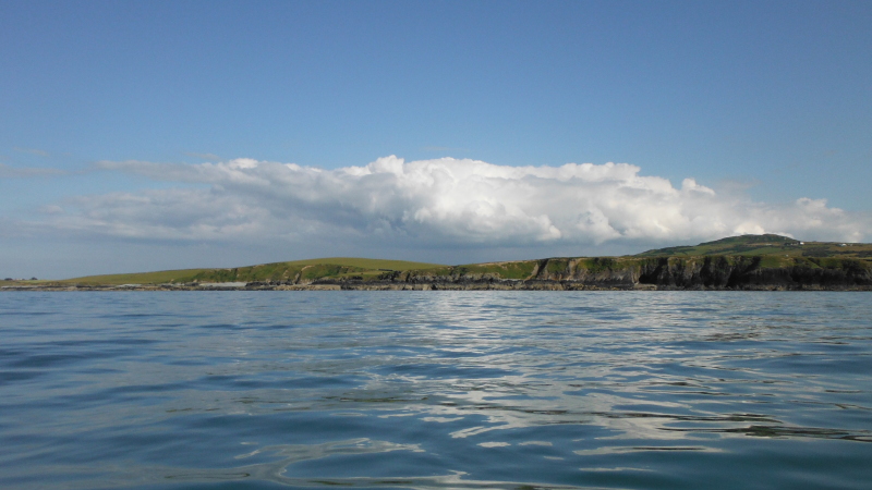
Heading back along towards Cemlyn - this cloud had sat in exactly the same place all afternoon, it doesn`t show too well in the photograph, but underneath the cloud was very dark, and it was obviously pouring down somewhere, and had been all afternoon.
Looking at the rainfall radar when I got home showed that it had indeed been sitting right over the Menai Straits and Caernarfon.
What an amazing afternoon and evening - I had absolutely no idea when I set out that I would end up doing some 21 - 22 km`s along the north coast in absolutely perfect conditions, and take in Dinas Gynfor, Middle Mouse, West Mouse, and Carmel Head.
--------------------------------------
Postscript
When I was passing Wylfa, I noticed that away in at the back of an inlet was a dam or weir - and over the top of this was flowing a considerable amount of water - as much as a small/medium river, and there was quite a knarly looking stopper at the bottom, where it met the sea.
The thought occurred to me that maybe it could be possible to somehow negotiate with the builders of Wylfa B to create some kind of an artificial playspot using the water outflow from the power station.
The flow of cooling water would presumably be available 24/7/365, and there would presumably also be loads of parking nearby - there is certainly loads of parking at the present Wylfa site.
Water quality would obviously be an issue, the water flowing out of the inlet looked quite scummy, but Wylfa is now old, and a new power station would presumably be built to higher environmental standards than the current one was built to.
How do you ask a nuclear power station designer to please build in a playspot ?
Postscript 2
Answer - you send them an e-mail.
Done !
website design by ron-t
website hosting by netnerd.com
© 2025 Ron Turner
![]()
![]()