ron-t kayaking blog
28 May 2014 ............ The Swellies
They weren`t very big high tides this Springs, so this trip was a bit of a gamble, as the tidal range was only 4.7 metres, which is a bit low for the Swellies wave.
However for the first hour or so the wave was not too bad, I got some decent surfing on it, but the wave was very changeable - it would completely change shape within about 20 seconds, so it was hard work to try and stay on it.
It was mostly a green wave, only very occasionally was there a pile, so it was okay for my boat.
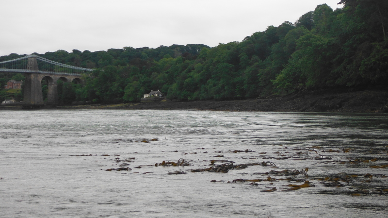
After that hour or so, the Swellies changed in a way I have never seen before - instead of the line of whirlies that flow down from the bottom corner of the rocks around the Cardinal Marker, it started generating a grade 1/2 rapid which gradually spread out from the rocks down and across and right through the normal Swellies wave.
It was most weird, and pretty much killed off my surfing on the main wave, although there were a few small waves at the head of the rapid which were surfable.
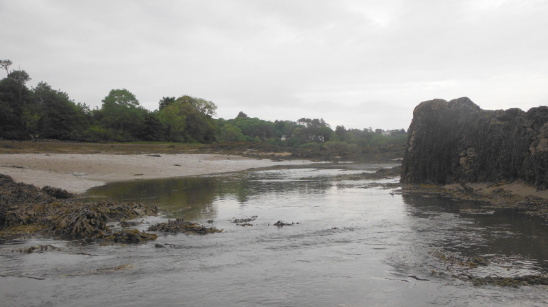
It is kind of hard to show it in a picture, but this is what it looked like.
I gave up, and headed over to the other side to see if there was anything worth playing on in the various channels that run through the rocks over on the Anglesey side, but there wasn`t enough of a flow.
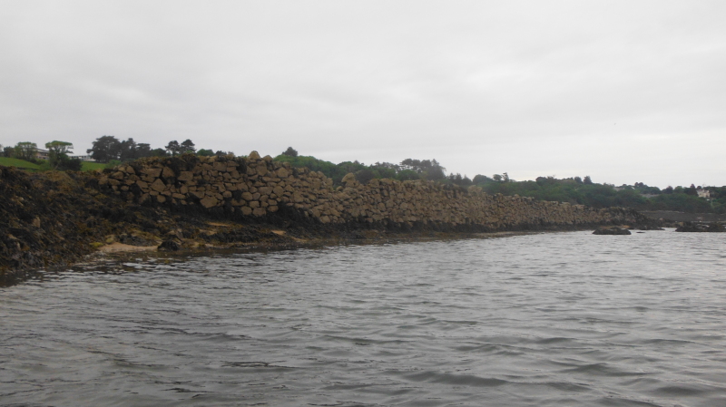
So I headed up the coast a bit, and found something else that was new to me - running up the coast is a large stone wall - it looks like at some time in the past, somebody has created a sort of lagoon - I wonder if it was for mussel farming.
There is a big area of mussel farming further along the Menai Straits to the south west, opposite Caernarfon.
It must have been very well built, to have survived decades of Spring tides and storms and whatever else the sea can throw at it.
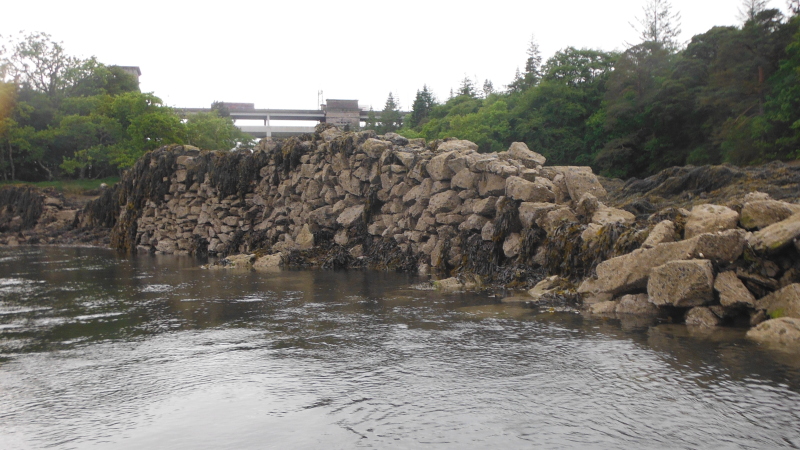
There is maybe about two hundred of metres of it, in two sections - here is one section -
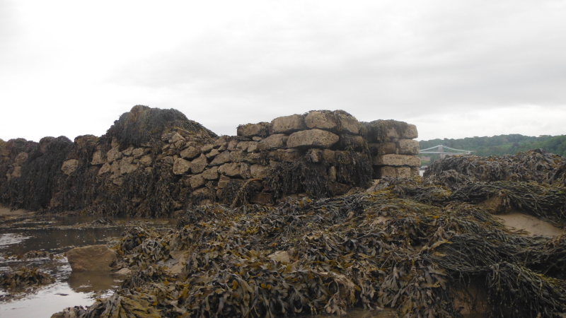
Here is the next section -
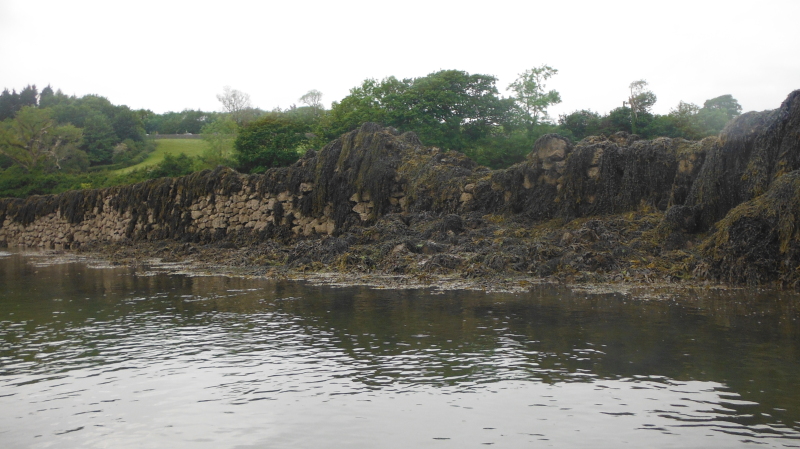
At the top end of this section, there is an opening - presumably to let the water flow in, and also boats.
Maybe it was an opening which allowed fish to swim in, then when the tide level dropped, the fish were marooned, and could be easily scooped up.
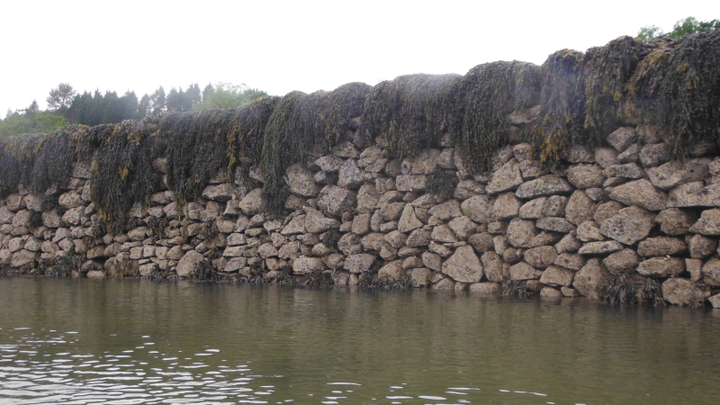
You can also see how the wall was built by looking at the end bit - it looks like it is actually two walls hard up against each other.
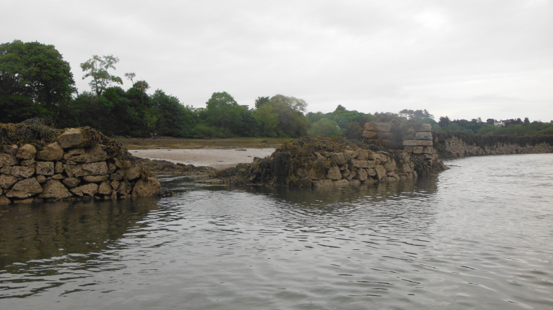
This is the lagoon.
A bit higher up towards Britannia Bridge there is another section of wall, but this section doesn`t seem to have survived as well as the sections lower down.
So despite the somewhat low tidal range, it turned out to be quite a good evening.
website design by ron-t
website hosting by netnerd.com
© 2025 Ron Turner
![]()
![]()