ron-t kayaking blog
25 March 2014 ............ Point Lynas to Amlwch
A quite good day with a bit of a north or northeast wind, and a Neaps ebb tide turning to a flood tide - so it seemed a good idea to go down and have a look at the tidal currents around Point Lynas.
I have seen the tidal currents around Point Lynas from up on the point - there are quite distinct currents and a bit of a tide race, but maybe not the biggest of races - at least not from what I`ve seen.
In fact Point Lynas has actually got two points maybe 50 or 100 metres apart, and you can get two races.
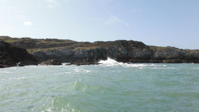
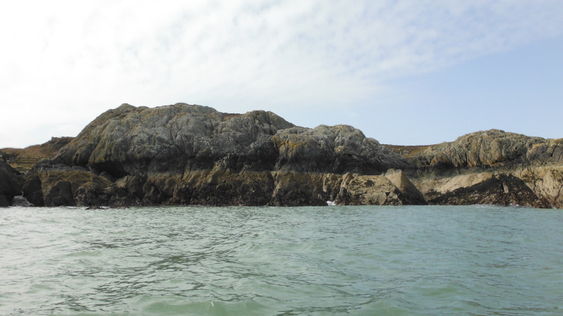
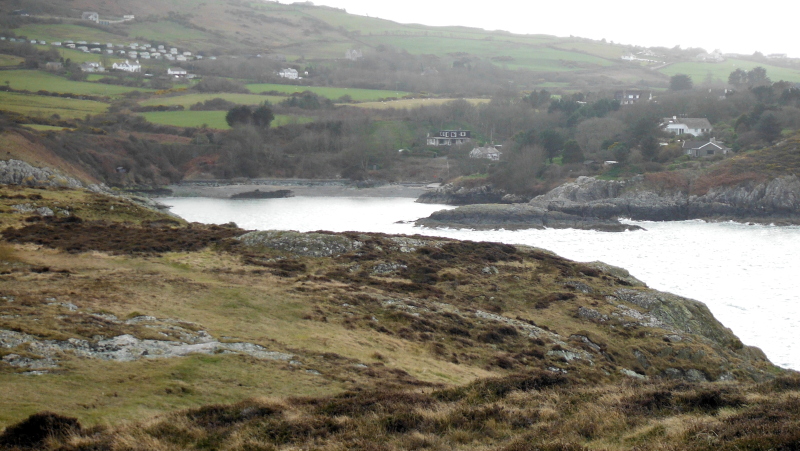
Heading out from Porth Eilian, Point Lynas has got a good few cliffs - not the biggest of cliffs, but quite impressive all the same.
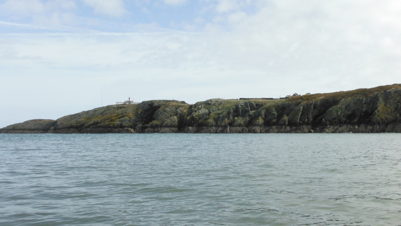
As I got closer to the headland, things went downhill a bit - the sea got bigger and bigger, and there was no way I was going to go round the headlands to see what the tide races were like - I think it must have been the effect of the north wind blowing across the tidal current - there were big waves coming in from the north.
I retreated back to more civilised water - time for a rethink - I decided to head off along the coast towards Amlwch, which is a bit of coastline I haven`t ever done, either by boat or along the coastal path.
Once away from Point Lynas, conditions were a bit more user friendly, I had the ebb tide to carry me along, and the north wind wasn`t too much of a problem.
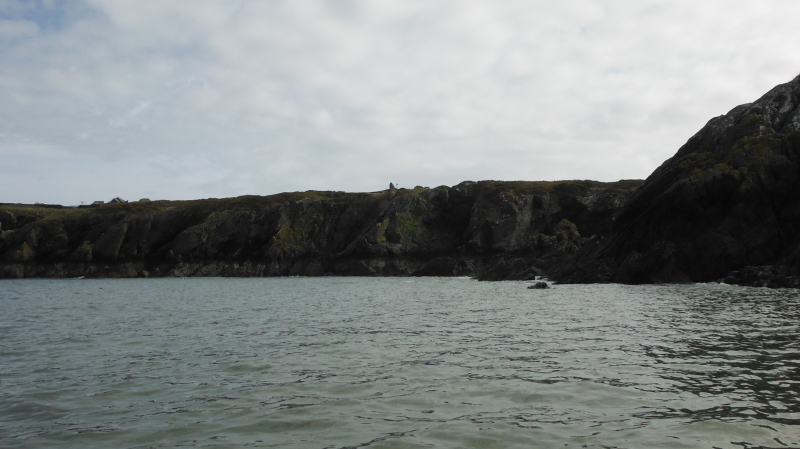
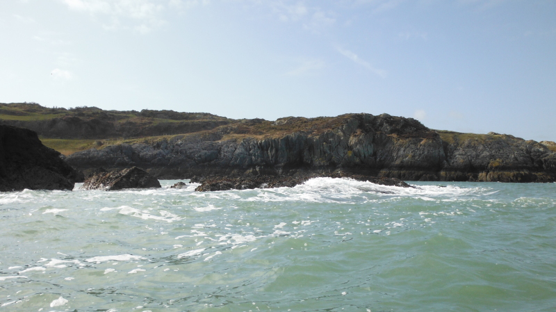
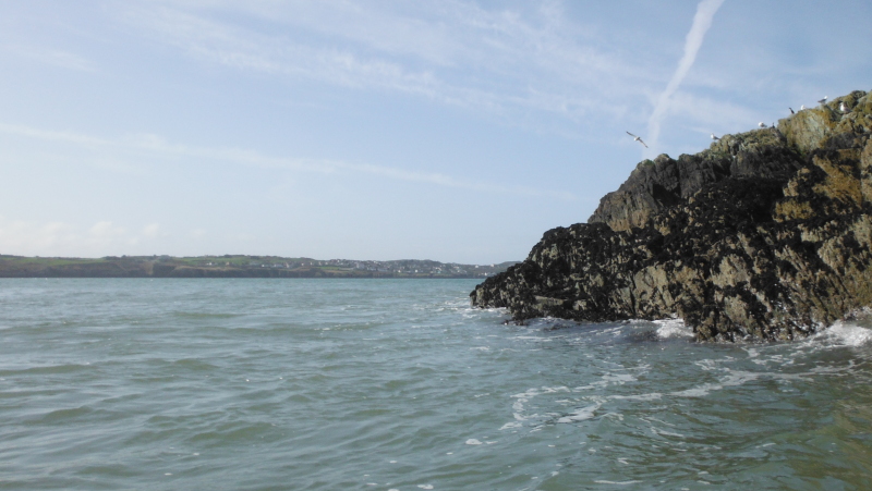
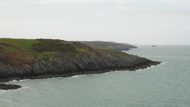
As I headed along the coast, I found that although the coastline is quite rugged along the way to Amlwch, it isn`t really the most dramatic of coastlines, and it doesn`t really change much all the way to Amlwch.
It is however quite committing, as there isn`t really anywhere suitable for landing except on the occasional seaweed covered rocks.
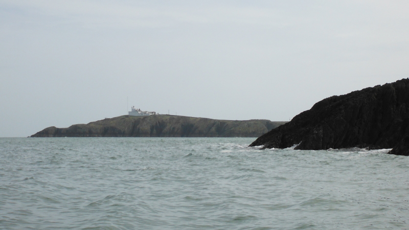
Here is a fairly typical view looking along to East Mouse in the distance.
There was a bit of swell in amongst the rather discontinuous waves, but nothing to write home about -
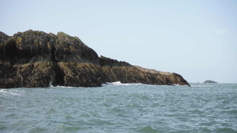
There was an occasional stand of more interesting rock formations -
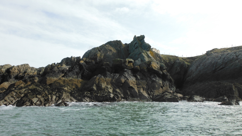
Some of the more fairly typical rocks -
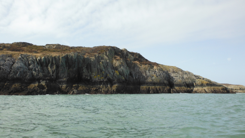
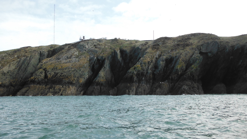
Looking back at Point Lynas from one of the small headlands.
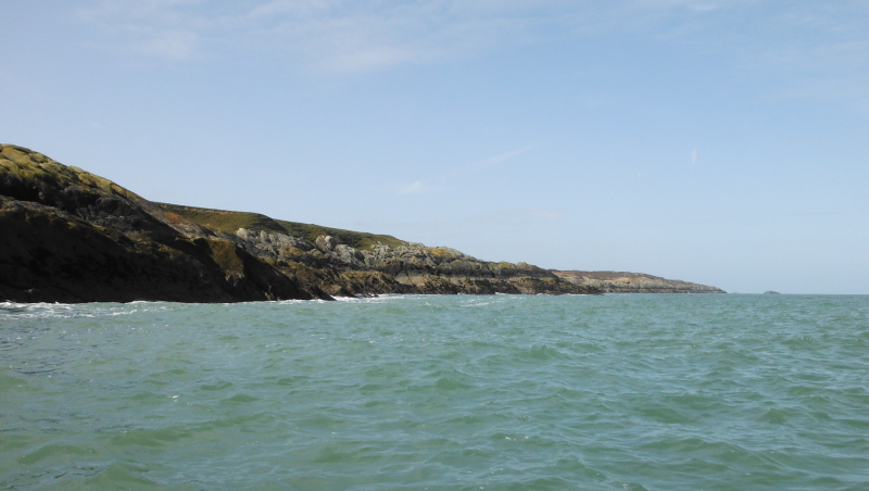
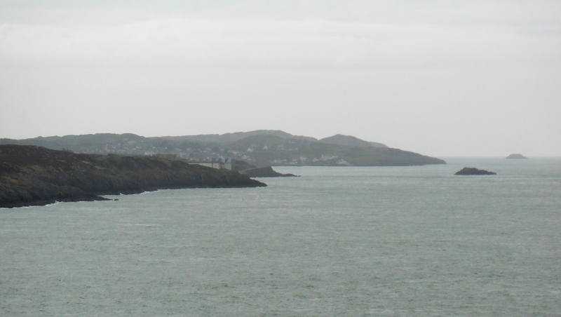
East Mouse isn`t so far away now - I think this may be at the more distinct headland Llam Carw.
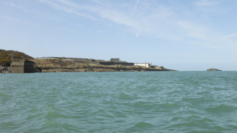
Just about at Amlwch harbour - looking across the entrance to the harbour to the industrial site on the next point, and of course East Mouse.
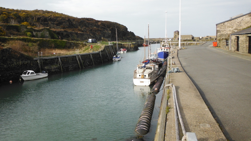
Amlwch Port is a very old harbour that makes use of a long narrow natural cut heading inland - a sort of mini fjord - and over the centuries it has had a series of extensions and new sea walls added further and further out.
Amlwch Port was the port that handled all the copper ore from Parys Mountain - at one time the biggest copper mine in the world.
It is quite a fascinating place, well worth a visit, either by boat or on land.
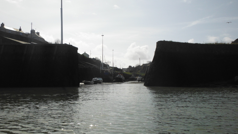
These are the newest and outermost seawalls, and they tower above you when you are there at low tide.
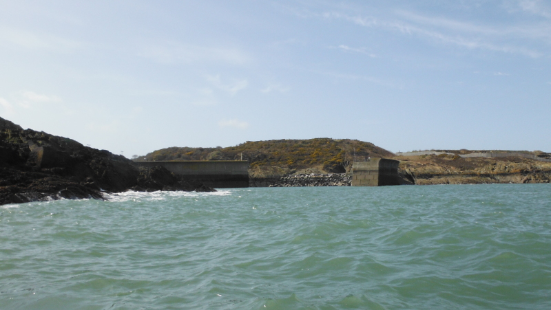
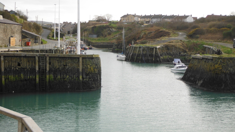
In past these outer seawalls, and you are into the outer harbour, looking towards the next set of older seawalls.
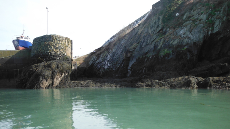
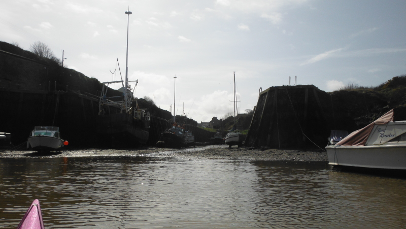
Two of the docks that form part of the outer harbour -
Over in the corner, there is the remains of an old dry dock - it is a shame to see it lying unused now.
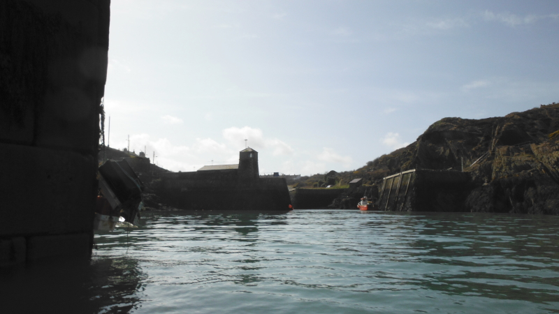
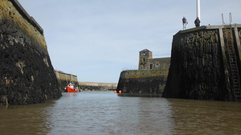
Heading further in past the second set of seawalls, and we are in the middle section of the harbour, looking towards the inner and oldest set of seawalls.
Then right in to the inner end - and as you can see, this dries out at low tides, so the boats are left high and dry.
Looking back out past the two sets of inner seawalls, with one bit of the outer seawall visible in the distance.
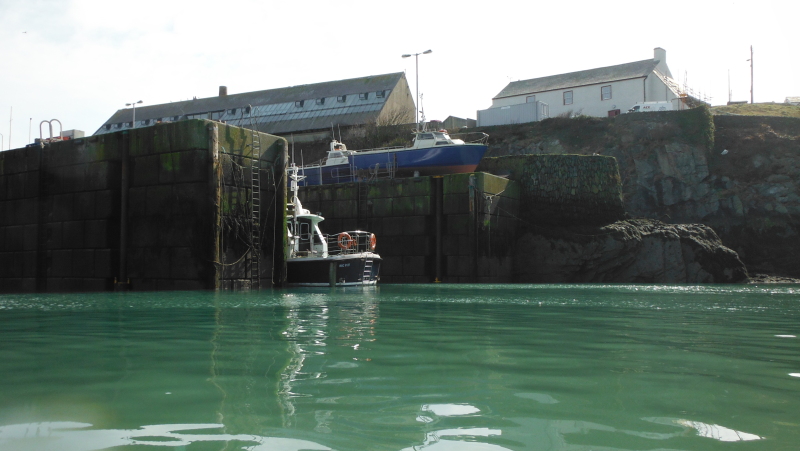
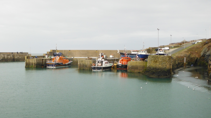
Back out to the outer harbour, and a bit of a surprise -
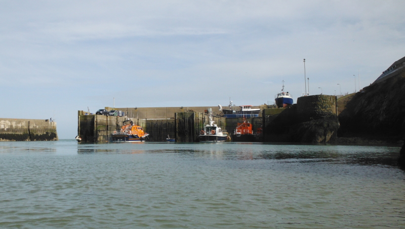
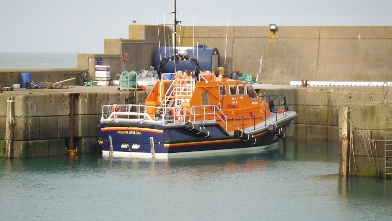
Sitting in one of the docks is Moelfre Lifeboat.
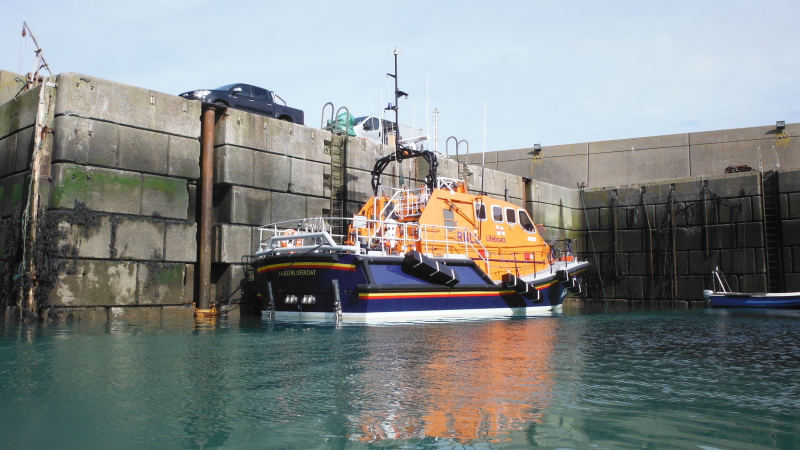
I assume that it is here because it has been displaced from Moelfre whilst the original boat house at Moelfre is being replaced with a new one big enough for this new lifeboat.
Named as Kiwi, Moelfre Lifeboat is a Tamar class lifeboat, and is very high tech - it has a storage compartment at the back that can carry a small Y-class inflatable daughter lifeboat.
It has high tech seats for the crew that absorb impact shocks from slamming on waves, so reducing the risk of spinal injuries.
It can carry - somewhat unbelievably - 118 people. How ? Where do they all go ????
It has a very sophisticated Systems and Information Management System - designed by the RNLI, it has six networked workstations, each one of which can control some or all of all the technical systems on board - comms, charts, radar, engines, driving the lifeboat - all from the workstations using a trackerball.
And the Tamar class lifeboats have engines.
Or should that be ENGINES !
Two of Caterpillar C18 marine diesel engines - 18 litres - turbocharged - aftercooled - each engine develops 1000 bhp !
They drive that lifeboat at 25 knots.
And they sound absolutely gorgeous !
-------------------------------
But back to the more mundane subject of sea kayaking - heading out westwards from the harbour, just before the point I found a place to pull out and have some lunch.
As it turned out, I would have been better going straight out to East Mouse - by the time I got going again, the flood tide had started in earnest, and there was a major tide race around the east side of East Mouse.
I had no idea that East Mouse developed such tide races - West Mouse and Middle Mouse I have found out about, but this new to me.
How much of it was due to the tidal current itself, and how much was due to the now increasing north wind blowing across the current I don`t know, but it was very slow going against the current with quite chunky waves coming in on my side - lots of bracing was required.
However I did eventually get to the shelter of East Mouse - and just to prove it, this is looking beyond East Mouse to the village of Bull Bay at the far end of the bay Bull Bay.
As it happened, that was my last photograph - as conditions had now got a bit worse.
Sitting out at East Mouse. it was very obvious that there was a distinct line between East Mouse and the nearest point on the mainland that separated the relatively quiet but fast moving water to the west, and the tide race to the east.
So I did a ferry glide back across to the mainland, then headed back round towards Amlwch harbour - it seemed a good plan - but I then found that there was a very strong eddy current all the way from the point, past Amlwch harbour, and all the way to the next headland Llam Carw.
So it was very slow going - I kept fairly close to the shore, and just another 20 or so metres further out I could see a lot more current.
Once past Llam Carw I was probably getting a bit of a boost from the flood tide, however the increased north wind was causing quite a lumpy sea coming in on my side - sometimes the lumps would rear up just beside me, sometimes they rose up underneath me, and I would be lifted up, and my paddle didn`t reach the water.
It stayed like this all the way back towards Point Lynas, with more and more white horses out to my left.
Getting closer to Point Lynas, I could see some very big white water around the headland, and I didn`t go and have a look !
The trip back wasn`t what I would call scary because it was within my capabilities, but it was hard work, and quite unpleasant, so I was quite happy to be back in the shelter of Porth Eilian.
-------------------------------
After I was all packed up, I went for a walk up to the lighthouse, and took a few pictures on the way - this is looking out from the road above the beach towards the lighthouse.
Up the road a bit, and you get a good idea of the cliffs along the side of Point Lynas.
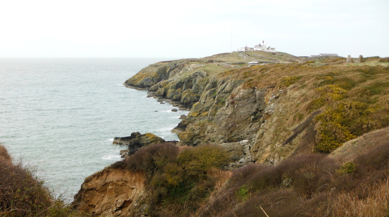
Further up the road, and this is looking down into Porth Eilian - you can see how sheltered it is.
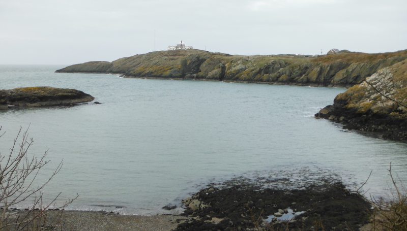
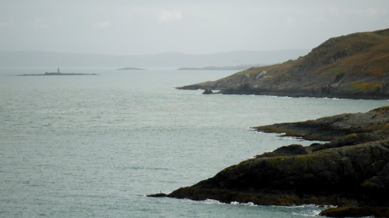
Looking northwest to where I had been - with East Mouse clearly visible, and Middle Mouse just viewable.
A bit further out towards the point, and a long focus lens provides a closer view of East Mouse and Middle Mouse, and also Bull Bay.
Amlwch Port is hidden away between the two nearest headlands.
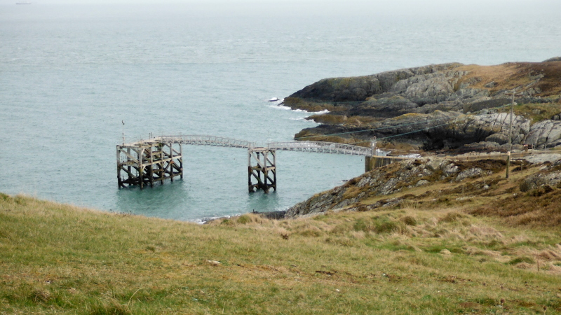
I have no idea what its history is, but immediately to the east of Point Lynas there is a steel and timber pier - my guess is that it was or is something to do with the lighthouse.
And finally for Point Lynas, here is a long focus view looking down to the southeast - Ynys Dulas with its tower is obvious, I think that the next headland and island is Moelfre and Ynys Moelfre.
-------------------------------
On the way back up the road, I dropped in to Amlwch Port, to have a look from up on land, as I said earlier, it is quite a fascinating place.
The tide is well in now, and this is looking right down the harbour from the top end.
Looking back up into the upper part of the harbour from the middle seawall -
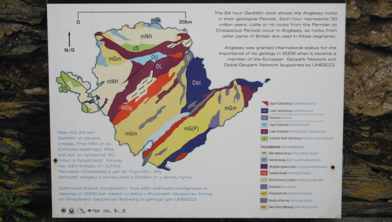
Tucked away on a wall in a bit of an alcove I found this plaque which displays the geology of Anglesey - it is no wonder the coast line of Anglesey has some amazing rock formations when you see what a mixed up geology forms Anglesey.
Here is the outer harbour again, with a bit more water this time.
Last but by no means least - a better view of Kiwi - or Moelfre Lifeboat.
website design by ron-t
website hosting by netnerd.com
© 2025 Ron Turner
![]()
![]()