ron-t kayaking blog
17 November 2013 ............ Cemaes to Middle Mouse and Porth Wen
After more days of wind, there was a small lull forecast for Sunday morning, before the wind got up again around lunchtime or so.
It coincided with a Springs flood tide in the first part of the morning, turning to the ebb tide mid morning.
So I went for a quickie out from Cemaes - the plan was a quick paddle out around Middle Mouse, back across to Dinas Gynfor, then back to Cemaes.
However in the end I went a bit further, and ended up in Porth Wen, beside the brickworks.
It was a grey day - everything was grey and drizzly - the sky was grey, the sea was grey, the coastline was grey.
The camera I am using just now does not like grey - it needs sunshine, so I am afraid the pictures are all a bit dull. Time to get another camera I think.
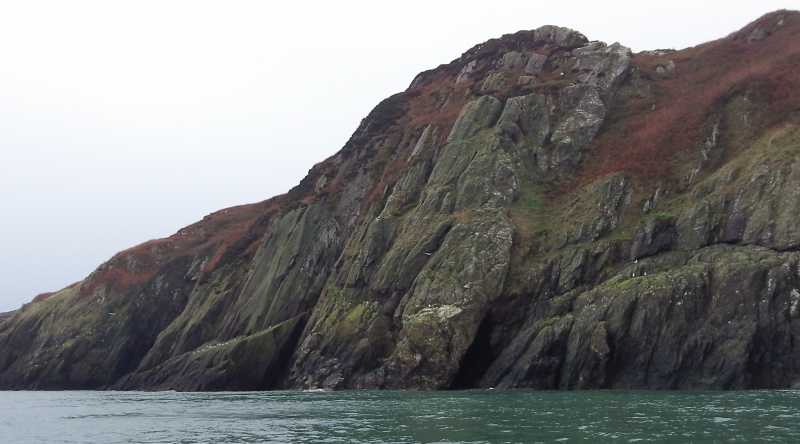
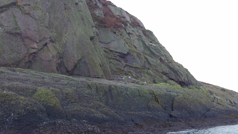
Anyway, heading out to Middle Mouse, and looking along the coast to the east, the first thing of note is the first un-named headland after Llanbadrig Head.
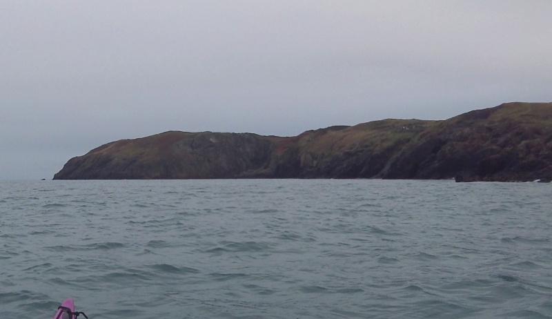
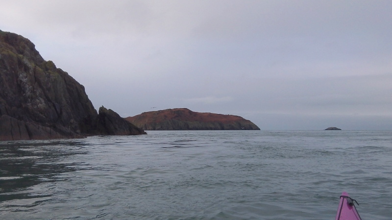
A bit further out towards Middle Mouse - and Dinas Gynfor appears - also known as Llanlleiana Head.
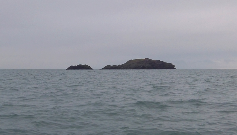
Middle Mouse isn`t too far away now.
From the far corner of Middle Mouse you can look right up the coast towards Point Lynas.
I didn`t hang around around Middle Mouse, but headed straight back over towards Dinas Gynfor and Porth Llanlleiana.
It was by now round about slackwater - except the timing of slackwater around that bit of coast is somewhat unpredictible, and tends to be some time before high water.
In agreement with what I was saying in my last blog about the nature of slackwater, sometimes the water was quite quiet, sometimes a bit more choppy, and in places there were quite strong currents.
I had just passed out of a quite strong current, and suddenly just off to my side, a black fin surfaced, and disappeared again.
Porpoise !
I spent the next ten minutes or so just sitting watching them - sometimes just twenty metres away, sometimes much further away.
There were at least three of them, obviously fishing around the areas of strong current.
It was quite amazing - they appeared and disappeared far too quickly for me to get pictures of them, but it was quite an experience.
Eventually they got further and further away, so I gave up and headed in to Porth Llanlleiana for a pit stop.
I don`t think I`ve been there at high tide before, and I discovered an area just to the west of the beach where I could paddle in, and do a bit of rock hopping, although there wasn`t much of a sea.
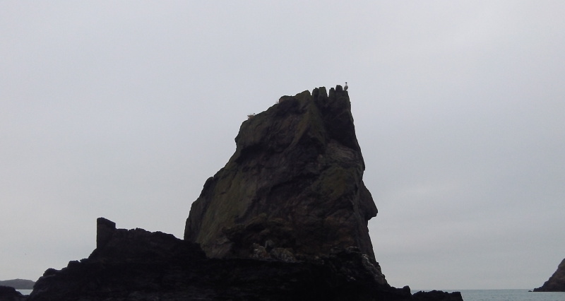
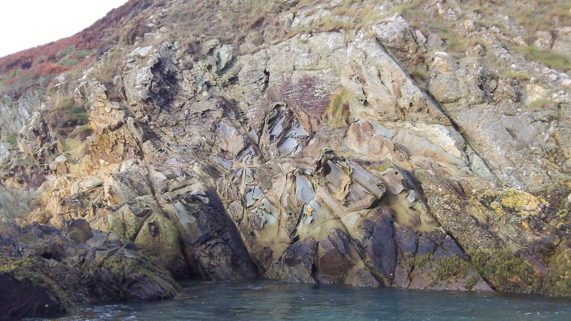
There are some quite interesting rock formations just there - here is a large pinnacle of rock being used by two seagulls to spy on me.
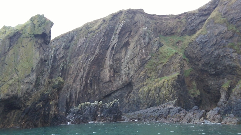
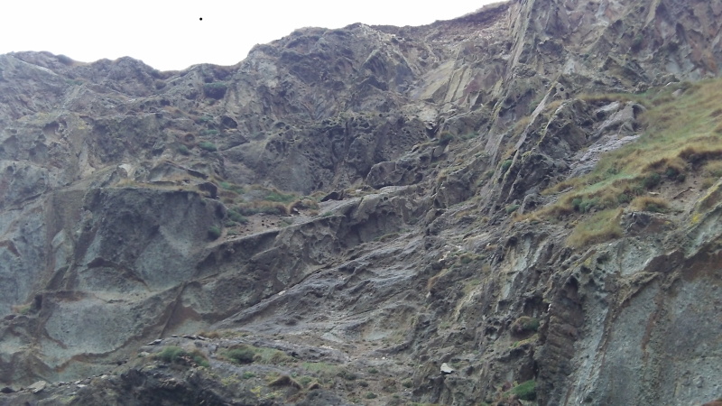
Just along from the pinnacle, there is a rather good bit of exposed cliff - it looks like ( to my totally un-geological eye ) that it is a layer of sedimentary rock, which has been up-ended, and part of it has split away.
The weather had by now improved a bit, and I didn`t feel like going straight back, so I headed out to Dinas Gynfor, and paddled out into the ebb current that flows out from the headland.
In a big Spring tide, the ebb current flowing there can be very strong, but it wasn`t that strong on this occasion, and with a bit of effort I could paddle up through it close to the rocks, and get past the headland.
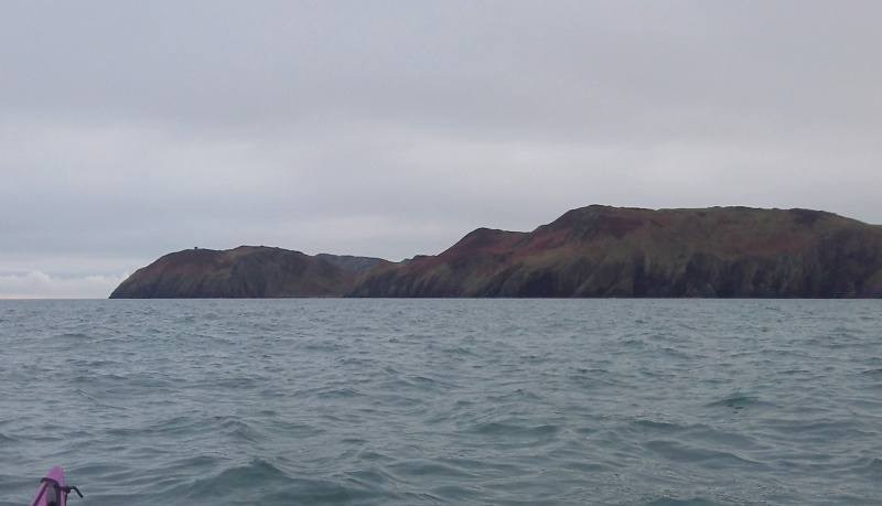
It is quite a striking bit of coastline to the east of Dinas Gynfor - here is the view looking east.
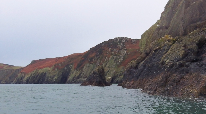
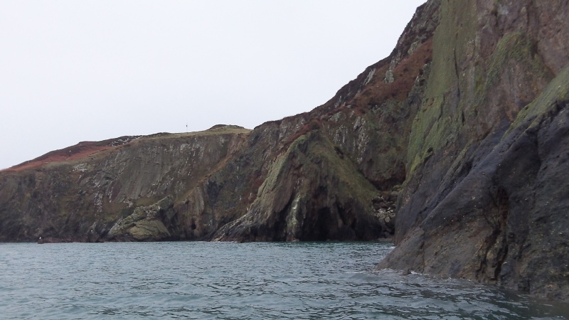
A bit to the east of Dinas Gynfor lies Hell`s Mouth, or Porth Cynfor. It wasn`t looking particularily hellish today, although I believe it does have a bad reputation, hence the name. As you can see, at high tide, there is a beach where landing might be possible - obviously depending on sea conditions.
I don`t know what it is like at much lower tide levels.
It maybe worth noting that the Anglesey Coastal Path is just above the beach, so it might be possible to do an emergency evacuation off the water from there. The snag is of course that it is miles from anywhere.
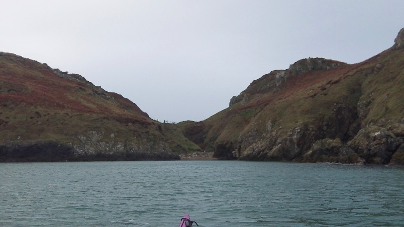
Heading eastwards from the beach there are some stunning bits of coastline. Here is a general view just along from the beach.
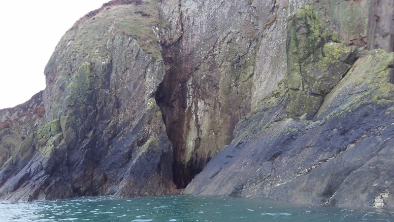
At one point there is a narrow slot into the rocks,
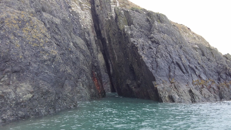
and if you work your way into it, eventually you can turn sharp right, and come out through another slot. At least, I was able to do it - it may not be possible in a bigger boat.
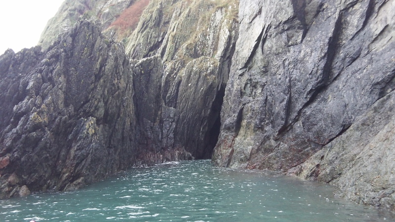
Next to the slot there is a clean cliff where it looks as if the big jagged rock in the sea has sheared off the cliff. It would have made a fair splash !
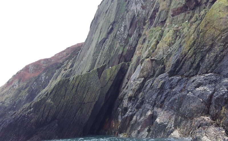
Here is a nice rock shelf, if you like climbing. It doesn`t look it in the picture , but where the seagulls are sitting the shelf is about 4 - 5 metres deep.
I couldn`t really see how deep this slot is, it was above the water.
A couple of interesting "bits" projecting out from the rest of the cliffs.
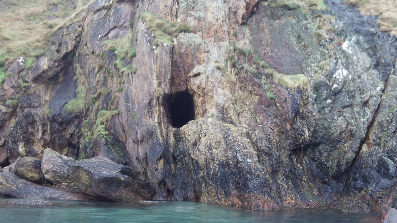
If you look closely, just off from the centre of the picture you can see a hole in the cliff - I think it must be an old mine.
It must have been a very wet environment to be digging a mine in.
Nowadays it seems like a strange place to start digging a mine, but I guess that back whenever it was it was quite sensible.
Just along the coast, Amlwch was the port for processing and exporting copper ( ore ? ) from one of the biggest copper mines in the world at Parys Mountain.
Along the coast in the other direction on Carmel Head there was another smaller copper mine - some of the buildings are still there, the Anglesey Coastal Path goes past them.
There was another mine near to Bull Bay, as well as several others inland around that part of Anglesey.
I read somewhere on the internet that due to the high price of copper and the presence of other minerals, it may be economically viable to re-open the mine in Parys Mountain.
Fascinating stuff !
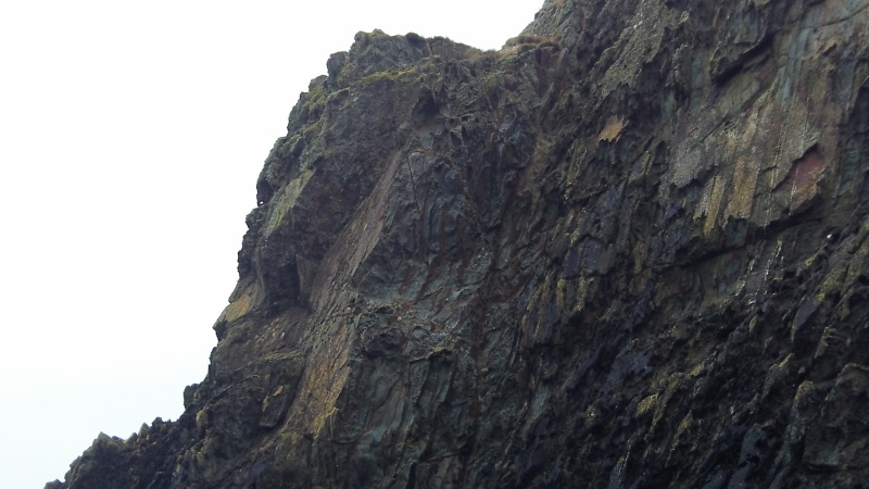
A bit further on, and there is a wonderful bit of weathering high up the cliff.
Quickly followed by another bit.
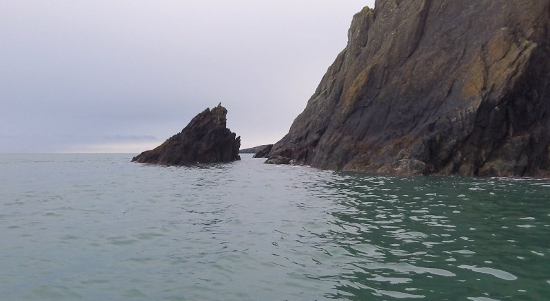
Eventually I got to the headland Torllwyn, with its little offshore island, and another bit of rockhopping without a big sea.
After Torllwyn, I was into Porth Wen, and here the weak sunshine screwed up the auto-exposure on the camera, but it gives you an idea of the west side of Porth Wen.
Further into Porth Wen, there is a small patch of the oddest looking rock. I`ve no idea what it is or what would cause it. Anglesey has some amazing geology.
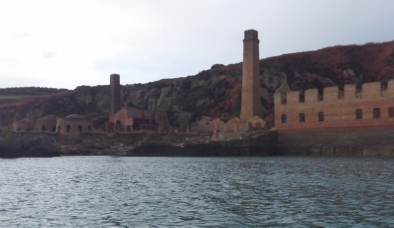
Here is the brickworks in Porth Wen, and again, the weak sunshine has overwhelmed the auto-exposure - I can`t tell from the screen what a picture looks like, I just have to shoot it and hope it comes out alright. Sometimes it doesn`t.
Some time ago I came across a website about the brickworks, with big warning messages on the website that the brickworks are private property, no trespassing. It is a pity that Wales doesn`t have the same access rights that Scotland has.
I believe there is currently a review in hand by the Welsh Government - it would be very good news if Wales adopted an access strategy more like the Scottish one.
There is a good beach just beside the brickworks, which works at pretty much all tides.
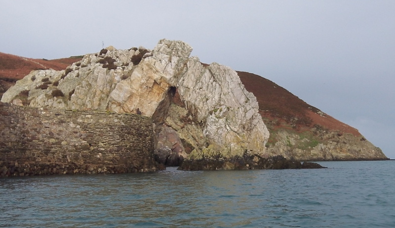
Just off the brickworks there is a fine looking arch, maybe not too easy to see in this picture because of the background beyond the arch.
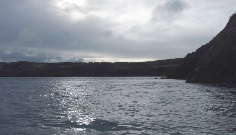
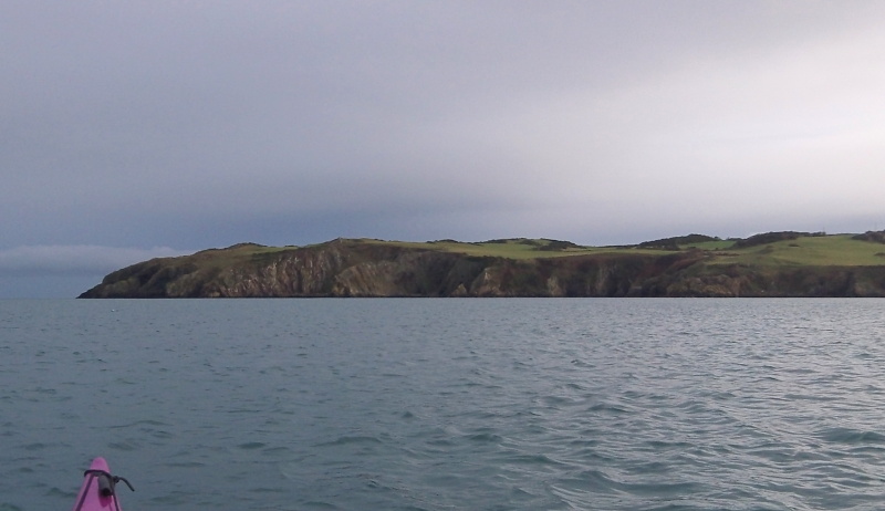
Heading back out of Porth Wen, this is the far side of the bay, with a bit of quite rugged coastline.
This sort of ruggedness continues pretty much all the way to Bull Bay - in fact it continues of and on all the way beyond Point Lynas.
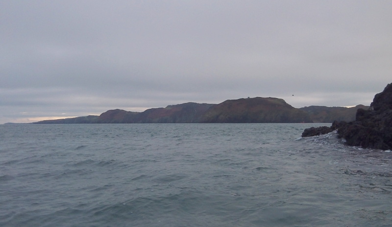
Back around Torllwyn, this is the view looking west back towards Dinas Gynfor and Middle Mouse.
By now it was well into the ebb tide, and round Torllwyn there was quite a significant current. But as soon as I was away from there, I was into an eddy all the way to Dinas Gynfor.
I was anticipating quite a strong current round Dinas Gynfor - I have seen very strong currents there in the past on some previous trips out from Cemaes - however today was a bit quieter, it wasn`t any stronger than it had been on the way out.
The current is significantly forced outwards by Dinas Gynfor, and if you don`t deliberately turn and break out of the current, you are going to be pushed out in the direction of Middle Mouse.
Of course, if you are going to break out of the main current. that means that you have to cross the eddyline - now as eddylines go, from what I`ve seen so far, the eddyline here isn`t the sharpest or cleanest eddyline you are ever going to meet, but there are huge volumes of water moving here at some speed, and it can be quite a lumpy and confused bit of water.
So not the easiest of places to negotiate - Dinas Gynfor is probably not a good place to learn about crossing eddylines.
I spent a while there, then headed back to Cemaes.
More bad news - the west wind had arrived and was producing quite strong gusts - fortunately they were heading straight for me, so they didn`t cause too much grief, although they did slow me down a lot.
The other bad news was that there was a huge eddy all the from Dinas Gynfor back towards to Wylfa Head, so it was a rather slow and tedious journey back against the current in the eddy.
I could see quite clearly the long tail off Middle Mouse out to the west, so further out there was a strong ebb flow.
But if I had headed further out, I would have been much more exposed to the wind, and I think to get out to the ebb flow, I would have had to go quite far out.
A sort of lose - lose situation.
The problem is that close to the coast the current in the eddy was flowing east, but further out the current was flowing to the west, so somewhere out there in the middle there were tidal shear lines and strong confused currents circulating around, so again, it would not be the easiest of paddling.
The current flowing out of Cemaes Bay at Llanbadrig Head was quite amazing, it was quite a fight to get through it.
But all in all it was a good few hours out, and I really didn`t expect the coast beyond Dinas Gynfor to be so interesting.
website design by ron-t
website hosting by freevirtualservers.com
© 2024 Ron Turner
![]()
![]()