ron-t kayaking blog
14 November 2013 ............ More on West Mouse and Cemlyn
Here are three different afterthoughts I have been having, after my trip from Cemlyn to Carmel Head.
First of all, I was curious about what was happening at West Mouse, with a tail out to the west, as well as the one to the east which I would have expected during a flood tide.
So the next day I cycled up to Cemlyn, and from one point on the road you can look out over that bit of the sea, and get a good view of West Mouse and of the Skerries.
It was a flood tide again, but a bit earlier in the tide cycle, so the sea level was lower.
There was no sign of a reef of rocks out to the west of West Mouse, and there was a bit of a tail on the east side of West Mouse. The sea was a bit quieter than it had been on the previous day.
The next day I went the same way again, but this time I took my camera with me.
Here is the view you get looking west towards Carmel Head - the furthest point you can see is the most northerly point of Carmel Head, and as you can see it is a long low sloping headland, so not the most spectacular bit of Carmel Head.
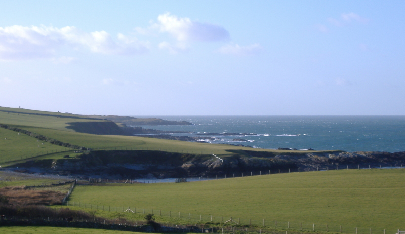
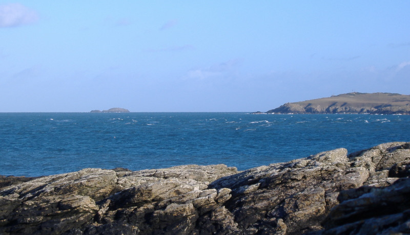
A bit further round to the right, and you get a good view of the Skerries, though they appear to be all one island, rather than several individual ones.
And now the mystery deepens - because as you can see from the photograph, West Mouse has a tail on both sides - ie, both to the east and to the west.
This photo was taken roughly 2 hours into a flood tide.
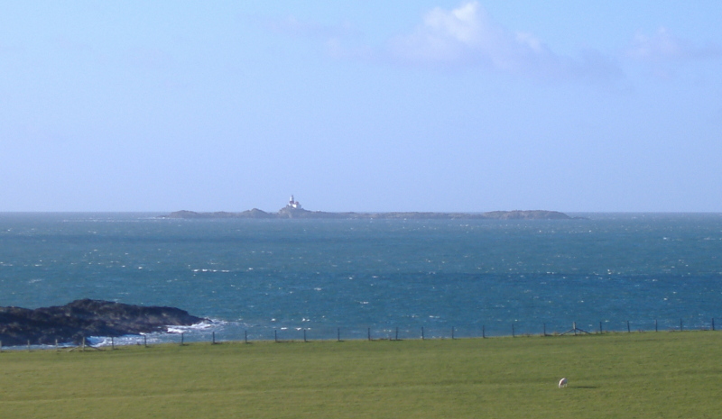
I went back again the next day, earlier in the day, so it was about half way through the ebb tide, and there really wasn`t much of a tail on either side.
So appears that the sea around West Mouse behaves quite differently from the sea around Middle Mouse, where you get a quite predictible tail out to the east during a flood tide, and a tail out to the west during an ebb tide.
The Admiralty chart for this part of the Irish Sea has provided me with an answer - Middle Mouse is a fairly discrete lump of rock sticking up out of quite a flat ocean floor, so the affect on the tidal flow is as a fairly simple vertical obstruction.
However West Mouse is like an iceberg - it is the highest part of a much bigger "hill" sticking up out of quite an undulating ocean floor.
Quite a lot of this "hill" is around four to five metres or so below Springs low tide level, and West Mouse is the summit at the east end of this "hill".
So not only is the undulating ocean floor causing disturbances in the tidal flow, but the larger bulk of this "hill" causes quite a significant interruption to the tidal flow, and also to any swell, mostly to the west of West Mouse.
So this all explains the white water I could see to the west of West Mouse, on my trip out to Carmel Head during the flood tide.
It therefore looks like - the white water to the east of West Mouse is caused by West Mouse and its lower land mass interrupting the tidal flow, just as happens at Middle Mouse.
The white water to the west of West Mouse is caused by the interaction of tidal current and rough sea breaking over the big land mass five or so metres below the surface, out to the west of West Mouse.
Interestingly, The Skerries also have quite a big land mass underneath them, and there are other sub-marine peaks between Carmel Head and the Skerries. Maybe this explains the different sea conditions that I experienced when I paddled out from Ynys y Fydlyn to the Skerries a few months ago.
In some places it was quite rough, in some places there were tide races in the middle of nowhere, and sometimes it was relatively calm.
I wonder if there are any 3D maps of the sea bed around this area in the public domain - I had a quick look on Google, and there are various forms of mapping going on around the UK as well as other countries. The deep-sea fishing industry uses dynamic sea bed mapping. However nobody seemed to want to show me anything - at least not for the UK.
Maybe I didn`t ask Google the right questions.
I wonder how easy it would be to predict sea surface conditions down to tens of metres by combining data from seabed mapping, tidal currents, and weather conditions - all of which are known or predictible. Maybe there is an app for it already !
Something else that I was pondering over was the way the tidal currents were behaving - I was definitely paddling against the flood tide as I was heading up to Carmel Head.
It also appeared to be still the flood tide out at West Mouse.
Halfway back to Cemlyn I could see quite a distinct strong westerly flow just a bit further offshore, and yet at Cemlyn there was no current.
So it looks like I have to rethink my view of what slackwater actually means.
I have sort of assumed that there was a fairly simple change in direction between flood and ebb, or between ebb and flood.
It now appears that the change of direction happens in a more complex way, with different bits of sea changing at different times, over a period of time.
It explains why on the paddle back I was seeing quite a strong ebb current just off to my side, and yet at Cemlyn Point, there was no current at all.
It explains why the timing of slackwater is notoriously difficult to predict, whereas the times of high and low water are mathematically predictable.
It also explains why you can get quite significant differences between Springs and Neaps in the time difference between slackwater and high or low water.
So it is something else to I need to make allowance for when planning trips.
The third thing I thought of is that I have never posted any pictures of Cemlyn Bay and Cemlyn Point on my blog.
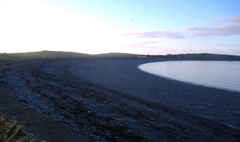
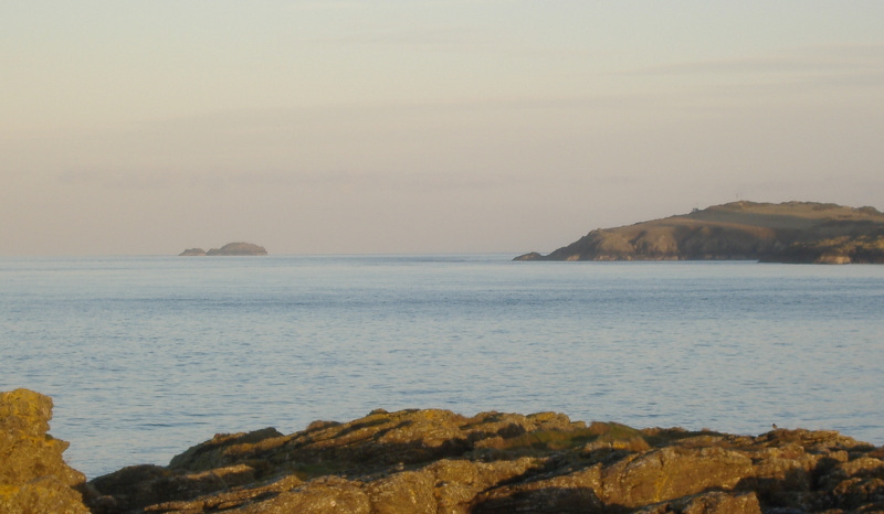
So first off, here is a couple of pictures I took way back in January - the first one shows the long low spit of land that ends in Cemlyn Point. The island off the end of the point is part of Harry Furlough`s Rocks.
At the back of Cemlyn Bay there is a steep loose shingle bank. It is not the easiest beach to walk on, pulling a trolley up it is even worse.
Being steep, it has a tendency to produce quite dumpy aggresive waves that fill your boat up with stones. This is it at low tide.
Here is a much more recent picture of Cemlyn Bay, taken from Cemlyn Point.
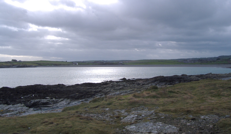
Cemlyn Point sticks out quite a lot, so you get a good view in all directions. Here is the view looking east, past Wylfa Head to Middle Mouse.
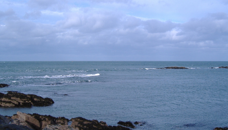
You get a good view across to The Skerries and to West Mouse. I hope you appreciate the exploding wave in the foreground.
It`s real - wasn`t done with Photoshop !
This is looking across to the Harry Furlough`s Rocks, I think that this is about mid ebb tide.
At low tide heights, the Harry Furlough`s Rocks are just about connected to Cemlyn Point by a crescent of rocks, and a semi-lagoon is formed.
At high tides everything is covered.
Now the interesting thing about a mid ebb tide is that there is a strong current through the section right in the middle of the picture - it feeds into quite a distinct tide race heading off to the left.
There is a possibility that with a good swell coming in from the west, you would get a bit of a playspot forming here.
I haven`t ever seen it, but there is also a possibility that without a swell, the tidal current flowing over the rocks will produce a static wave. This would apply to both a flood tide and an ebb tide.
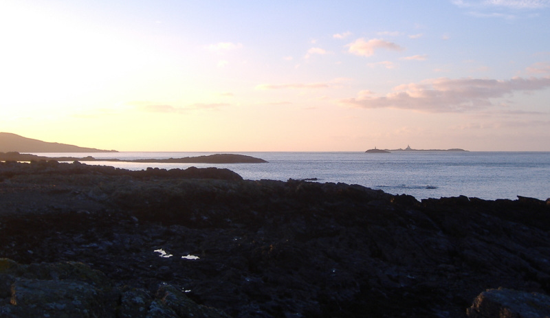
To close, here are three more pictures taken back in January, late afternoon, quite close to sunset. The low angle winter sun gives an unusual lighting effect. This is looking west from Cemlyn Point to Carmel Head, West Mouse, and the Skerries.
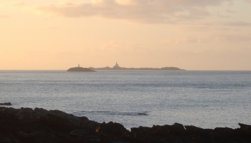
Using a longer focal length, looking east.
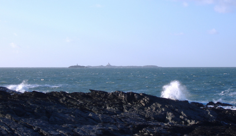
And finally, my favourite, the longer focal length picks out the Skerries and West Mouse.
website design by ron-t
website hosting by freevirtualservers.com
© 2024 Ron Turner
![]()
![]()