ron-t kayaking blog
11 July 2013 .............. Church Bay to the Skerries and Carmel Head
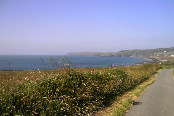
I had my first trip out to the Skerries from Church Bay - here is a general view of this bit of the Anglesey coastline, taken from a minor road a bit south of Church Bay.
Church Bay itself is hidden in a hollow beyond the two white houses, you are looking north up the coast to Carmel Head, and the Skerries are rather faint I`m afraid, but they are just visible on the horizon of the wide area of sea to the left of Carmel Head.
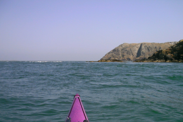
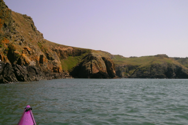
Approaching Ynys y Fydlyn, there`s a good view up towards Carmel Head, and also you can see a quite distinct tide rip of some kind just off Ynys y Fydlyn.
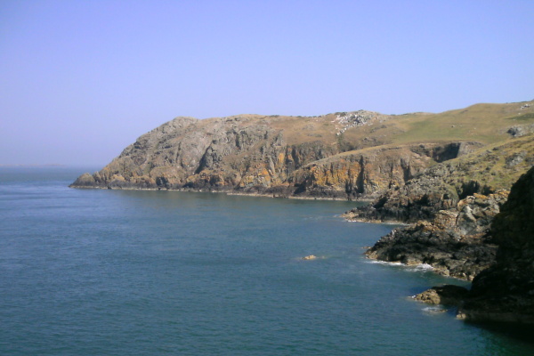
If you land on the beach there, you can climb up onto the inner part of Ynys y Fydlyn, and get a closer view of the coastline towards Carmel Head.
Another interesting view you get from the same place is the eddyline caused by Ynys y Fydlyn interrupting the huge flow of water flowing up the north west coast of Anglesey from North Stack up to and around Carmel Head. When the picture was taken it was about 2 hours before high water, it was close to Springs, and it was of course the flood tide. The tide rip in one of the earlier pictures is related to this as well.

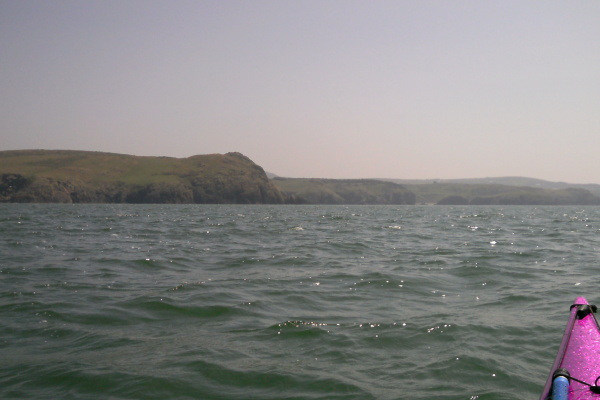
Not quite perfect conditions for the crossing over to the Skerries - there was a bit of a north east wind, so it was wind against the last of the flood tide. It did get quite choppy at times, and I also found that the tidal flow around there isn`t smooth, there were several tide rips to negotiate or avoid. In a quieter bit somewhere in the middle - here`s the destination.
I got out there okay, but my route wasn`t the best - I got washed a bit by the flood tide out to the north and east - I wasn`t too worried about it, as I knew that slackwater wasn`t too far away, however it looks like my open crossing and tidal planning skills need a bit of work.
I think the strongest current was in the last third of the crossing, before getting into the shelter of the Skerries.
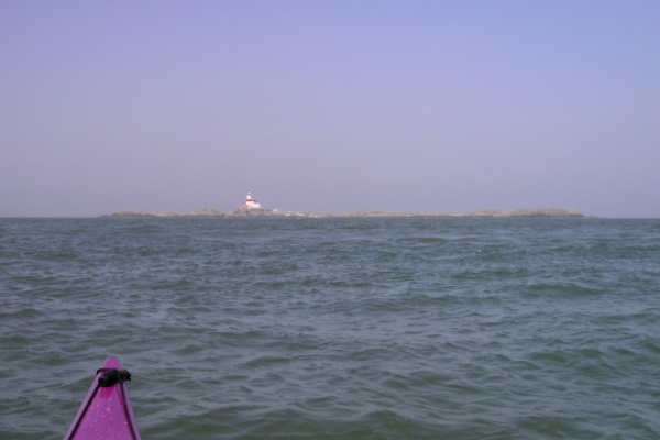
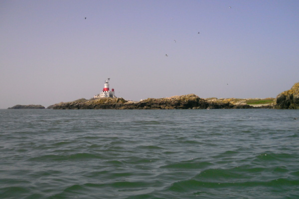
Not too far away now, here`s the lighthouse -
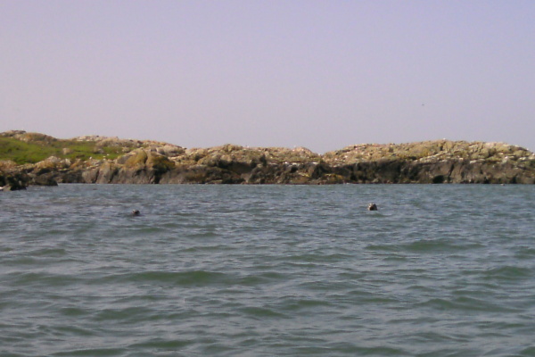
Up towards the other end of the Skerries, a couple of the locals took an interest in my passing.
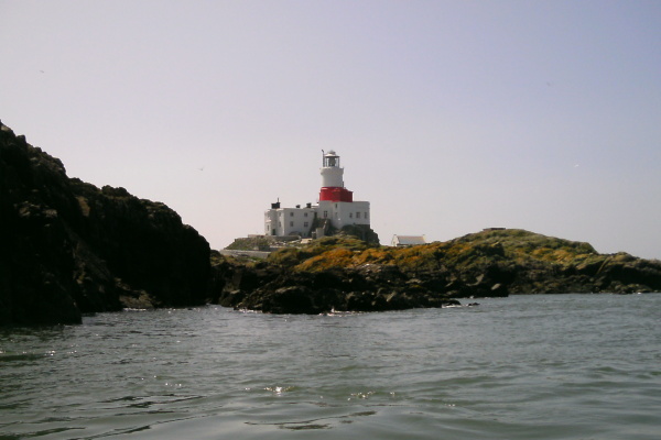
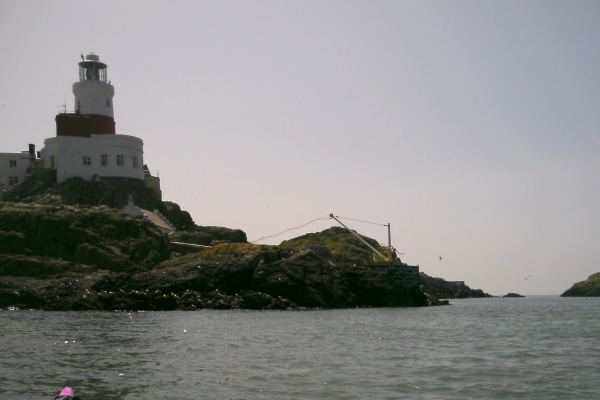
I paddled around the Skerries for a wee while, here`s the other side of the lighthouse, and also the landing stage used by people going to the lighthouse. I believe that the landing stage is quite often used by visiting sea kayakers to get onto the island, though it wasn`t where I stopped.
By the time I left after my lunch break, it was quite clear that out to the north and west of the Skerries it was now an ebb current, but I quickly found that out to the south and east it was still a flood tide.
Interestingly, this is quite the opposite from what you would expect from looking at the Admiralty Tidal Stream Atlas NP259 - this clearly shows that the current between the Skerries and Carmel Head reverses up to an hour before the current reverses out beyond the Skerries, not after it.
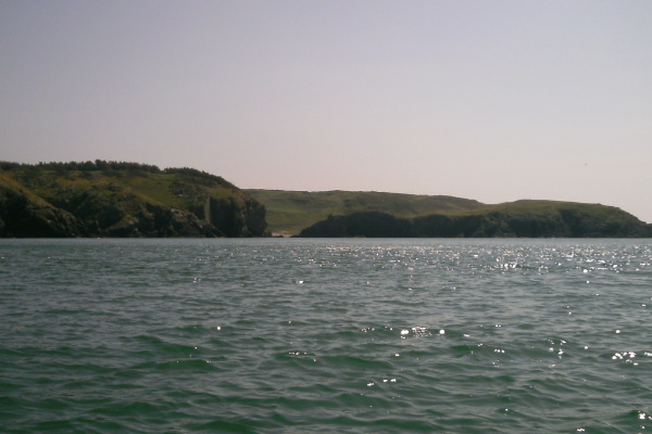
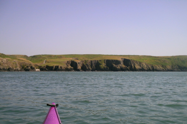
When you are out at the Skerries, Carmel Head looks to be a long way away - here it is, just after I started back.
However the current didn`t give me too much grief, and I was soon back at Carmel Head - by the time I was getting closer to Carmel Head, there was quite a strong ebb flow.
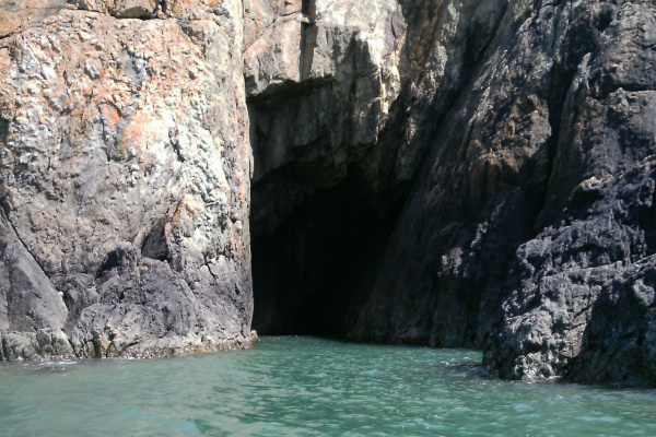
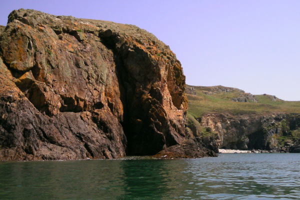
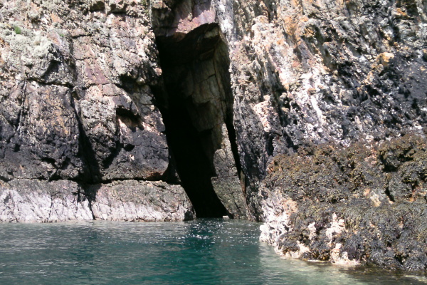
Somewhere along the westerly facing side of Carmel Head there is quite a good cave. It was quite hard work paddling against the current to get to it.
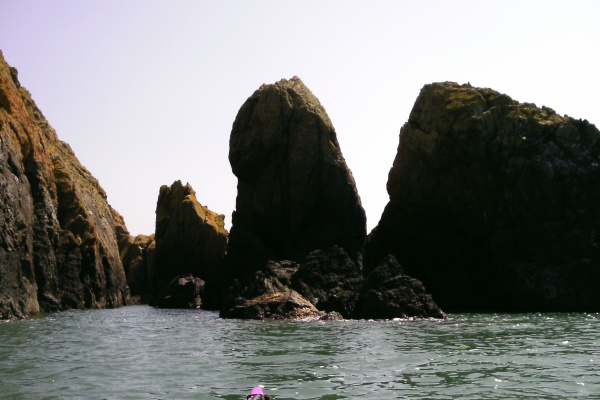
The coastline from Carmel Head down to Ynys y Fydlyn is quite a spectacular bit of coastline - at Carmel Head itself there is a big jumble of rocks -
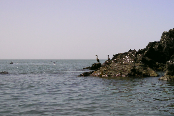
- and some of the local residents.
Here are a few more pictures of that area, the last one is looking down towards Ynys y Fydlyn - I seem to cut off its outermost point, I`m afraid.
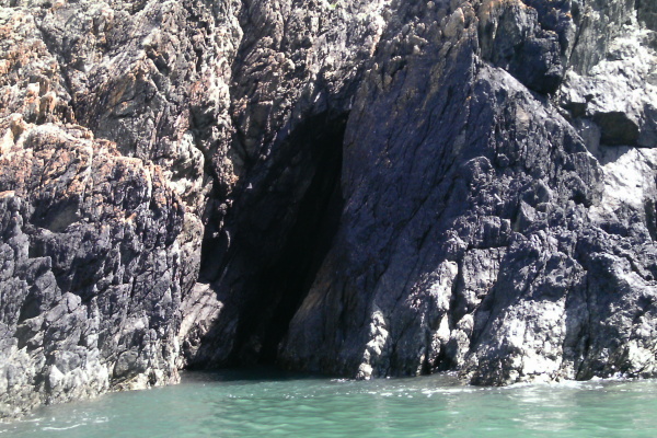
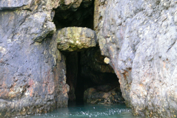
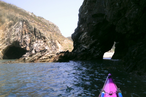
The next headland after Carmel Head is amazing - it is almost hollow. First of all you meet a narrow opening with a huge chockstone stuck in it.

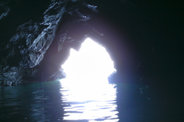
I got into it quite a long way, but it was getting very dark inside, and I couldn`t find a way to get further in. I did try to take a picture from inside, but the contrast ratio was just too high for the picture to work.
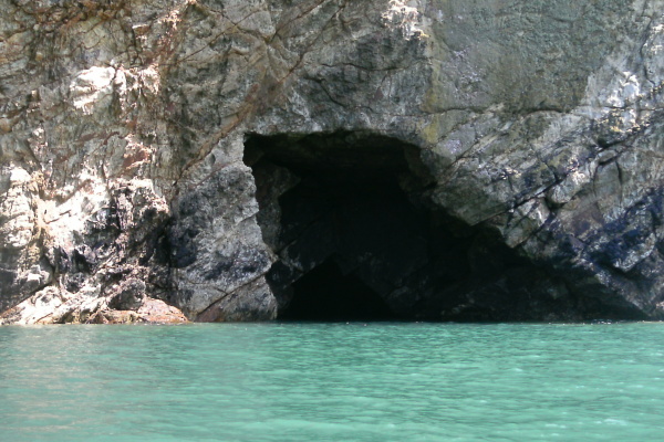
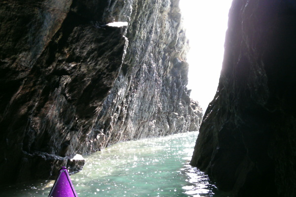
Round the corner, you come to another cave, with quite a low entrance, however inside it is a bit of a surprise. You paddle in through the opening into a large squarish cave, and find another three small entrances hidden away, one of which you can paddle through.
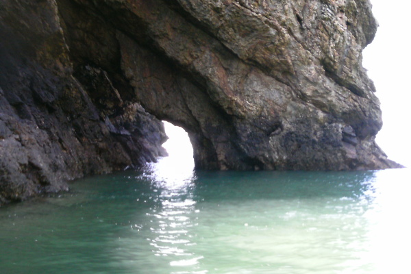
One of the other entrances to the cave is actually the cave with with the chockstone - since I could now see where I was going I tried to paddle through it, however the water wasn`t quite deep enough, so it was a fail.
Ynys y Fydlyn is quite a distinctive feature, and on the north side there is a good arch, which you can paddle through at high tide levels. However I`ve seen it from land in rough weather, and the waves and swell positively explode through it - so go canny if there are waves and swell around.
Here`s the the arch from the outside, and you can see another cave off to the left in the adjacent headland.
On the other side of Ynys y Fydlyn there is yet another cave, and you can get quite far into it.
After Ynys y Fydlyn, the large bay Porth y Bribys has a rather distinctive section of cliffs. I have seen them from the Coastal Path that runs right beside them, and it is almost impossible to photograph them from above, because you are right on top of them. If you are not on top of them, you can`t see them. So it is nice to see them from the sea.
For the journey back to Church Bay, I stayed well out hoping to get a free ride on the ebb current. However I found that there are a load of eddies all the way back to Church Bay, and some of them are strong enough to produce their own tide races. So it wasn`t as easy as I had been hoping for.
Although not perfect, the weather and the sea conditions were quite benign - there are strong currents around Carmel Head and out to the Skerries and in poorer conditions it would be quite challenging paddling around that area. I think it is an area that requires respect.
website design by ron-t
website hosting by freevirtualservers.com
© 2024 Ron Turner
![]()
![]()