ron-t kayaking blog
10 June 2013 .............. Porth Dafarch to South Stack
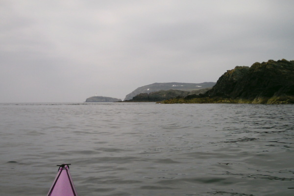
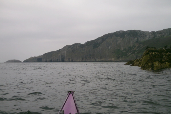
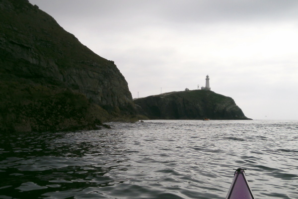
A grey day, but windless, so I headed off to Porth Dafarch to see if I could get up to South Stack. Here is my goal, which comes into view as you head towards the most westerly point of the Penrhyn Mawr peninsula.
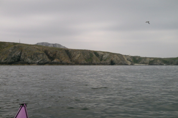
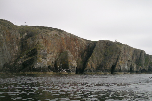
As you head across the entrance to Abraham`s Bosom, you get a good view into Abraham`s Bosom, and can begin to appreciate the grandeur of the cliffs as the coastline sweeps round towards South Stack.
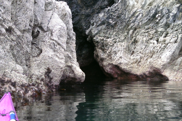
As I headed in towards the coast, I spotted a couple of caves -
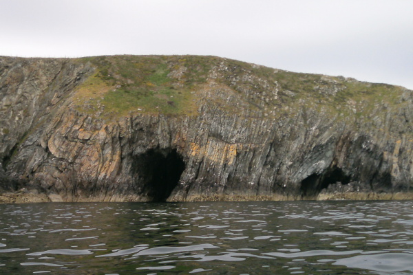
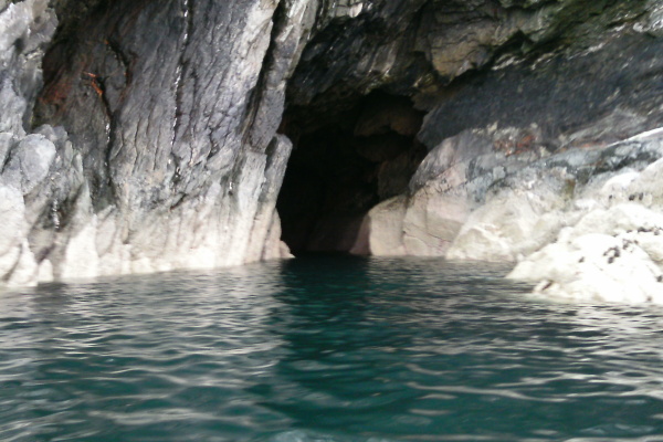
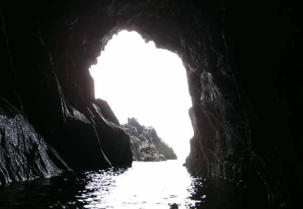
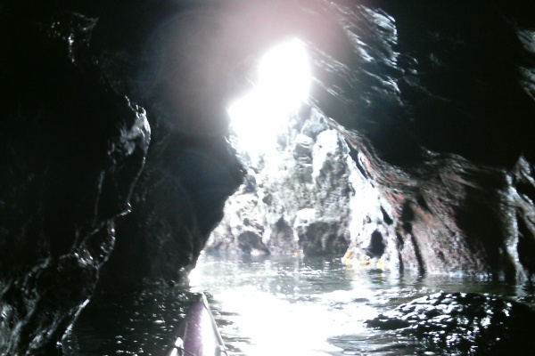
The larger left hand one was a disappointment, as it had little depth. However the right hand one was much more interesting - despite it`s smaller profile from the outside, it is actually quite a deep one. Here are the outside and inside views of it.
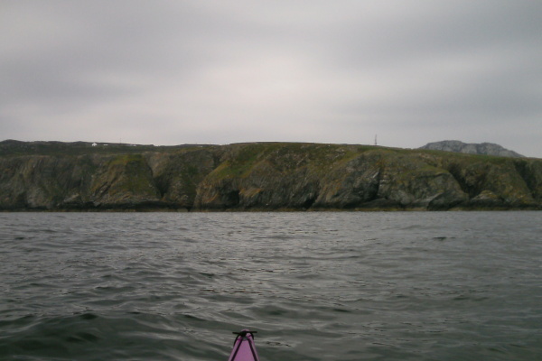
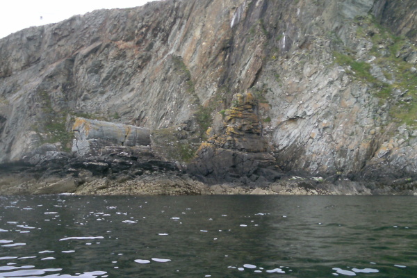
Along a bit from the caves, the coastline gets a bit more broken at sea level, here are a couple of pictures looking along the coast - a rather interesting feature is a big cylinder of rock. You can just see it in the first picture, the second picture has a better view of it. It`s rather odd to think about how it got there - presumably many millions of years ago the rocks were folded and bent to produce all the various amazing rock formations you get round Angelsey, including this one, then over the years the cliff has eroded away to leave just the cylinder. We scream and shout and think how important we are - but in the timeline of the world we are less than a speck of dust.
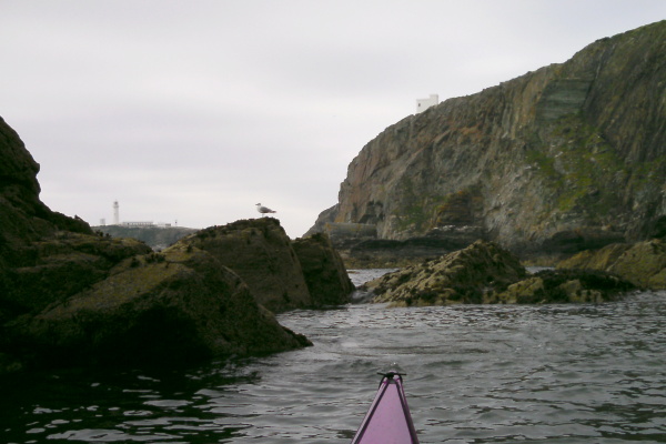
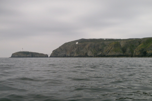
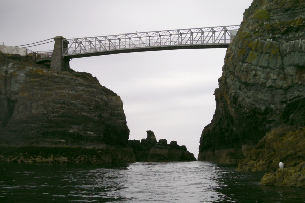
This is heading in to the narrows between the South Stack island and the mainland - there are certainly two, maybe three, passages through the rocks that you can see, and this is close to low tide, so it looks like they are going to be negotiable at all tide levels.
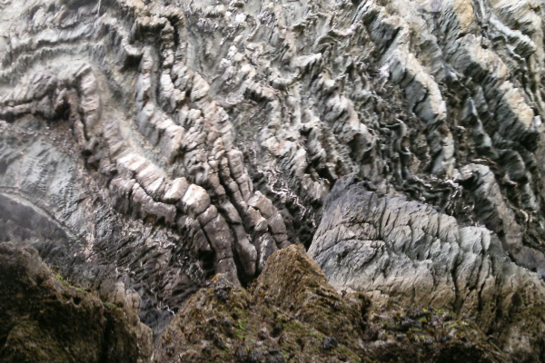
Halfway through the channel there are the most amazing patterns in the rock wall of the mainland - I couldn`t get any further away to photograph them properly, but here is a bit of them.
I headed through the narrows, and paddled towards Gogarth Bay. Just after the narrows there is a sort of arch on the mainland side - it`s not too clear in this photograph, but it is an arch - actually it might be more appropriate to call it a flying buttress because of its shape. Maybe it`s there to hold up the cliff !

After rounding a bit of a point, you are into Gogarth Bay, and can look across to North Stack, and the huge shear cliffs that face Gogarth Bay.
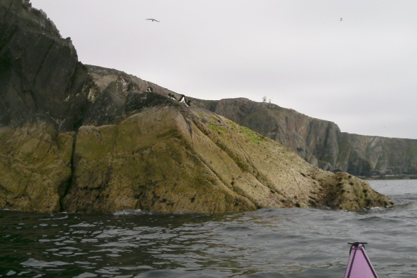
It was too near the end of the ebb tide to think about carrying on to North Stack, and anyway I would have been struggling with time as well. I really must get a bit more organised and start these sort of trips in the morning, not after lunch. So I turned around, and headed back to South Stack - here it is from the north.
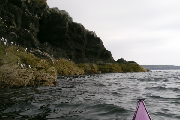
South Stack has masses of birds - here are a few of the local residents sitting on the rocks round the outside of South Stack.
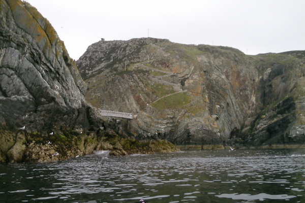
There was a bit of a tide race around the outside of South Stack, but it wasn`t enough to cause me any concern. Further round, and you begin to see the cliffs to the south of South Stack again - the first picture shows the wall beside the steps that zig-zag their way right down the cliffs from the road at the top down to the pedestrian bridge. The second picture shows a bit more of the cliffs - it looks like there are several caves along that bit, but I don`t recall if I ever went into them.
Then I headed back to Penrhyn Mawr, pretty much in a straight line. As I was heading across, I could see a helicopter hanging around over the land a bit inland from the western point - it didn`t seem to be doing much, but it turned out it was. Once I got a lot closer I could see that they were doing some kind of training exercise involving a climber on a rope on a cliff, and going into to rescue him off the rope.
As I was sitting watching them, I started to wonder what is going to happen when the helicopter SAR service is taken over by a private profit driven company.
What will happen when the main motive behind the whole search and rescue service is to make a profit. Will we see the same sort of training exercises ?
What budget analysis will be done before a helicopter lifts off the ground, whether it is an emergency or not ? How long will it be until a helicopter won`t take off until they have got your credit card number ?
From my limited experience of sea kayaking around Anglesey, I get the impression that they currently operate pre-emptively - ie, they estimate when there is likely to be an incident, and they are airborne standing by. I doubt a profit making company is going to do that.
Hmmm !
Anyway, back to Penrhyn Mawr - and the outer race was starting the flood tide. I could with a bit of effort paddle against the current - there was the beginnings of the tide race downstream of the narrows between Tide Rip Rock and the Fangs, and I paddled through it and onto to smoother water above the tide race.
In the area directly between Tide Rip Rock and the Fangs, the water was smooth - completely smooth, it was like paddling on glass. Right in the middle, there was a wave, just at the start of the tide race - it wasn`t what I would call a static wave, as it came and went a bit, but it was just about surfable. Every now and then I had to do some lazy paddling to get back on track, and I stayed there for something between five and ten minutes. It was magic. It was the nearest thing I have met yet in Anglesey which was anything like a decent static wave.
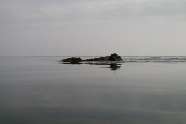
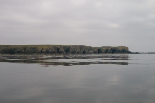
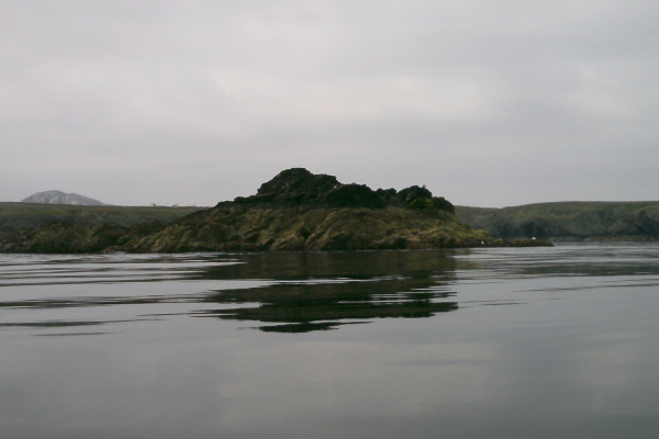
Whilst I was sitting there, I took some pictures - the first one, looking to my right, is one of the Fangs, complete with resident seal. The second one is looking straight ahead at Dinas Stack and the neighbouring mainland, and the third one is looking to my left at Tide Rip Rock, the outermost rock at Penrhyn Mawr.
Eventually I gave up playing, and headed into Porth Ruffydd for a break - but just on the way in I found another cave which I don`t remember seeing before. It is quite a good one, with a small opening. Here are the outside view and the view from inside.
After a break on the beach, I headed back out to the outer race to see what it was now like. The outer race was now too fast to paddle up, and there wasn`t really any decent waves, so no surfing. So I went home.
But it was a most successful afternoon - out to South Stack, and surfing at Penrhyn Mawr in conditions that you just don`t associate with Penrhyn Mawr - it is normally known for its mega tide race. So there you go !
website design by ron-t
website hosting by freevirtualservers.com
© 2024 Ron Turner
![]()
![]()