ron-t kayaking blog
30 April 2013 .............. Porth Dafarch to the westerly point of Penrhyn Mawr
Another good day to be out, so where to go ?
I looked at the tide state and found that it was heading up to high tide, for the next 6 hours or so it was an ebb tide.
I haven`t ever seen Penrhyn Mawr during an ebb tide, so that was the decision made, and I was off to Porth Dafarch.
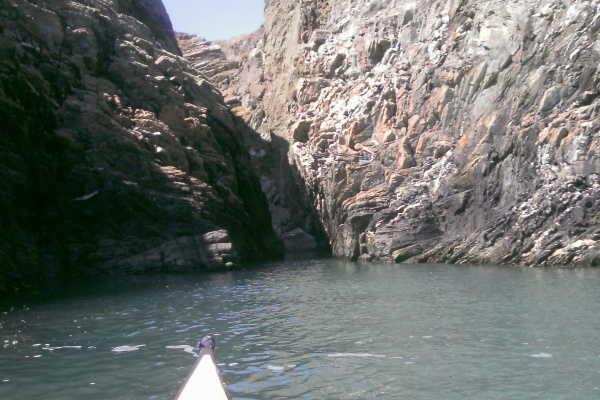
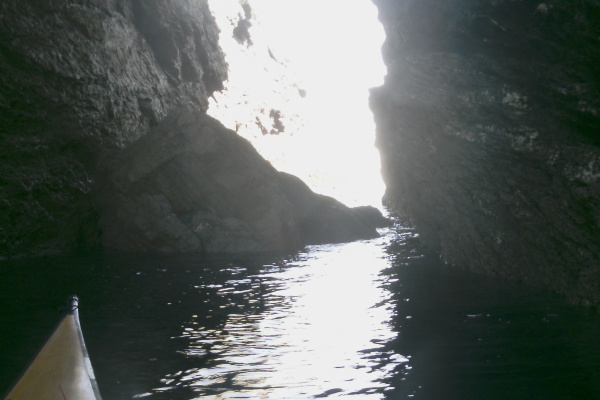
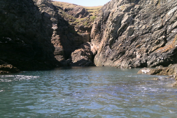
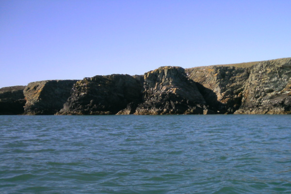
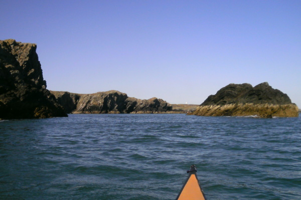
I wanted to have another look at the cave/caves in the shape of a cross which lies in a corner a bit before Dinas Stack, so that was my first stop. This is what you see as you head in through the outer slot in the cliffs.
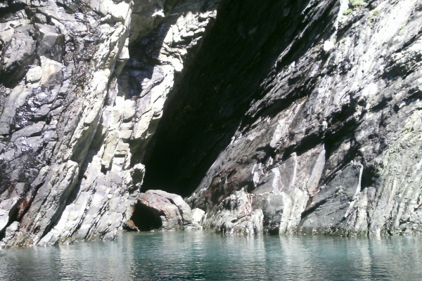
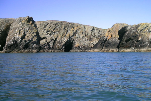
Once in through the slot, I reversed into the cave on the left, so I could take a picture of the cave on the right, and here it is.
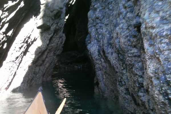
Then turned around, and reversed into the cave I had just photographed, and took some pictures of the cave on the left. I didn`t know it at the time, but once I was home and uploaded the pictures on to my computer, I found these -
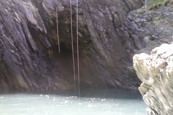
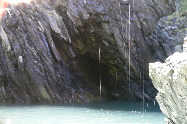
The white streaks are actually little drips or streams of water that were dropping down just in front of me, and have been lit up by the sun. Down at the bottom you can see little curved lines which are splashes.
It is amazing what you sometimes capture just by accident.
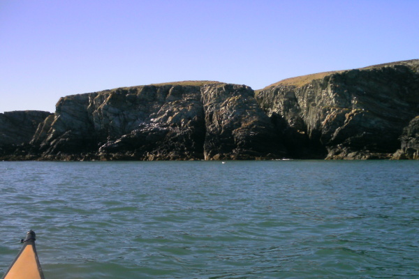
Then it was off and around Dinas Stack, and into the arch. It was still pretty close to high tide with not a lot of swell, so after a little consideration, I finally proved conclusively to myself that yes, it is possible to paddle through the arch at high tide.
Now I took this photograph when I was on the way back to Porth Dafarch several hours later - I am in a channel at the back of the arch, and this shows the boulders that you have to negotiate past if you paddle through the arch. So it shows why it has to be pretty much high tide.
And do remember to be very careful about the swell - the swell coming in through the arch positively explodes over these boulders, so you`re timing has to be spot on. Get it wrong and you are toast !
Whilst I was playing around the back of Dinas Stack, I could hear a helicopter somewhere over the land somewhere near to Porth Ruffydd, but I couldn`t see it, so didn`t pay a lot of attention to it.
However as I headed round toward Porth Ruffydd, I saw the helicopter, and a winchman dissappearing up inside.

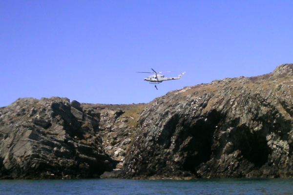
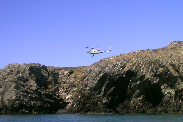
Then I noticed 4 sea kayaks on the beach, so guessed that there may have been something going on - I headed in towards the beach and asked them if they were okay or if they needed any assistance. But I think by then whatever had happened had been resolved, so they just said they were okay, and I left them to it. All the time the helicopter was hovering somewhere above me - it was my first experience of helicopter downdraft.
Then I headed out to Penrhyn Mawr - followed by the helicopter. My personal safety net. I played around there for a bit, and eventually they went away and hovered over Dinas Stack for a while.
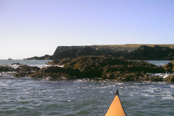
As you head along the coast from Porth Ruffydd towards Penrhyn Mawr at high tide, there are some interesting channels you can paddle into.

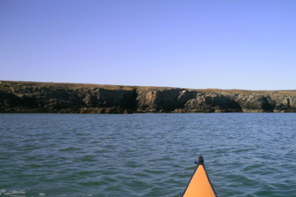
At high tide most of the rocks at Penrhyn Mawr have dissappeared - this is looking out to Tide Rip Rock in the distance.
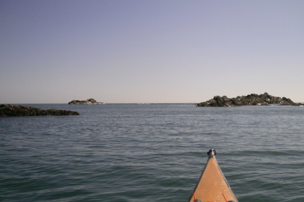
Just inside Tide Rip Rock the first of the other rocks were beginning to show.
After a break on the wee beach at the back of Penrhyn Mawr, I headed further around the coast.
Now I think a bit of an explanation is in order here, because for a long time I was confused by this - unless I am still getting this entirely wrong, the bit of coast that sea kayakers refer to as Penrhyn Mawr is not the same bit of coast that the OS map sheet 114 refers to as Penrhyn Mawr, nor the bit of coast that the Admiralty chart refers to as Penrhyn Mawr.
The OS map and the chart show Penrhyn Mawr as being the most westerly point of the whole headland.
The tide races that sea kayakers talk about are at the most southerly part of the headland - on the Admiralty chart you can clearly see the Tide Rip Rocks.
So as you head out from the sea kayakers Penrhyn Mawr towards the most westerly point, you are heading further out into the main tidal flow, and when I was there the sea was getting noticeably more chunky as I headed out.
It was sufficiently chunky that I had difficulty taking many photographs, but here are a few that I took in some of the more sheltered corners. It is quite a spectacular bit of coast line, and I followed it around to the most westerly point, until I could see into Abraham`s Bosom, and across to South Stack. I am afraid the sea was a bit too chunky to be taking photos by then.
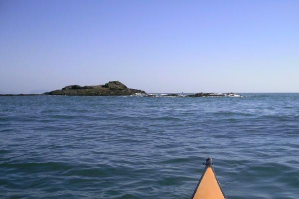
I then headed back to the sanctuary of the sea kayakers Penrhyn Mawr. The tide had dropped a bit more by then, so the rocks to the inside of Tide Rip Rock were a bit more exposed - this picture is looking out over them towards the westerly point.
I played around there a bit, and whilst I was there, I realised that the current in the inside race was flowing in the wrong direction - it should have been flowing east, but it wasn`t - it was flowing west. So I was a bit puzzled by this. The current in the outer race was not particularily distinct, but it was flowing the correct way.
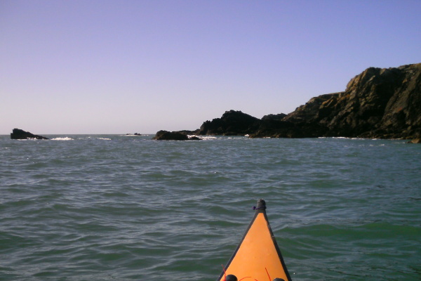
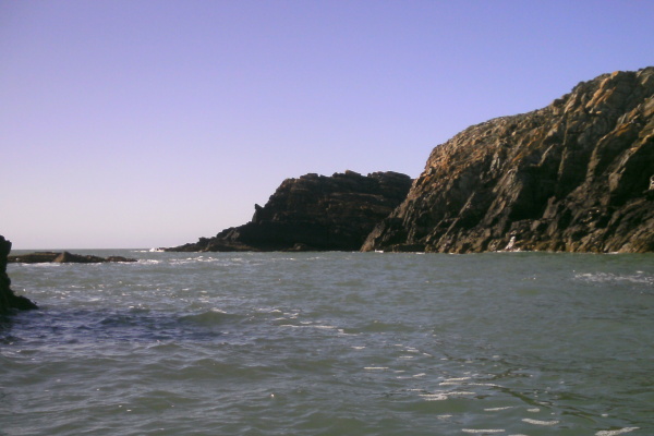
I headed back towards Dinas Stack a bit further out than usual, and took these pictures of various bits of the coastline between Penrhyn Mawr and Dinas Stack. It doesn`t matter how many times I paddle this bit of coastline, I still think it is stunning.
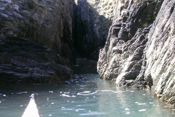
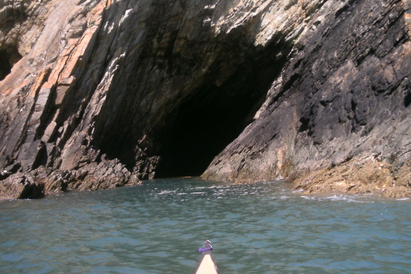
I headed into the little bay at the back of Dinas Stack, and into a sort of channel between the rocks. I showed you the picture of the boulders at the back of the arch earlier on in this web page, but if you turn round, at the other end of this channel there is a sort of a cave which takes you a bit under Dinas Stack. You might be able to get further in at high tide, by this time the tide had dropped about a metre from high tide, and there were boulders in the way, but this is what it looks like.
Then it was back round Dinas Stack - I tried to be arty and take a picture of the next headland framed by Dinas Stack and Gul Rock - I am not sure that it really works.
On the way, there was a small normal tide race between Gul Rock and Dinas Stack. On the way back, there was also a small tide race - but it was flowing the wrong way. Just like the inner race at Penrhyn Mawr.
Thinking about this on the way back, I came to the conclusion that there must an eddy - that is the only reason that the current would flow the wrong way. If you think about how the ebb current will flow from the westerly point at Penrhyn Mawr down to Rhoscolyn Head, then there is a real possibility that there is a huge eddy all the way from Rhoscolyn Head back up to the westerly point of Penrhyn Mawr - past Ravens Point, past Treaddur, past Gul Rock and Dinas Stack, and past the southerly point of Penrhyn Mawr on the way.
An eddy 6 km`s long !
Or maybe Ravens Point splits the ebb flow, and part of the current turns back at that point, so the eddy is only a mere 4.5 km`s long.
It also explains the chunky sea as I headed out to the westerly point of Penrhyn Mawr - because that is the bit of coastline where the top end of the eddy flowing west meets the tidal current flowing south and east.
Well it`s a nice theory anyway.
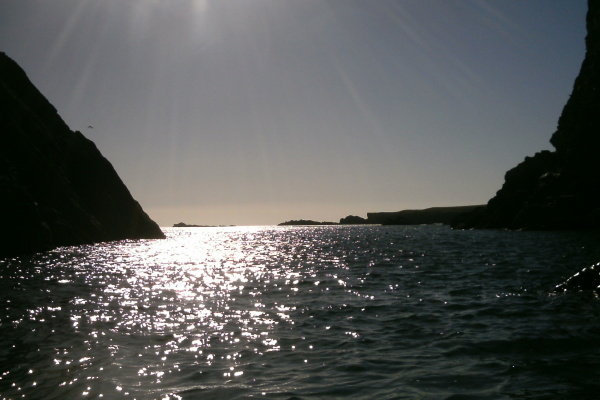
Finally, here is another picture which didn`t come out quite as expected - it was taken from the back of Dinas Stack, looking out towards Penrhyn Mawr, looking straight into the sun.
website design by ron-t
website hosting by freevirtualservers.com
© 2024 Ron Turner
![]()
![]()