ron-t kayaking blog
18 March 2013 .............. Porth Dafarch to Penrhyn Mawr
On the 18th March, whilst the north east of the uk was being blasted by snow showers, Anglesey had a near perfect day for sea kayaking.
Whilst I had seen the various bits of the coastline from Porth Dafarch to Abraham`s Bosom from the coastal path, sometimes more than once, it is quite a complex bit of coastline with a lot of features, so there is a lot to take in. So I took the opportunity of the good weather to paddle out from Porth Dafarch around to Penrhyn Mawr.
Now I thought it was a stunning bit of coastline when up on the coastal path - but that is nothing compared to seeing it from the sea. It is an incredible bit of coastline, I was in scenic overload by the time I got back, with a total of 118 photos.
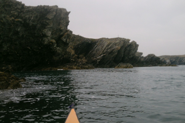
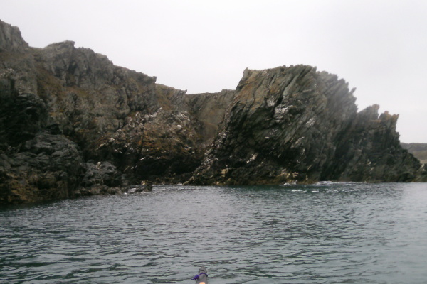
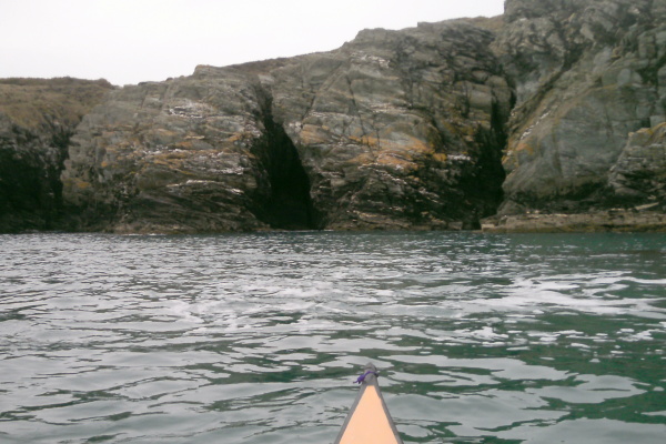
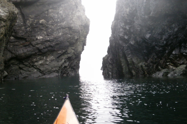
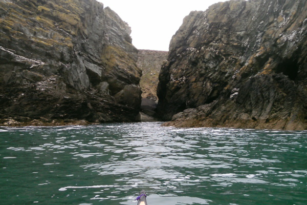
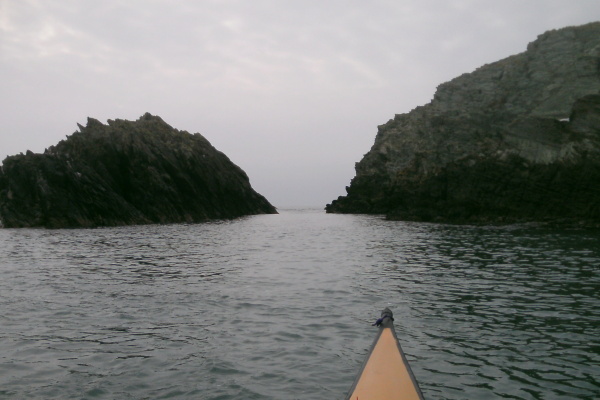
So here are thirty or so of them. Heading out of Porth Dafarch, and around the corner, the impressive rock structures start straight away. The first picture is looking back towards Porth Dafarch, the second one a bit further along.
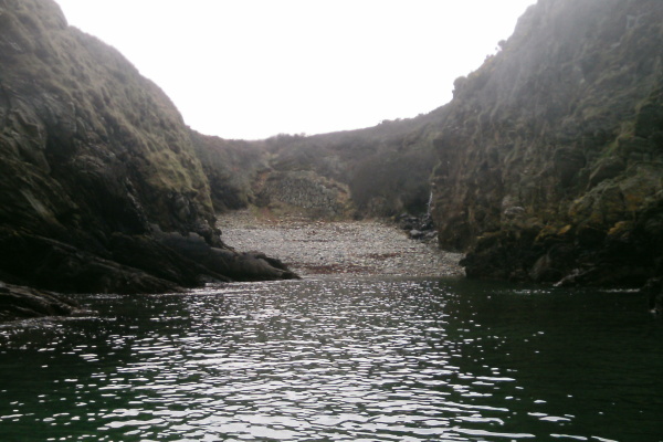
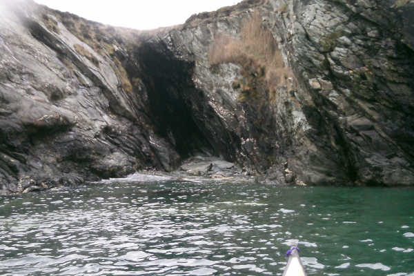
After not too long a distance, tucked in the corner, there is another beach - it is not shown on the OS map, but I think it is called Porth Rhwydau or Coppermine Cove.
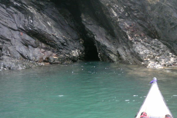
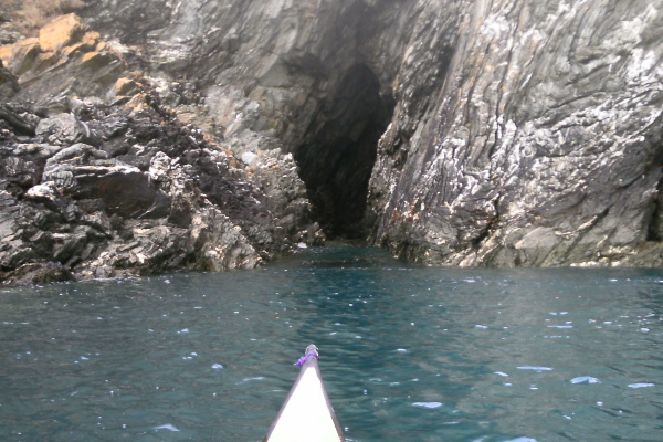
Just beside Porth Rhwydau, there was a very small cave, too small to get into. However listening to the swell, it sounded as if it might be quite big inside. It might be worth investigating at a lower tide level.
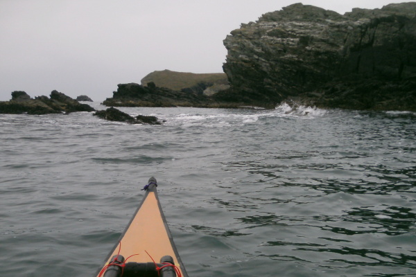
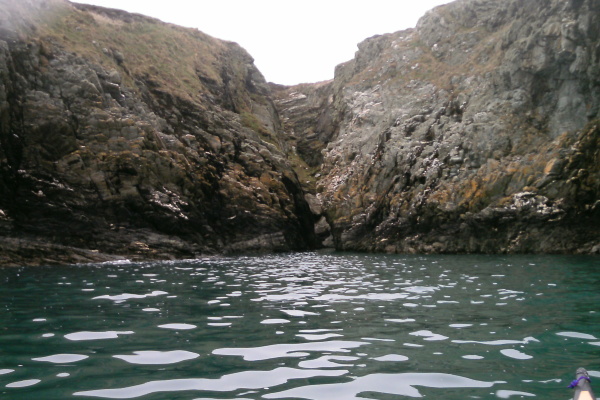
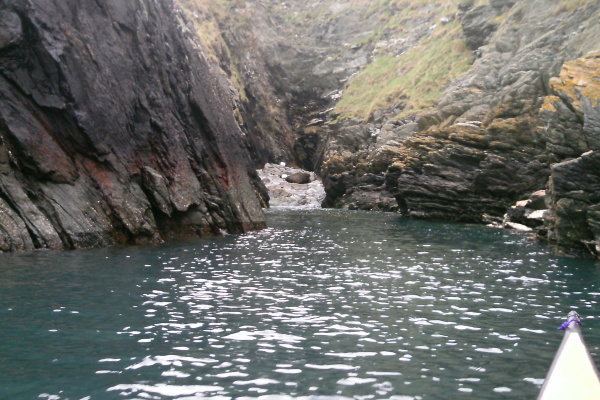
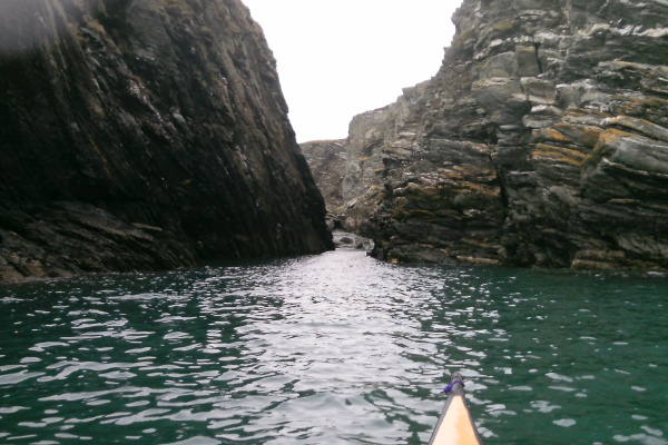
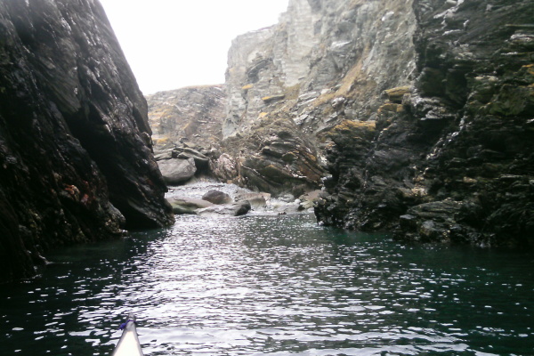
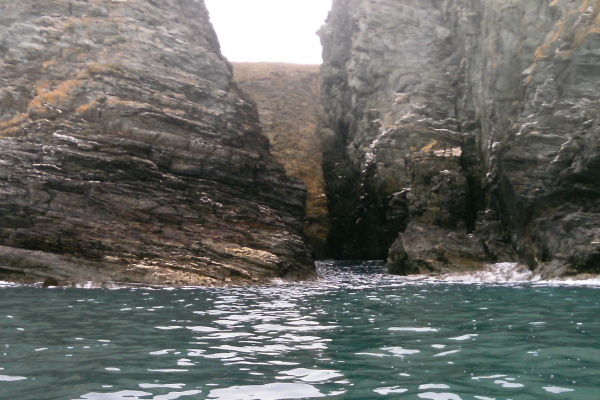
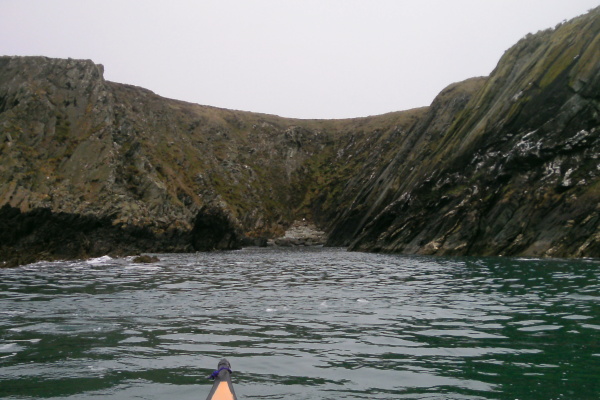
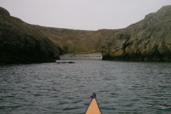
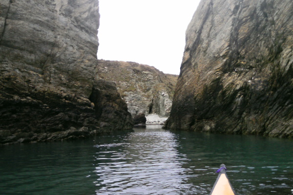
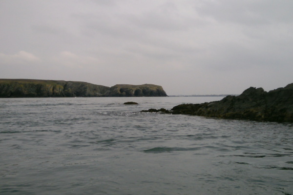
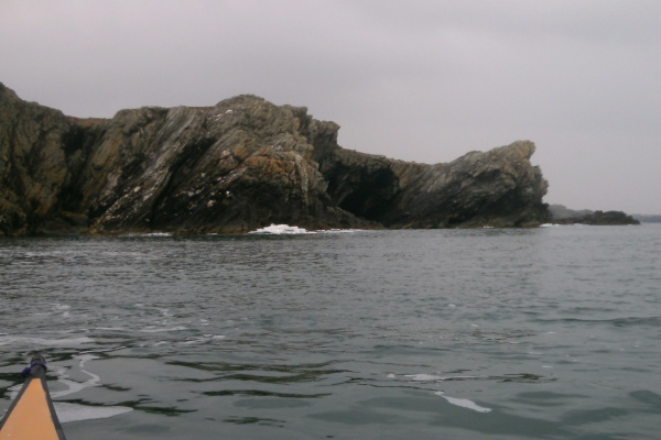
From Porth Rhwydau all the way along to Dinas Stack the coastline continues to reveal feature after feature - here are a selection of photos taken along the way.
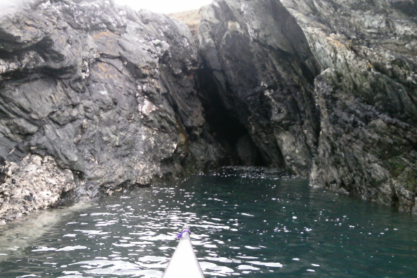
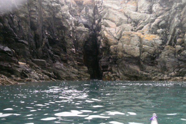
On the way back from Penrhyn Mawr, I was able to paddle into one of the caves - at this point I can`t remember which one it was. I couldn`t get too far in because the swell was making for some rather unpleasant conditions inside. I think it was quite close to Porth Rhwydau.
Also, on the way back from Penrhyn Mawr, somewhere along that bit of the coast, I found a fascinating feature - there was a slot about 3 metres wide in the rocks, I paddled in, and it opened out inside to a large cross shape. On either side, directly opposite each other, there are two quite deep caves. What kind of sea conditions would cut two large caves in behind a narrow slot. Scary !
This is me sitting in the middle of the cross, looking out through the slot.
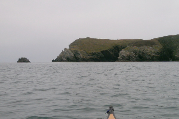
From somewhere along that bit of the coast, you can look towards Dinas Stack, in this photo you can begin to see the big chasm between Dinas Stack and the mainland.
You can also see an outlying rock off Dinas Stack - a small tide race forms in the channel between the two during the flood tide. I think that this is Gul Rock that is referred to in tidalrace.com.
As you get along to Dinas Stack, you get to see the side of the big boulders that connect Dinas Stack to the mainland that you can`t see from the coastal path. This is looking into the big chasm between the two. Notice the walls of rock on either side - on the left, which is Dinas Stack, the layers of rock are vertical. Just a few metres to the right, which is the mainland, the layers of rock are horizontal.
What kind of geological forces can twist rock through 90 degrees in just a few metres ?
As you get round to the west side of Dinas Stack, there are some more amazing features. The first one you come to is this mini-headland - have you ever seen folded rocks like this before ?
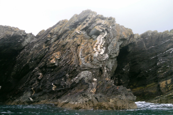
Right next door to this is an arch at the bottom of some quite big cliffs, and the cliffs on either side taper in towards the arch. Right in the middle of the arch there is a large boulder.
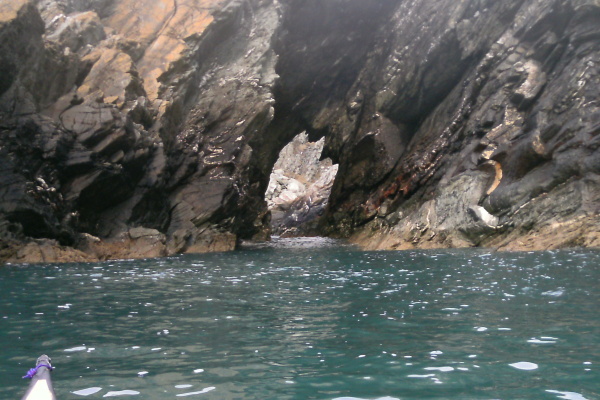
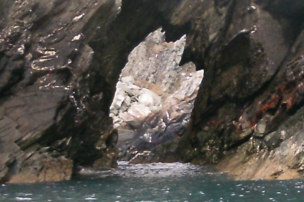
I was sitting about 20 - 30 metres out from the arch, and wondering if I should try to paddle through one of the gaps on either side of the boulder. I am usually quite wary when rock hopping or caving to see what the swell is going to do to the water where I might be going - I was just sitting there waiting and thinking about it, and a set of three large swell waves passed under me and in towards the arch. The tapering cliffs before the arch squeezed the waves, they got bigger and bigger, and then exploded onto the boulder. If I had been in there, I would have been mincemeat.
The joys of being a wimp !
Right next door to the arch is the west side of the pile of boulders that connect Dinas Stack to the mainland. You can also see why I couldn`t get down to the boulders from the coastal path.
I actually took this photo on the way back from Penrhyn Mawr, which was just on high tide, close to Neaps. I was looking at the high water marks on the boulders, and started to wonder - if you had a combination of a high Springs high tide and a bit of a westerly swell - could you paddle over the boulders ?
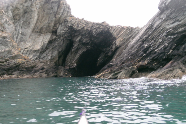
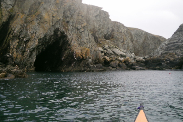
Just beside the boulders there is a cave - a good one. I paddled forward into it for quite a distance, until it was clear that the swell was making it a bad idea to go further. At a very rough guess, I would say it is about 100 metres deep.
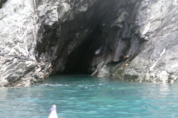
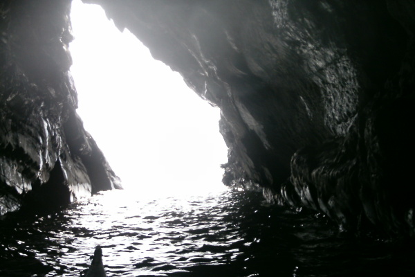
I came out, turned round, and paddled in backwards. I am not sure how far I went in backwards, certainly not as far as the previous time going forward. I got my camera out, switched it on - and just at that moment the sun came out through a hole in the clouds and blasted the outside world with sunshine, somewhat wrecking my picture.
However the reflection off the water does light up the cave walls a bit, so all was not lost.
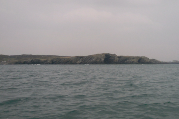
As you head further round the coast, there are more stunning features - here are a few of them.
The coastline turns and heads inland a bit, and you come to Porth Rhuffydd. This is it at a Neaps high tide.
After Porth Rhuffydd, the coastline isn`t just so spectacular, and you soon get to Penrhyn Mawr. One of the interesting things is the beach that lies in the back of quite a narrow entrance. At low tides the area is very rocky, so I`m not sure that you would want to land, or if indeed you could. However at high tides, as long as they are not too high, it provides a good place for a pit stop.
Here is the channel which forms the chicken run - it is quite a wide channel at high tide levels, although the sea is still noticeably rougher to the west of the channel during the flood tide.
One of the things that I found quite surprising was how far out from the shore the outermost rock is - when you are up on the cliffs, it doesn`t appear to be very far out, but when you are out there beside the rock, the shore seems to be a long way away. I think the outermost rock is called Tide Rip Rock.
The Fangs were of course well covered, as it was high tide.
I spent about half an hour playing around in some of the tide races. I think that because I had been moving along the coast so slowly, the tidal stream was beginning to slow down a bit by the time I arrived. However it was good fun, and a good introduction to Penrhyn Mawr.
After a pit stop on the wee beach beside Penrhyn Mawr, I started back, taking a few more photos on the way. Here`s the view of Dinas Stack looking back, from out in one of the Penrhyn Mawr channels.
Once back round Dinas Stack, the next headland looks very impressive from this direction.
Round a bit to the right, and from this direction Dafarch Point reveals some interesting looking features.
Then it`s back to the last headland before turning into Porth Dafarch and the end of an amazing journey.
It is a stunning bit of coastline, but I suspect that it would very quickly become a much more challenging paddle if conditions were less than ideal.
website design by ron-t
website hosting by freevirtualservers.com
© 2024 Ron Turner
![]()
![]()