ron-t kayaking blog
17 February 2013 .............. Falls of Lora and a trip out from Connel
Two days of good kayaking started with a dawn raid on Friday to catch the last of the flood tide at the Falls of Lora. The predicted tide height was about 3.7 metres, and I think it would have been around that.
The wave beside the north pier was a fairly classic 3.7 metre wave - easy surfing on a medium sized wave. I played there for half an hour or so, then headed out to the middle, which proved to be excellent.
The first wave was a bit longer than usual, and the Anas Acuta just matched it beautifully, and there I stayed for I guess about 10 minutes or so, while it gradually flattened beneath me.
Eventually it was too flat to hold me, and I drifted backwards onto the second wave, where I held on for a minute or so, before dropping back to the third wave, which held me for 2 or 3 minutes. The fourth wave only held me for a few seconds before I was gone.
I didn`t try to go round again, there wouldn`t have been anything there, but it was a most successful session.
After packing up some lunch, I then headed off westwards, to do a trip that I have long wanted to do, but never got around to doing - to head across to the two headlands Rubha Garbh-àird and Rubha Fion-àird, and then maybe to head over visit the islands to the east of Lismore.
An interesting extra dimension to the trip was it was my first trip out with my latest toy - a cheapo supposedly waterproof Vivitar camera. I had it out a few weeks ago when I was walking somewhere, and experimented with it then, but this would be it`s maiden voyage.
I do know that the digital zoom is quite useless, because of the huge drop in quality, however it has a 10Mps resolution, so I just point and shoot, and then cut out the bit I want later. I don`t think it is as sharp as my usual camera, but I`m not taking that into a wet environment.
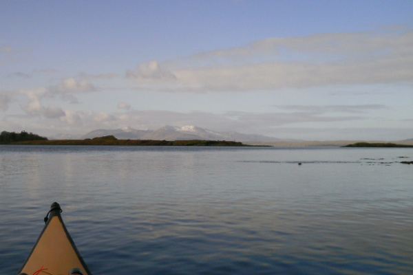
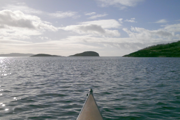
So here is the first wet picture from it, I`m heading out of Loch Etive, looking across Eilean Mòr to the mountains in the north east corner of Mull.
It was a beautiful day, and it didn`t take long to get across to Rubha Garbh-àird. The next bit across to Rubha Fion-àird seemed to be slower.
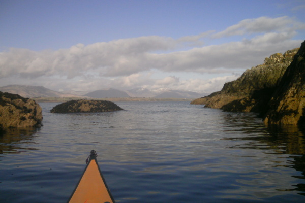
There are a few small islands around Rubha Fion-àird which provided some framing for a view up to Morven - or more strictly, Kingairloch. I think that it is the two Corbetts up there, Fuar Bheinn and Creach Bheinn, that are just visible.
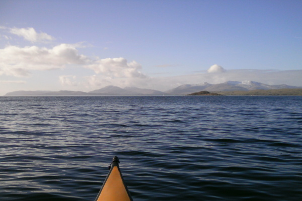
Heading away from Rubha Fion-àird towards Lismore, there was a great view across to Mull, and right down the Firth of Lorne, between Kerrera and Mull.
In the first photo, the flat green island on the right is Lismore, and the lumpy darker green island is Creag Island, with Pladda Island just in front of it.
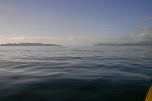
As you get closer to Lismore, Creag Island and Pladda Island fairly dominate the view southwards.
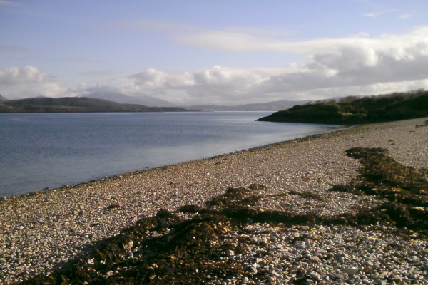
On the map, Eilean na Cloiche and Eilean Dubh look like one island, but they are actually two islands that are joined together by a ridge of beach - steeply sloping and stoney on one side, with a rather mucky sandy - muddy - bouldery - seaweedy beach on the other side. This is the stoney beach on the north east side of the ridge looking eastwards back to Ben Cruachan in cloud.
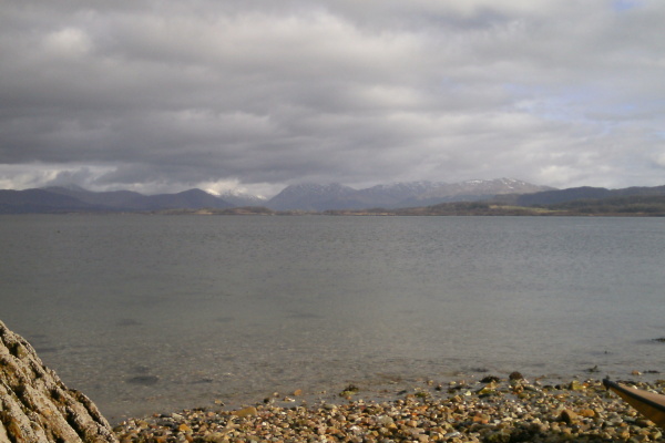
Looking north east towards Appin, there should be a great view of all the mountains there, however a lot of low grey clouds were creeping down from the north, so it was a rather cloudy view.
After some lunch I headed off around Eilean na Cloiche, then across to and around Creag Island and Pladda Island. By now the heavy dark grey clouds had travelled quite far south, and it was only much further south that had any sunshine. The sunshine actually lit up and highlighted some of the islands down that way - they were a bit clearer in real life, but you can just make out the Garvellachs, Eilean Dubh Beag and Eilean Dubh Mór, Lunga, and the top of Scarba. Belnahua was also visible, but doesn`t show in the picture.
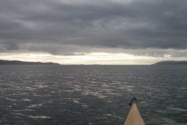
And the camera isn`t lying - it really was like this, with the heavy grey cloud and the grey sea - it was quite threatening.
The crossing back to Rubha Fion-àird was quite easy and I made good progress. However heading towards Rubha Garbh-àird was slow, and it took quite a time to get there. Then I set off for Eilean Mor - and progress got slower and slower. By the time I was a bit more than halfway there, my progress was just about nil. I paddled and paddled, but Eilean Mor just wasn`t getting any closer.
By this time it was well into the flood tide, so I guessed that there must be a bit of a tidal current sweeping into the bay. However after a lot of real effort I slowly made progress towards Eilean Mor, and I realised that Loch Etive was still in ebb tide, and this also was what I was fighting against.
I headed for the middle of Eilean Mor to try and get a bit of protection against the current, and I could see the current on either side of me. It looks like the ebb current out of Loch Etive joins up with the flood current sweeping up the coast from Kerrera, and because it can`t all flow into Ardmucknish Bay, it all turns and heads out towards Rubha Garbh-àird.
I got there eventually, but it was quite a struggle !
-----------------------------------------------
On Saturday it was another early start at the Falls of Lora. The predicted tide height was 3.4 metres, which is generally too low for surfing on the flood tide.
However it wasn`t too bad - the wave beside the north pier was still surfable, so I played there for half an hour or so, it was a small wave, but surfable. Then headed out to the middle.
The first wave was a bit shorter than the previous day, and the bow of the Anas Acuta was tending to catch, so I had to lie back quite a lot. However I was on it for something like 5 - 10 minutes, but it was hard work. The best part of the first wave forms where the reef has a bit of a high spot, and at lower levels in particular, the water flow tends to divide and flow round the sides of this high spot. There was only one very precise spot where the water wasn`t pushing the bow around quite strongly, so it was a constant fight to stay on this spot.
Eventually I lost the wave, but the second wave produced some good, slightly easier surfing for another few minutes.
So not the most exciting surfing, but still good fun. And overall it was a good two days.
website design by ron-t
website hosting by freevirtualservers.com
© 2024 Ron Turner
![]()
![]()