ron-t kayaking blog
24 October 2012 .............. Cuan, Torsa, and Luing
This amazing weather just goes on and on - and it was far too nice to stay at home. So it was back to Cuan - partly because I think that around the Firth of Lorne and the Sound of Luing is a fabulous area, but also I wanted to do a wee trip around Torsa.
I had stuff to do in the morning, so didn`t get down there until lunchtime, just on slackwater in Cuan Sound.
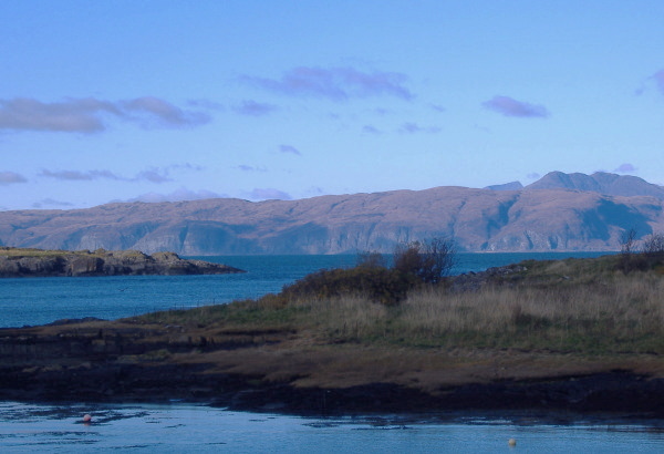
When I arrived at Cuan, Mull was in sunshine, and the visibility was absolutely fantastic, you could see nearly every stone on the cliffs. The view from Cuan across to Mull is a bit obscured, so this is about the best I could do without having a huge pylon dominating the picture - not very pretty. I don`t think you really can see the visibilty in the photograph.
Then it was off and down and round Torsa anti-clockwise. Down at the bottom of Torsa it was extremely hot, and I had far too many clothes on. By the time I was halfway up the east side I was frozen, and wished I had my pogies on. There was a viciously cold wind out of the northeast - a bit of a contrast from twenty minutes ago.
I found a wee grassy beach where I was sheltered from the wind on Seil just round from Cuan, and had a break, and fell asleep in the sun !
Then it was off to Cuan Sound, headed across, and paddled through the sound beside Luing, against the Neap ebb tide. There is still a significant current during Neaps, but it isn`t such a struggle as it is during the Springs. The wee passage round the back of the last point provided me with the same escape route as last time, later in the tide cycle the level would be too low to use this passage.
There was the same big eddy down the side of Luing trying to push me back into Cuan Sound, but it didn`t have the force it does during Springs.
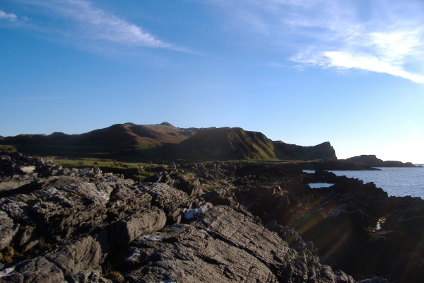
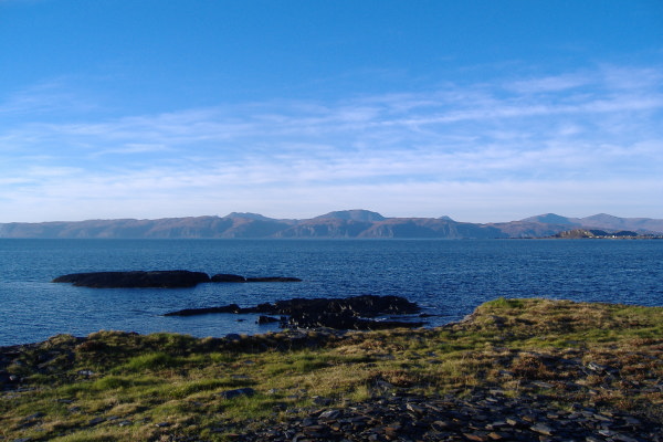
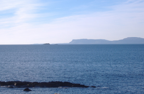
I didn`t go too far before stopping on a stoney beach and got out again. It looks better from a boat when you are out a bit from the shore, but here is the view looking south down the west side of Luing. It is quite a rugged island.
The north western corner of Luing certainly shows the part Luing played in the slate industry, everywhere there are piles of spoil, artificial shaping of the landscape, slate buildings, and quarried faces. Looking inland it is really a bit of a mess -
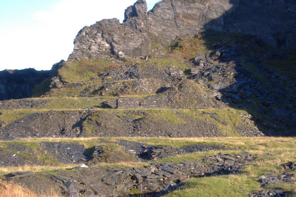
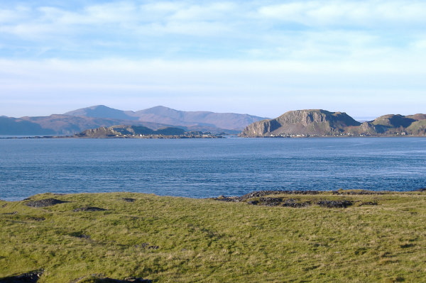
Climbing up a bit, and looking back the way I`d come, more spoil - but also the fabulous view out into the Firth of Lorne.
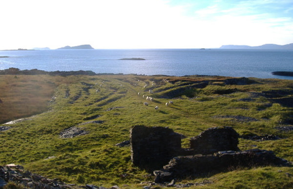
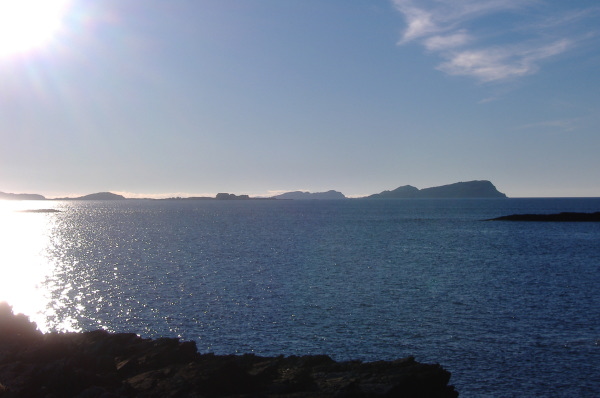
I was a bit limited on what I could photograph down to the south west, because I was looking straight into a fairly low sun, so the fabulous views down to all the islands couldn`t be caught. However the Garvellachs, Belnahua, Eilean Dubh Beag and Eilean Dubh Mor were okay, and looking as good as ever. Fladda was a bit overwhelmed by the sun and Colonsay was just visible over the flat north west end of Belnahua.
As usual, the south coast of Mull was looking fabulous, but it had lost the incredible clarity of earlier in the day.
Looking to the northwest beyond Easdale and Insh Island, the two peaks on Mull, Sgurr Dearg and Dun da Ghaoithe were looking good. A wee bit over 2500 feet, Dun da Ghaoithe just makes it as a Corbett. Sgurr Dearg is just below 2500 feet, so only qualifies as a Graham. However they both look to be impressive hills.
Back in my boat, I played around about the wee islands just off the coast of Luing. Dubh-fheith looked quite close, and I was quite tempted to paddle out to it, however it is a bit over 4km`s out, so I thought I had better not. So I set off northwards, across the mouth of Cuan Sound, and headed up the coast of Seil towards Ellenabeich and Easdale. I paddled this a long time ago, but couldn`t remember much about it.
I was looking for anywhere I could play, but there wasn`t really much on offer. However I did note that there are some long rocky ridges sticking right out, and if you had a quite high tide, and a westerly swell, I think there might be some good rock hopping to be had. You could hop out of Cuan Sound on the last of the flood tide, have a play for an hour or two, then hitch a ride back on the ebb tide.
By the time I was a fair bit up the coast, the sun was just about to disappear below the sea, so I paddled out into the ebb current to get a lift back to Cuan.
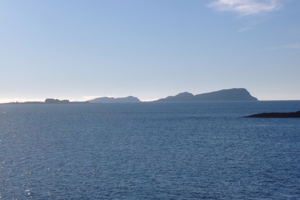
It was a bit of a lazy day, but good fun, and it is a fabulous area to be paddling in. Just to close, here are two further photos I took from Luing using the zoom on my camera. I don`t what it is about them, I just love them, they have a magic about them. The first one is of Belnahua and the Garvellachs, the second one is looking down the lower end of Mull, and over Dubh-fheith to the Ross of Mull.
website design by ron-t
website hosting by freevirtualservers.com
© 2024 Ron Turner
![]()
![]()