ron-t kayaking blog
07 October 2012 .............. Cuan to the Grey Dogs
I finally made it - I have been wondering how to get to them for a while now, and I finally got down to the Grey Dogs. It was full-on Neaps, and a fabulous day with no wind.
The Grey Dogs, sometimes known as Little Corryvreckan, is a narrow channel between the north end of Scarba and the south end of Lunga. During Springs, it provides some very fast currents and big waves, both on the Flood tide and the Ebb tide, with speeds up to 8.5knots. I believe that the most spectacular conditions arise during a Flood tide, when there is a big westerly swell coming in.
I paddled down from Cuan around the start of the ebb tide, so had a tide assisted passage down the side of Luing. Somewhere after Cullipool, I started to head across to the north end of Lunga, but the further I went the more I got into some rather unpleasant tidal cross currents and whirlies, so I retreated back towards Luing again.
Carried on down past Eilean Mhic Chiarain, and down the side of Luing towards Black Mill Bay. Somewhere down that way, I headed out and across to Lunga.
I do know from reading about it that whilst the bottom end of the Sound of Luing does have strong tidal currents, they are much less malevolent than the tidal currents at the north end of the Sound of Luing, around the north end of Lunga, Ormsa, Belnahua, Fladda and Dubh Sgeir. I saw them during Neaps - I wonder what they are like during Springs !
After a bit of a break on Lunga, I headed down and round to the Grey Dogs. There I met three other paddlers who were passing by, and having a bit of a play at the east end of the Grey Dogs.
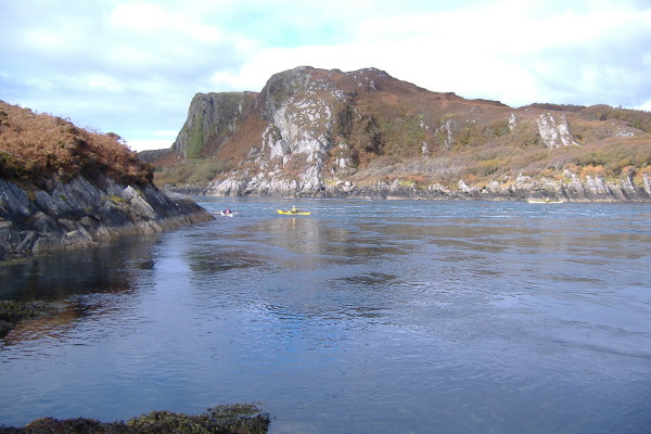
If you are not familiar with them, as you are coming from west to east through the Grey Dogs - they start off quite wide, as the north end of Scarba has a big taper on it. Heading east, the channel narrows down to about 150-200 metres or so, then widens out again. But just as it widens out, there is an island Eilean a'Bhealaich in the middle, so the current splits into two on either side of this island.
To the north side of the island, the current flows in pretty much a straight line out into the Sound of Luing.
To the south of the island, the current flows in an S-shaped path around the island, and the channel there is quite a bit wider than the north channel. However just to the west of Eilean a'Bhealaich there are two small rocky islands, which confuse the water flow somewhat.
So the above picture was taken from Eilean a'Bhealaich looking into the north channel.
I landed on Eilean a'Bhealaich at the east end, and tried to cross the island to get to the higher west end.
Nightmare ! Very thick foliage, half dead bracken, and rock faces right across the island made it incredibly slow going, but eventually I got to the top of a fin of rock at the west end of the island, and took the next few photographs.
Looking west over the top of one of the small islands, along the south coast of Lunga.
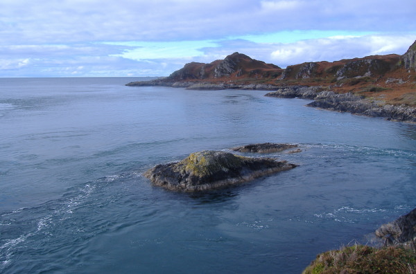
From up on the fin of rock, I was looking straight down onto the other rocks/small island, with a wee peninsula on Scarba in the background.
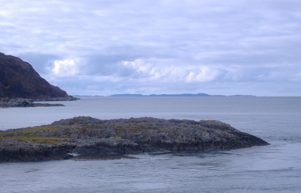
Looking west again over the top of the same rocky peninsula on Scarba, down the coast of Scarba, and out towards Colonsay.
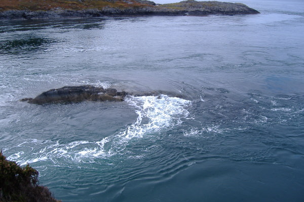
Up on the fin of rock, I was really too close to the action to get a good photographic feel for the Grey Dogs, from over on the north side of Eilean a'Bhealaich, you get a bit of a better view of the north channel.
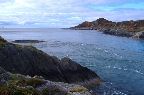
You also get a good impression of the east end of the north channel, whilst looking across to Black Mill Bay on Luing.
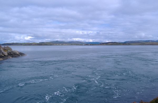
I don`t know why, I don`t seem to have taken any pictures of the south channel - it is maybe about 70-100 metres wide, quite flat, and curves round the island.
Having eaten and finished taking pictures, I thought I would go and have a play and see if I could paddle up through the Grey Dogs against the current - I did finally manage it by going up the south channel close to Scarba.
One thing that I became quite aware of was the tide rip just out from the west end of the Grey Dogs, where the taper at the north end of Scarba squeezes the tidal flow down into the narrowest part of the Grey Dogs. I paddled through it okay, but it would be very meaty nearer Springs.
Having paddled through the Grey Dogs, I wondered what to do, and decided the most interesting route back would be up the west side of Lunga - there is a good chance I wouldn`t ever get such good conditions again to do this, as it is a quite exposed bit of coast line. There was still an ebb tide, but it didn`t really seem to hold me back too much until I got up to the top end of Lunga. It seemed to be a long paddle though, although very scenic, the west side of Lunga is wild, high, and feels quite remote.
Eilean Dubh Mor and Eilean Dubh Beag looked rather interesting islands, and didn`t seem to be too far away, but I wasn`t tempted to go visit them. Some other day perhaps.
After rounding the very tip of Lunga, I met an unpleasant looking tide rip, so had to paddle down the side of Lunga a bit to go round it. I tried to go straight across to Dubh Sgeir - I got about two thirds of the way, and then more tide rips, and I just sat there - I paddled away and went nowhere. So eventually I gave up, turned, and went across to Eilean Mhic Chiarain instead. I found a beach to land on, then sat and waited for the flood tide to start.
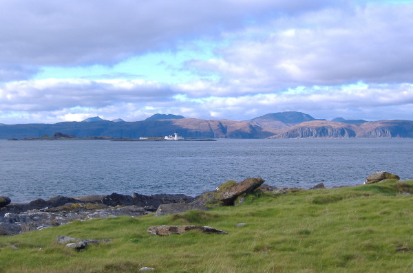
There were nice views across to Mull, looking out over Belnahua and Fladda -
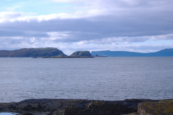
and also across to Ormsa, with the north end of the Garvellachs behind it, and the south end of Mull in the background.
Then it was back up to Cuan. Why is it that when you paddle down from Cuan to Cullipool, it only seems to take minutes. But when you paddle back up from Cullipool to Cuan, it is an absolute slog the whole way.
So that was my first trip to the Grey Dogs. I`m very pleased to have done it, not only because I wanted to see what they Grey Dogs are like, but also because it is the longest sea kayak trip I have ever done, and I had no idea how I would get on on that length of trip. I have to land to get out of my boat quite often, as I just can`t sit for long periods of time, but apart from that it was good.