ron-t climbing
27 September 2018 ................ Elidir Fawr - almost
A clear morning and all the mountains were clear, the weather forecast was good, I haven`t been up a mountain for ages - time for an afternoon outing to Elidir Fawr.
I frequently seem to go to Elidir Fawr rather than other mountains because it is the nearest one to Anglesey, and you drive up quite a height, so it is a good choice for impulse afternoon outings.
I tried out a different route, just a short distance up the water board road and off to the right up through the former slate quarry - it is quite a spread out quarry, with a deep hole lower down, terraces higher up, a big but quite tidily done spoil heap further round.
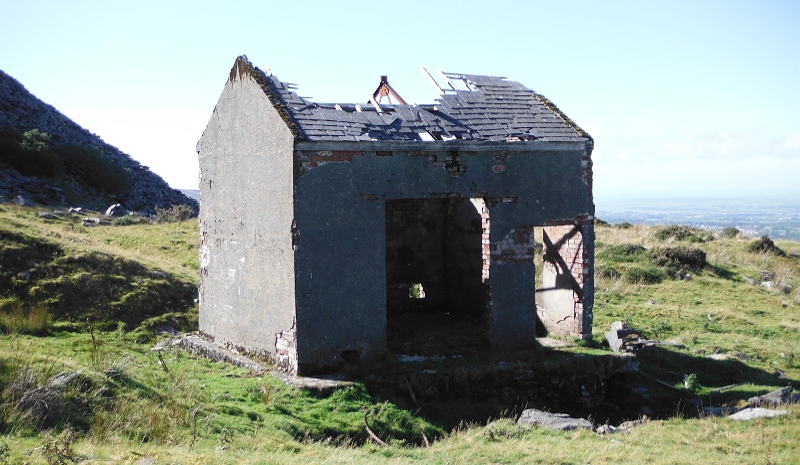
There is only one building that I could see, rather small, and brick built - I don`t really know what it would have been used for, the big high doorway suggests it housed some kind of machinery, but inside there isn`t any sign of a concrete base for any kind of machinery like you usually get for winches or generators - but here it is anyway -
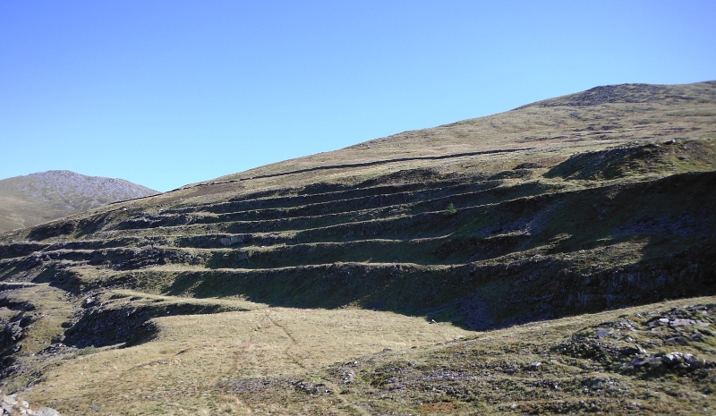
Higher up, and there are some quite impressive terraces -
And so on up through the rest of the quarry, across the private road that winds around the side of the hill, and up the flank of the long ridge of Elidir Fach.
It wasn`t a good route for me, quite steep, and an endless slog over quite rough ground covered in mounds of moss and bilberries - it didn`t suit my dodgy hip joints at all.
There were a few bilberries to be had, but generally the bilberry plants were in a poor shape, rather decayed and dried up, I don`t think they liked the long dry summer.
As I struggled my way upwards, I began to realise that there was quite a bit of cloud around me - I was disappearing into a grey clag.
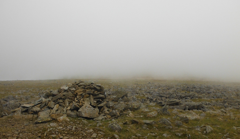
Eventually up on to the ridge totally in cloud, and then a long but easier walk up the ridge to the summit of Elidir Fach - I have been there lots of times, so it was no problem finding my way, and I knew the rather flattened cairn that marks the summit, although I am not sure it really qualifies as a summit, it is the just the highest point of a giant featureless blob.
So here is the cairn, and somewhere hidden away in all that cloud is Elidir Fawr -
So what to do now - Elidir Fawr was nowhere to be seen, my hip joints seemed to have recovered a wee bit - and did I get the impression that the cloud was easing a bit - so I reckoned I would give Elidir Fawr a go - again, I knew exactly where to go in the cloud, and there is a bit of a path - so I set off.
And as I climbed, the cloud was lifting, and by the time I got up to the long ridge that forms Elidir Fawr it was completely clear and beautiful again.
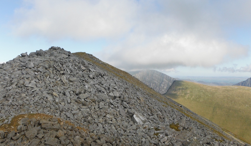
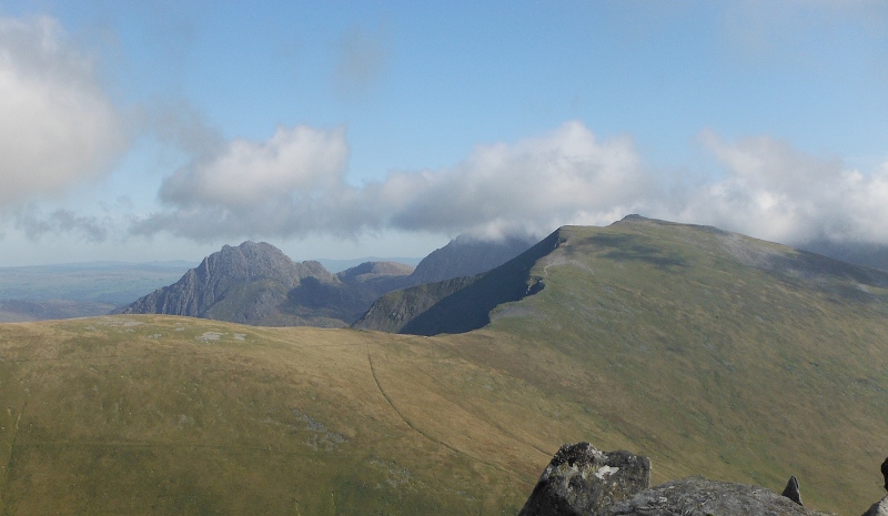
Since I had come up from Elidir Fach, I ended up right at the southwest end of the Elidir Fawr ridge - it is not the easiest of ridges to go along, with masses of summits and broken rocks - so I decided just to stay at the southwestern end of the ridge, where there is a quite distinct summit, which I am not sure that I have ever been to before. It gave a different sort of viewpoint - this is looking along the ridge, past the very distinctive shape of Foel-goch, with Pen yr Ole Wen at the back -
Looking across to the southern end of the Glyders, Tryfan and Y Garn were in the clear, but the higher summits were still in cloud -
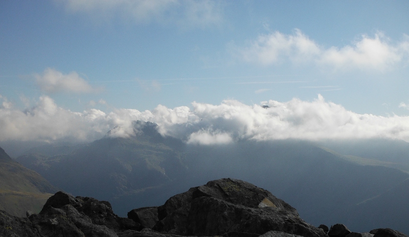
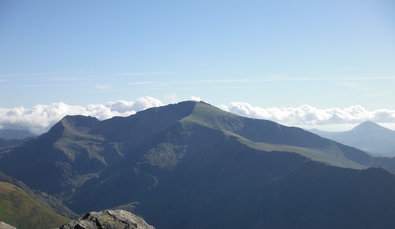
The Snowdon block was still in cloud, except the summit of Garnedd Ugain was just peaking out above the cloud -
Time for the inevitable tea break - happiness is sitting in the sun on top of a mountain with a flask of tea and a custard doughnut.
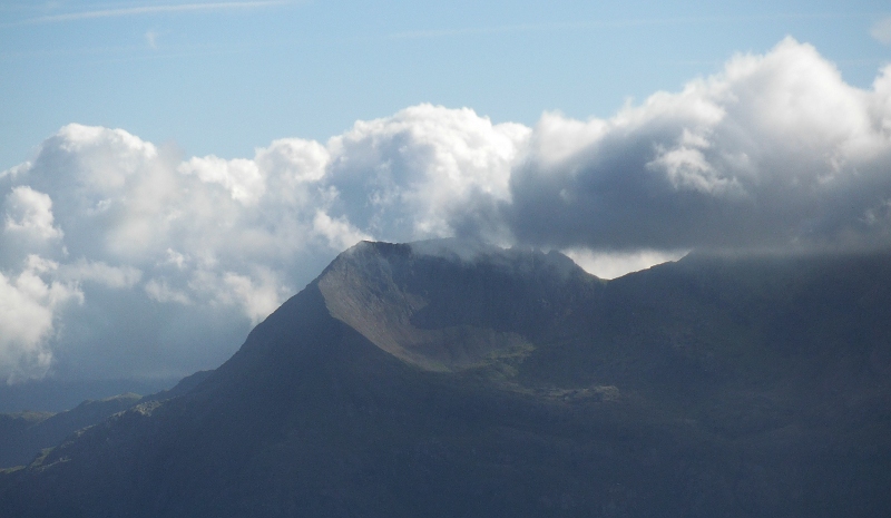
Tea break over, and a closer view of Crib Goch with the last fragments of cloud just about away, and the sun highlighting the amazing north ridge of Crib Goch -
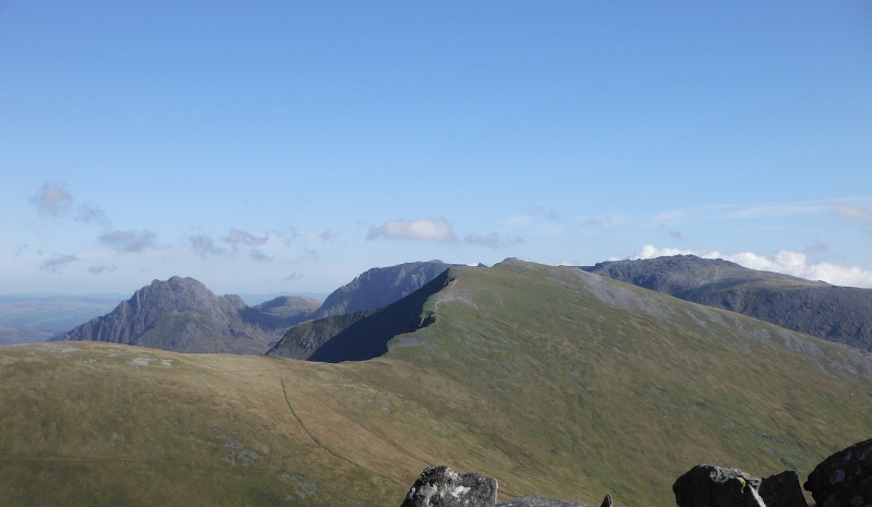
The Glyders were by now completely clear of cloud -
Not too long after that, and Snowdon was completely clear as well - and it was interesting to note that from this end of the ridge, you can just see the summit of Snowdon peaking round the side of Garnedd Ugain -
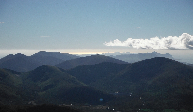
A super view away down the Lleyn Peninsula, with some nice lighting away in the distance, and Yr Eifl in full view as usual - is there anywhere in North Wales from where you can`t see Yr Eifl -
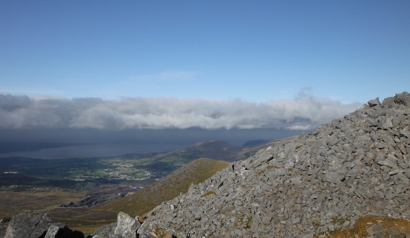
One of the things that I was noticing all the time I was up on the summit was a thick heavy dark layer of grey clag that was covering right down the east side of Anglesey, and further east along the North Wales coast.
By the time I was down off Elidir Fach and back onto the water board road, Elidir Fawr was in cloud again.
By the time I was back down at the end of the public road all the tops were in cloud, even the un-named top down from Carnedd y Filiast had gone, I couldn`t see it, but I think that even the dam would have been in cloud.
So I was amazingly lucky getting the break in the cloud that I got, so a good afternoon, despite my not good choice of route up the flank of Elidir Fach.
website design by ron-t
website hosting by netnerd.com
© 2025 Ron Turner
![]()
![]()