ron-t climbing
30 October 2017 ................ Mynydd Moel - a summit on Cader Idris
A few years ago, I drove up and down between Anglesey and South Wales quite a few times - there are various possible routes, and sometimes I would drive up and over the A487 between Dolgellau and Machynlleth through Bwlch Llyn Bach, and would often wish I could stop in the layby right up at the top of the hill, and climb up to the north towards the north east end of Cader Idris.
However it was never convenient, and I always had to drive past it.
Ever since then I have had a wish to go down to that layby, and see if I could get up Cader Idris from there.
Today there was a good sunrise again, and the mountains were looking very clear, so I checked the weather forecast - which wasn`t bad - no chance of rain, and a 90% chance of cloud free tops in Snowdonia.
So that was it - decision made - Cader Idris here I come.
Cader Idris has cliffs and crags just about all round it, so I really wasn`t sure how I would get on, and it was a pretty steep ascent most of the way.
I subsequently found out that I gone the wrong way, if I had just crossed a fence I would have had a path all the way up, but I didn`t know this, and ended up dound a very steep climb up until I got to the crags - and then things got really difficult.
I would look up at the crags, and see a possible route up, but when I tried it I just couldn`t get up.
So I had to traverse along a bit and look for another possible way up.
I did eventually find a way up, it was pretty horrible, very wet, grass and rocks and steps that I just couldn`t get up so had to keep on deviating.
Then I got above the crags, climbed on up - and found the path that had been about 100 metres along to the right.
So I wasted a lot of time, and had a very unpleasant climb up.
Up on the ridge, and looking up at the un-named 683 metre summit - odd how it has a wall around it - it would be an awfy exposed place to build a sheep pen - does it have any more of a historical significance ?
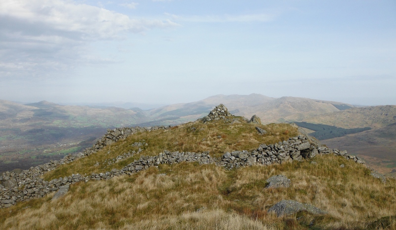
Up on that summit now, and looking along the long northeast ridge of Cader Idris to Mynydd Moel, the most easterly of the three highest summits of Cader Idris.

Looking at the map, you think it will be a nice ridge walk - it wasn`t and it isn`t.
The ridge is a broad bog - bog, bog, and more bog.
Just bog - absolutely sodden bog - the whole way across - it was foul.
Thankfully, once you start climbing up Mynydd Moel there is a better and drier path.
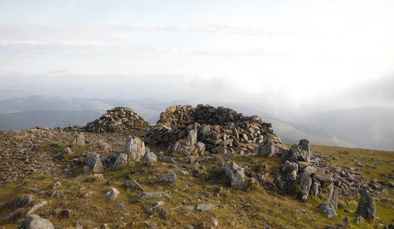
Up on the summit of Mynydd Moel now - and a good shelter for the inevitable tea break.
You might get some good views from there, I didn`t - I could see lots of hills all around, but not really very interesting to look at or take pictures of - Cader Idris is surrounded by sort of much more rolling hills around the sort of 400 - 600 metre height, so not really the most stunning of hills.
And you might get a good view looking along the rest of the summit ridge of Cader Idris - I didn`t, because it looked like this -
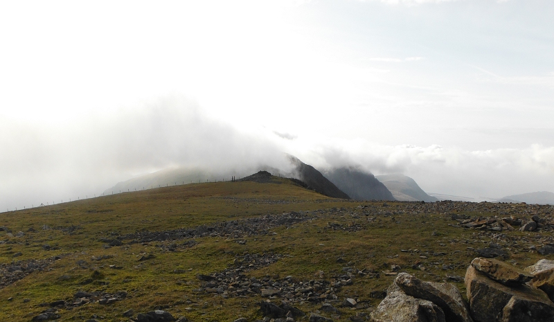
I was lucky, apart from a few brief minutes when the cloud rolled around me, the summit of Mynydd Moel stayed clear of cloud.
Mynydd Moel was probably the only summit of that sort of height that wasn`t in cloud - I couldn`t see any of the mountains in the northern half of Snowdonia, all I could see up that way was great banks of cloud.
So I think that MWIS got that one very wrong.
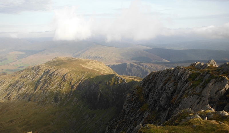
Starting to head back down now, and looking away back down the northeast ridge and all its bog to the 683 metre summit catching the sun -
By the time I was back down on the northeast ridge floundering through the bog the summit of Mynydd Moel was in cloud, and I never saw it again.
The descent back down the path was very steep, but a lot easier than trying to get down through the crags.
So I can cross that climb off my wish list - it wasn`t the best of trips, but I have had worse. I don`t have much desire to do it again, it was all a bit too steep for my comfort.
If I ever fancy going up Cader Idris again - since I didn`t actually get to the true summit - I would be doing it from the west end, not from the east end - there are several well documentated routes up the west end of Cader Idris.
The true summit, Pen y Gadair, is 893 metres high, so just 21 metres short of being a Firth.
...........................
PS - there seems to be a strong diversity of opinion as to whether the name should be Cader Idris or Cadair Idris - locally it is known as Cader Idris, and the proponents of that spelling say there is documentation going back 450 years showing that name.
However according to various websites, the Welsh Language Commissioner and Canolfan Bedwyr at Bangor University reckon it should be Cadair Idris.
The OS map shows Cadair Idris.
As a complete outsider, it isn`t really my place to say which it should be, however I believe that the Snowdonia National Park Authority has gone with Cader Idris for some signs they have been putting up, so I went with Cader Idris.
Similarily, there seems to be a diversiy of opinion between various websites as to whether the highest summit of Cader Idris should be referred to as Pen y Gadair or Penygadair.
Again, the OS map shows it as Penygadair.
I reckoned that Pen y Gadair sounded more Welsh, and goes nicely with Pen y Fan in the Brecon Beacons.
However it shouldn`t be confused with Pen y Gadair Fawr, which is in the Black Mountains in south eastern Wales.
I had some very enjoyable trips up to Pen y Fan, but I never made it onto the Black Mountains.
website design by ron-t
website hosting by netnerd.com
© 2025 Ron Turner
![]()
![]()