ron-t climbing
19 September 2017 ................ The Glyders via Seniors` Ridge
Not a bad forecast for the day, but not the best either - about an 80% chance of cloud free tops, no chance of rain, the wind getting up but not likely to cause any problems.
The plan was to try out Seniors` ridge, a broad ridge that climbs up out of the Llyn Idwal area above the Idwal slabs, and encloses the west side of Cwm Cneifion, eventually reaching the wide summit plateau of Glyder Fawr.
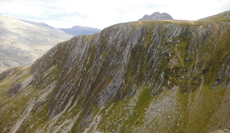
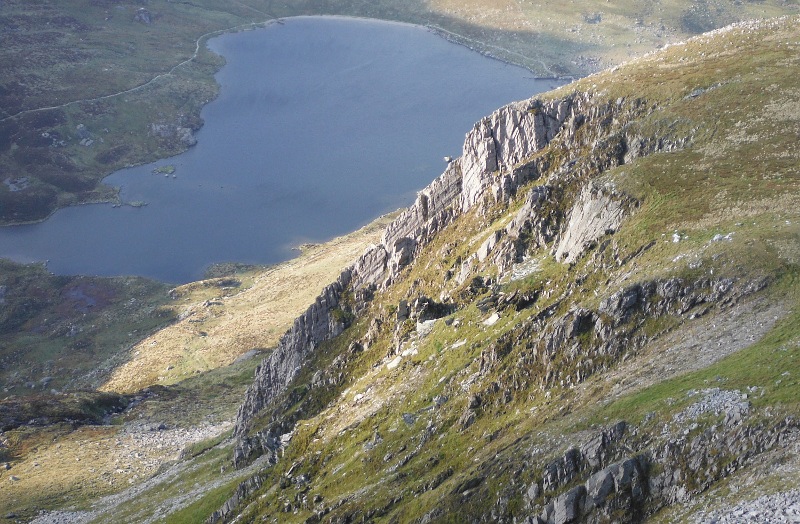
I am down by Llyn Idwal here, and looking up into Cwm Cneifion - with the Sub-Cneifion Rib (I think) and the Cneifion Arête on the left, and Seniors` Ridge on the right
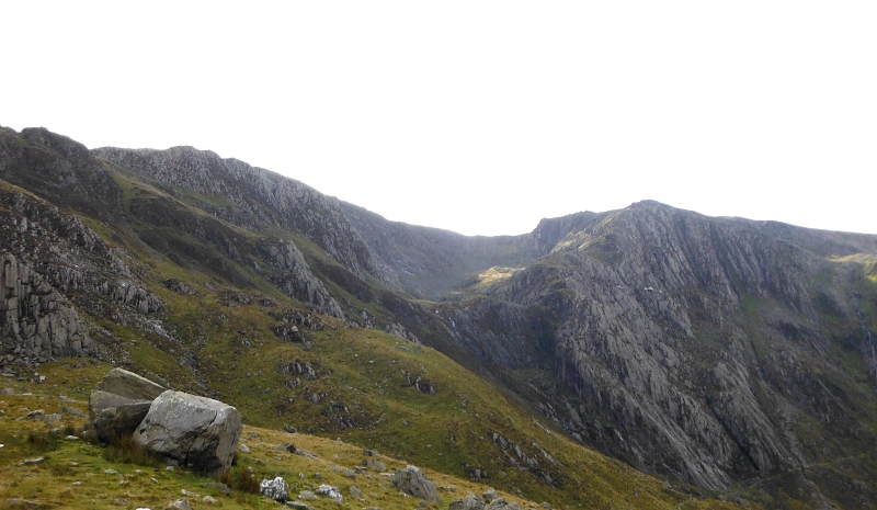
A closer view of Seniors` Ridge -
There is a path that leaves the east side of Llyn Idwal, climbs up past what I think is the Sub-Cneifion Rib, and then contours along the side of Y Gribin and eventually into Cwm Cneifion.
I did a bit of a boo-boo, I thought that the path wasn`t going where I thought I wanted it to go, so I left it, and cut off to the right and climbed diagonally up the flank of Y Gribin, but then met the path again - it was a bit of a rather messy and very wet route, but apart from that not a problem.
And so into Cwm Cneifion - I was curious about it so headed towards the Cneifion Arête to have a look at it - my time in Cwm Cneifion was characterised by a lot of helicopter activity - first one that was generally cruising around the Glyders, and then another which came zooming round the lower part of Y Gribin and almost into Cwm Cneifion.
Not quite sure what was of interest to them - is a bent old man with two sticks perhaps viewed as being a bit out of place in Cwm Cneifion ?
Should I be appreciative of their concern - I`m not sure, since I don`t really know why they were there.
And so across to Seniors`Ridge, and I started on my way up.
It is rated as a grade 1 scramble, and I reckon that it would be about that - as it turned out, the best bit of actual rock scrambling was quite early on, where the path leads up a bit of a face.
The path is quite well defined, and for most of the way, there is only one path, it doesn`t suffer from the annoying characteristic that there are paths going off in other directions, that eventually go nowhere.
A good view into the Devil`s Kitchen and Sheep Walk - I have come down the usual path that you can`t see in this picture down through all the rocks on the left side of the Devil`s Kitchen, but I haven`t ever said hello to Sheep Walk.
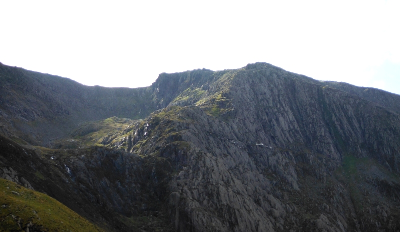
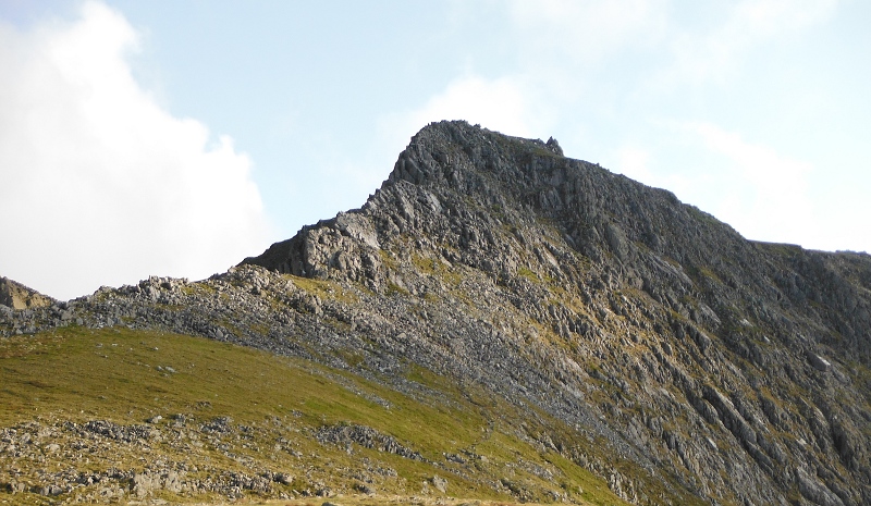
Over on the other side of Seniors` Ridge, and a good view across to the Cneifion Arête -
I think it would be roughly three quarters of the way up, and things went a bit down hill.
I followed the path as it sort of contoured round to the right - and then it stopped - above a big drop, which there was no possibility of me going down.
Now I could have retreated a bit, dropped down, and come back round below the drop - but something wasn`t right, because there was no sign of a path lower down, and if I had done that, I was going to meet some very large steeply sloping rock slabs, and I had no idea whether I would find a way up them or not.
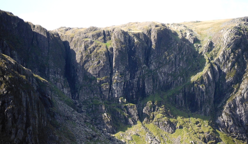
I wasn`t particularily aware of it at the time because there was a sort of grassy plateau just below the drop, but looking at the close-up picture of Seniors` Ridge higher up this web page, those rock slabs were the upper part of much bigger rock slabs away up the back of Llyn Idwal.
So it was probably just as well that I decided to head back round the path, and go up the grassy rocky slope that is just catching the sun in the above picture.
It wasn`t a fun route, quite steep, mixed mud and grass and rocky bits - and very wet.
It was quite a relief to get up onto the summit plateau of Glyder Fawr.
Somewhere up the higher part of the Senior`s Ridge I took another picture of the Cneifion Arête - it looks so different from here -
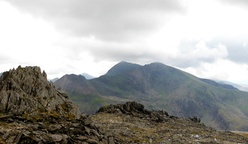
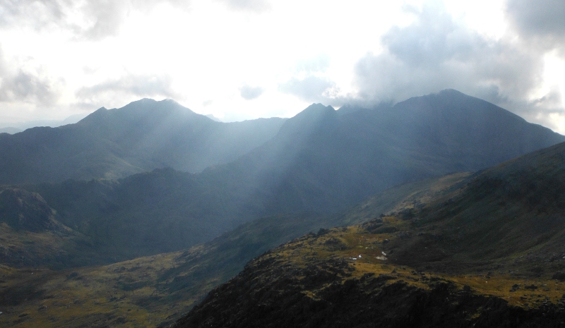
Up on the summit of Glyder Fawr now, and Snowdon is just escaping the cloud -
Looking away to the north end of the Glyders - Y Garn in the foreground, and further back, Elidir Fawr on the left, with Foel-goch and Carnedd Filiast on the right.
A closer view of Y Llymllwyd, the ridge I climbed up a couple of weeks before - it has a surprisingly steep outer end.
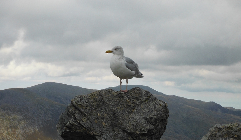
Time for a spot of lunch and enjoying the solitude - well, you are never alone up a mountain in Snowdonia -
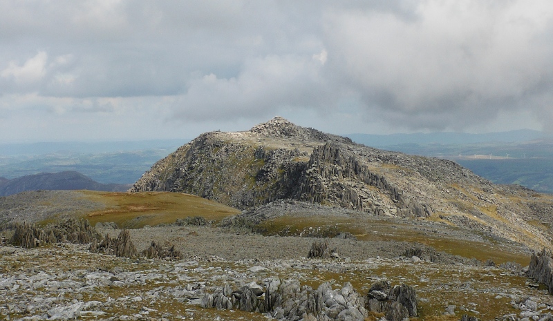
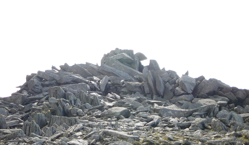
Up on a slightly lower tor now, looking up to Cain and Abel on the actual summit -
Looking across to the summit of Glyder Fâch, with Castell y Gwynt in front of it -
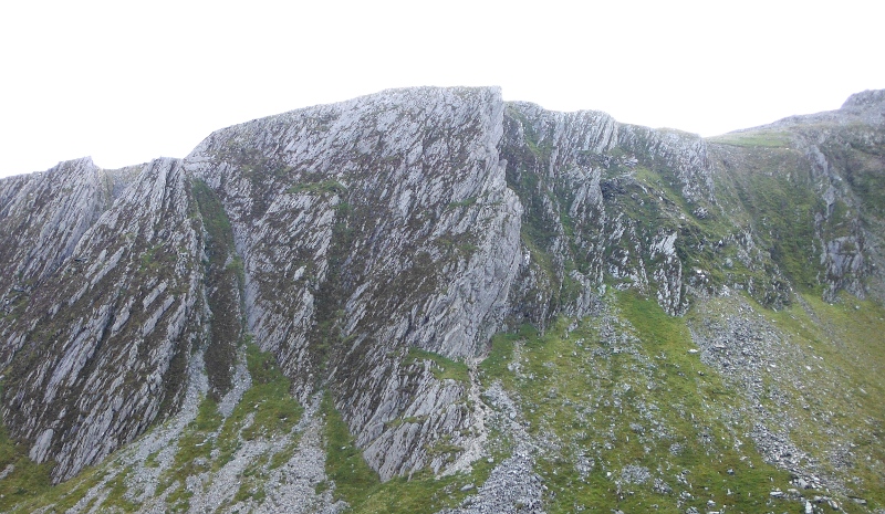
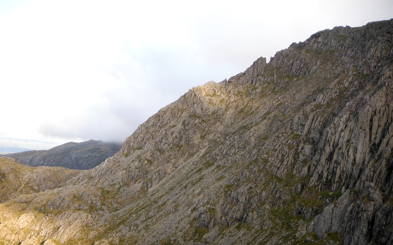
Heading across towards the top end of the ridge Y Gribin, looking down the west side of Y Gribin with another view of the Cneifion Arête, and also a view of the Sub-Cneifion Rib -
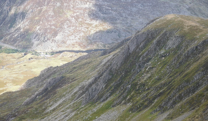
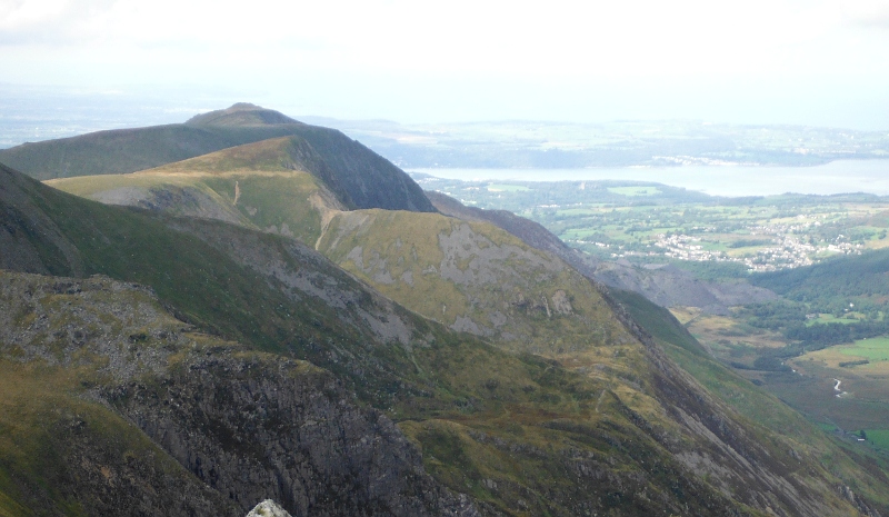
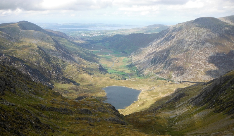
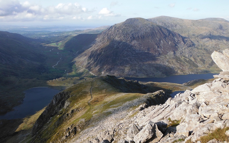
A good view down to and across Llyn Idwal, right down Nant Ffrancon, past Bethesda, and across the Menai Straits to Anglesey -
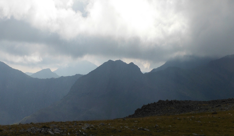
Snowdon is now deep in cloud, producing a somewhat sinister view of Crib Goch -
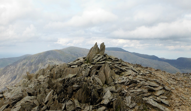
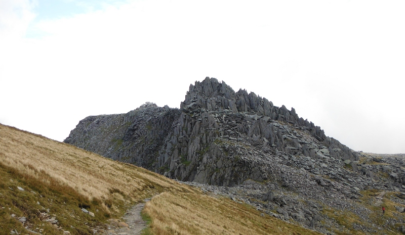
Passing the top end of Y Gribin now, looking up to Castell y Gwynt -
Things went a bit downhill again now - I was following the path around the base of Castell y Gwynt, expecting to end up on the relatively flat top of the Glyder Fâch ridge, but it didn`t work, and I ended up going far to far at a lower level, then had to climb up over what seemed like miles of huge boulders to gain height, and ended up right over by the famous Cantilever Stone.
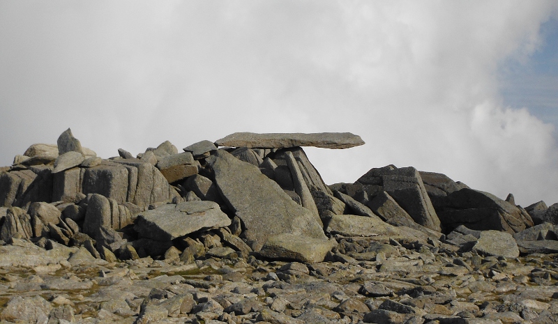
I didn`t really want to be there, but never mind, time for another picture.
This picture gives you absolutely no idea about how high up the Cantilever Stone is, or how big it is, so from that point of view it is a bit of a fail.
Looking up at the big tangle of huge slabs of rock that form the summit of Glyder Fâch -
A few years ago I did manage to get up to top of that huge tangle of rocks, but it isn`t easy, so as time was moving on a bit too fast, on this occasion I gave it a miss, and headed down the flat top of the ridge towards Castell y Gwynt.
As I got closer I decided I would give it a go - I have done it before, and my recollection was that although it looks quite formidable, it isn`t too bad to get up.
I did get up - a bit of a struggle, I have to say, but I got there.
Up on top of Castell y Gwynt, looking away up to Glyder Fawr -
Back down again, and I followed the path down, and then down over all the rocks to the base of Castell y Gwynt - and then I realised that if you are coming from Glyder Fawr and heading for Glyder Fâch, you have to turn up to the left immediately after passing Castell y Gwynt - that`s what I didn`t do, so got a bit lost.
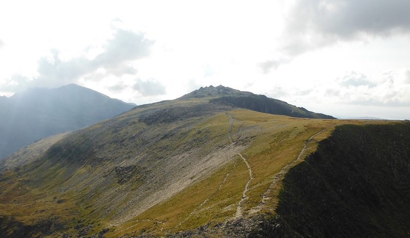
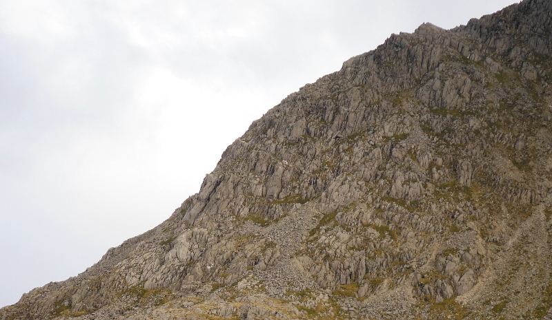
Up on the high point of Y Gribin now, and some super lighting now over the Snowdon block -
Looking down the flank of Y Gribin to the flatter mid section -
Another view of the Arête catching the sun - funny how it seems to change shape so much when you view it from different places.
I have been down Y Gribin before, and my memory of it was that it was an easy walk down.
I totally failed to recollect that the path drops down the west flank of Y Gribin down through some pretty horrible rocky, loose, steep hillside, and I was a bit spooked to suddenly land in this, but there was no other way down - it took quite a bit of route finding and bum sliding to get down - the path seemed to have no hesitation in heading down places that there was no chance I was going to get down, so I was constantly have to change route, go off to one side or the other, find another way down.
It took a long time to get down through it, and down onto the flatter mid section of the ridge.
Looking back up at the upper section of the ridge - the path comes down through all that horrible looking rocky stuff on the right.
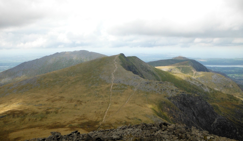
And so on back down the ridge, followed the main path down to Llyn Bochlwyd, and on down to the road.
Quite far down the ridge the path actually splits, the main path turns right, and as I said, goes down to join onto the Bochlwyd path.
The other branch is shown on the map, but I don`t know where exactly it ends up, but it drops down to somewhere along the east side of Llyn Idwal - it would be useful to know where it goes, because I think it would be a shorter route back down to the road.
So I can tick the box for Seniors` Ridge - I don`t think that Senior`s Ridge is a particularily exciting way to get up the Glyders, it is rather shut in at the back above Llyn Idwal, so it doesn`t have much of a view.
There was little good quality rock scrambling - maybe I would have got a bit more if I had tried to ascend the rocky slabs away up in the top quarter, I don`t know.
But I have done it, although I don`t think I will bother doing it again, there are more fun ways to get up the Glyders.
A couple of pictures of Bristly Ridge to end - these pictures are really for my own benefit, I would love to find a way up Bristly Ridge that didn`t involve climbing either Sinister Gully or Dexter Gully.
So I keep looking for other ways to do it - once you are above the gullies, the rest of Bristly Ridge is good fun, just follow the crampon marks.
A closer view of the lower part - there is an interesting sort of line heading diagonally across the rocks - I wonder if it would provide any sort of a route.
website design by ron-t
website hosting by netnerd.com
© 2025 Ron Turner
![]()
![]()