ron-t climbing
05 May 2017 ................ Elidir Fawr
A sunny day - but it turned out to have a vicious east wind. On Anglesey it was warm and very pleasant, on Elidir Fawr it was anything but.
It seemed to take forever to walk up the road to the dam, all my speed has gone and it fairly showed.
The climb up the northerly ridge was plagued by the wind blowing across the ridge, and I spent as much time using my sticks to stop myself being blown over as did using them to help with my climbing.
In an effort to avoid as many of the boulders as I could, I went slightly more to the left than I used to do, and found a sort of path that I never knew existed, so that made life a bit easier, and eventually I joined onto the more distinct path that connects Bwlch y Brecan with the summit.
And so up to the summit and thankfully, into the shelter at the top.
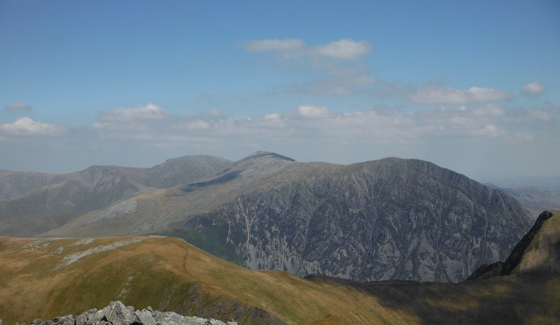
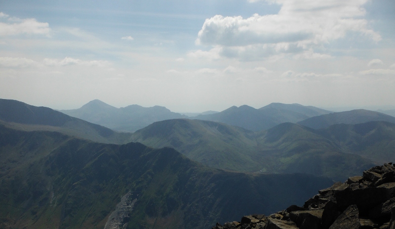
Super views today - looking across to the cliffs of Yr Ole Wen and the Carneddau -
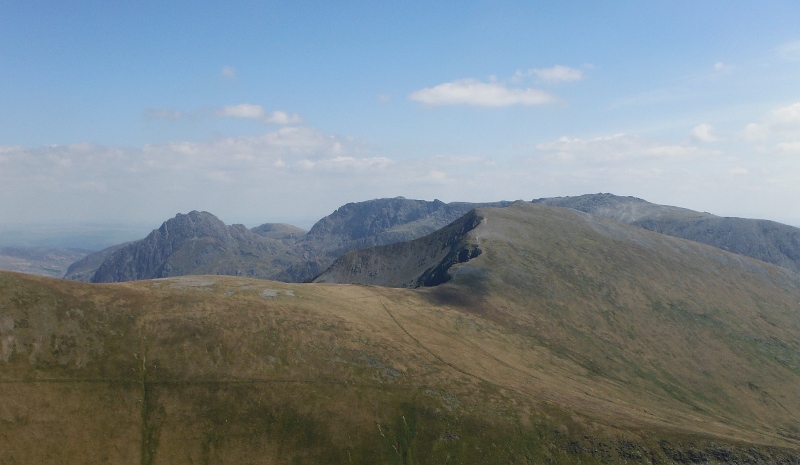
Looking away over the top of Y Garn to the Glyders -
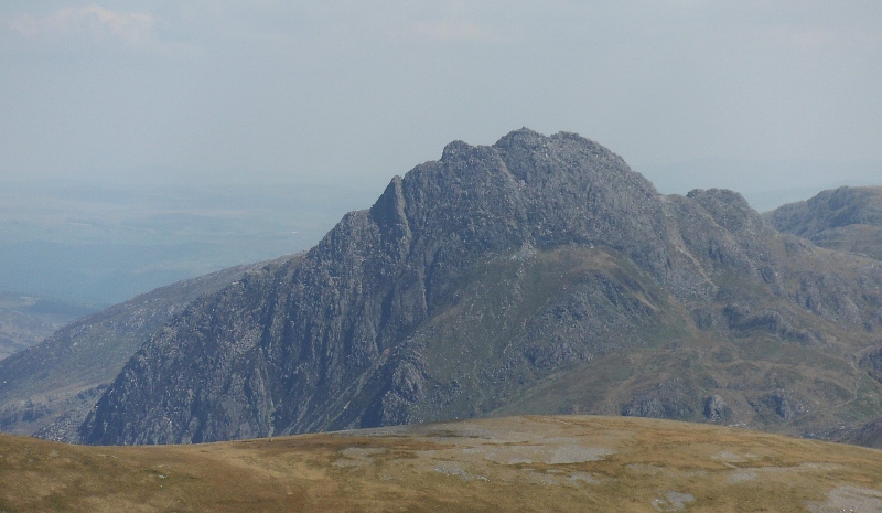
Tryfan was looking superb and deserves its own picture -
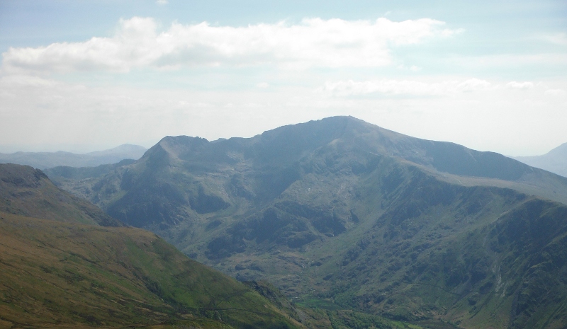
I am beginning to look into the sun now, so Snowdon was a bit hazy -
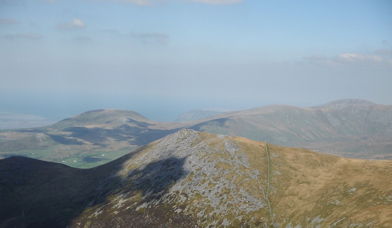
Again, rather looking into the sun, so a bit of a hazy view across to Moel Hebog and the Nantlle Ridge -
Away round in the opposite direction, and not surprisingly, a view over the top of Carnedd Filiast across to Penmaen Mawr, passed Moel Wnion and Drosgl and Bera Bach.
I say not surprisingly because there was a clear view of Elidir Fawr when I was on Penmaen Mawr, so it is logical there would be a clear view in the other direction as well.
However Penmaen Mawr doesn`t look that distinctive from up on Elidir Fawr -
Because of the wind, and also because of the rate at which the day was passing, I decided against going round the horseshoe of Mynydd Perfedd and Carnedd Filiast - instead I decided to drop down the northwest face of Elidir Fawr down to Elidir Fach, then head down the north ridge of Elidir Fach back down onto the road up to the dam.
Once off the ridge of Elidir Fawr it was easier going, without the big blocks that cover so much of Elidir Fawr - however there was absolutely no let up in the wind.
This was a bit strange as I should have been sheltered by the long ridge of Elidir Fawr, but I wasn`t, and I didn`t really escape the wind until I was well back down the road.
One of the things that became quite clear was that sticks with big rubber feet are quite unsuitable for this kind of terrain, you need hard points.
But walking poles with hard points generally have vertical handles, whereas I now need horizontal handles - I think I need to do a bit of stick creative thinking and see what I can come up with. I now can`t go up hills without them.
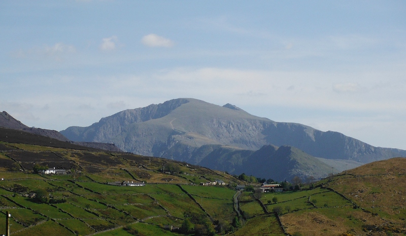
Driving back down the road to Deiniolen, and suddenly there is a superb and very different view of Snowdon which I have never seen before - looking up the long north ridge of Snowdon to Garnedd Ugain, the actual peak of Snowdon just peeking over the top at the back.
Off to the left of the north ridge is the Llechog Buttress, and running up the left side up to the summit of Garnedd Ugain is the ridge Crib y Ddysgl, which is the continuation of Crib Goch.
Over to the right the famous Clogwyn Du`r Arddu - or Cloggy to its friends.
Famous if you are a climber, that is.
website design by ron-t
website hosting by netnerd.com
© 2025 Ron Turner
![]()
![]()