ron-t climbing
04 January 2017 ................ Cruach Scarba
A good weather forecast for one day - so I took the chance of trying to get up Cruach Scarba - it is a trip that I have wanted to do for some time, so I am now pleased to have done it.
Cruach Scarba is the highest point on Scarba, with a height of 449 metres - Scarba is an island in the Firth of Lorne in Argyll, there is no public ferry service there, so if you want to go there you have to arrange your own maritime transport.
I used my sea kayak to get there, and I have done a page in my kayaking blog about my trip across to Scarba, and back again at the end of the day.
From a small harbour on the NE corner of Scarba there is a landrover track that heads away up the hill away from the coast, past Kilmory Lodge, and onwards and upwards to a height of about 100 metres or so above sea level, then contours around the east side of the island.
There is another bit of track the start of which is shown on the OS map, but it goes a bit further up than what is shown - it isn`t a landrover track, you might get a cat up it, it is very wet in places, but it does make progress a bit easier than it would be if it wasn`t there.
Eventually this track runs out, and then it is over the rough ground right up to the top.
It is a rather soul destroying climb up - it is just crest after crest after crest, and you never get to the see the summit.
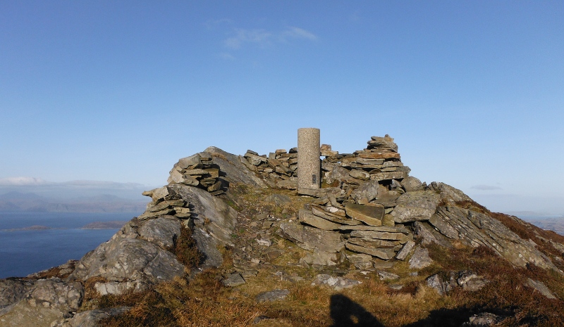
In fact I found it quite hard to find the summit, there are several summits, and I had no idea which one to aim for.
I guessed for one, and headed on up, and slowly seemed to be getting higher than the other summits - you only see the cairn when you are almost up to it, it is well hidden.
But eventually I got there.
And just to prove it -
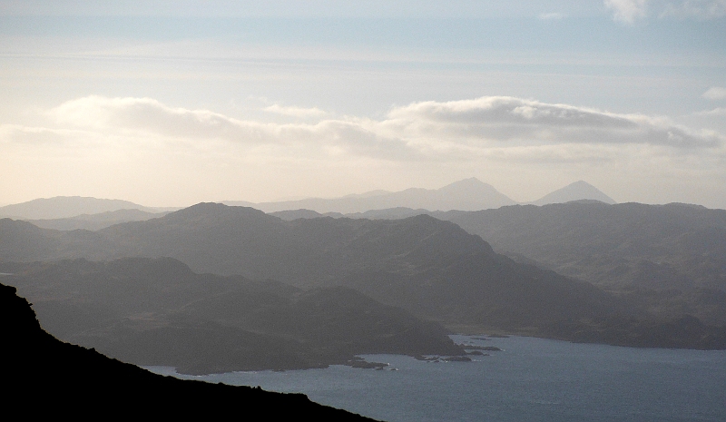
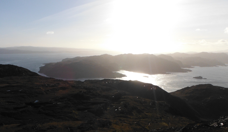
Fantastic views in every direction - well there would have been if it hadn`t been so hazy - lots of sunshine, an unbelievably cold north west wind - and haze, haze, haze.
So rather disappointingly, the pictures aren`t good - the ones shown on this page are really the least worst of all the pictures I took.
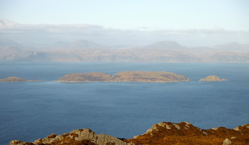
This is looking away to the south down Jura, and I could just see the Paps of Jura.
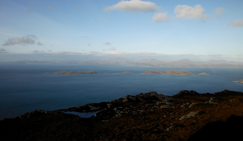
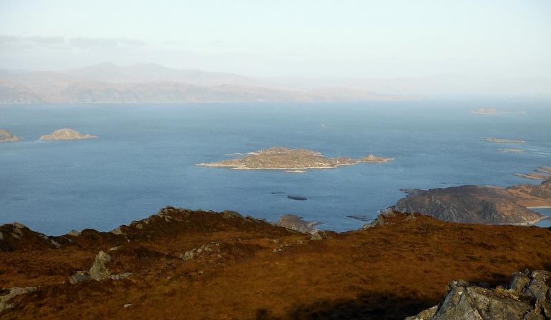
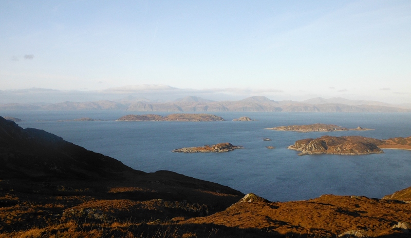
Round to the northwest, and there was a good view across to the Garvellachs - I don`t often get to somewhere from where I can look at the Garvellachs side on - normally I just see them from the north and just see the top end of them, so it was good to see them from this angle for a change.
It is quite surprising, but they are over 6 kilometres from top to bottom.
A closer view of the southern half of the Garvellachs -
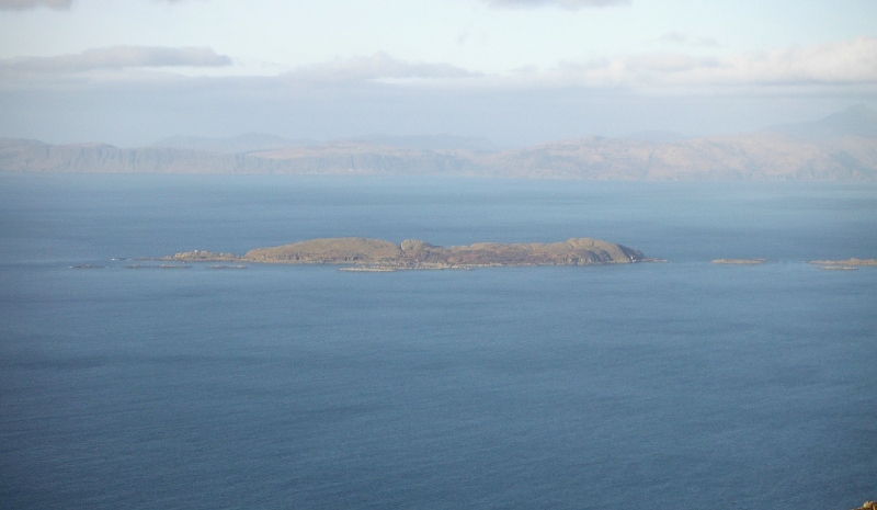
And the northern end -
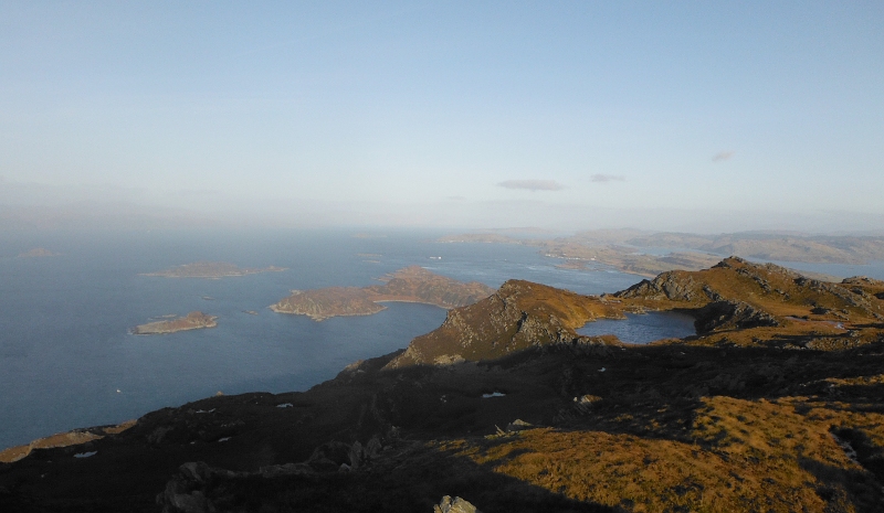
Not a good picture, but it gives a wider view of the Firth of Lorne to the north - showing the northern of the Garvellachs, Eilean Dubh Mór, Lunga, and a wee bit of Luing.
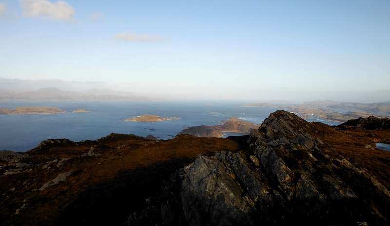
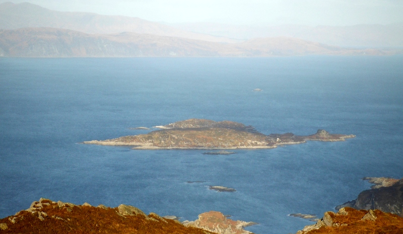
A closer view looking down on Lunga, a wee bit of Eilean Dubh Mór on the left, you can just make out Belnahua and Ormsa, and all the whitewash on Fladda fairly stands out.
Over on the right you can see a bit of Cullipool on Luing, further back the houses around Easdale and Ellenabeich, and you can just make out Insh Island away to the north.
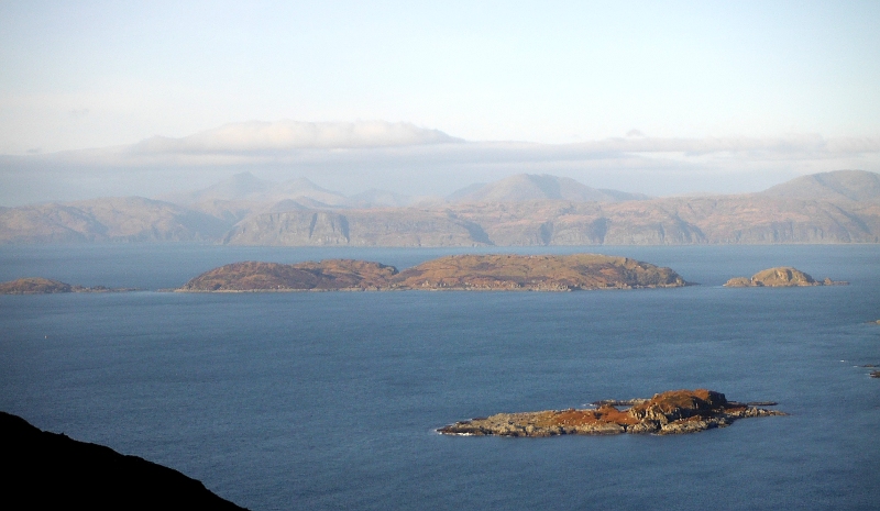
Another closer view which shows Belnahua, Ormsa, and Fladda a bit better.
A closer view of Eilean Dubh Mór and Eilean Dubh Beag -
And a bit closer - a rather artificial looking picture, but it maybe conveys some useful information.
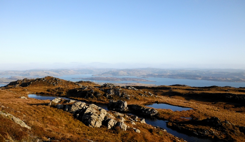
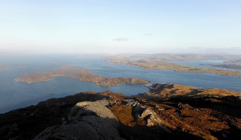
Finally, the view across to the northeast - Luing is mostly hidden, the obvious island is Shuna, and beyond that the mainland around Arduaine Point, Loch Melfort, and Craobh Haven.
It isn`t all that obvious from the map, but Cruach Scarba is the highest point in the middle of a bit of a ridge, with another smaller summit at each end.
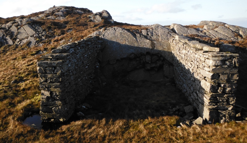
I headed off to the south end of the ridge, and just below the summit there is a double garage - why somebody built a double garage on top of a mountain I don`t know - it was very boggy inside it.
From the summit you can see a bit of the Corryvreckan - this would be an ebb tide, and what I could see of it looked quite calm.
Looking straight into the sun, I am afraid -
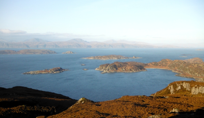
Then I headed back up to the summit, and this is looking away along to the north end of the ridge, and I think that the rocky peak is the 422 metre summit shown on the OS map.
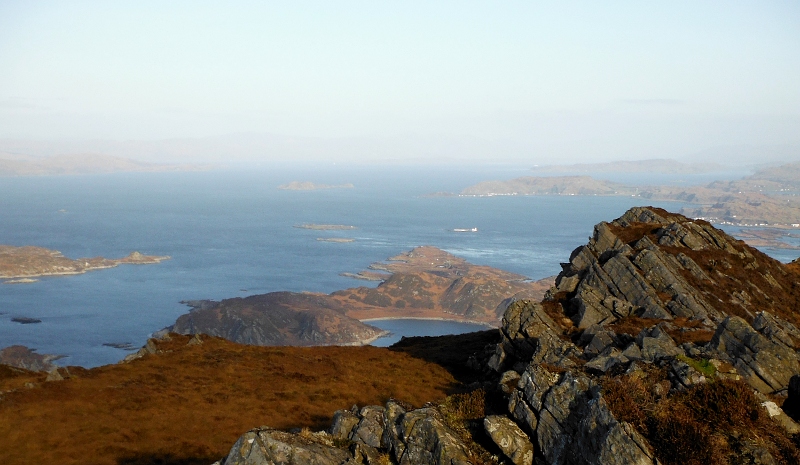
On that summit now, and the view to the north gets a bit better - looking down on Lunga - the narrow channel right of centre is the Grey Dogs, and you can see most of Luing across the Sound of Luing.
A closer view of the Grey Dogs, again, near the end of an ebb tide.
When I was climbing up, I couldn`t see anything to the north, but having gone along to the north end of the summit ridge, I then went down much closer to the north end of the island, so got quite a few good views to the north - so here are a few pictures taken from different places as I headed down.
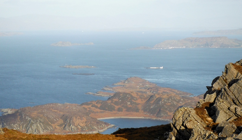
Another view of the northern end of the Garvellachs, and also now getting a better view across to the fabulous looking cliffs along the east coast of Mull.
A closer view of the Garvellachs -
A bit more round to the right -
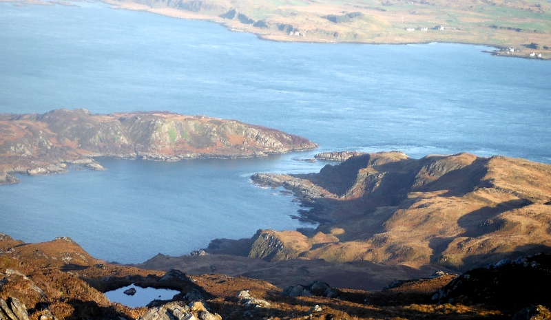
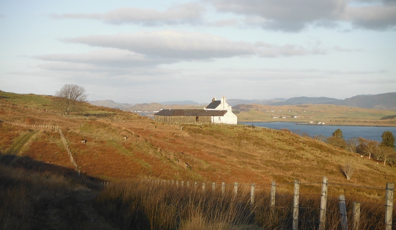
Looking down on Kilmory Lodge, across the Sound of Luing to the south end of Luing, with Shuna behind it.

Down on the track now, and heading back towards Kilmory Lodge - it is in a fabulous location, with terrific views away to the north, the east, and the south.
It does have one snag - you wouldn`t be able to see the sunsets.
And so back down to the harbour to pick up my boat, with about an hour of daylight left.
It is only 449 metres high, but you start from sea level, and it was quite a strenuous climb up, but it was well worth the effort.
website design by ron-t
website hosting by netnerd.com
© 2025 Ron Turner
![]()
![]()