Wales - 2015
04 January 2015 ........... Carnedd Moel Siabod
*** also known as Moel Siabod, and Carnedd Moel-siabod - depending on which map or website you are looking at ***
This was one of these days that ended up quite differently from what I expected - a clear day was forecast, with a rising wind, before another two weeks of forecasted wet and windy weather.
So it seemed a shame to miss out on the weather, and I headed down to Moel Siabod - a mountain about which I had little knowledge - except that I had seen it from other mountains to the north and west, and had noted that it would be a good one to do during the shorter winter days.
Curiously, I can`t find that I have taken any photographs of it, even after digging through lots of my picture archive - hence my lack of knowledge about it.
Essentially, it is an isolated mountain that is a ridge maybe about 3km`s in length overall, with the summit being more ridge about 600 to 800 metres in length. A small distinct cairn marks the obvious highest point.
There are significant crags to the southeast side of the ridge, with established climbing routes.
Over the last couple of days the milder weather had shifted a lot of the snow off the tops, especialy the lower ones, so I wasn`t really expecting there to be much snow - however just in case, I put my crampons and ice axe in the car.
I discovered that - unless I missed it - I couldn`t ever see Moel Siabod as I drove down the road, but there was little snow on the hills I could see, so in the end I left the crampons and the ice axe in the car when I set off from Pont Cyfyng.
I headed up the track to the first of the old quarry buildings - however by this time I was getting bored of walking up a low level track, and decided I would climb up on to the ridge, and head up the ridge.
My boredom came to an ubrupt end - it was some climb up - scrambling over big boulders, through deep dead bracken, and very long heather - well, I was looking for a challenge !
Up on the ridge, and heading up - eventually I started to meet the snow - little patches of quite crunchy snow, so not a problem to walk on.
Up and up, and more and more snow, with the character of the ridge slowly changing from grass to broken rock.
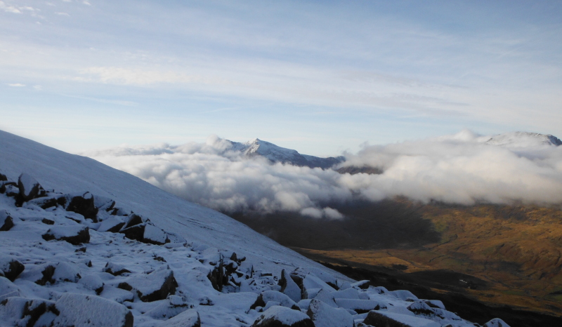
Then I looked around, and horrified - saw a long bank of cloud blowing past Moel Siabod - on no - not cloud.
This didn`t look good for the summit - so I grabbed some pictures looking across to Snowdon, the Glyders, and the Carneddau.
With the cloud threatening to envelope me at any time, I headed off up the ridge as fast as I could - but the ridge had other ideas - increasingly I was climbing over bigger and bigger blocks, that were fully or partially covered with snow.
It turned into some really good quality winter scrambling - not the rock climbing kind of scrambling - but good four wheel drive type of scrambling - no path, finding my up.
It was a shame I was in a hurry, because it was good fun - and it did occur to me that it would have been even more fun with crampons on.
It wasn`t ever risky, if I couldn`t get up one way, there was always another way a few metres to the side, so it wasn`t a problem not having crampons - but it would have been good.
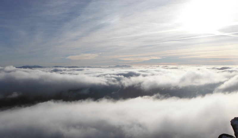
Eventually the big blocks run out, and then it was just a flat walk up crunchy snow to the real summit.
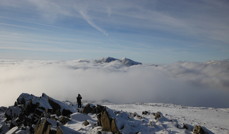
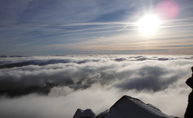
I didn`t need to worry about the cloud - what a fantastic sight - the summit was above the cloud !
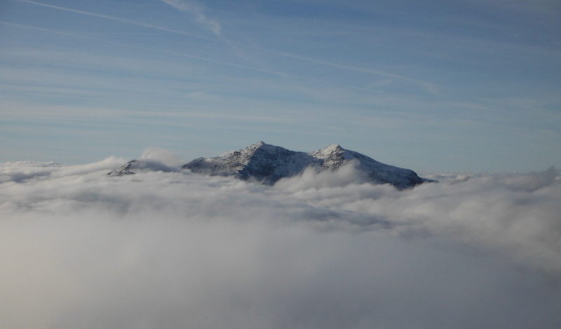
I had no idea what the mountains were that are just visible on the left side of the picture - eventually back at home I worked out that they are probably the Aran Range on the left, and Cadair Idris on the right.
I have known of the existence of Cadair Idris for a while having seen them from the Barmouth / Dolgellau area, but the Aran Range are quite new to me. Looking at the map and the contours, it looks as if they could be quite chunky.
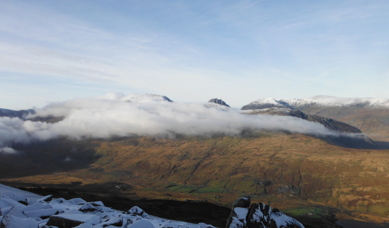
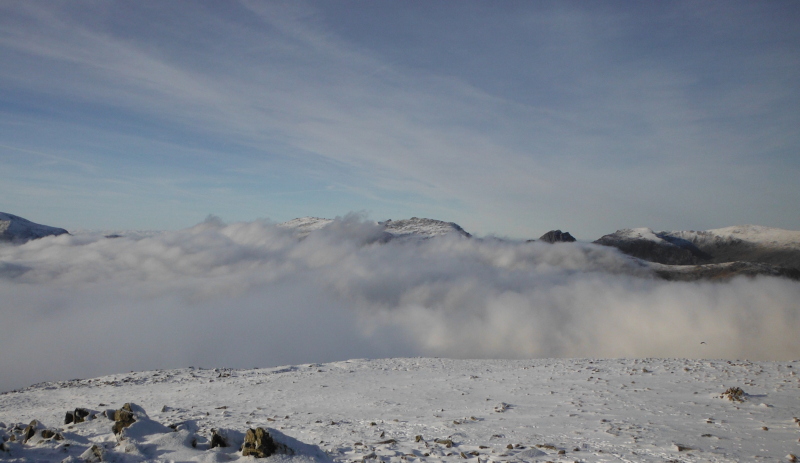
Here is a slightly closer view of them just peaking out above the cloud.
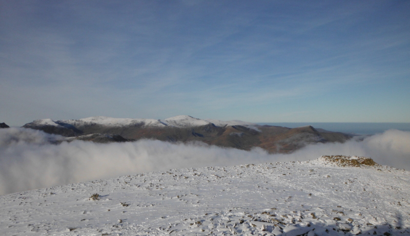
Round to the right, and Snowdon was quite clear above the cloud -
The very summits of the Glyders were just above the cloud, and Tryfan was possibly a bit sheltered by the bigger bulk of the Glyders, so it was quite clear as well.
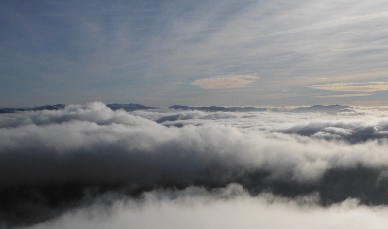
The Carneddau escaped the cloud until much later on, and the visibility was so good that I could see a little black dot making its way along the ridge between Carnedd Dafydd and Carnedd Llewelyn.
This is looking back along the ridge that I had come from, and you can see the sort of rocky not-quite-pinnacles which had provided the fun earlier on.
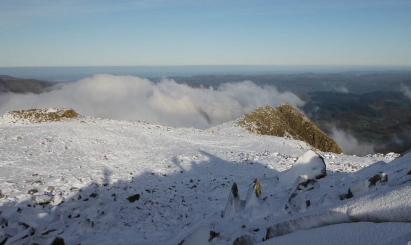
You can also see right on the left a handy stone shelter - in fact it was a life saver.
Up above the cloud layer, the summit was in a very cold and strong air stream roughly from the south, and it was very very cold on the summit. I was in dire need of sustenance by now, so I hid in the shelter for twenty minutes or so.
Even though I was somewhat sheltered from the wind there, I was getting colder and colder, so I headed back up to the summit for a last look - a closer view of Snowdon, with Y Lliwedd just managing to make an appearance -
And a last look out to the south across the cloud, before heading back down after a most fabulous and unexpected day.
website design by ron-t
website hosting by netnerd.com
© 2025 Ron Turner
![]()
![]()