Wales - 2014
29 November 2014 ........... Y Gribin and Snowdon
One of the things that I have had a notion to do for some time now is to climb up the ridge Y Gribin - not the Y Gribin in the Glyders, but the Y Gribin that rises from the Miners Track up to the coll between Y Lliwedd and Snowdon - the coll is I think Bwlch y Saethau.
None of the OS Landranger, the OS Explorer map, or the Harveys maps show the name Y Gribin.
So after lunch in the car park at Pen-y-pass, I headed off up the Miners Track - it was a beautiful day, so I took a gamble on shorts and trainers as being ok.
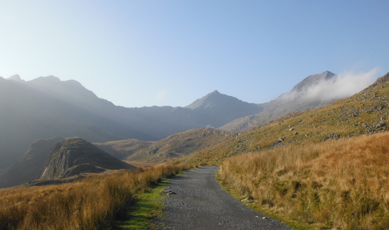
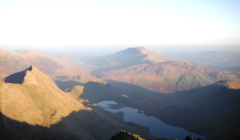
With trainers on I romped up the Miners Track - this is part of the way up, looking up to Y Lliwedd, Snowdon and I think Crib Goch on the right.
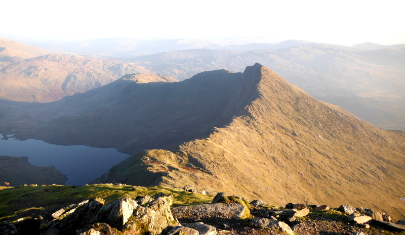
Further up the track, and I can get a good view of Y Gribin -
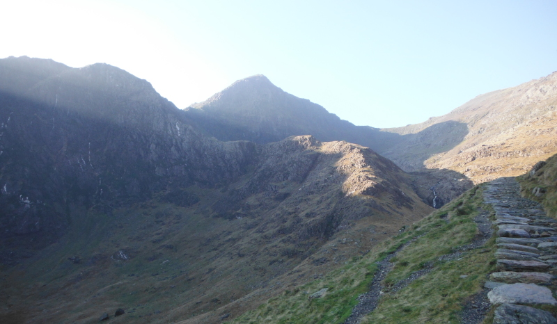
I didn`t drop down off the Miners Track and go up the bit of Y Gribin that is lit up, I stayed on the track right up to the river crossing right at the end of Glaslyn.
It was a good enough scramble - there is a path which winds its way right up the ridge, but it often gets lost in the sections of bare rock, so you do need to do your own route finding.
At times you are climbing on bare rock - sometimes I left the path and went off to find a bit of a more challenging route up, sometimes the path was the best route.
My guide book says that you can use Y Gribin as a descent route - I must confess that I don`t think it would be a good descent route - could be a bit tricky to find your way down. I do find that I disagree with many of the opinions expressed in this guide book about how hard or easy various routes are.
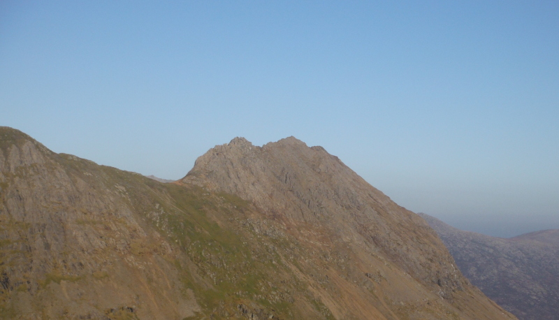
Up at Bwlch y Saethau and a superb view looking up to Crib Goch - shows it off nicely.
Now it is decision time - do I head left and go over Y Lliwedd and back down to the Miners Track, or do I head right and go up Snowdon, then come back down via the Pyg Track ?
Well after some humming and hawing I set off up to Snowdon - I didn`t follow the path that heads a bit over to the left, I tried to stay fairly close to the edge, and got a bit more scrambling.
At one point I climbed my way quite a distance on a micture of grass and rock, but eventually I came to a dead end - there was nothing but rock face above me, and there wasn`t much chance of getting up it - so I had to do a fair bit of a descent, then contoured round a bit to the left, and found a well used path - so I headed up that instead.
However it was another dead end - it just went up to some more rock face that I couldn`t see any way up.
So it was a bit odd - it was a well used path, that would indicate that there was a straightforward way up, but there wasn`t.
So I had to descend again, contoured further round, and found another path up - this one worked, and I climbed up with little scrambling required.
And so on to the summit - and the summit of Snowdon is never empty - even at the end of November there were the usual youth groups, families with very small children, grandads and grannies, etc, etc.
Some good views, but not in all directions - looking across to Crib Goch, with the Glyders in the background, and even further back, the start of the Carneddau.
Round a bit to the right, and I noticed this mountain - and I couldn`t work out what it was.
However after studying the map at home, I reckon it is Moel Siabod - I am not sure if it is one of the Moelwynions, I don`t know how far they spread.
It looks like it could be a good walk up from down by Capel Curig - one for the shorter winter days.
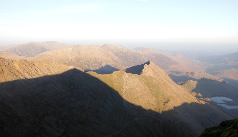
As always, Y Lliwedd is a fabulous looking mountain -
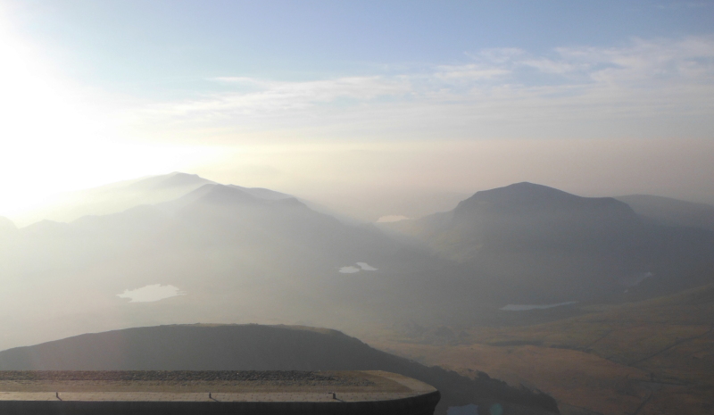
Round to the west and southwest, the sun was a bit of a problem - so this is the best I could for a picture of the Eifionydd - or more specifically, the Nanttle Ridge on the left, and Mynydd Mawr on the right.
After taking my various pictures, I looked at the time - hmmmm - an hour and a half of daylight left - and it would take me most of that to get back down to Pen-y-pass.
So I headed off.
I did find it quite surprising that there were so many people up at the summit of Snowdon who seemed quite unaware of the fact that it would be dark in about an hour and a half.
Various others were starting to head off, but many showed no sign of going.
Heading back down, and there were still people coming up - if it has taken them that long to get up, how long will it take them to get back down.
There were more people heading up or down the Llanberis path than the Pyg Track, so the Pyg Track was quite quiet, and I moved quite quickly, passed two groups still going up, and a few groups going down.
This was only the second time I have been on the Pyg Track, the previous time I was going up - so this was my first descent - and I have to say, I found it a very unpleasant path to go down.
It is very mixed in construction - some gritty bits, some bits with laid stones, some bits with large boulders arranged as steps.
There is a sign down at Pen-y-pass that says that nobody knows why it is called the Pyg Track - well I can tell them - it is called that because it is a pig of a track.
Why queues of people want to go up the Pyg Track in the summer is beyond me - I don`t think I will ever use it again - if I ever need to get up that way from Pen-y-pass again, I`ll use the Miners Track.
Back at Pen-y-pass an hour and 20 minutes later - a quick cup of tea, then off down the road in the dark.
And the car park at Pen-y-pass was still half full, as were the various layby`s down the road through the Pass of Llanberis - that`s a lot of people trying to get off the mountains in the dark.
But a good day out, I`ve ticked the box for Y Gribin, and there are not many years that you can climb 3000 foot mountains in shorts and trainers at the end of November !
--------------------------------
PS - just for those with a bad case of sniffles - yes, I did have more clothing in my rucksack.
And a hat
And gloves
And a map
And a compass
And a hot drink
And food
And two mobile phones on different networks !
website design by ron-t
website hosting by netnerd.com
© 2025 Ron Turner
![]()
![]()