Wales - 2014
05 November 2014 ........... Yr Eifl
Another week of wet and windy weather, and then the wind went round to the east for a day - the forcast was not good, lots of heavy showers over Snowdonia - so I reckoned the best place to be was down the Lleyn Peninsula, so I went to say hello to Yr Eifl.
I have taken several photographs of it from places like Llanddwyn Island, Mynydd Mawr, Elidir Fawr, and Carnedd Filiast - and also from down by Trefor - it is a very distinctive mountain, so I wanted to go and see what it is like.
I certainly got the best of the weather, sunshine for most of the day, but at times with a rather cold wind.
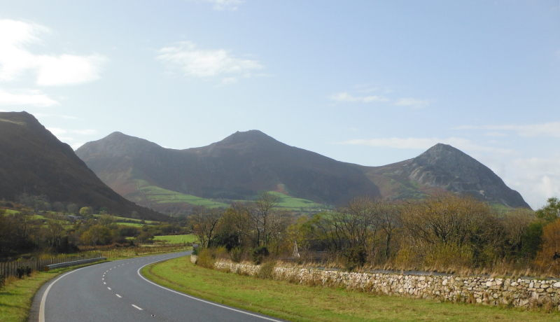
Here is Yr Eifl from the Trefor area - even close up it looks good.
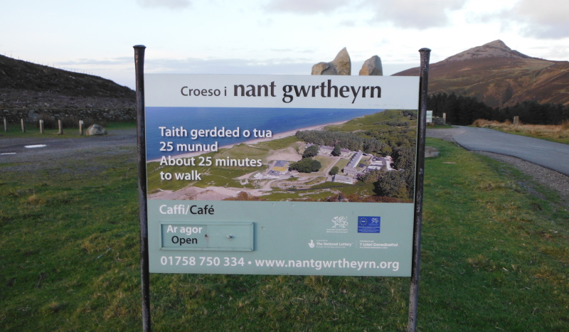
I started from the car park between Llithfaen and Nant Gwrtheyrn, there are plenty of tracks and footpaths up to Yr Eifl from there.
As an aside, I noticed that on the noticeboard Nant Gwrtheyrn is spelt ( or if you prefer - spelled ) with lower case initial letters.
However in their website, it is spelt Nant Gwrtheyrn, ie, with upper case initial letters - I wonder if there is any significance in this.
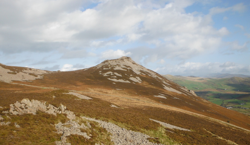
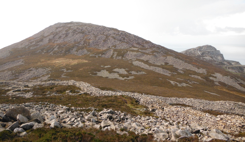
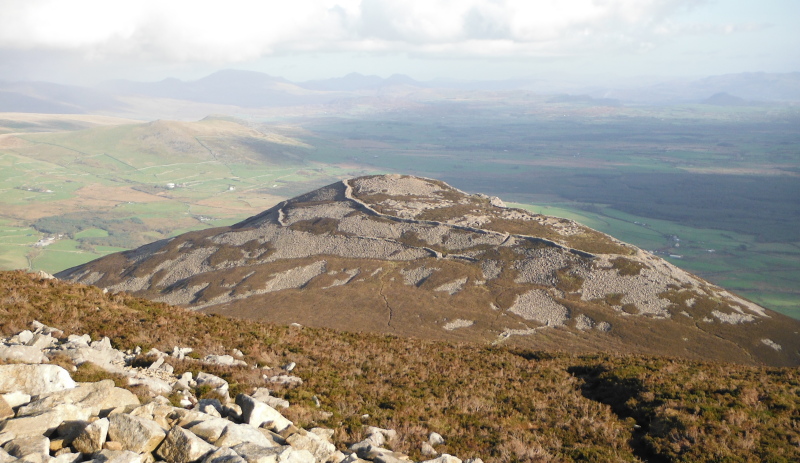
I headed off around the south side of Yr Eifl, my first summit was to be Tre´r Ceiri, the most easterly of the three peaks.
This is looking up to the summit of Tre´r Ceiri taken from the rocky outcrop Caergribin -
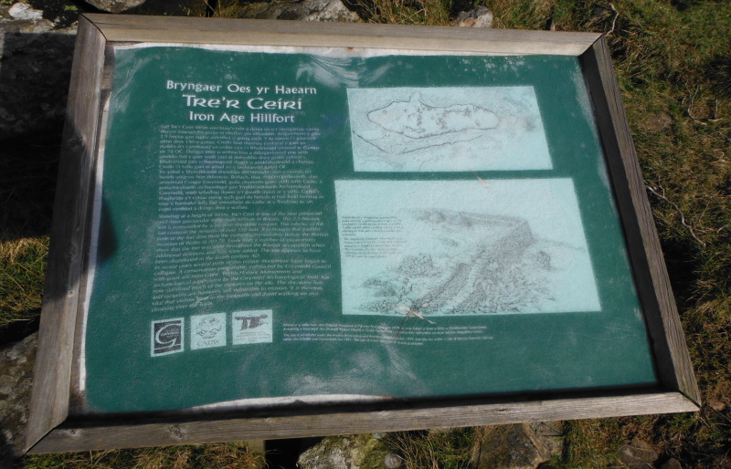
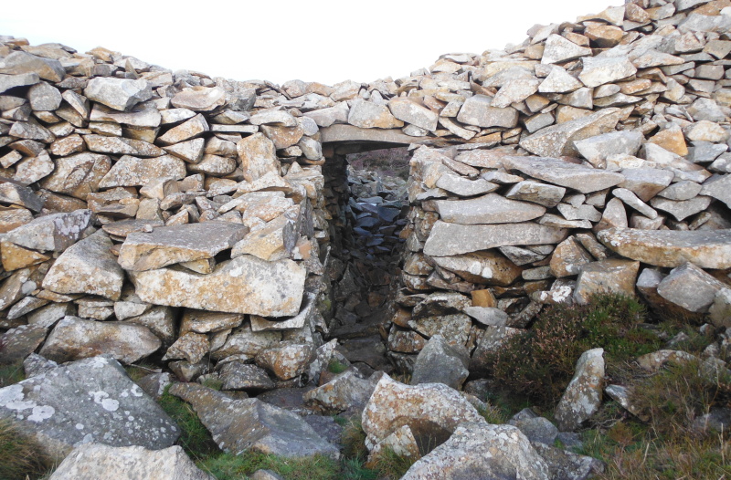
It is easy walking on well defined paths, and it didn`t take long to get there - and once there, I found that at the top of Tre´r Ceiri there is the remains of an Iron Age hill fort - one of the best examples in Europe.
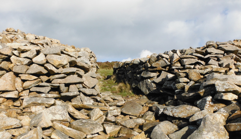
There is a large drystone dyke all around the summit, this is one of the entrances -
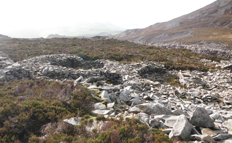
Looking down on some of the houses -
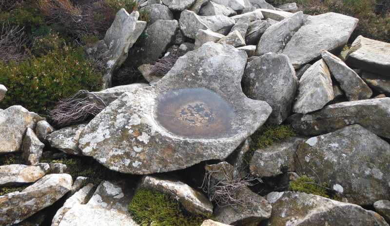
I came across this, it wasn`t the only one, there were a couple of others - is it an Iron Age basin ?
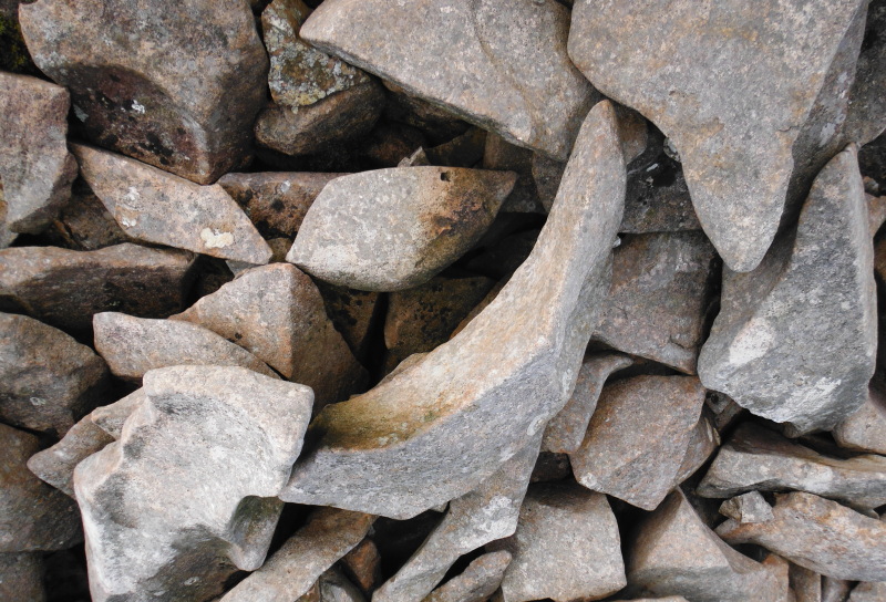
That one certainly looks to have been man-made, but the stone around there does seem to split into quite unusual curved segments - here is one -
The outside wall completely encloses the summit, here are a couple of sections of it -
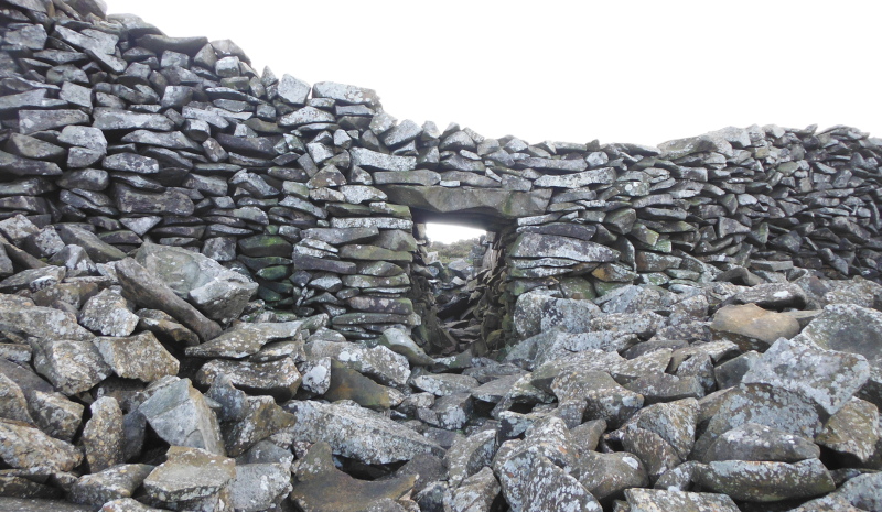
On the opposite side of the summit from the entrance shown above is another entrance - this one is very well preserved, and is quite a neat bit of dry stone wall building. It is quite amazing to think that this was built over two thousand years ago.
From the other side -
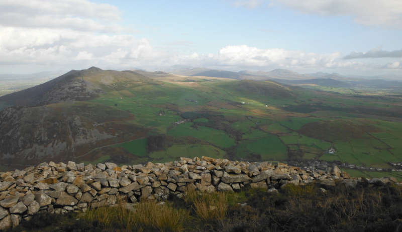
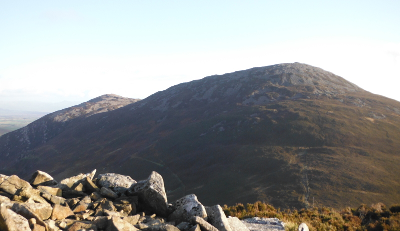
Time to head off, and up to the centre and highest summit of Yr Eifl, Garn Ganol. Up on the summit, and this is looking back to Tre´r Ceiri - the wall surrounding the summit is quite obvious, and you can also see a lower wall, which doesn`t go all round the summit.
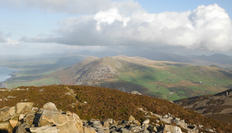
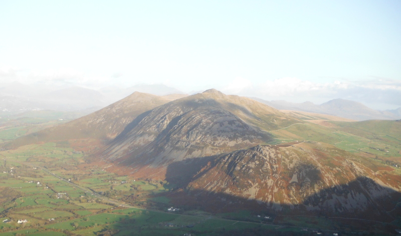
This is looking northeast over to Gyrn Goch, and in the background, many of the summits in Snowdonia are enjoying the rain.
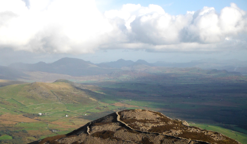
Just round to the right, and I think this is Moelwyn Mawr and Moelwyn Bach away in the distance avoiding the rain.
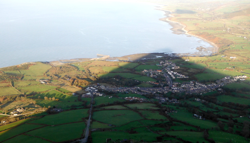
Further round again, this is looking down the east side of the Lleyn Peninsula to the flat area to the south of Abersoch - the bay is I think called St Tudwal`s Road, and those are the two St Tudwal`s Islands.
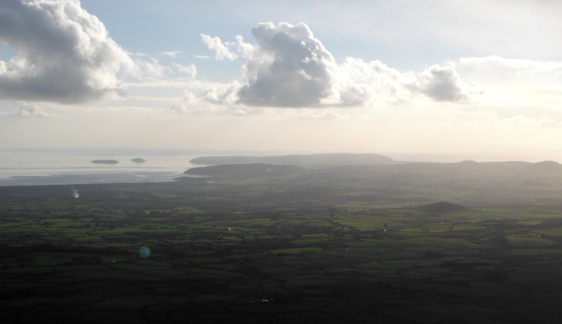
Looking right down to the bottom of the Lleyn Peninsula and Bardsey Island -
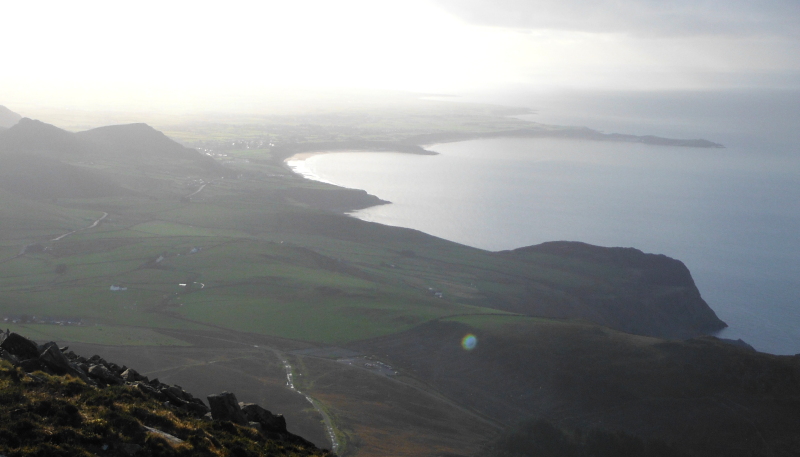
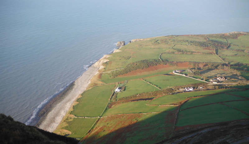
This is looking down the west side of the Lleyn Peninsula - the nearest big headland is Penrhyn Glas - the huge cliffs make it a fantastic place to sea kayak around on a calm day - but it can be wild there.
The next headland is Penrhyn Bodeilas, then Penrhyn Nefyn, then the long headland of Trwyn Porth Dinllaen.
Penrhyn Nefyn looks quite innocent, but a long spit of boulders sticking out from the tip of the headland causes mayhem in a rough sea.
There is a tiderace off Trwyn Porth Dinllaen.
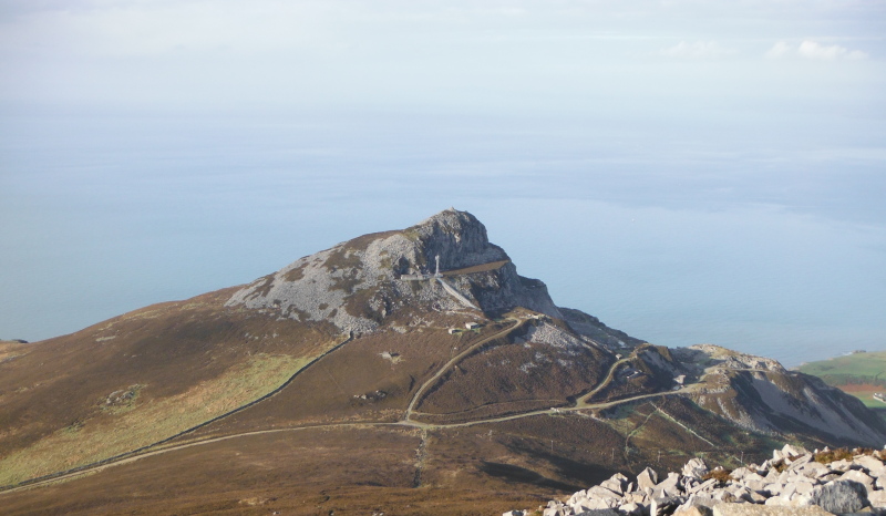
Finally for Garn Ganol, this is looking down on the most westerly summit of Yr Eifl, Garn For - at least, it is looking down on what is left of Garn For - a huge quarry has eaten away a substantial portion of it.
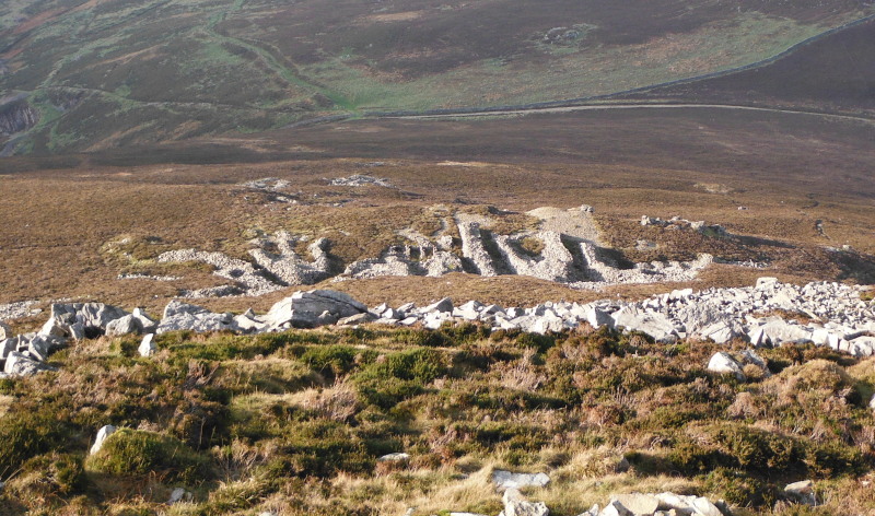
Heading down the west side of Garn Ganol, I looked down on these dry stone walls - when I looked down on them, I just saw a lot of dry stone walls that didn`t seem to have any sense or purpose - but when looking at the photo, I realised that they could be letters, and the whole lot forms a word or two.
Was this an Iron Age nameplate for Yr Eifl ?
Garn For is right above the coast, and provides its own viewpoint, somewhat different from the view from up on Garn Ganol - this is looking down on Morfa, the headland just down from Trefor - another good place to sea kayak around. You can just see some of the cliffs in this picture.
Trefor is in deep shade from Garn For -
You also get a better view of Moel Bronmiod, Gyrn Ddu and Gyrn Goch - it looks like Bwlch Mawr is hidden behind Gyrn Goch.
Looking back across to Garn Ganol and Tre´r Ceiri -
It was a good day out, and I am pleased to have said hello to Yr Eifl.
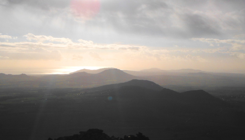
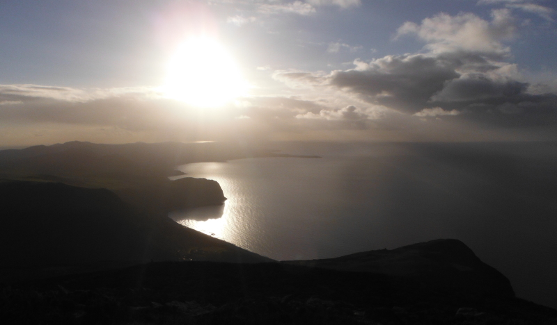
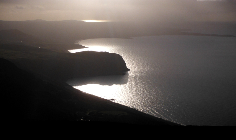
I`ll finish with two photographs which prove beyond doubt that you really shouldn`t shoot pictures looking straight into the sun - especially with a camera with a doubtful auto exposure.
They may be technically awful, but I quite like them-, so I am going to give myself a bit of artistic licence, and put them here, otherwise they will end up buried in a DVD along with thousands of other photographs and never see the light of day again.
website design by ron-t
website hosting by netnerd.com
© 2025 Ron Turner
![]()
![]()