Wales - 2014
29 October 2014 ........... Mynydd Mawr
After a week or two of wet and windy weather, a brief ridge of high pressure took the wind round to the east - and produced a beautiful sunrise.
It also produced sunshine and blue skies for the western end of Snowdonia and the Lleyn Peninsula.
However the forecast was for more cloud cover by late afternoon, so I went for a shorter trip - to Mynydd Mawr at the north end of the Eifionydd.
After seeing it from Llanddwyn Island, I did some digging, and found that there is limited scope for scrambling on Mynydd Mawr - all of which is grade 2 or 3, on loose rock.
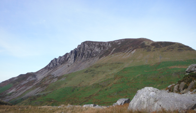
I think there may well be other ways, but the generally accepted way to get up Mynydd Mawr is to start from around the Rhyd Ddu area, through the forest, and up the east end of the Craig Y Bera ridge - so that is what I did - sort of !
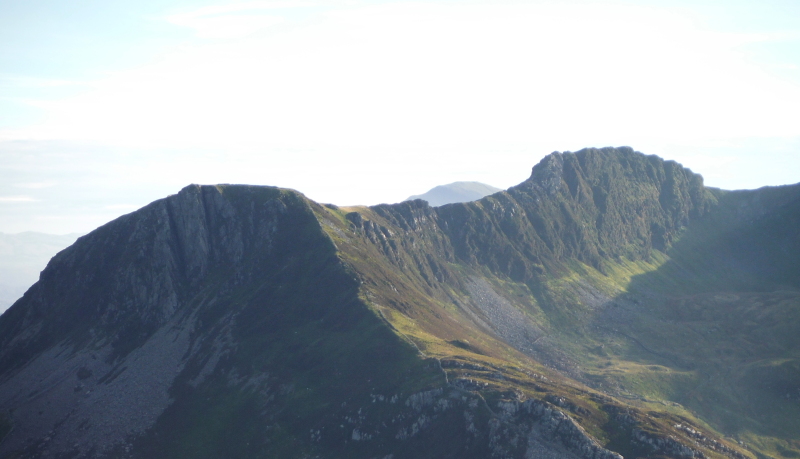
This is looking up to the crags along the southside of Craig Y Bera -
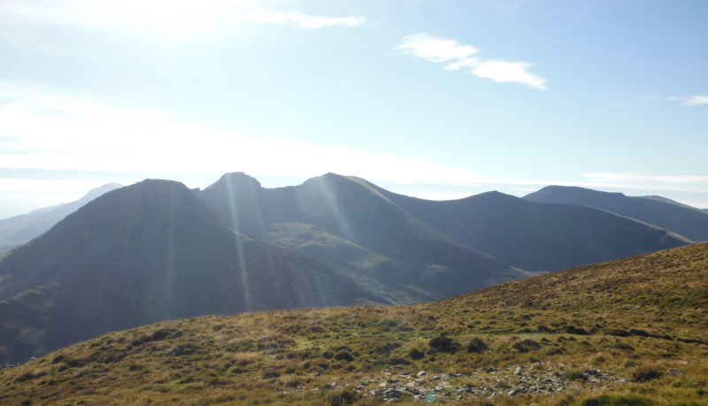
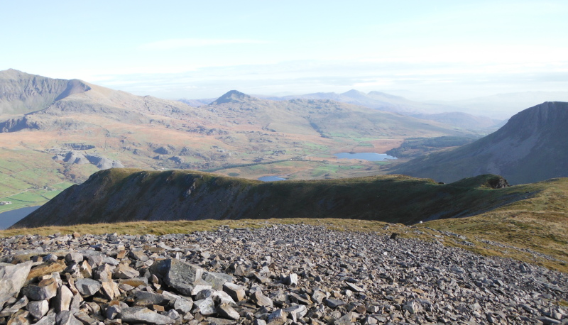
It was a fairly simple walk up onto the ridge of Craig Y Bera, but being right on the crest all the way up, you get some good views all the time - looking across to the Nantlle Ridge -
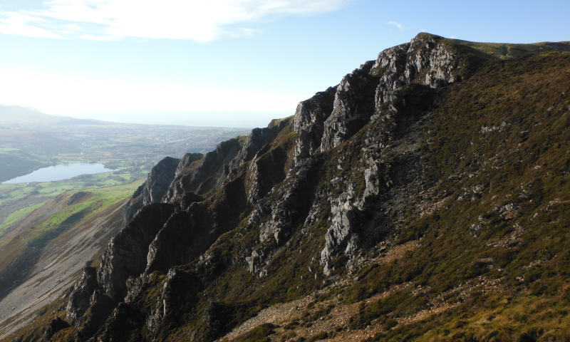
A closer view of the crags of Craig Y Bera -
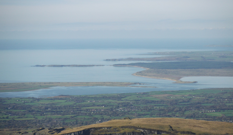
All the way up right up to Mynydd Mawr there are the most amazing views pretty much in every direction - to start with - this is looking out to Llanddwyn Island and up the west coast of Anglesey.
It was after all my trip out to Llanddwyn Island that got me interested in what the Eifionydd has to offer.
This is quite an interesting picture actually, as it is quite close to high tide - 5.2 metres at Holyhead - so not the biggest of high tides, but well up on the range.
I don`t think I have ever seen Llanddwyn Bay and Llanddwyn Island at high tide before - it is quite surprising how much of the beach is underwater.
You can`t really see it in this picture, but looking at the HD original, it looks like Llanddwyn Island is cut-off.
Turning round to the east, and Snowdon dominates the skyline - looking right into Cwm Clogwyn - it looked so close I could almost reach out and touch it.
This is almost the same view of Snowdon that I got from Llanddwyn Island - on the left of Cwm Clogwyn is the ridge Clogwyn Du´r Arddu that leads down to a range of summits that end in Moel Eilio.
On the right of Cym Clogwyn is the Llechog ridge.
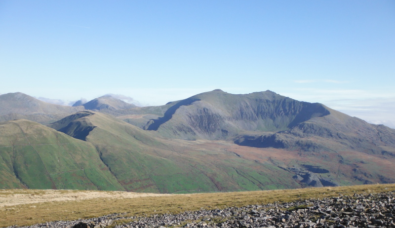
To the left of Snowdon, Glyder Fawr just has a whisp of cloud beside it. Looking a bit further round to the northeast the Glyders are quite pronounced - on the left is Elidir Fawr, in the middle is Y Garn, and on the right is Glyder Fawr.
In the lower part of the picture is the northwest ridge down from Snowdon that continues on from Clogwyn Du´r Arddu - Moel Eilio hasn`t made it into this picture, the three summits that are visible are I think Foel Gron, then Foel Goch, and Moel Cynghorion.
Away at the back, the Carneddau were mostly in cloud all day.
Just to the side of Glyder Fawr you can see Tryfan desperately trying to shake off the cloud - it never succeeded all day.
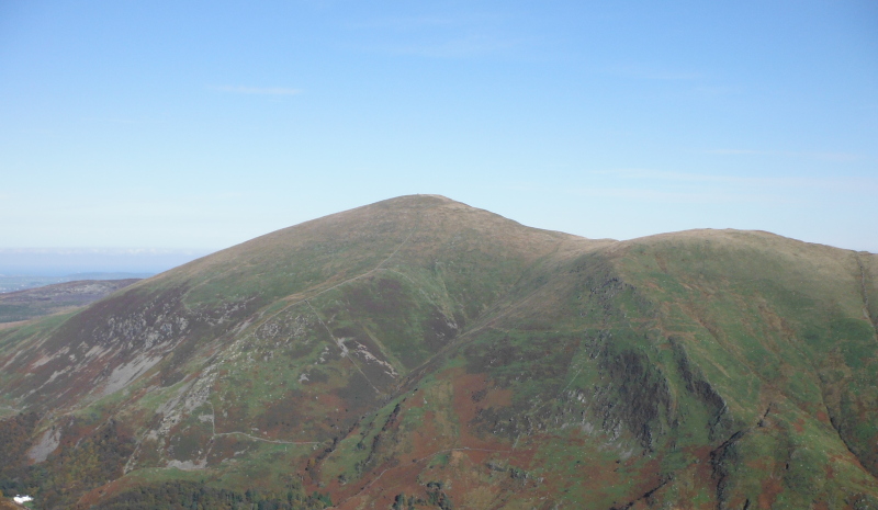
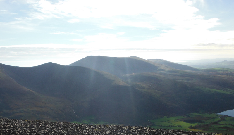
Just so it doesn`t feel left out, here is Moel Eilio.
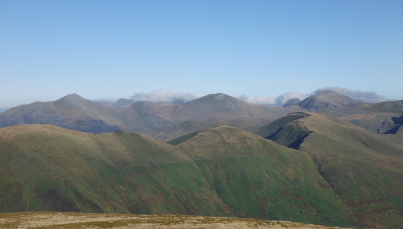
Round a bit to the right of Snowdon is Yr Aran, and beyond it lies the Moelwyns - or more correctly - the Moelwynion.
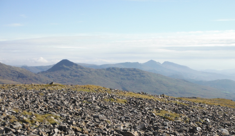
I haven`t worked out for certain which mountains these are, as I haven`t met the Moelwynion before, but I think what we are seeing in this long focus view is the long ridge of Cnicht, then Moelwyn Mawr, and then Moelwyn Bach.
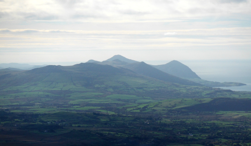
Away to the southwest, the Lleyn Peninsula was enjoying the same good weather - this is looking down past Craig Cwm Silyn and then Mynydd Graig Goch - away in the distance I think we are seeing the St Tudwal`s Islands - and over on the right is Bwlch Mawr and Yr Eifl.
I can`t help it, I just love these hills in a close-up view -
I spent quite a lot of time on the summit of Mynydd Mawr taking far too many pictures, but I had plenty of time, so I headed off down the lower summit which I think is called Craig Cwmbychan - but that name may actually refer to the cliffs to the north, rather than the summit itself.
You are standing right above some fairly major cliffs that drop right down to the valley below Llyn Cwellyn, and Moel Eilio is very close.
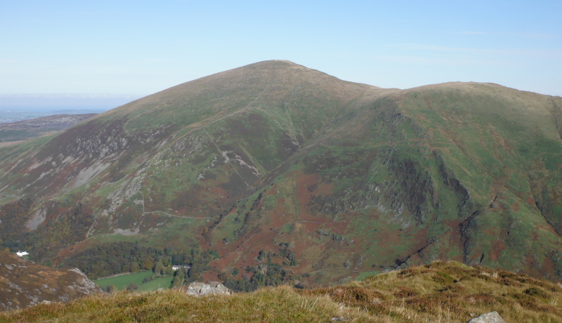
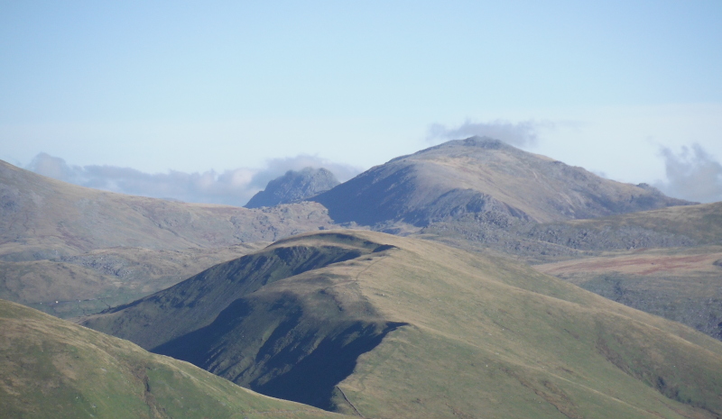
There was a rather interesting view across Cwm Planwydd to the summit Foel Rûdd which lies atop the crags Craig y Bera - the whole Mynydd Mawr block is a big U-shaped hill with the two ridges forming the legs of the U.
Beyond Foel Rûdd is part of the Nantlle Ridge, and away in the distance is Moel Hebog, the highest summit in the Eifionydd.
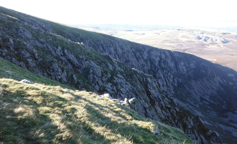
On the way back up to the summit of Mynydd Mawr I didn`t follow the main path, I headed off to the right to have a look at the cliffs Craig Cwm Du which dominate the north side of the Mynydd Mawr block.
They aren`t perhaps the most dramatic cliffs you have ever seen, but quite imposing all the same.
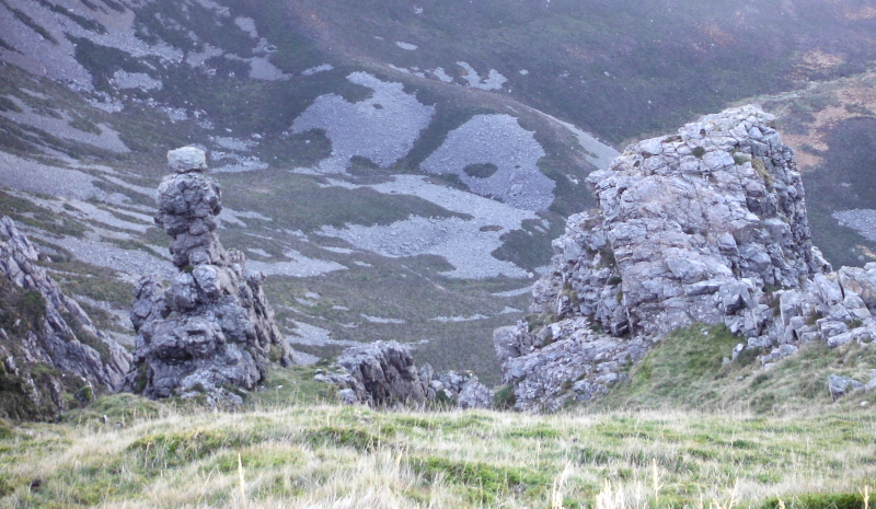
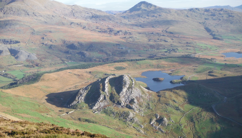
At one point I looked down and saw a rather distinctive pillar sticking up from a gully - it doesn`t stand out too clearly in the photo, it is in the lower right corner.
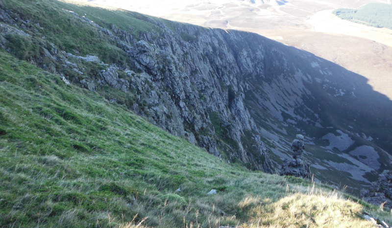
This is looking down the gully towards the pillar, and to a bigger lump on the right - the climb up to the top of the right hand lump was easy enough, but the somewhat female shape of the pillar with a small waist and a much larger upper part meant there were two significant overhanging bits - so they somewhat cooled my enthusiasm.
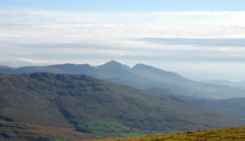
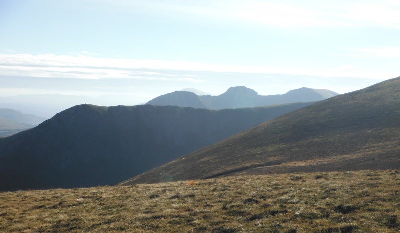
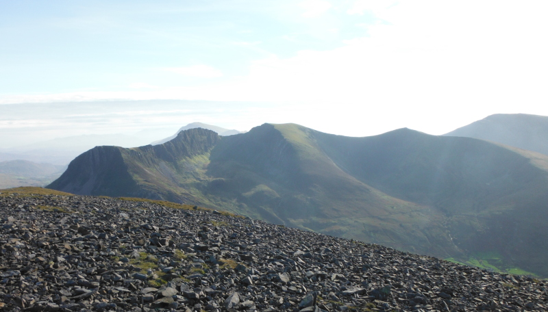
Back up on the summit of Mynydd Mawr, and looking down on the ridge heading along to Foel Rûdd, with Snowdon and Yr Aran in the background, and the Moelwynion in the distance.
By now the sun had gone around sufficiently that I could get some decent pictures of the Nantlle Ridge without a massive flare - so this is looking across to the Nantlle Ridge - on the left is Y Garn, then Mynydd Drws-y-coed, then Trum y Ddysgl, and finally Mynydd Tal-y-mignedd.
Not quite making it into the picture is Craig Cwm Silyn.
Further round, and here is Craig Cwm Silyn and Mynydd Graig Goch, with the Lleyn Peninsula just off to the right.
Heading along the ridge to Foel Rûdd, and there is an amazing view across to the Nantlle Ridge - in particular to Mynydd Drws-y-coed - what an impressive ridge of rock - maybe there is an easy way to get past it on the far side, but I wonder if you can go right over the top.
Now heading back down the ridge below Foel Rûdd, and looking down on the rather curious Clogwynygarreg - I climbed up it and down the other side - even got a tiny bit of scrambling to get to the top.
An interesting end to an excellent day out.
website design by ron-t
website hosting by netnerd.com
© 2025 Ron Turner
![]()
![]()