Wales - 2014
17 September 2014 ........... Y Garn and Elidir Fawr
One of the routes I have wanted to do ever since I first climbed Y Garn some 18 months ago was to go right down the ridge to the northwest of Y Garn, up above Nant Ffrancon.
After my last and rather wet trip up Elidir Fawr I finally worked out a way of doing a horseshoe round Y Garn, this ridge, and Elidir Fawr.
Unfortunately it didn`t really go according to plan.
The plan was to start from the east end of Llyn Peris, head up to Y Garn, then go anticlockwise around the horseshoe, eventually dropping down to the east end of Llyn Peris again.
It was a good theory, however I got bogged down in access problems - I`ve been in Wales for nearly two years now, and I still have no idea how access works, what paths you can go up and what you can`t - and everyone I ask about it gives a different response - even people who live in Wales don`t understand the access situation.
Looking at the map, there are one or two ways to get away from the A4086 and onto the lower flank of Y Garn - but they all seem to go right past houses, or through farms, and I have no idea if they are useable.
The Welsh government proudly boasts on its website that there is a public right of access to 20% of Wales.
That means there is no public access to 80% of Wales !
So the reality is that if people want to access the countryside - mountains, rivers, sea cliffs, etc - they are better off going to Scotland rather than Wales.
What a ridiculous situation for a country that is so dependant of tourism.
The Scottish Access legislation came into effect on 09 February 2005 - nearly ten years later Wales still lives in the dark ages.
In the end, I went up the track that leads up into Dinorwic Quarry, then after a few hundred metres, cut off, and headed northeast around the bottom of the spoil heaps.
It turned into a nightmare with thick foliage, brambles, and 2 metre high bracken, and all the time I was climbing over big blocks of slate that had dropped from the sky after blasting.
So it took an awfy long time to cover very little distance.
Every now and then I came to a path, but they never went in the direction I wanted to go, so were not much help.
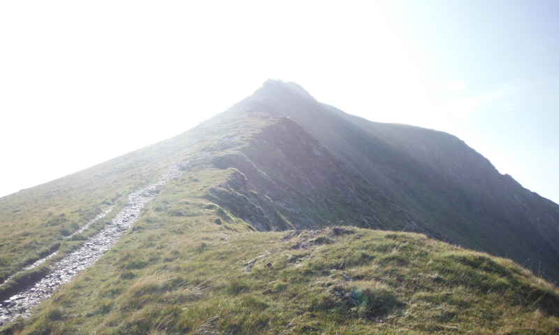
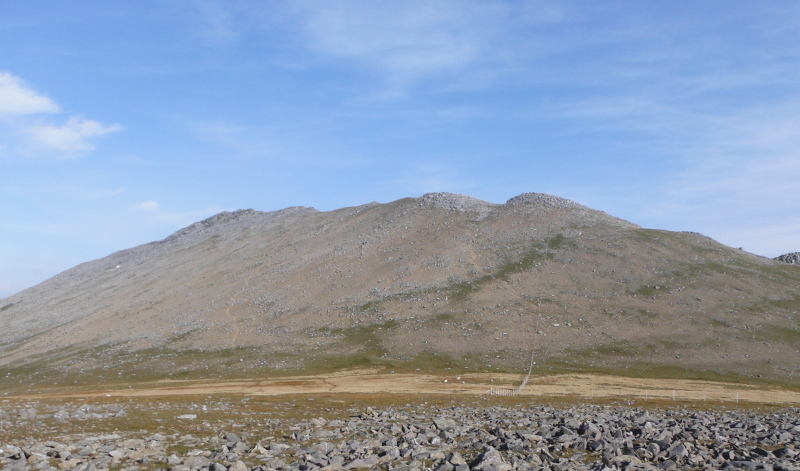
I am still not sure how I got to this point, or even where it is - I think it is the lower end of the ridge that runs between the Afon Dudodyn and the Afon Gafr - but it did provide a nice view across to the twin peaks of the Tryfan that is part of the north ridge of Snowdon.
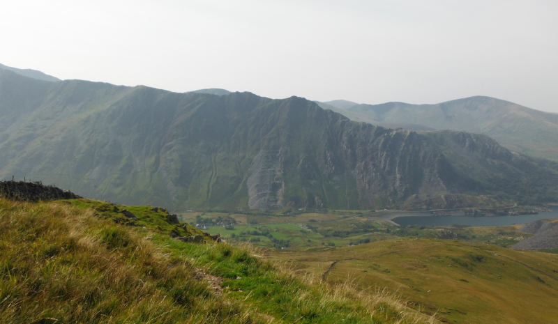
This is looking across Llyn Peris past the spoil heaps, and just a wee bit of Llanberis is showing.
From there to the top of Y Garn was the most tedious climb I have ever done - it is an absolutely constant gradient that is too steep to walk comfortably up, but not steep enough to go into four wheel drive mode, and it took me and hour and a half to get to the top of Y Garn.
It was soul destroying, and a huge relief when I finally got there.
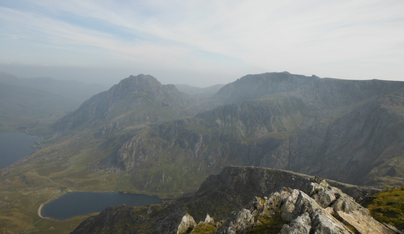
Y Garn is a bit separated from the rest of the Glyders, so is a good vantage point - this is looking across to the rest of the Glyders, in particular, Tryfan, Glyder Fâch, and the Y Gribin ridge.
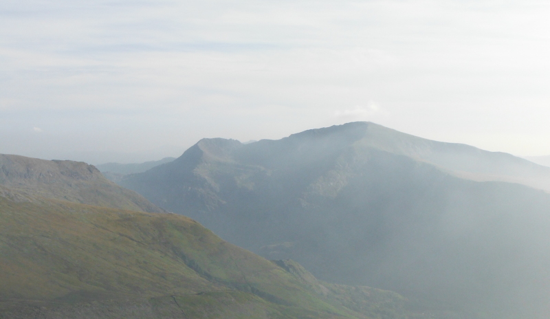
Round a bit, and Crib Goch, Garnedd Ugain and the north ridge of Snowdon are in view - Snowdon itself is just peaking over Garnedd Ugain.
Round a bit more, and this is looking right down the Lleyn Peninsula to I think Bwlch Mawr - I still haven`t quite worked out what mountain is what down the Lleyn Peninsula.
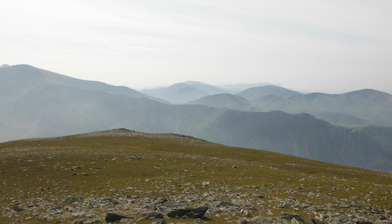
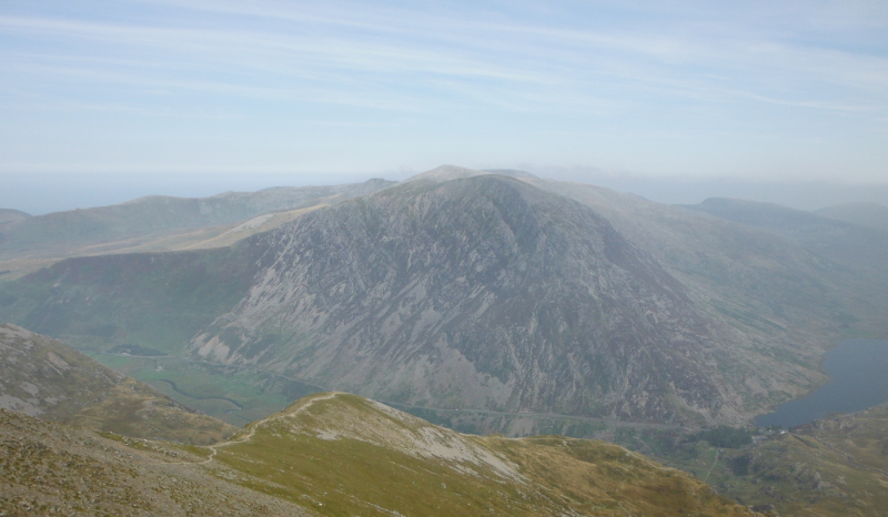
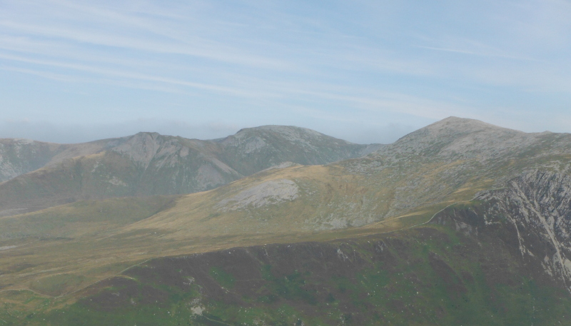
Round again, and looking across to Pen yr Ole Wen and the Carneddau - they don`t really show too well from Y Garn, as you are looking right along the spine of the Carneddau.
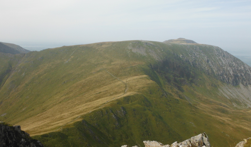
And here is the way ahead - much more interesting than the slog up Y Garn - looking right down the ridge past Foel-goch, Mynydd Perfedd, to Carnedd Filiast, with Elidir Fawr off to the left.
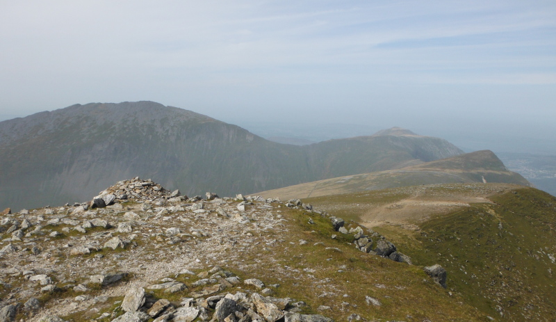
Some time later, and I`m now on Foel-goch, looking back up the ridge to Y Garn, with Glyder Fawr in the background.
Looking forwards again, up to Mynydd Perfedd, with Carnedd Filiast just showing, and round to the left is Elidir Fawr -
Now as you can see in those pictures, the main path doesn`t go up to Mynydd Perfedd, it curves off to the left and heads for Elidir Fawr.
It seemed a shame to miss it out, so I headed up to Mynydd Perfedd - this is on Mynydd Perfedd, looking back to Foel-goch, then Y Garn, with the rest of the Glyders in the background.
Now if you look at a map, it is quite clear that going across to Carnedd Filiast is a no-no if you want to go to Elidir Fawr, and I swithered as to whether to do it or not.
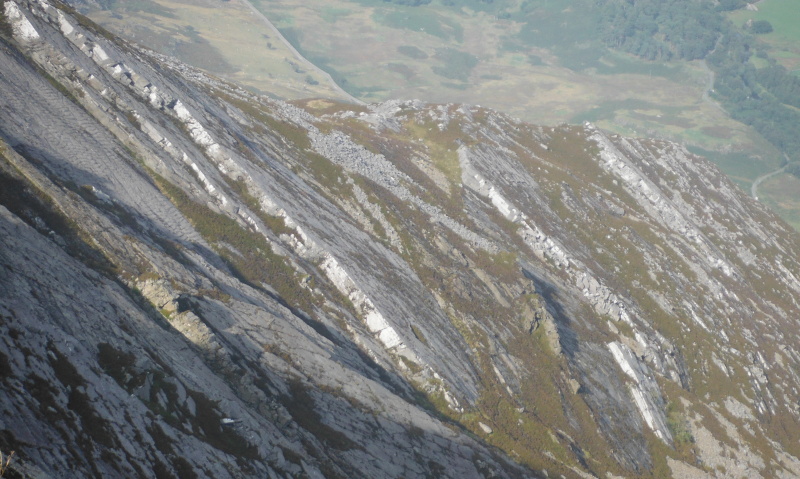
Eventually I decided to go, and I am so, so glad I did - once you are over the wall, you come across a most amazing rock formation on the east side of Carnedd Filiast - this is a wider view of it -
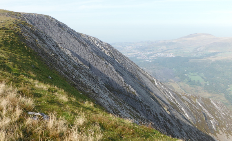
The upper part has a series of absolutely uniformly spaced grooves for tens of metres down the face - what on earth would cause these ?
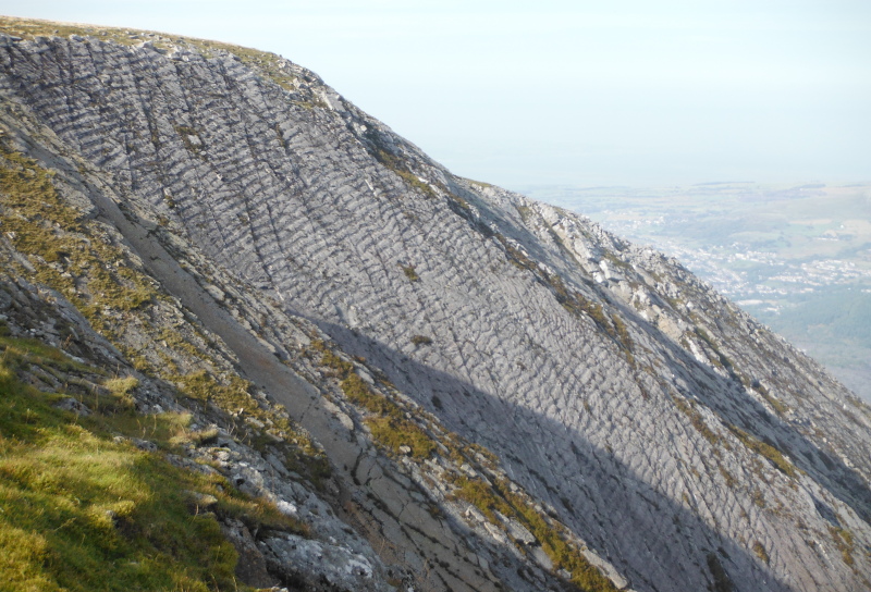
The lower part of the rock face has these giant edges - I have no idea if you could climb up to them, they would be fascinating to go and visit.
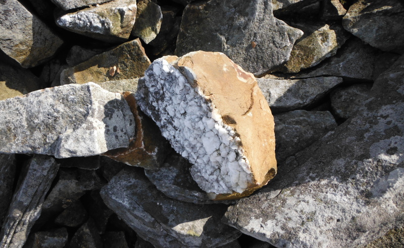
I also found another geological oddity - in amongst some completely different kinds of stone, I found this rock fragment - a layer of quartz stuck to what looked like sandstone.
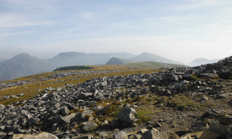
Even more than Y Garn, Carnedd Perfedd is quite isolated, so provides a good viewpoint in all directions.
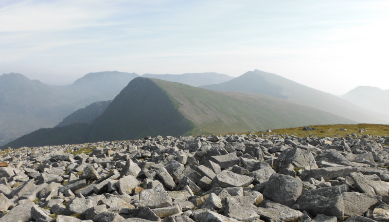
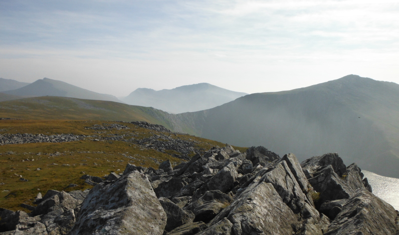
This is looking back right up the whole length of the ridge to Y Garn, with the whole of the Glyders in the background.
Because it is quite far north, it is almost broadside on to the Carneddau - this is looking across to Yr Ellen, Carnedd Llewelyn, and Carnedd Dafydd, and almost into the horseshoe that these summits enclose.
And looking across to Elidir Fawr -
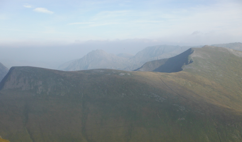
Round a bit to the left, and we can see the high level horseshoe that connects Carnedd Filiast with Mynydd Perfedd and with Elidir Fawr.
Of particular interest is the low point of the ridge that connects Mynydd Perfedd with Elidir Fawr - it is quite steep on the other side as well.
So does it qualify as an arête ?
Here is a closer view - it is still debatable whether it qualifies as an arête.
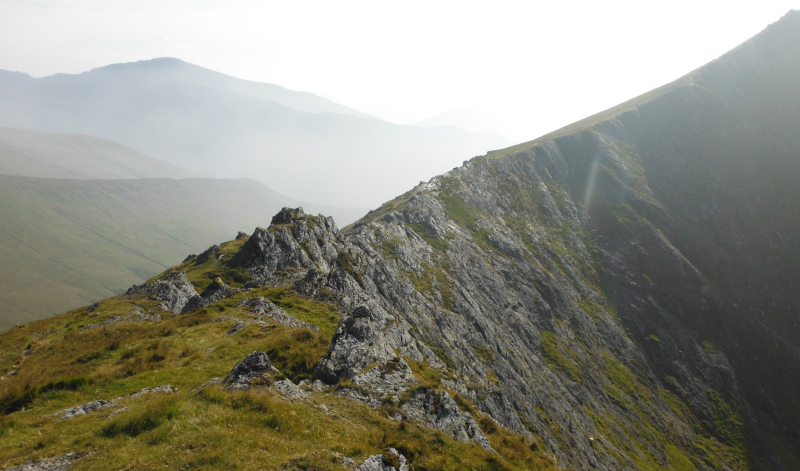
Now there is a path on the other side - in fact there are two, a low one and a higher one - however I climbed right along the crest of the ridge.
So I made this decision - if you climb right along the crest, it is an arête - if you follow the paths, it is just a ridge.
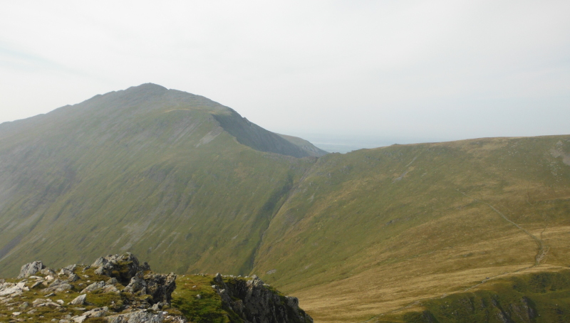
Across the arête, and looking up to the summit of Elidir Fawr - good fun !
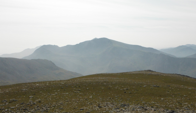
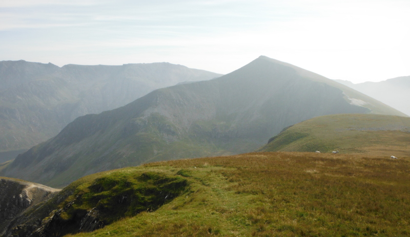
Elidir Fawr is well away from other summits, so provides good views - looking across to Crib Goch, Garnedd Ugain, and Snowdon`s north ridge.
Looking across to almost the whole of the Glyders - Foel-goch, Y Garn, Tryfan, and Glyder Fâch.
And look at the huge bank of cloud sitting a bit further over to the east - it was there when I got to the top of Y Garn, and I thought that it would come over, and I would disappear into it.
However it didn`t, it stayed over in the east, and I had sunshine for most of the day.
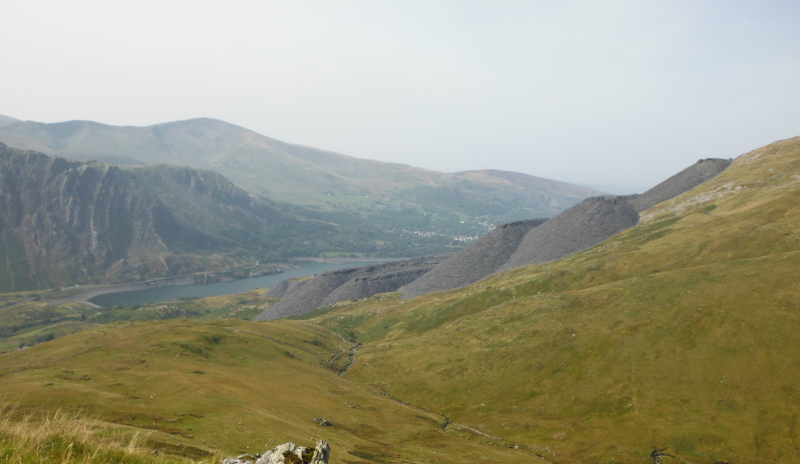
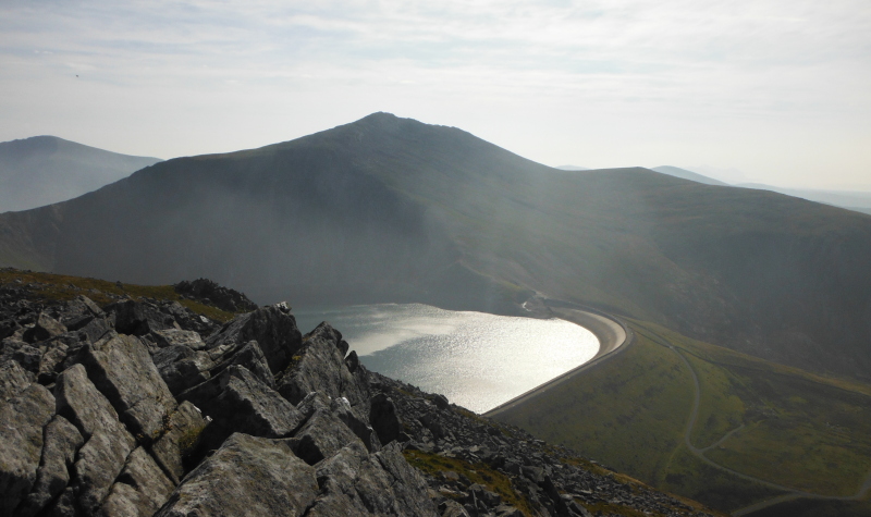
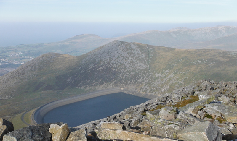
Looking back to Carnedd Filiast across the reservoir -
Now I had to work out how to get down again to the east end of Llyn Peris - there was no way I was going back the way I came - I actually worked out my route back down quite early on - there is a road that circles around the west side of Elidir Fawr - it is something to do with the hydro scheme - and it goes right down into Dinorwic Quarry, and somewhat vaguely joins up with the track that heads right through the quarry, from Nant Peris to Dinorwig.
So that would be my route back.
The best way to get to it is to drop down from Elidir Fawr to Elidir Fach, and from Elidir Fach it is just a short drop down to the road.
However Elidir Fawr is a long ridge, and it is quite good fun to follow the ridge over all the ups and downs - some of the tops are big mounds of rocks, so they can be quite scrambly to get up and over.
Here is the ridge of Elidir Fawr, looking back up from Elidir Fach.
A short drop now down to the road, and then easy walking all the way back to Nant Peris.
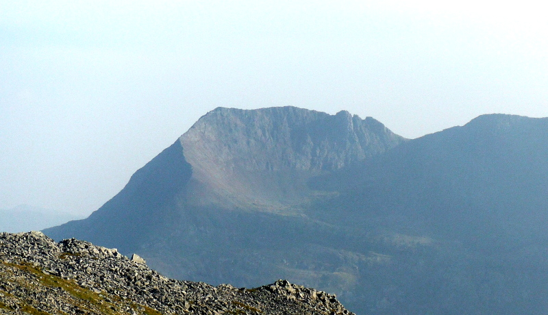
But first, how about this for a view of Crib Goch, taken from Elidir Fach -
website design by ron-t
website hosting by netnerd.com
© 2025 Ron Turner
![]()
![]()