Wales - 2014
03 September 2014 ........... The northern Carneddau
After several days of off and on rain, there was a good forecast for the day, so it was time to see if I could tick off some more of the furths in the Carneddau.
From a distance, the Carneddau seem to be a fairly long range of fairly rounded hills, so I anticipated some easy going ridge walking - what I didn`t expect to get was some most stunning views of hanging valleys, precipices, and ridges that would give Crib Goch a run for its money.
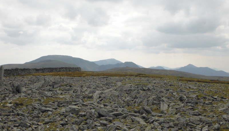
I headed off up a track that headed east away from the top end of Bethesda, then turned off the track to the south, down across an interminable bog, to reach the Afon Caseg.
Because of the previous spell of wettish weather, there was quite a lot of water in it, and could find no way to cross it without getting wet - eventually I did what you should never do - especially on assessments - boots off, socks off, splash splash across.
Why do assessments - or assessors - take such a delight in making you miserable - you get very wet boots and socks which you then have to live with for the rest of your day, week, whatever - when all it takes is a couple of minutes getting wet feet, then putting dry socks and boots back on again ?
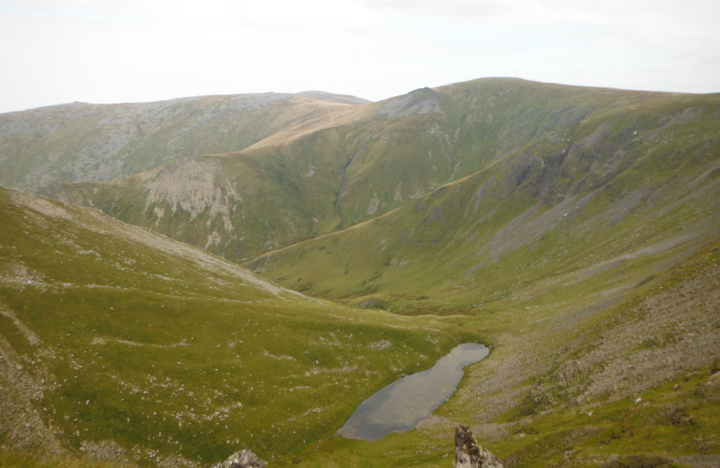
More bog, then eventually I started to ascend up the west ridge of Yr Elen - this is looking up the ridge past Foel Ganol towards the summit -
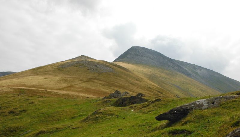
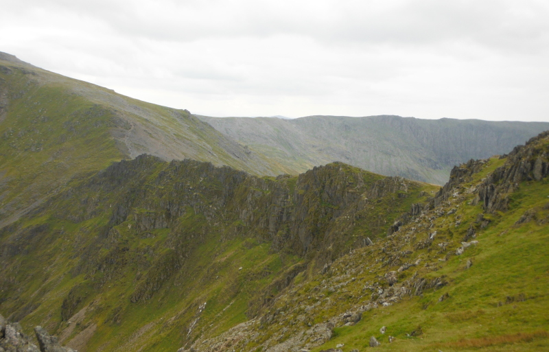
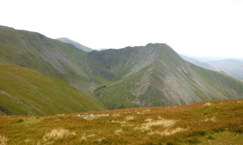
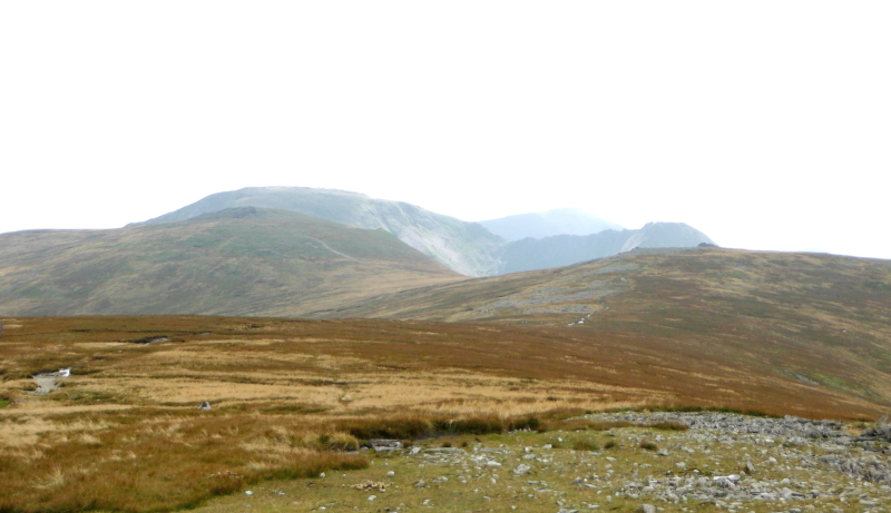
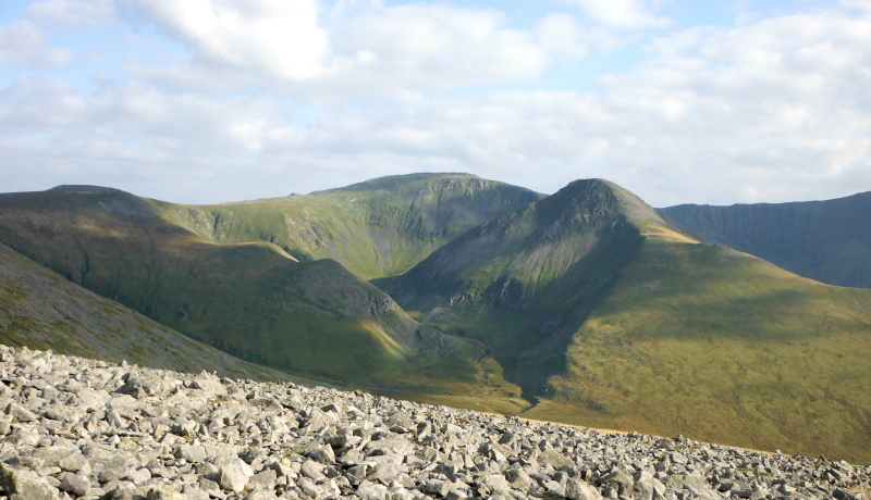
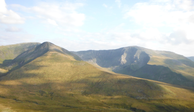
Quite quickly as you head up the ridge you start to get fabulous views across to Carnedd Dafydd and beyond - and the north side of Carnedd Dafydd is amazingly rugged - with a lovely example of a hanging valley and a classic double escarpment with an edge that the mountain gods could cut themselves on.
In the background, you begin to see the Glyders - Y Garn, Foel-goch, Mynydd Perfedd, with Elidir Fawr at the back.
The summit of Yr Elen - with a beautiful flake of rock sticking up -
Yr Elen connects to Carnedd Llewellyn with a rather fine looking jaggy ridge - sadly, the other side is a lot less steep, so it isn`t difficult walking.
If you look carefully, you can just see what I think is Glyder Fâch beyond the ridge that curves round between Carnedd Llewellyn and Carnedd Dafydd.
This is looking beyond the jaggy ridge up to the summit of Carnedd Llewelyn -
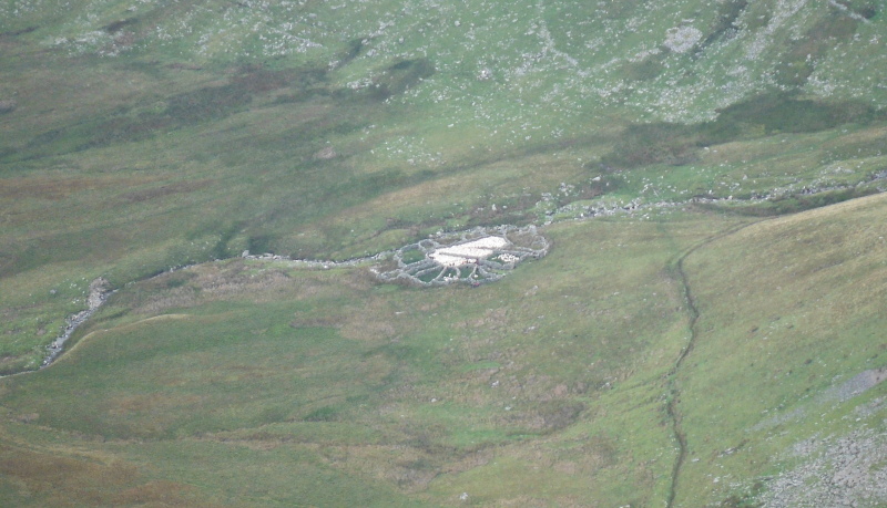
Up on the ridge, I was far above the Afon Caseg, and looking down I could see some strange stone construction beside the river - I couldn`t work out what it was.
At first I thought it was some kind of settlement tanks for a quarry or mine that might have existed at one time, but after a while I heard a dog bark coming from it - and realised that the white things were sheep - it is a sheepfold, and they were separating out the sheep.
It is actually much clearer in this photograph than it was in real life.
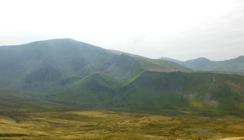
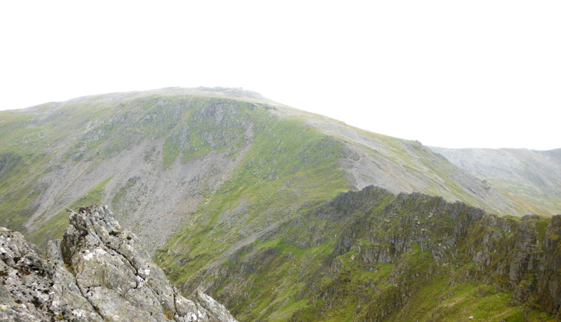
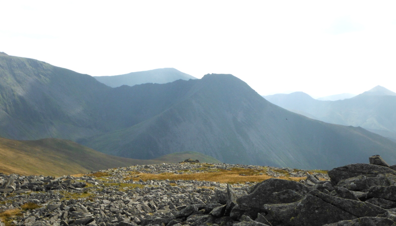
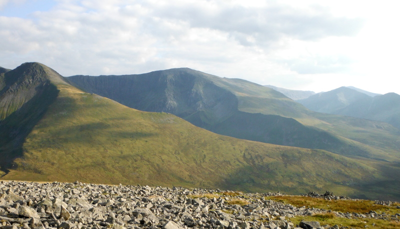
This is looking across to Carnedd Dafydd - surprisingly precipitous, with a sharp ridge running down - all quite unexpected kind of scenery.
Looking in the opposite direction over the top of Cwm Caseg towards Foel Grach, with a beautifully even slope running right up onto the ridge.
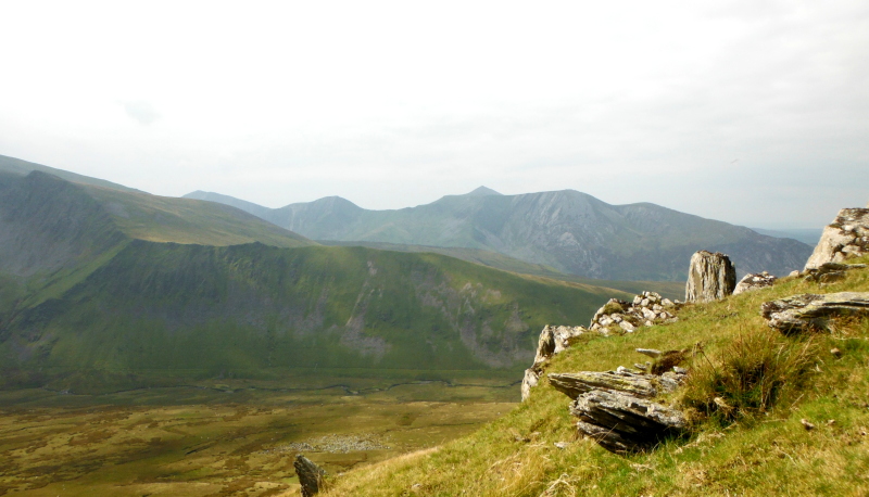
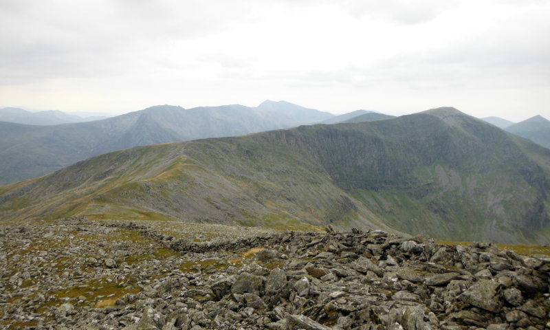
I headed right up to the far end of the ridge that forms the summit of Carnedd Llewelyn - this is looking southwest from Carnedd Llewelyn along the curved ridge to Carnedd Dafydd, with the Glyders in the background, and I think Snowdon away in the distance.
This is looking southeast over to Pen yr Helgi Du and Pen Llithrig y Wrach -
This is looking north up the Carneddau - Foel Grach, then Carnedd Uchaf ( or Carnedd Gwenllian ) and then Foel-fras.
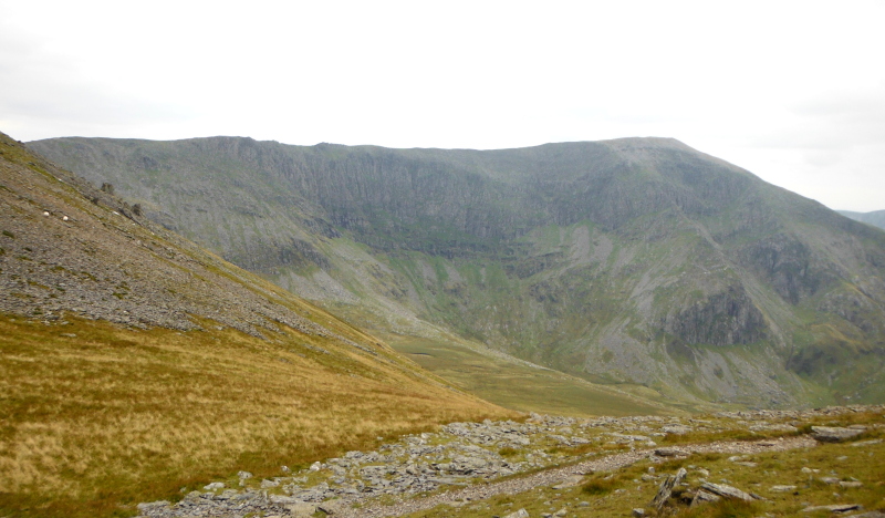
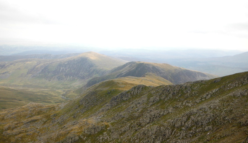
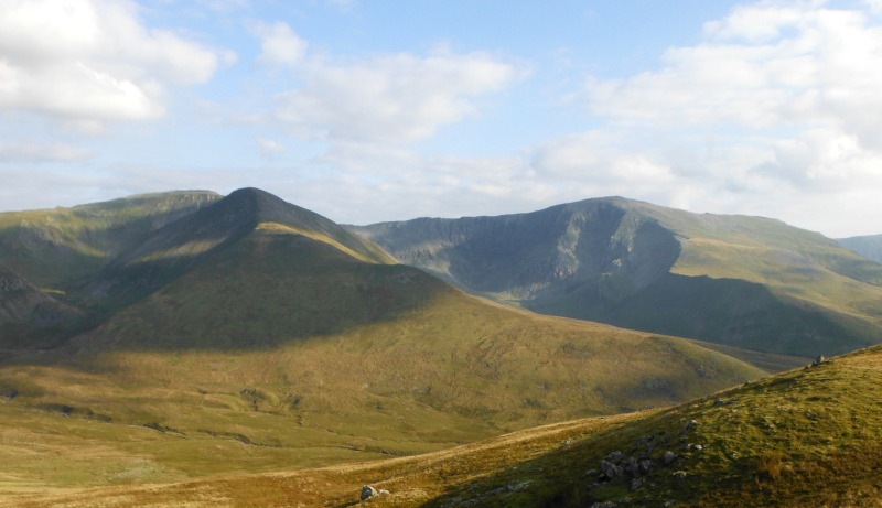
Heading over to Foel Grach now, and looking back at Yr Elen, there is another impressive ridge - it would be an interesting route up to Yr Elen.
It is facing northeast - I wonder what it would be like in winter with snow on it.
On the summit of Foel Grach - and now I had a problem - and I still do.
I can`t reconcile what I could see in front of me and what I can see in this picture - with what the OS maps show. They just don`t agree.
Neither the Explorer map, nor the Landranger map - nor the Harvey`s maps either !
The OS maps show two paths, the Harvey`s maps show three paths - which is correct, there are three.
But all the maps show Carnedd Uchaf lying in the V between the paths, whereas I see the summit of Carnedd Uchaf lying over to the right of all the paths.
So I don`t know what is going on - lot`s of people have gone this way before - does anyone want to tell me if I`m going gaga ?
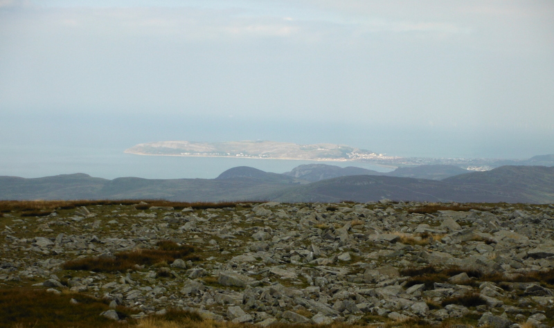
On the summit of Foel-fras now, and looking down on Llandudno and the Great Orme in sunshine.
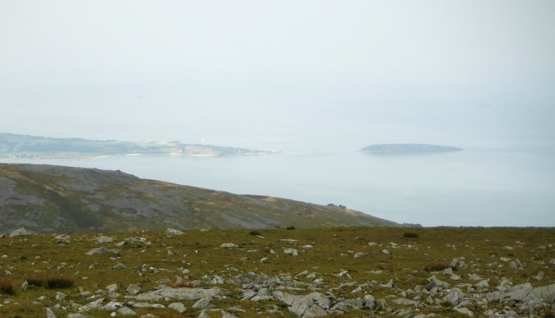
Looking down on Penmon and Puffin Island - not quite so sunny.
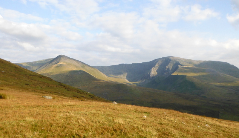
Looking south and southwest back down the Carneddau - Foel Grach, Carnedd Llewelyn, Carnedd Dafydd, Yr Elen, Elidir Fawr, and just a hint of the hills down the Lleyn Peninsula.
Because it is a rather flattish summit, you get a better view of the Carneddau as you head back - and you get a much clearer view of Carnedd Uchaf - it is quite obvious that that is what it is.
Back on Carnedd Uchaf - or Carnedd Gwenllian - looking across to Yr Elen, and you get a good idea from here of just how sharp that northeast ridge is.
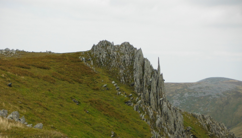
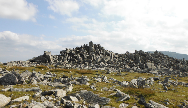
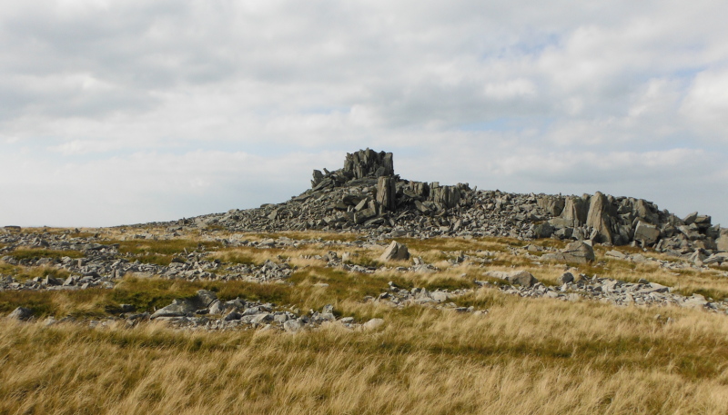
The summit of Carnedd Uchaf is a big pile of quite large boulders, which makes it interesting scrambling to get to the summit.
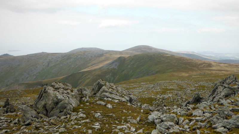
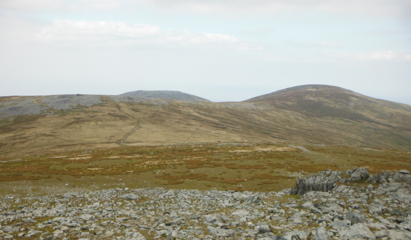
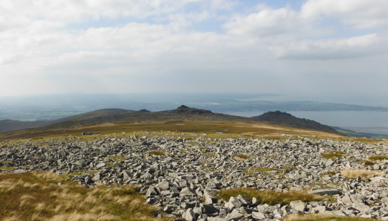
Looking right down the west ridge of Carnedd Uchaf - the rounded summit on the left is Drosgl, Bera Bach is the rocky summit in the middle, and Bera Mawr is the big rocky mound on the right.
My route back down to the real world was down this ridge, first stop was Yr Aryg - another rocky outcrop - this is it.
Again, a bit of a scramble to get up it, but the top is a completely flat rocky table of a few square metres in area.
Excellent, I thought, I can sit here and have a teabreak, and enjoy the view across to Yr Elen and Carnedd Dafydd.
Not for long I didn`t - within minutes I was under attack by a cloud of insects - I don`t know what they were - they had stripes like wasps, but they buzzed around like flies - and they made it very clear that I was not welcome.
I fled !
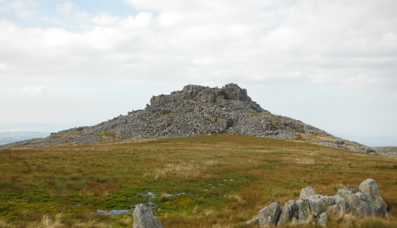
I detoured slightly from my route down the ridge to go across to Bera Mawr - again some interesting scrambling to get to the top.
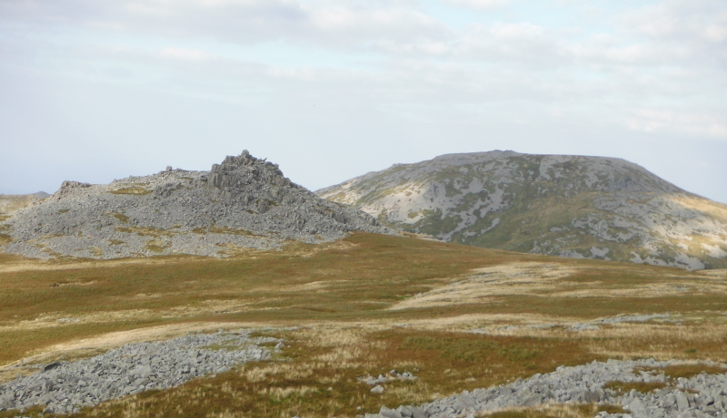
Then across to Bera Bach, the other rocky outcrop - this is looking back from Bera Bach to Bera Mawr
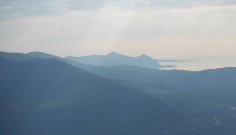
Bera Bach also opened up some fabulous views across to Yr Elen, Carnedd Dafydd, and the Glyders, and also right down the north coast of the Lleyn Peninsula.
And now I have a problem, because all the way down the ridge I was taking more and more pictures - it was a beautiful late afternoon / early evening, there was a lovely diffused and broken low angle sunshine producing fabulous views, and I was on a high after a superb day.
So I don`t know from where I took all these pictures - all I can say is that they were from somewhere up on the ridge.
Some would be from Bera Bach, some would be from Drosgl, which provided a very good viewpoint, and anywhere else as well.
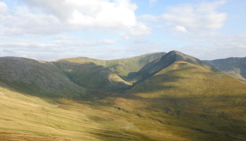
Here are a few of Yr Elen and Carnedd Dafydd - as I descended down the ridge, I sort of rotated around Yr Elen, so the angle of view is constantly changing.
A bit further down now,
I think these were taken from Drosgl, which provides a very good viewpoint.
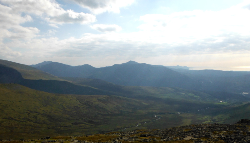
This is the view looking across to the Glyders, and right down the north coast of the Lleyn Peninsula, certainly as far as Yr Eifl, and I think as far as Trwyn Porth Dinllaen.
I think these two were taken from Bera Bach - the first one is a wider view, and the second one is a long focus view - I love the effect you can get with a long focus view - it doesn`t always work, sometimes it does.
Further down the ridge -

Away down the ridge now, and a last look back at Yr Elen and Carnedd Dafydd, and down the Lleyn Peninsula.
Almost the end of a fabulous day, with my last four furths now done.

website design by ron-t
website hosting by netnerd.com
© 2025 Ron Turner
![]()
![]()