Wales - 2014
07 August 2014 ........... The Carneddau
For days the weather forcasters had been predicting that wet and windy weather was just around the corner, but it just didn`t happen - the sun just kept on shining.
Eventually they had to admit that a ridge of high pressure had arrived, and it was going to be a very hot day, with a high risk of sunburn.
They didn`t get that right either, it was actually quite hazy and at times with a freezing cold wind, though for the first half of the day it was very pleasant.
So I reckoned it was time I went to say hello to the Carneddau, a part of Snowdonia I haven`t been to yet.
I parked in the mile long carpark to the east of Llyn Ogwen, and headed up the path northwards, then turned and headed up the ridge to Pen yr Ole Wen.
This ridge had a few benefits - firstly it is quite steep in places, so I got a bit of scrambling, which makes a change from a long uphill plod.
Another advantage was that because it was quite steep, as I climbed upwards my head was not too far from the ground in front of me, and I realised that the bilberries were fruiting, so I munched my way up the ridge.
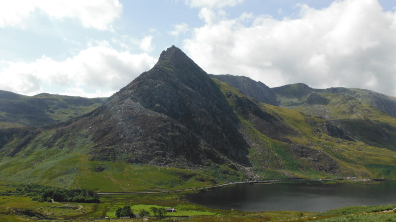
Another advantage is that when you stop for a breather, you can turn round and get a fabulous view of the north ridge of Tryfan - what an amazing ridge it is.
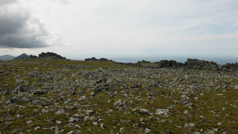
I wandered around a bit up on Pen yr Ole Wen, so there was a bit of variety in the places I took these pictures from, and also in the lighting.
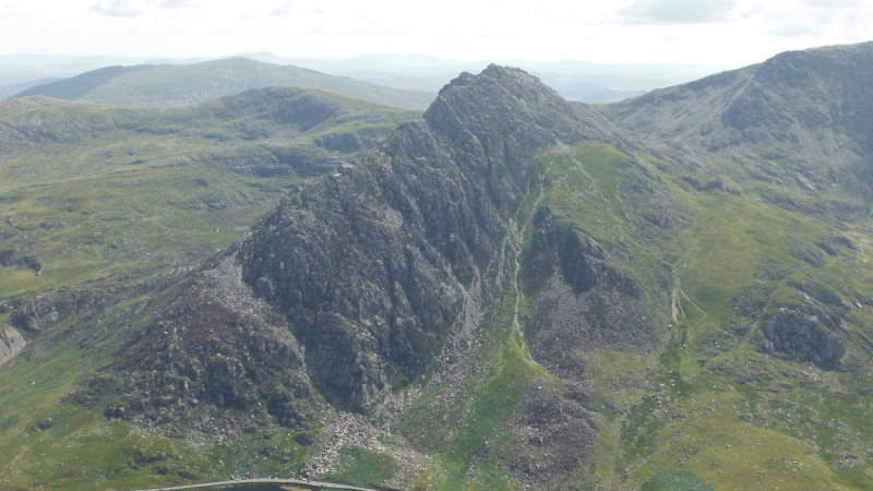
Here is another view looking down on Tryfan, with the sun now shining on the west side. The picture shows quite clearly a path going up the gully just at the foot of the west face of Tryfan - I have come down this path, and I definitely do not recommend it - especially going down.
Unless you are trying to get to the west face, the path further over to the right is a much better option.
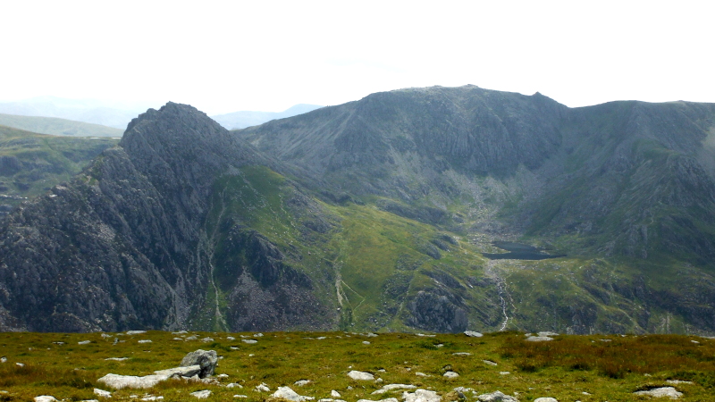
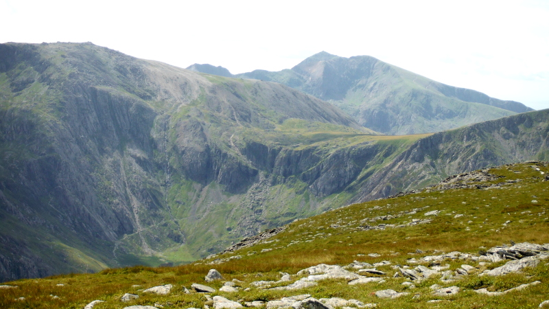
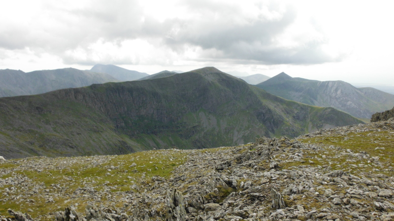
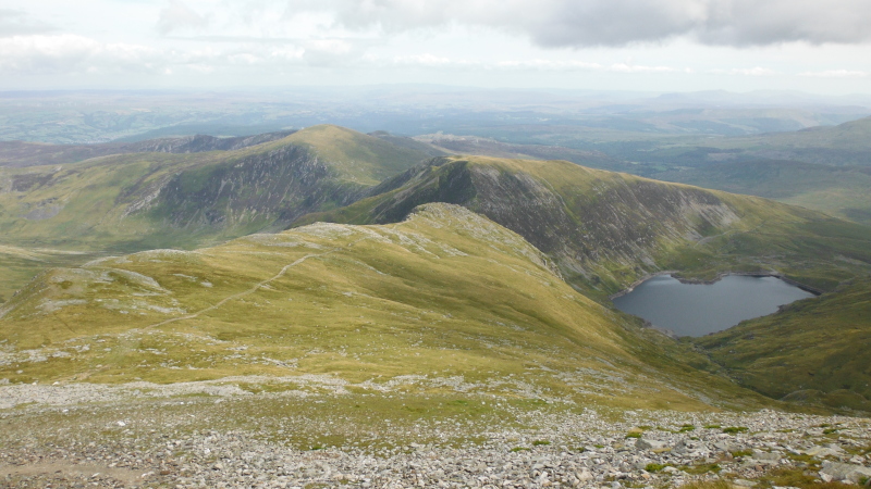
A bit round to the right, and we are looking in towards Llyn Bochlwyd, with Glyder Fâch in the background, with Bristly Ridge just left of centre.
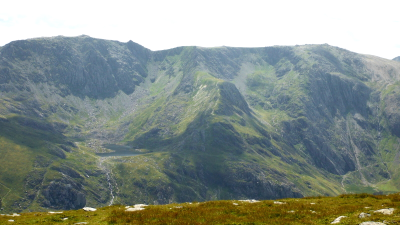
Further round to the right, and the ridge Y Gribin separates Llyn Bochlwyd from Cwm Idwal.
The initial descent down Y Gribin is to the right of the crest of the ridge, and is very steep with a loose surface, and I found it easier to leave the path, and come down nearer the crest of the ridge. Once past that initial steep bit, the rest of the descent is straightforward.
A bit more to the right, and the paths into Cwm Idwal are quite clear in this picture.
The Idwal Slabs and the Idwal Staircase are just to the left of centre in this picture, and the Devils Kitchen is a bit over to the right, though not very clear in this picture.

Here is a closer view of the Devils Kitchen, with the line of big stone blocks leading up to a deep gash in the cliff.
I believe the gash can be climbed, however I think you are climbing up a water fall, so getting somewhat wet seems inevitable.
The normal path lead ups to the left of the gash, it is rather steep, and climbs over biggish boulders, so it is hard going.
There is also a route of some kind up the narrow sloping shelf to the right of the gash - it is known as Sheep Walk.
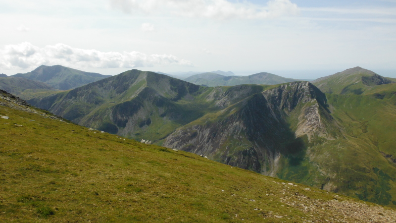
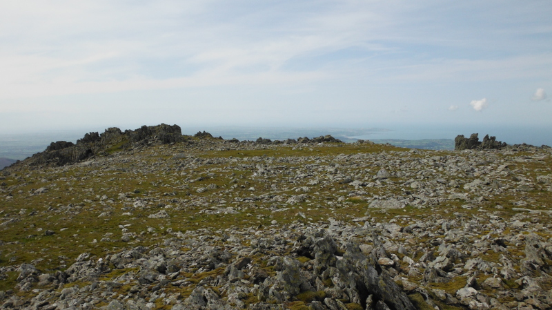
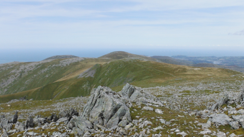
From up on Pen yr Ole Wen you also get a good view looking across to the very angular shapes of Y Garn and Foel-goch, with a backdrop of Snowdon on the left, Elidir Fawr on the right, and right down the Lleyn Peninsula in the distance.
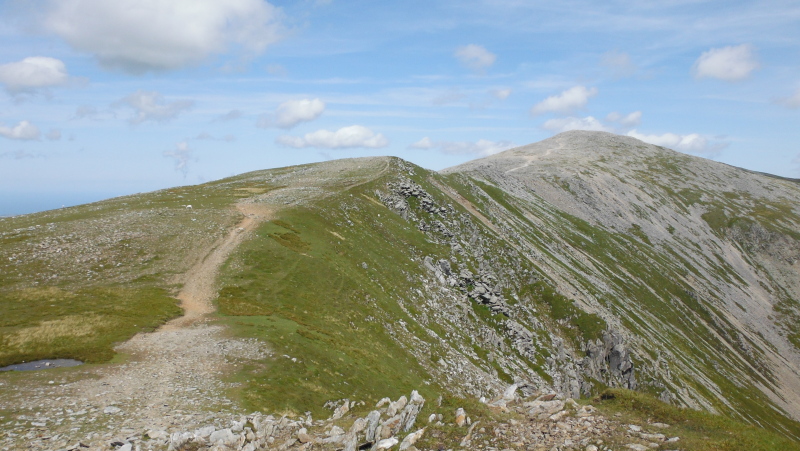
Time to head off, this is looking up the easy looking ridge up past Carnedd Fach to Carnedd Dafydd - it is an easy walk, and didn`t take too long.
Carnedd Dafydd is a bit higher up than Pen yr Ole Wen, so the views open up a bit - this is looking back towards Pen yr Ole Wen, beyond that is Y Garn and Foel-goch, then Snowdon and Elidir Fawr again, and more of the hills down towards the Lleyn Peninsula.
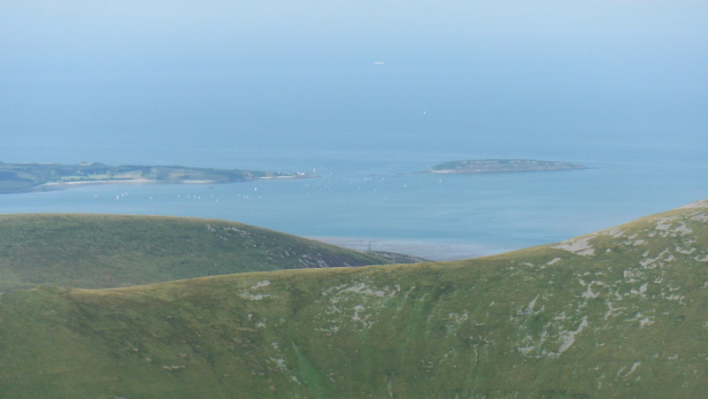
The views have also opened up to the north - looking over more of the Carneddau, across the Menai Strait to Penmon at the south east tip of Anglesey, and Puffin Island.
Looks like there is a sailing event on the left side of the picture.
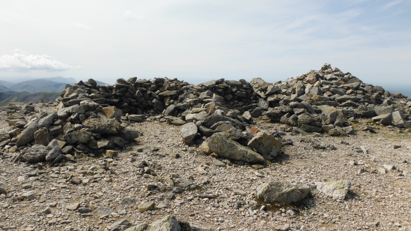
There are several semicircular stone shelters on the summit of Carnedd Dafydd facing in various directions - here is a His and Her pair facing roughly north or northeast.
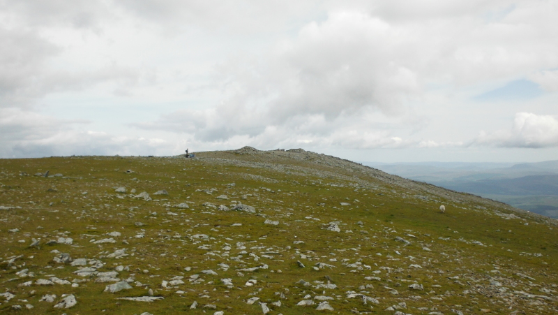
It looks to be another easy ridge walk across to Carnedd Llewelyn - it actually took me a lot longer than I expected - maybe I was getting weary, but much of the top of the ridge is made up of chunky broken rocks, which made for slow going.
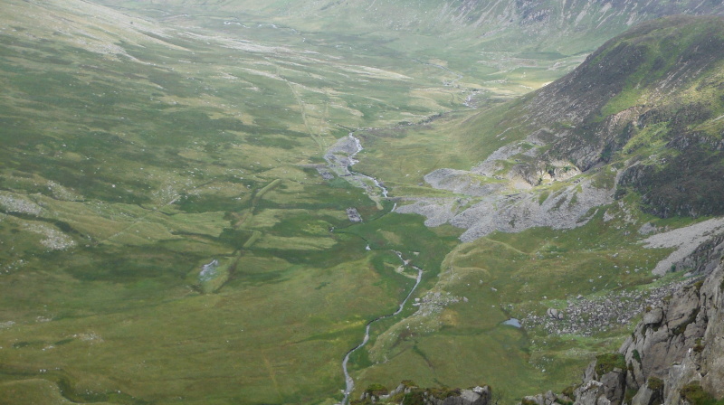
I think the path actually goes further to the southeast, but if you follow the path, you miss all the views to the north and west which would have been a shame, as it is quite an impressive drop down to the northwest.
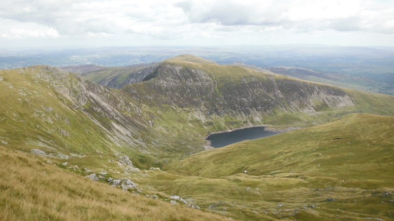
Heading up the ridge, and you get a good view looking across the reservoir to Pen yr Helgi Du, with Pen Llithrig y Wrach just visible behind it.
Up on the summit of Carnedd Llewelyn now, and I still don`t know where the actual summit is - the top is a big rounded area with lots of rocky outcrops -
It is possible that this is the highest point - a rather indistinct smooth knoll at the east end -
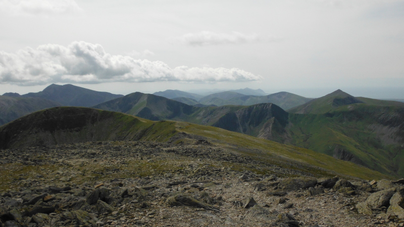
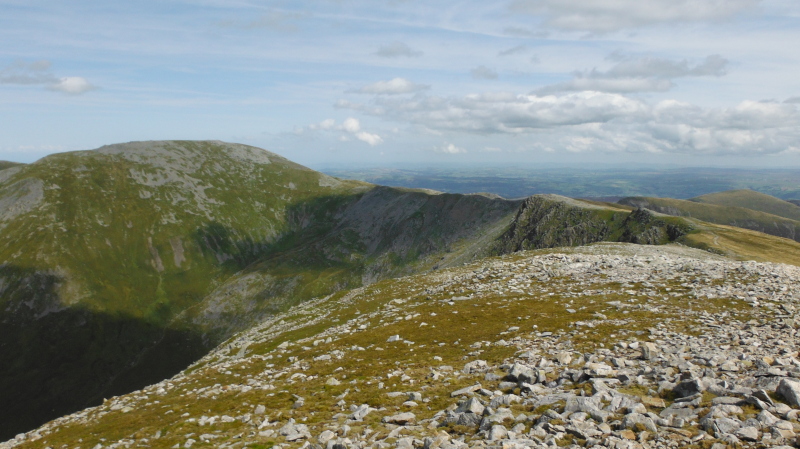
If you wander around the various high spots, you get some more good views - this is looking back to Carnedd Dafydd, and as you can see, it looks as if a front is arriving from the south west, as Snowdon now has a hat on, and it got quite cold, with a lot of heavy grey cloud overhead.
To the north it was still blue sky and sunshine - I think that the first hill is Foel Grach, I`m not sure about the others.
Something I didn`t expect to see from Carnedd Llewelyn - just to the right of centre, you can just see a wee bit of Llandudno and the Great Orme !
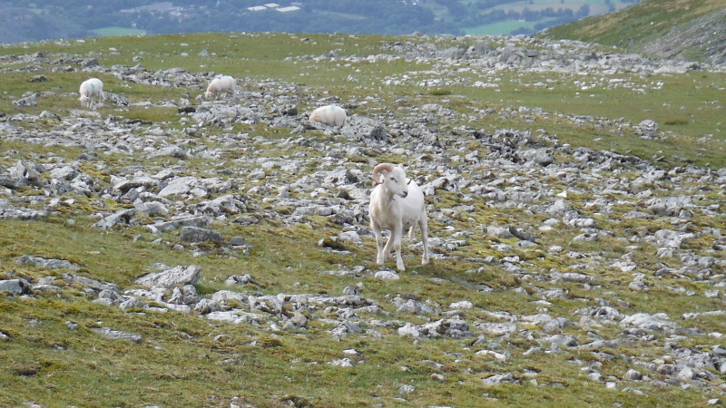
In amongst some sheep there was this animal with a lovely pair of horns - I still don`t know if it is a sheep or a goat - maybe it is a cross breed - I believe it does happen, though it is comparatively rare.
A slightly better view of Penmon and Puffin Island - the sailing boats are up to the far end of Puffin Island now.

Time to head off, and started down the south east ridge of Carnedd Llewelyn towards Pen yr Helgi Du - you get a better view of Pen Llithrig y Wrach from here.
When you look up at them from the road, it would be a good horseshoe route to do Pen yr Helgi Du and Pen Llithrig y Wrach.
Part of the way down the ridge you get a view to the east, and look down on an old quarry. Just across from the quarry there are two interesting scars in the landscape - the nearer one is quite obvious, the further one a bit less clear.
I`ve no idea what they are - I don`t think they are anything to do with the quarry, which suggests that they could be much older.
The OS Explorer map just shows them as black lines, so maybe they don`t know either.
The descent from the ridge down to the resevoir is quite steep, but once down, it is a tarred road all the way down the A5, so it is an easy walk, then you have to follow the A5 back to the mile long car park - so it gets a bit tedious.
However it was a good day out, and it means I have now done 10 of the Welsh Furths.
website design by ron-t
website hosting by netnerd.com
© 2025 Ron Turner
![]()
![]()