Wales - 2014
14 April 2014 ........... Bristly Ridge and the Glyders
Although the day started rather grey, the forecast was for the weather to improve, with a high probability of the summits clearing - and a significant risk of sunburn from the bright spring sunshine !
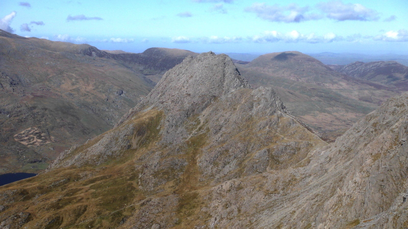
So I headed off to see if I could get up Bristly Ridge, as a way up to Glyder Fach.
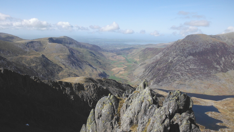
From the A5 I headed up into Cwm Bochlwyd, past Llyn Bochlwyd, and up to Bwlch Tryfan.
Now my guidebook may suggest that Bristly Ridge is a grade 1 scramble - and there may well be routes up it that are grade 1 - but I don`t think that Sinister Gully is one of them.
I don`t know how it fits into the scheme of things because I really don`t understand what scrambling grades mean - there seems to be so much disparity between their various desciptions that I increasingly don`t trust either them or guide books.
Back in the days when I dabbled in rock climbing, there seemed to be a reasonable amount of coherence in the descriptions of Easy, Moderate, Difficult, Hard Difficult, Very Difficult, etc, but scrambling grades seem to have added an area of confusion.
There is an additional problem in that, after doing some digging around on the internet, I now don`t know whether I climbed up Sinister Gully, or another gully, possibly called Dexter Gully or Main Gully - there seems to be a lot of disagreement between various websites about which gully is Sinister Gully.
I climbed a rather narrow one, which if I remember correctly, was the right hand one, straight above the man-made wall.
It seems to be quite a deficiency in a guide book that it doesn`t say anything about the fact that there are two gullies side by side, with no suggestion as to which one might be the harder or easier of the two.
-------------------------------
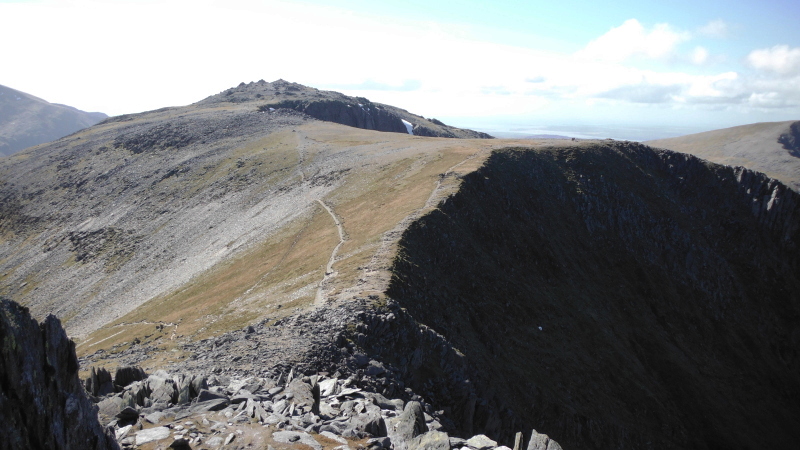
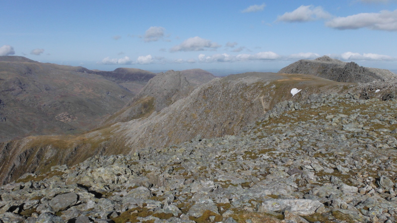
Once above Sinister Gully things get a bit more open and easier.
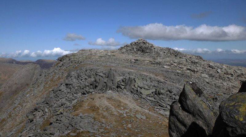
There is quite a quick transition from scrambling upwards to being on the open plateau of Glyder Fach.
On the right is a very distinctive feature - a stone circle.
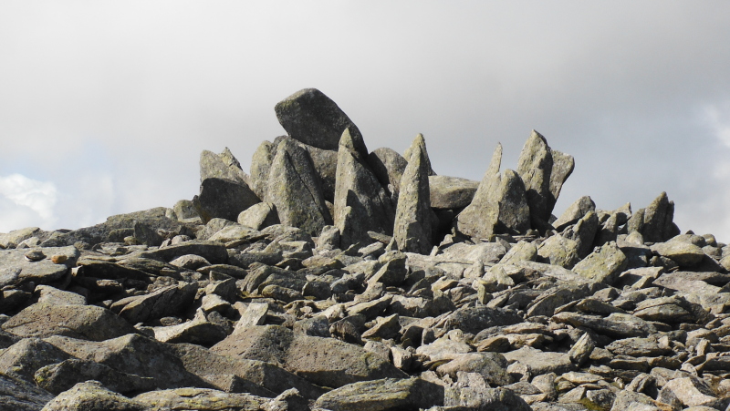
Personally, I don`t think it is natural, I think it is man-made, however despite doing searches on Google, I can`t find any reference to it as a man-made stone circle.
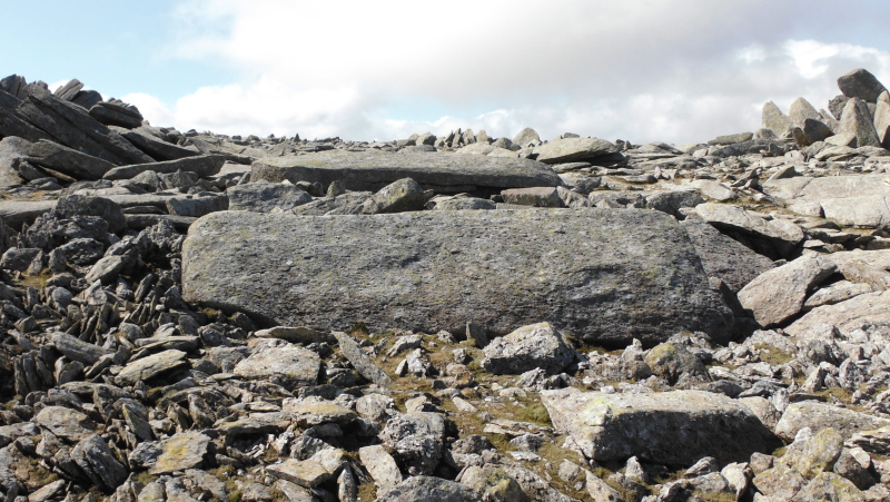
There is more possible evidence of man`s handywork - these two huge stone slabs are lying well away from all the other slabs around the summit, as if they were in the process of being moved.
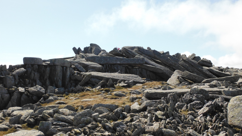
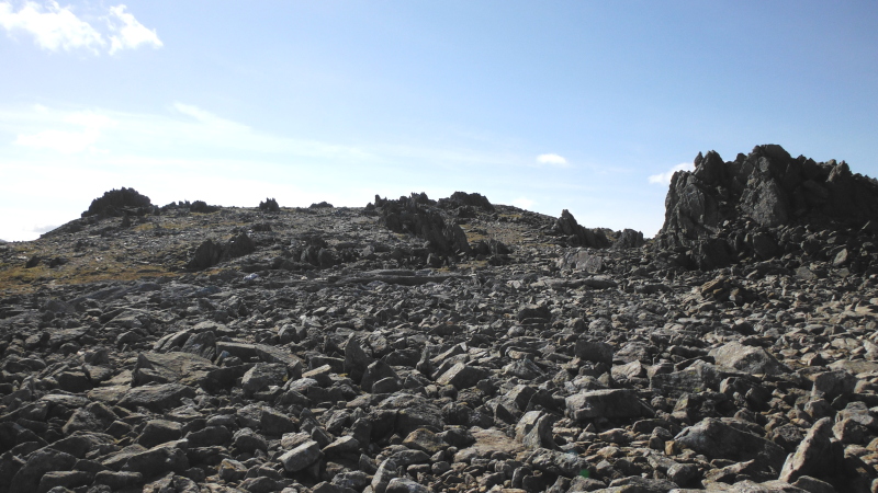
Looking at the big mound of stone slabs that form the summit, it looks as if some of these are man-made as well - look at the two blocks lying on top of the uprights on the left of the picture.
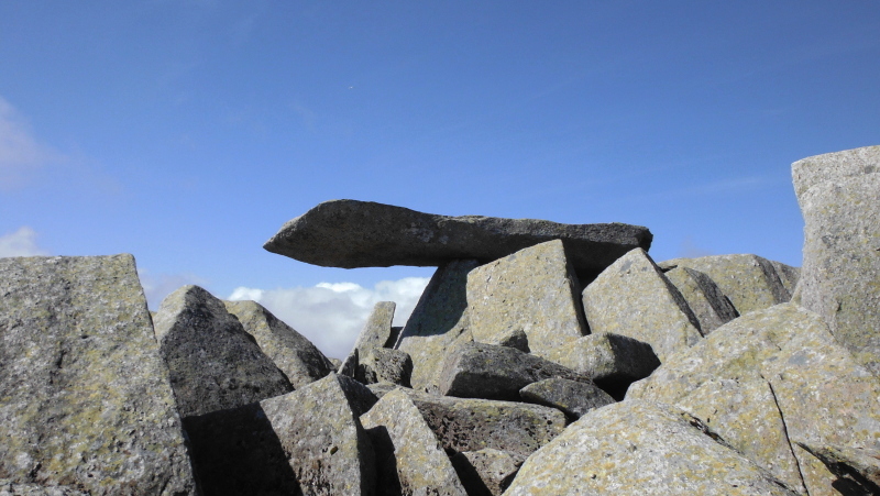
A fascinating feature is the Cantilever Stone -
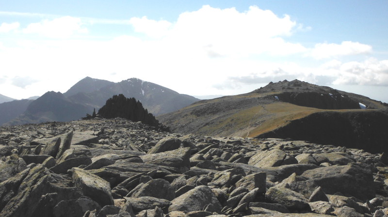
Further round the summit - I think it would be on the north or northwest side - you can have a great time climbing over huge blocks, jumping over deep gaps, crawling under huge slabs - a lovely playground for those into second childhood.
The weather had certainly improved by then, with good sunshine - no chance of getting sunburnt though, as every bit of me was covered up, due to the biting cold wind.
However the views were good - looking back at Tryfan -
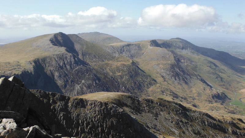
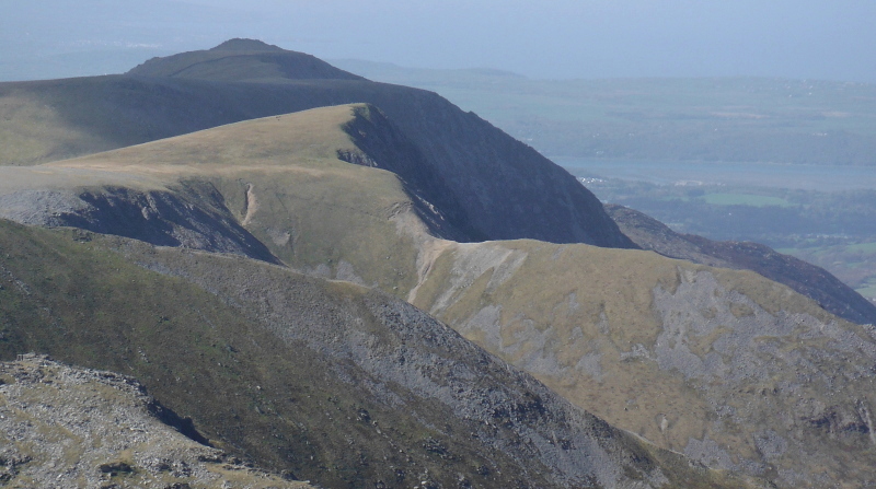
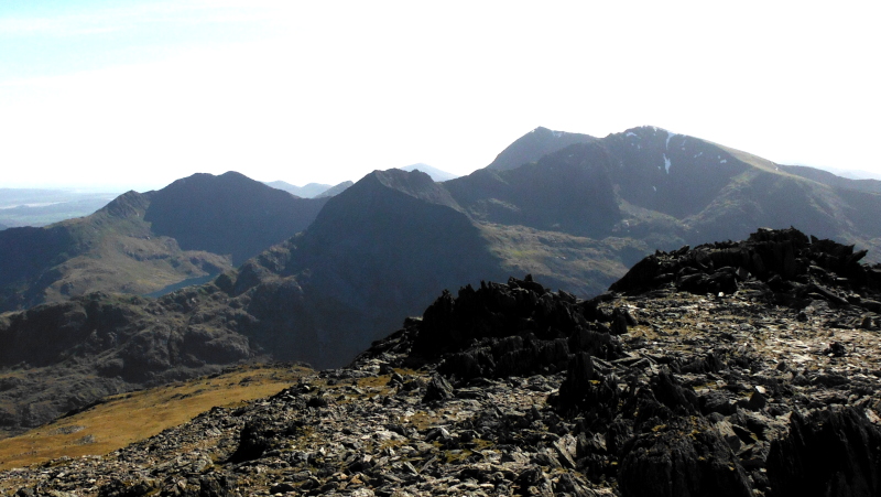
A fascinating view of the ridge way beyond Y Garn, with the light and shade from the bright sunshine highlighting the features of the ridge.
Looking west towards Glyder Fawr, with Snowdon, Crib Goch and Garnedd Ugain in the background.
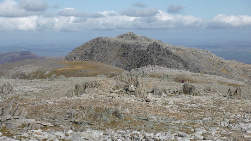
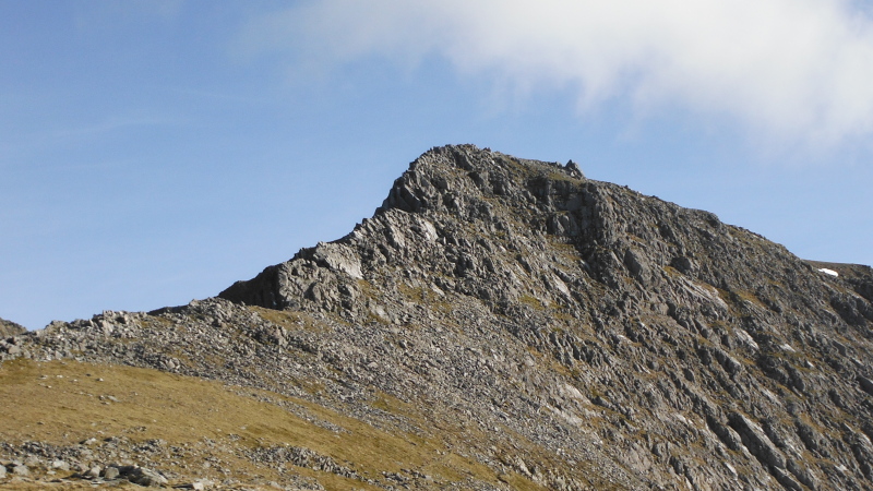
Just before the drop down Bwlch y Ddwy-Glyder stands the strange looking peak of Castell y Gwynt.
As you head towards it, Castell y Gwynt looks un-climbable, however as you get closer, you begin to see a way up it - it proved to be easier than it looked.
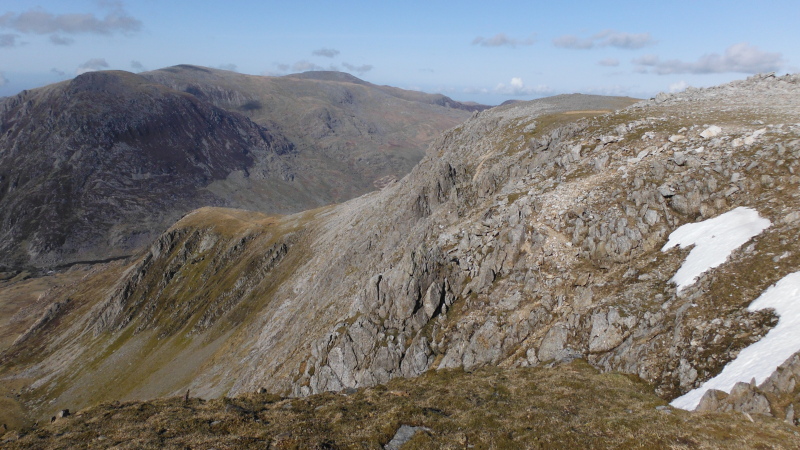
Looking back at Glyder Fach from the top -
At the top, you are directly in line with Nant Ffrancon -
Also from up on Castell y Gwynt, not a very wonderful picture, but it shows the rim above Cwm Bochlwydand as you head round towards the top of Y Gribin, then the rim above Cwm Cneifion, as you head up to Glyder Fawr.
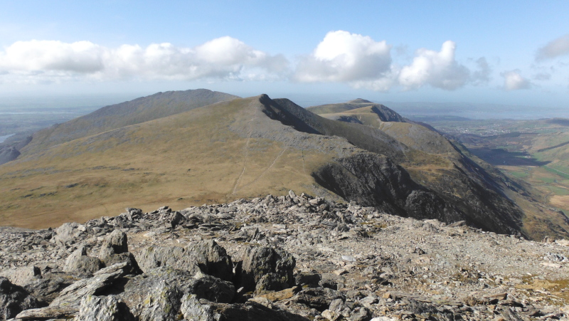
The summit of Glyder Fawr doesn`t have the same features that the summit of Glyder Fach has, but there is still plenty of rocks and highspots.
The summit of Glyder Fawr is directly in line with the ridge that heads away to the north beyond Y Garn - it would be a good ridge walk, but I think the picture taken from Glyder Fach shows the ridge in a more dramatic way.
There is quite an interesting looking arête off to the side, about halfway along the ridge.
This is looking back to Glyder Fach - the green portion is the top of Y Gribin.
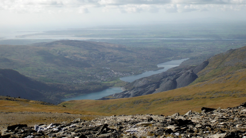
Looking to the northwest, you get a good view of Llanberis, Llyn Peris and Llyn Padarn, then across the Menai Straits to Anglesey - over on the left you can see Abermenai Point, Llanddwyn Island, and then the Malltreath Estuary.
You can also just make out Holyhead Mountain away in the distance.
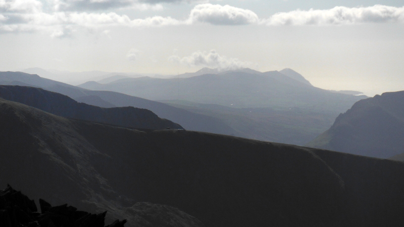
I am not sure that it is technically a good picture, but this is looking across the north ridge of Snowdon right down the Lleyn Peninsula - certainly as far as Mynydd Rhiw, and I think also Mynydd Mawr.
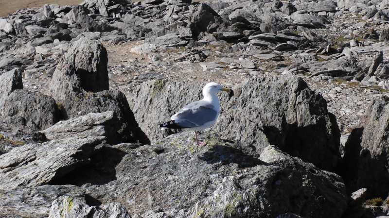
And of course, no summit in Snowdonia is complete without the customary wildlife - another seagull !
Now Glyder Fawr presents a good view across the Pass of Llanberis towards the Snowdon range - with Crib Goch and Garnedd Ugain in the foreground, and Y Lliwedd and Snowdon itself in the background.
I wanted a better view, so I dropped down a bit in their direction - one of the things that surprised me was the steepness of the east ridge of Crib Goch. In the bottom left hand corner of the picture, you can just see the Pyg Track as it heads over Bwlch y Moch, where the usual climb up the east ridge starts.
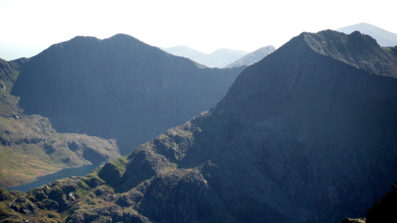
Looking across to Cwm Uchaf and to Cwm Glas - and it is really hard to imagine that in that high altitude glaciated bowl lies Llyn Glas - with its island, its trees, and its ducks !

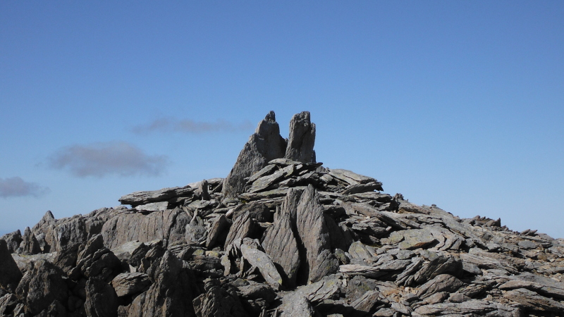
As I climbed back up to the summit, I realised that Glyder Fawr has its own version of Adam and Eve on Tryfan - I can`t find that they have a name - so I shall call them Cain and Abel - which continues the biblical theme, as Cain and Abel were the sons of Adam and Eve.
Sadly, days like this don`t last forever, and it was time to descend back down to real life.
I reckoned that I would try out Y Gribin as a way down - this is it, with Glyder Fach and Tryfan in the background.
A bit further round the rim of Cwm Cneifion, and you can see a bit further down.
And finally, looking back up Y Gribin from roughly half way down.
website design by ron-t
website hosting by netnerd.com
© 2025 Ron Turner
![]()
![]()