Wales - 2014
10 April 2014 ........... Crib Goch and Garnedd Ugain
It wasn`t the best of forecasts, but with light winds, it was a good day to see if I could do Crib Goch and Garnedd Ugain.
I was at Pen-y-pass by 10-15 - and the car park was full - not only was it full, it was taped off so there was no chance of squeezing in somewhere.
So I went back down the road to the first carpark.
Since I was down there, it was clear I wouldn`t be going up the Pyg Track, and up the east ridge of Crib Goch, instead I headed off sort of southwards, and curled round the base of Dinas Mot, and up and up going roughly west south west, so eventually got to the bottom of Crib Goch, just at the start of the north west ridge, and then headed up the arête.
Climbing the arête was good fun, I found that as long as you are going uphill, doing it on all fours works quite well.
Then it meets the east ridge, and heads on up to the first summit.
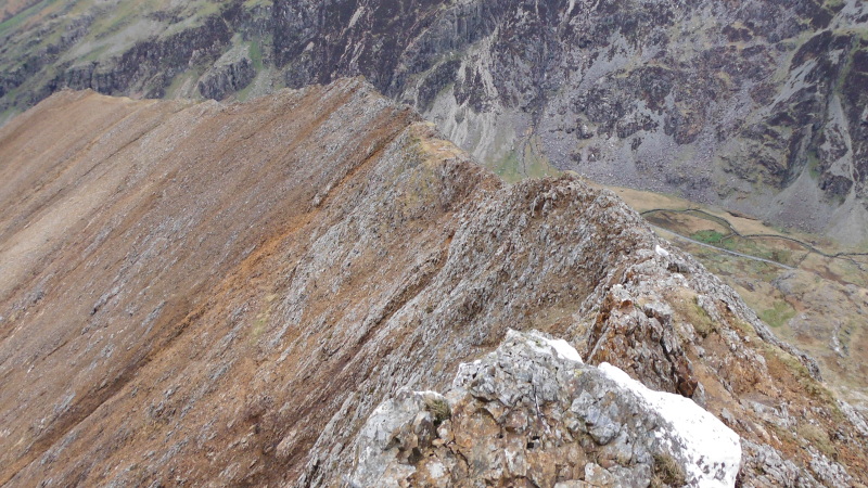
I think that this is where I took this picture from, but I`m not 100% sure - but it is looking back down the arête.
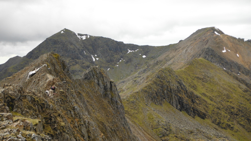
I`m afraid that I can`t really be sure at what point along the ridge I took some of these pictures, but this is looking further along the Crib Goch ridge, then the ridge up to Garnedd Ugain, and around to Snowdon.
At this point Snowdon was still clear, it subsequently dissappeared into the cloud.
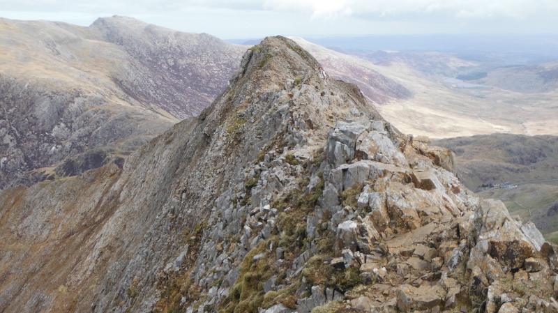
A bit further on, and this is looking back at what I presume is the first summit of Crib Goch, the 921 metre summit.
This is a bit further along the ridge, I haven`t a clue what it is - it might be the second summit, it might be the first and largest pinnacle.
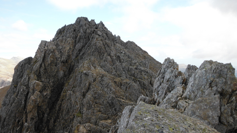
Now all the way so far I had pretty much stuck to the crest of the ridge the whole way up, but the pinnacles broke my flow.
The first, and the biggest pinnacle, had a rather intimidating look to it - I might have been able to get up it, but I was bothered about what I would find on the other side, and whether I would be able to get back down again - it would be a bit embarrassing to get stuck up there - so I followed the wimps route round the side, to see what the far side was like.
In fact it was no problem, so I climbed up it and round the side and up the front of the pinnacle to the top.
Back down, up the next pinnacle, back down and up the third one.
So I did three of the four pinnacles - the only one I didn`t do was the rather rectangular one off to the north side of the ridge.
Down to Bwlch Coch, and up to the first rise on the way up to Garnedd Ugain, and time for a tea break.
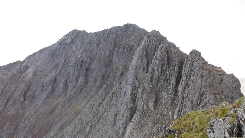
Looking back at Crib Goch, and you can see the thin seams of quartz that run through the rocks - every now and then, coming up the arête there would be a wee bit of brilliant white quartz right on top of the ridge - they must have been the ends of these seams.
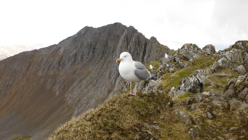
And you can`t have a teabreak on the Snowdon block without a bit of company.
They were there - seagulls !
I continued to try and go right up the crest of the ridge, though at times it would have been quicker to just follow the path which avoids them.
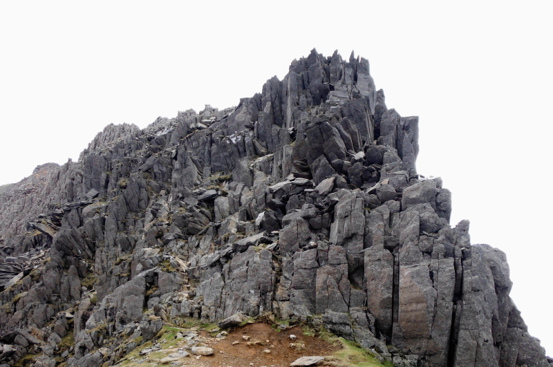
Eventually you come to a bit of a bad step - a big pile of broken rocks.
It was clear from the colouration on the rocks that there are two distinct routes up this - the first one starts right in the middle of the picture and goes almost straight up, the second one starts over to the left, and winds its way up somehow.
I went for the straight route - it wasn`t actually as bad as it looks, and I rather enjoyed it, so I was glad I did it.
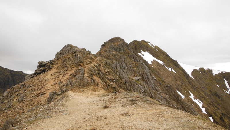
Above the bad step, looking up towards the summit of Garnedd Ugain, though what you see there isn`t the actual summit - the summit is actually fairly flat, with a triangulation pillar.
Since I was parked down the Pass of Llanberis, rather than at Pen-y-pass, it didn`t really make much sense to head either to Snowdon ( which was in cloud ), or back down the Pyg Track, as that would be taking me further away from where I was parked.
I was therefore interested in seeing if I could find a route back down to the Pass of Llanberis from Garnedd Ugain - I headed northwards away from the summit of Garnedd Ugain, aiming for a ridge that goes down from the Snowdon north ridge, over a nose which I think is called Gyrn Lâs.
This is looking down from Garnedd Ugain right down the north ridge of Snowdon, Clogwyn Station is just after the first bend in the railway track.
It would be a good ridge walk back down to Llanberis.
The distinct rocky rise a bit beyond Clogwyn Station is I think the top end of the Llechog Ridge or Llechog Buttress - it is a grade 2/3 scramble up from the Pass of Llanberis.
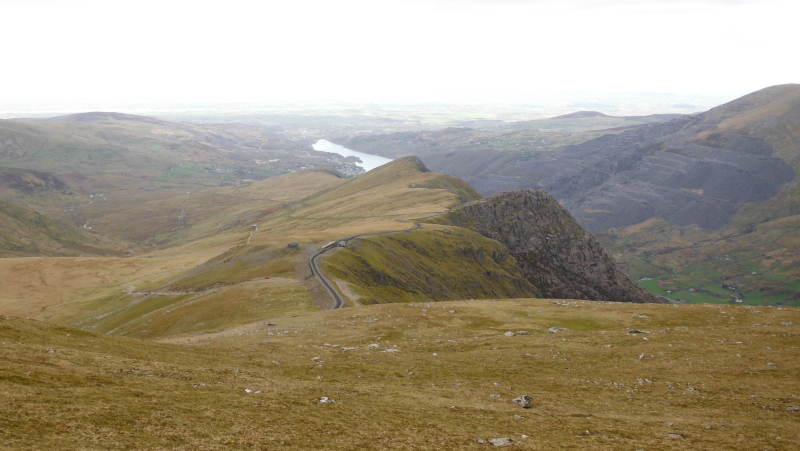
In the above picture, you can`t see Gyrn Lâs, as it is below the horizon, a bit further down, and it comes into view - down at the bottom of this picture - with a wide expanse of Elidir Fawr, Y Garn, Pen yr Ole Wen, and Carnedd Dafydd in the background.
You can also see a side ridge heading off to the right from just above Gyrn Lâs.
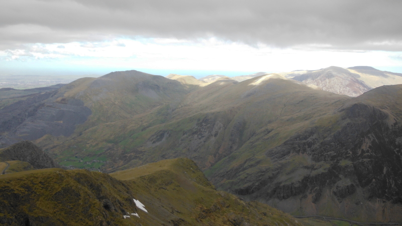
On the way up and over Crib Goch and Crib y Ddysgl I took some pictures looking across to Gyrn Lâs, but it makes more sense to show them here, rather than earlier on.
So this one was taken from somewhere on Crib Goch - the higher nose on the skyline is Gyrn Lâs, the lower and further away nose is Llechog Buttress.
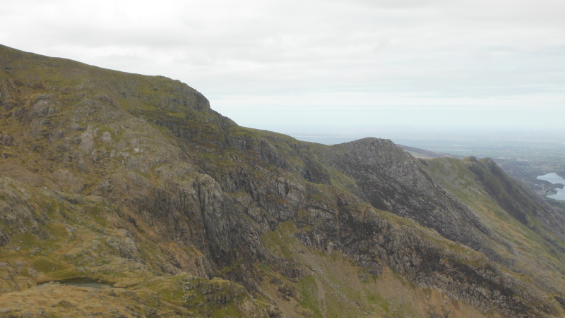
This picture was taken from somewhere on the lower end of Crib y Ddysgl, and shows how steep the whole area is, as it drops down to the Pass of Llanberis.
You can also see the side ridge which ends in a significant drop, just beyond Llyn Glas.
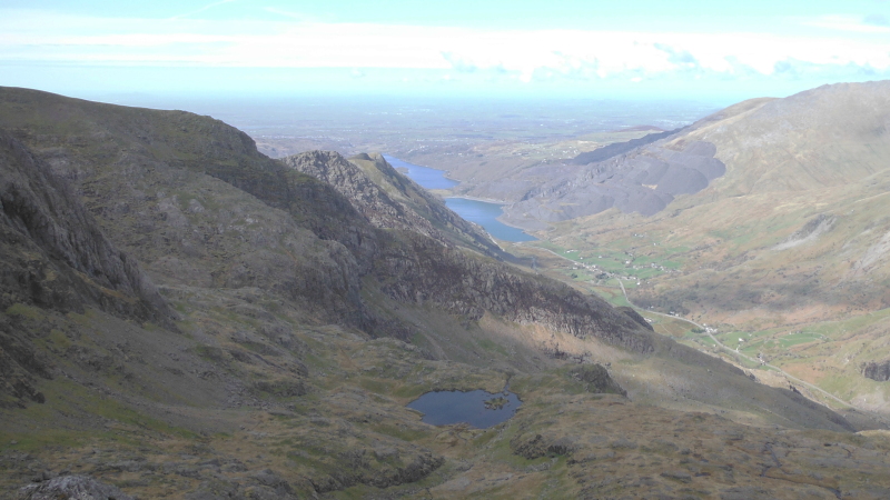
I headed right down to the top of Gyrn Lâs, but couldn`t see any way down it - so I reckoned that I would have to get down by heading down into Cym Glas.
I originally took this picture from the top of Gyrn Lâs because I thought it might be the last time I would have a view of Crib Goch, however it turns out it is much more useful than that - first of all it gives a good view looking down into Cym Glas - and look how Llyn Glas is perched on the edge of a massive drop.
It also provides a view of the bottom end of the Clogwyn y Person Arête - which is another grade 2/3 scramble.
It also appears to show an easy looking grassy slope just beyond the Clogwyn y Person Arête up to Crib y Ddysgl, just below the bad step. However that may be deceptive.
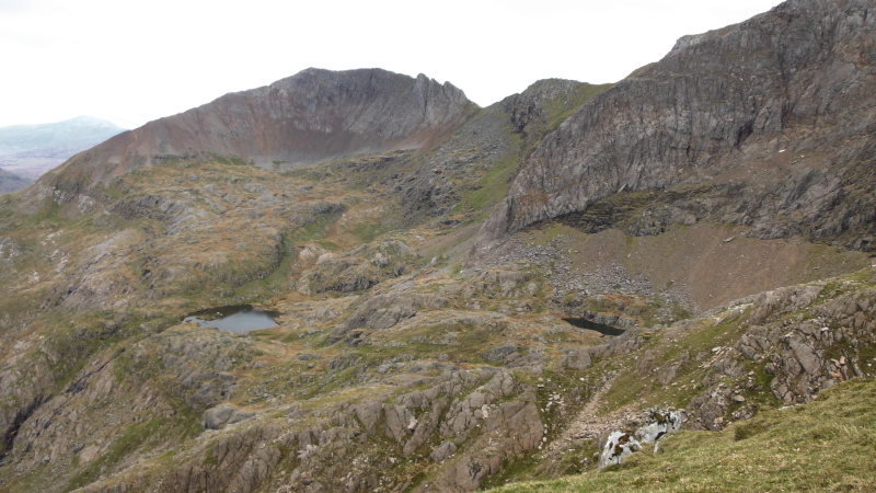
Not seeing a way down Gyrn Lâs, I headed back up a bit, and started down the side ridge, then dropped down the side of it, down to Cym Glas, and across to Llyn Glas.
Llyn Glas is a lovely place, with an island, trees, and ducks - all quite out of keeping with its location just above a huge drop in a high altitude glaciated bowl surrounded by massive cliffs and rocky ridges.
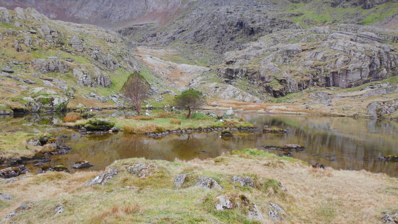
My descent from the upper part of Cym Glas was rather messy, I think I went to far east, and got messed up by another small ridge that ended in a nose that I couldn`t get down, so I had to retreat a bit, and try again.
I ended up going round the lower part of Dinas Mot - there are some big cliffs on Dinas Mot - I don`t know if they are climbable or scramble-able - I didn`t really examine them, by now I just wanted to get down.
However on the way down I looked across to Llanberis slate quarry, and a diffuse sunshine was rather nicely highlighting it all, and showing off the features.
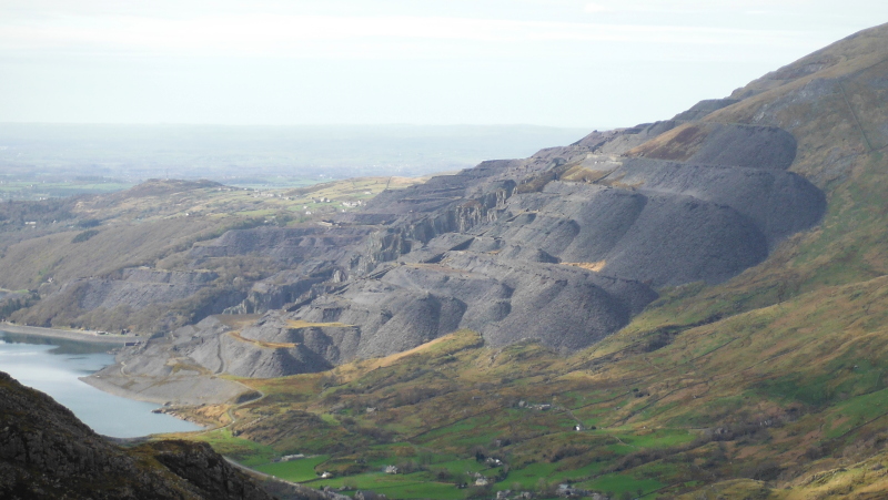
It is a huge quarry, you get a sense of the scale of it all from the size of the buildings down at the bottom - the picture was taken looking across Llyn Peris.
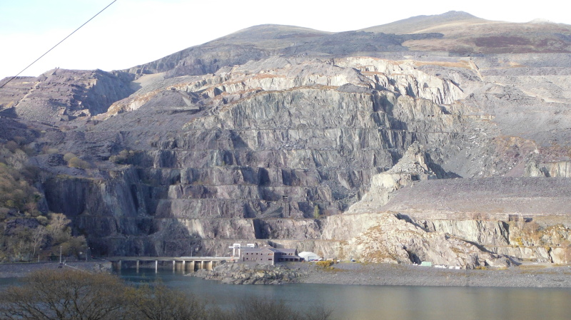
Snowdonia is full of slate quarries, there is another huge one at Llechwedd, where you can get on the original miners train and descent down into a slate mine underground - it is a fascinating trip.
There is another one at Penrhyn Quarry by Bethesda, which now has the longest zip wire in Europe - one for the adrenalin junkies, I think.