Wales - 2014
11 March 2014 ........... Snowdon and Y Lliwedd
A beautiful day, and so I had my first trip to Snowdon since coming down to Wales.
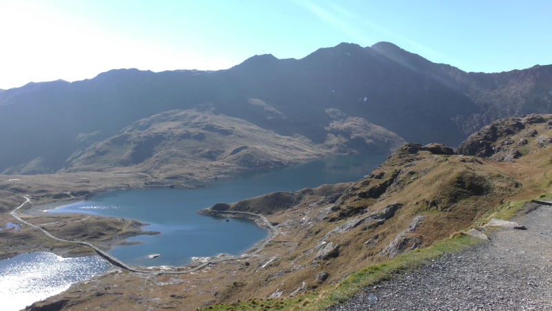
I chose to start from Pen-y-pass, and went up the Pyg Track - it climbs around the side of a hill, and then suddenly you are past the hill, and looking down on Llyn Llydaw and the Miners track way down below you - and in the background is Y Lliwedd.
A bit further on and you get a view of Y Lliwedd, Bwlch y Saethau, and the first view of Snowdon.
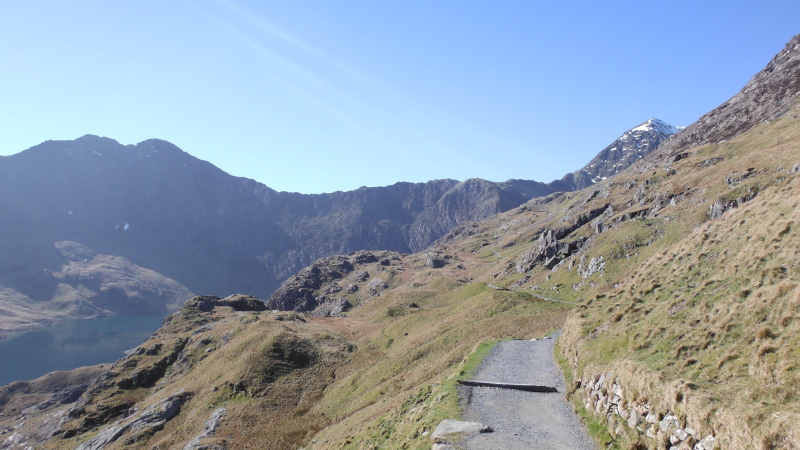
Further up the Pyg Track, and you can look down on Glaslyn, and across to Y Gribin, the ridge that leads up to Bwlch y Saethau.
Looking out beyond the flank of Snowdon, you can see along Bwlch y Saethau, past Y Gribin, and on to Y Lliwedd - and you begin to see the knife edge shape of Y Lliwedd.
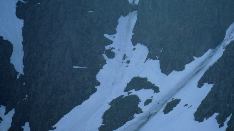
Deep in the shadow of Snowdon, high above Glaslyn, long thin snowfields offered another way up Snowdon for those who like to get away from paths and scrambling and plain old rock climbing.
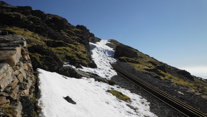
The Pyg Track winds its way up the zig-zags, and eventually meets the Llanberis Path, and the way up to the summit is much easier going.
However I think it may be a wee while until the railway is open.
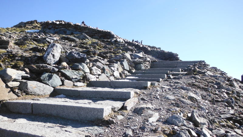
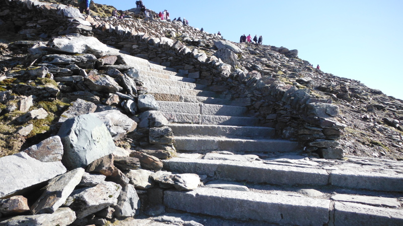
The final approach to the summit, and these beautifully cut and laid granite steps are just what you expect to find at the top of a mountain.
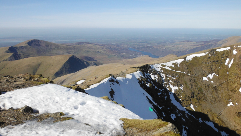
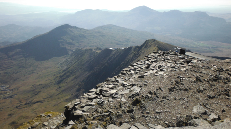
The view from the summit was fabulous in every direction - this is looking down on Grib Goch.
It appears in this picture that Crib Goch descends down and meets the ridge leading up to Glyder Fawr and Glyder Fach in the background - in reality there is something like a 600 metre drop between them, down to the Pass of Llanberis.
A bit round to the left, and here is Garnedd Ugain.
A bit more round to the left, and to the northwest of Snowdon lies Llanberis, and Moel Eilio and Moel Cynghorion.
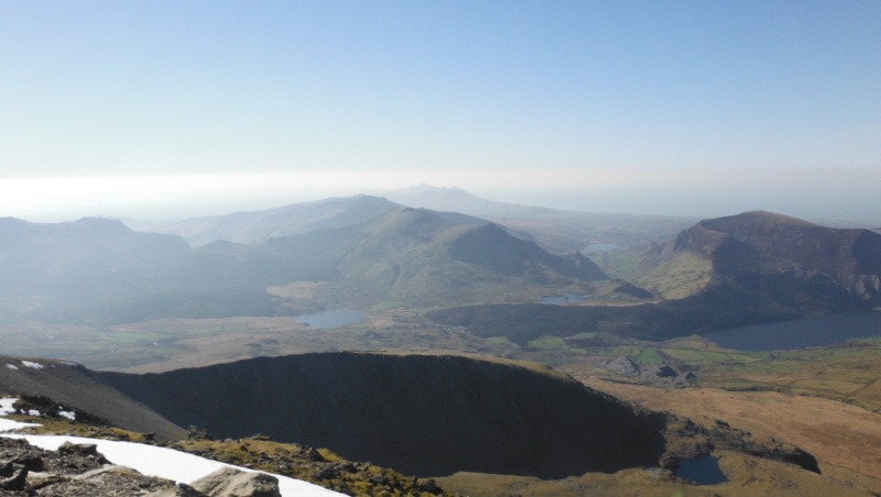
There is another ridge to the southwest of Snowdon, and here I have got myself a bit confused - this ridge splits into two - one heads off to the southwest, then curves round to the northwest, the other one heads due south.
So I think that is the view from Snowdon looking west and southwest - the dark area in the foreground is the first of these two ridges, known I think as Llechog - beyond it is Mynydd Mawr, and a bit round to the left a block of hills including Mynydd Graig Goch, and beyond that, right down the Llyn Peninsula.
Just to confuse the issue, there are two Llechog `s - there is this one at SH 596 537, and the other one is just beside the Llanberis Path at SH 606 567.
The second of the two ridges that heads south is this one, with the isolated hill Yr Aran just beyond it.
The last ridge heading away from Snowdon is of course Y Lliwedd, which runs southeast away from Snowdon.
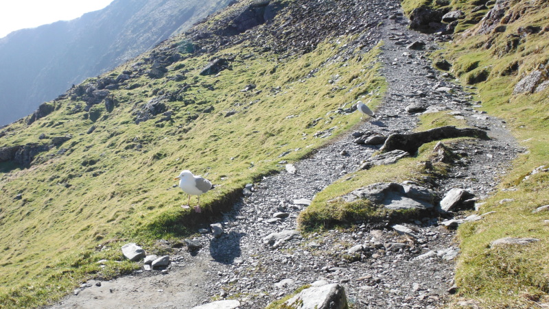
The train station and centre were shut for the winter, however the west side of it provided an excellent spot for a lunch break, in the sun and out of the wind.
I wasn`t the only one who enjoyed this spot - I had some company, who were no doubt extremely miffed that I didn`t share my lunch with them.
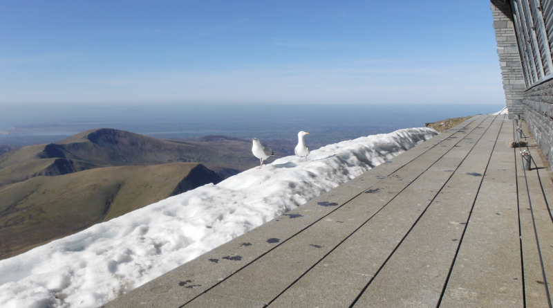
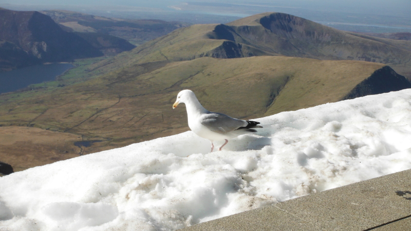
There really is something a bit incongruous about seagulls standing on a bank of snow on top of a 1000 metre mountain - but I guess a railway line and station on top of a mountain are a bit out of place as well.
I am not really a great lover of the idea that we should have manufactured footpaths, railways, gondolas and restaurants up mountains, but I have to say that I think that the railway and station at the top of Snowdon has been done quite sympathetically to the environment, with quite a low profile - compared to the mountains in Scotland that have been thrown on the alters of tourism and skiing, such as Cairngorm, the Lecht, Anoch Mor, Glenshee, and Glencoe.
They are just hideous places now, with roads and tracks bulldozed up the hills, huge car parks, restaurants, other buildings, chair lifts, ski tows, miles of snow fencing, and massive scars all over the hillsides.
Yuk !
Time to get away from manufactured paths and tourism - I headed off to Y Lliwedd.
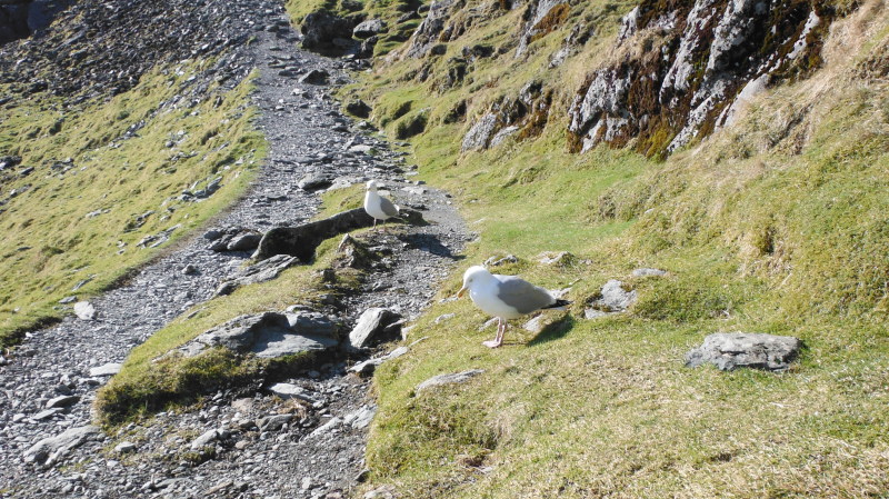
Down on the coll, and as soon as I stopped, they were there again - no wonder there are no seagulls in places like Middle Mouse and the Skerries - they have all moved house to Snowdon !
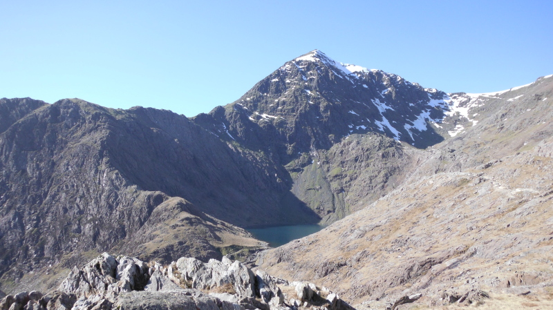
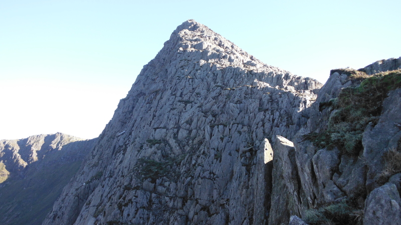
From the coll, Y Lliwedd continues to look impressive -
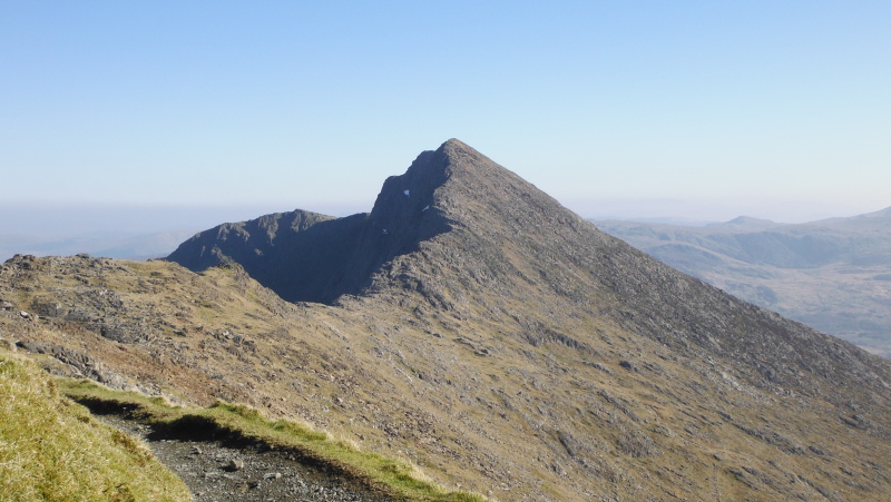
A bit further along the ridge, and we get a better view of the north face of Y Lliwedd, although it is deep in shade -
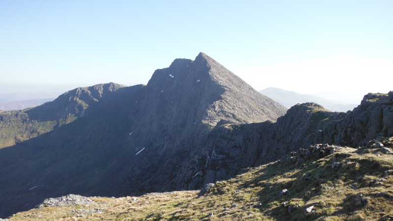
It appears that the climb up Y Lliwedd can be as easy or hard as you want it to be - there is a path of sorts that winds its way up the sunlit slope, and doesn`t involve much scrambling.
However if you like the exposure you can scramble right up the edge - there is certainly plenty of opportunity to fall off and end your life prematurely.
I did a bit of both - scrambling is a lot more fun when you know that at any point you can just go right and get away from the scary bits.
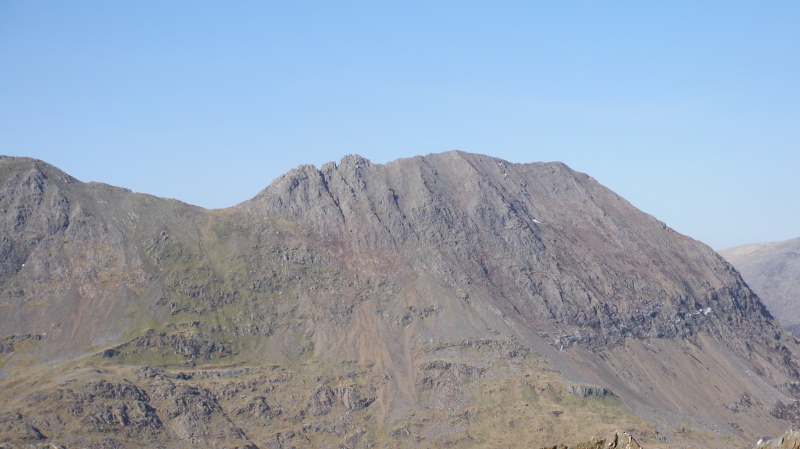
Here is a closer view of the top end of the north face, taken from somewhere on the way up - I believe the north face is a bit of a classic multi-pitch climb, and no, I don`t think I`ll be doing it any time soon !
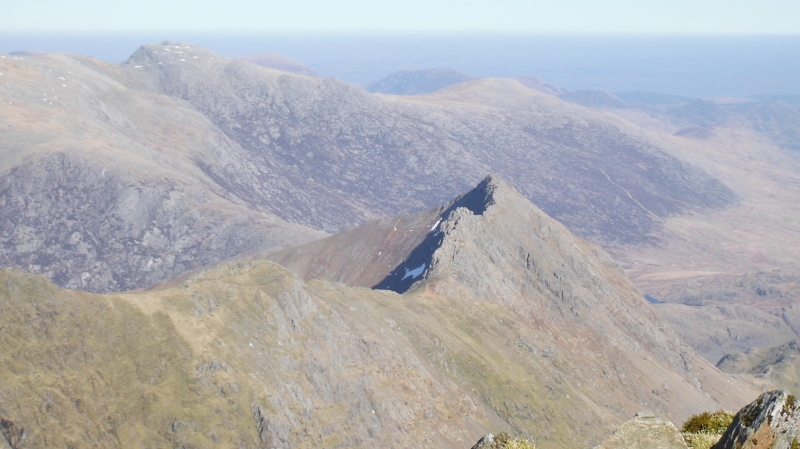
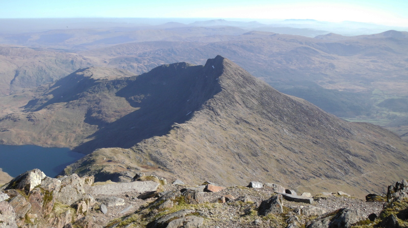
From the top of Y Lliwedd there is a good view across to Garnedd Ugain and Crib Goch - it is a fabulous looking ridge.
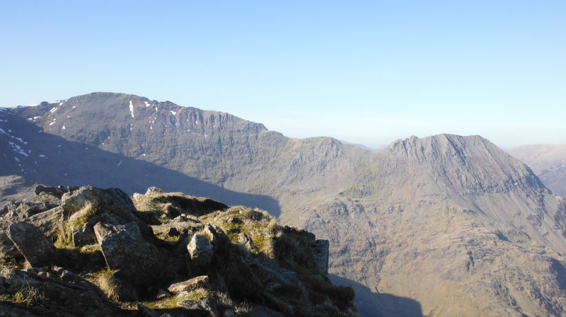
It might be useful to have a couple of closer views - here are they - first off, here is Crib Goch -
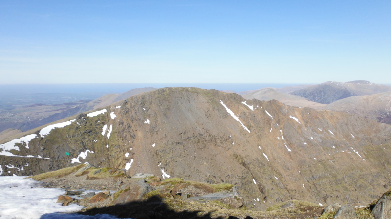
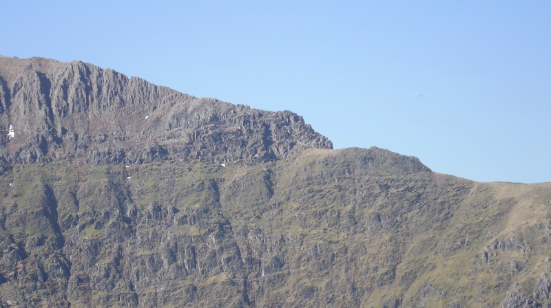
and here is what could be a bad step at the east end of Garnedd Ugain.
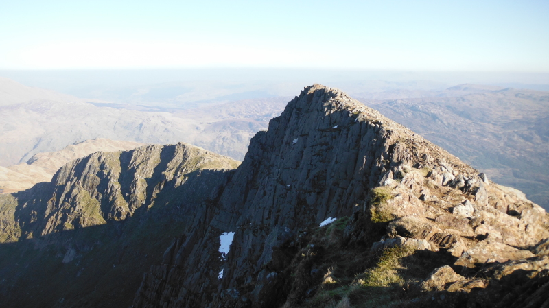
Y Lliwedd has two peaks, West Peak is the bigger of the two at 898 metres, and East Peak is 893 metres.
This is looking east from West Peak over East Peak and another summit of 818 metres - I am not sure if this is called Lliwedd Bach.
Sometimes the OS maps show things that the Harveys maps don`t show, and sometimes it is the other way round, and on this occasion the OS Explorer map wins, as it the only one which shows the 818 metres summit.
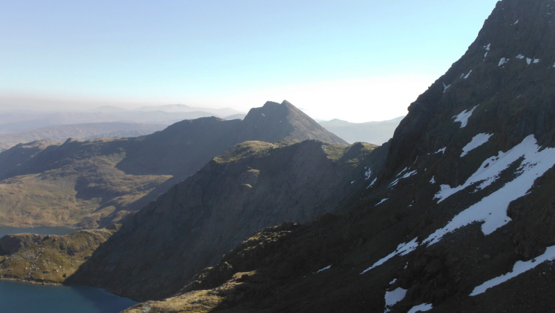
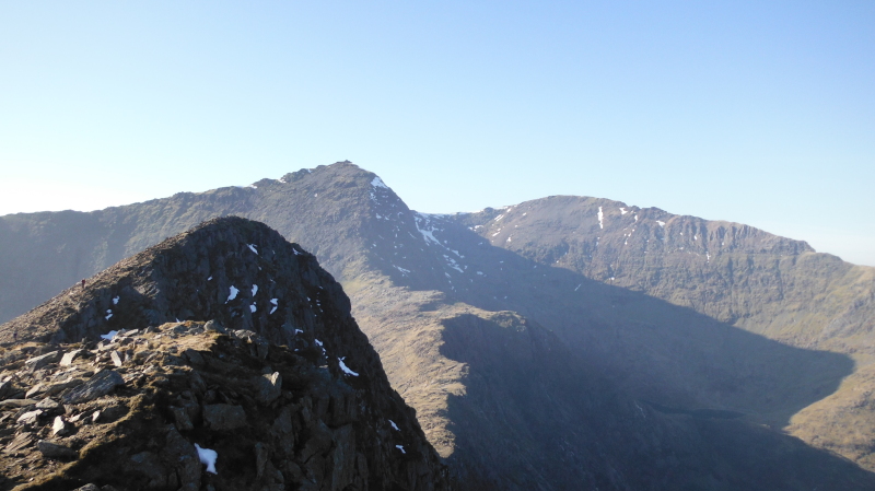
From the East Peak, you get an interesting view back past the West Peak, past Y Gribin, and up to Snowdon and Garnedd Ugain.
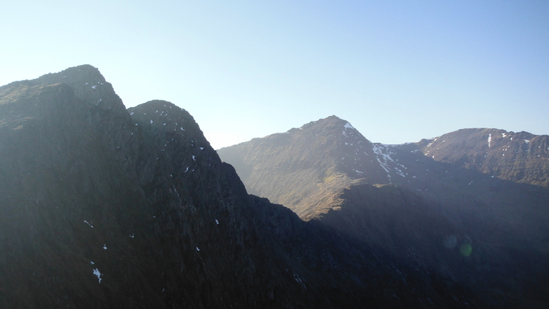
Further down the east end of Y Lliwedd, and the view back to where I`ve come from is catching some fascinating lighting from the sun that is begining to get a bit low.
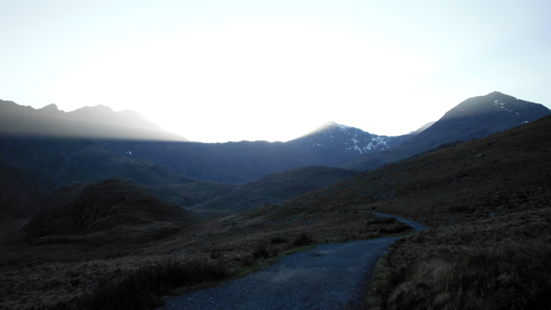
Later on, and well down the Miners Track, I just happened to turn round and caught this - it wasn`t really as dark as it looks, the picture was deliberately a bit under-exposed so as to catch the lighting in the sky.
A striking end to a fabulous day.
website design by ron-t
website hosting by netnerd.com
© 2025 Ron Turner
![]()
![]()