Wales - 2013
11 December 2013 ........... Tryfan - the west face
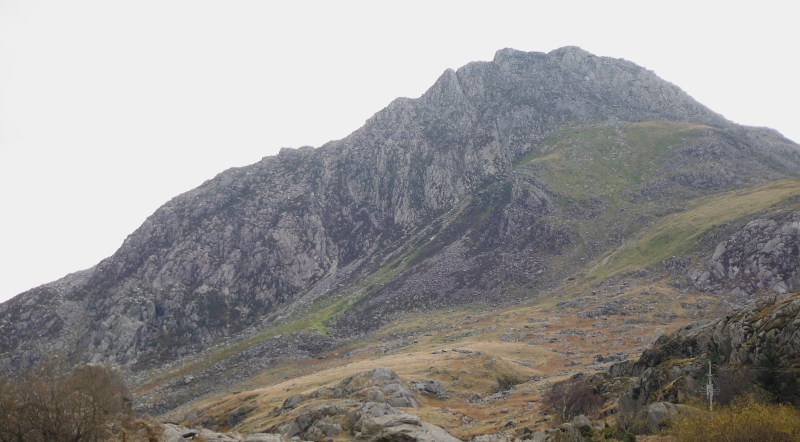
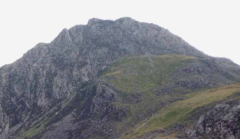
On my last visit to Tryfan, I took a couple of pictures of the west face of Tryfan, and something that I was interested in was the route that climbed up over grass, then up a sort of shallow gully to get to the crest of the north ridge between the north and the middle summits of Tryfan.
Here are the photos again.
This was the last day of reasonable weather before some fronts start coming in, so even though there was a forecast of very strong winds on the tops, I went anyway.
The wind was from the south, so I would be pretty sheltered until I got right up to the top.
I think I`m right in saying that the footpath up to there starts from the second carpark on the right, after leaving the west end of Llyn Ogwen along the A5.
However because I wasn`t sure how I would be coming back down, I started from the carpark at the visitor centre - which made the ascent up to the top of the grassy slopes a bit more messy than it could have been.
The ascent up the gulley is quite straightforward, there is some scrambling involved - maybe a grade of 0.5 !
Up on the gully between the two summits, the wind was getting quite strong at times, but rather than follow the path up, I did a bit more scrambling up the crest of the ridge to the top.
The wind on the top was horrendous, walking about was impossible, I had to scramble about virtually on all fours.
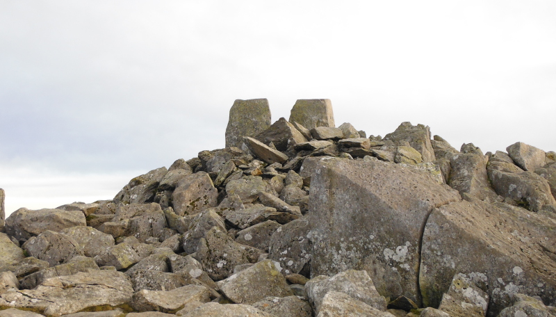
I found a small sheltered patch at the back of Adam - or was it Eve - I don`t know which is which - so had a lunch break.
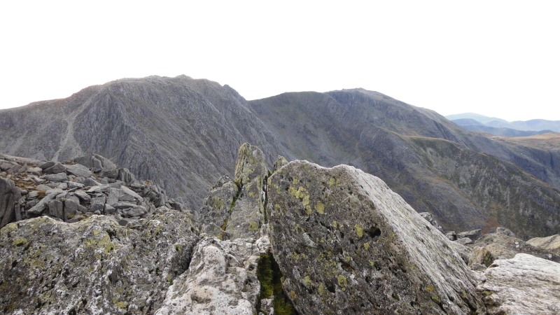
The visibility was fantastic, so here are some of the views from there - most of the pictures were taken whilst hiding down amongst the rocks, which is why there are so many rocks in the foreground of most of the pictures.
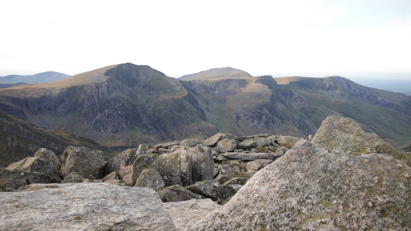
Firstly, Glyder Fâch and Glyder Fawr -
Round a bit to Y Garn, and right down that ridge.
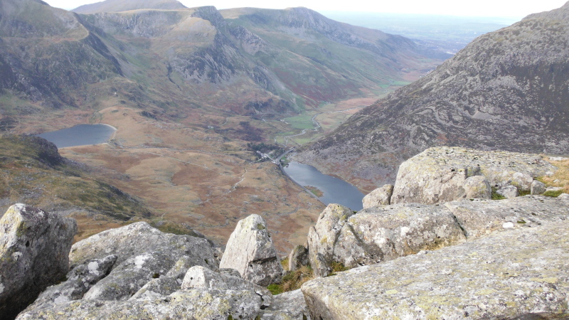
Looking down Nant Ffrancon beyond the west end of Llyn Ogwen.
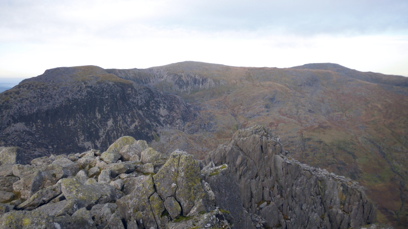
Then around to the Carneddau, looking over the top of the north summit of Tryfan.
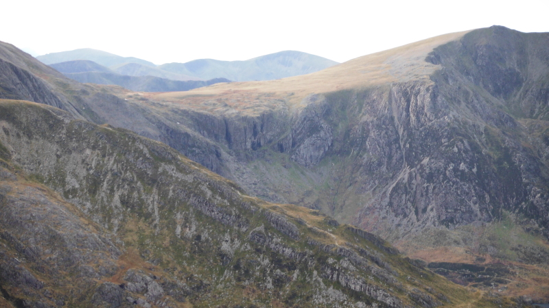
Lastly, here is a long focus view of the Devils Kitchen - the Devils Kitchen is the deepest gully left of centre.
Just on the centre of the picture there is a steeply sloping grassy terrace called Sheep Walk, which has little scrambling.
On the right is the East Ridge of Y Garn - I believe it is a grade 2 scramble.
The wind was so strong that there was no sense in trying to go down the south ridge of Tryfan, so I went back the way I had come, back down the shallow gully.
Going down seemed easier than coming up, with a more defined path, and less scrambling.
Maybe bum sliding down over boulders is just easier than climbing up them, but it is certainly quite a straightforward way down.
I came all the way down to the road down what might have been a path, or what might have been just a scree filled gully - it runs all the way down just at the bottom of the west face.
I don`t recommend it as a route, if I wanted to get to some part of the west face I would use it, but otherwise I`ll go some other way.
The more I use some of the routes round Tryfan, the more unsure I am about the scrambling grades - I have found a website that claims that the south ridge of Tryfan is a grade 1 scramble - the same as the north ridge.
To me, they are worlds apart, so how can they be the same grade ?
Did I miss whole sections of easier routes up the north ridge ?
I don`t know.
website design by ron-t
website hosting by netnerd.com
© 2025 Ron Turner
![]()
![]()