Wales - 2013
01 May 2013 ........... Y Garn + Glyder Fawr
My first experience of climbing mountains in Snowdonia - actually strictly speaking that isn`t true, as I have a vague recollection of climbing Snowdon up the tourist track from Llanberis about 45 years ago.
I am writing this some 6 months later, so my memory of it is a bit vague, and I have spent a lot of time trying to work out what some of the photographs are of. However I think that I have got them all sussed.
I started from the car park at SH 650 604, and I think I just followed the signs that pointed to Y Garn, the first sort of stage post being the small lake Llyn Idwal.
Round the end of the lake, and up the path to Y Garn.
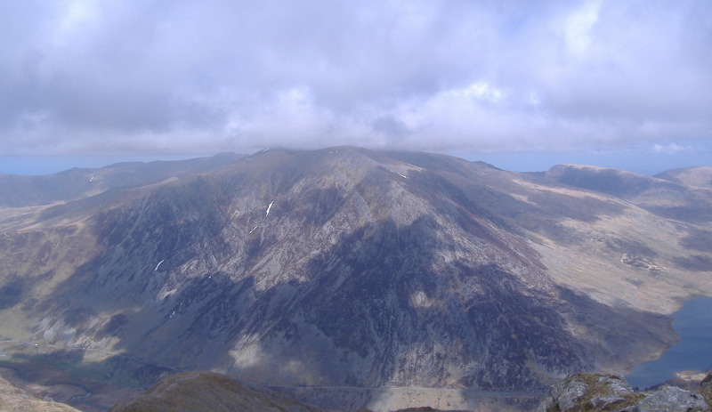
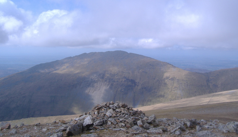
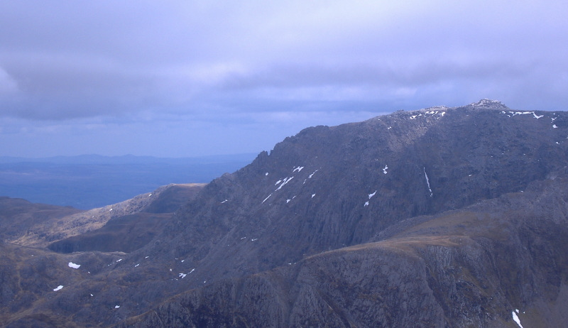
The summit of Y Garn not surprisingly provides some excellent views in all directions. First of all, to the northeast, you look across to Pen yr Ole Wen - hidden in the cloud is Carnedd Dafydd.
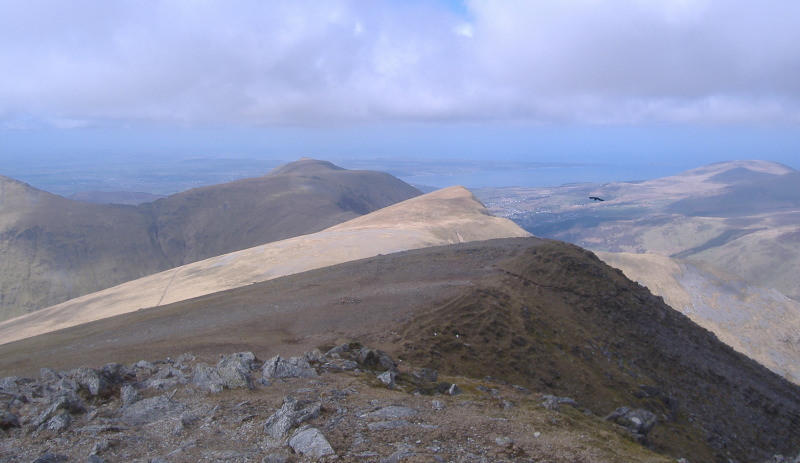
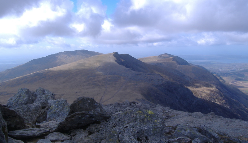
Going anti-clockwise, to the north and northwest you look along the ridge - in the background, you can see the eastern end of the Menai Strait, and across to Anglesey.
A bit further round, and you get to Elidir Fawr.
A bit more round, and you are looking down on Llanberis, and in the background you can see the western end of the Menai Strait, and the southwest corner of Anglesey.

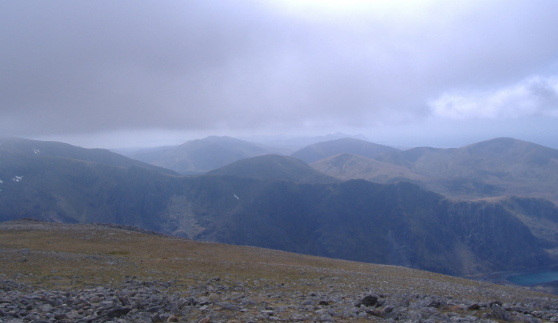
To the southwest, you can look right down the Lleyn Peninsula. though it is rather grey and cloudy down that way.
Then it is Snowdon - or it would be if it didn`t have its hat on.

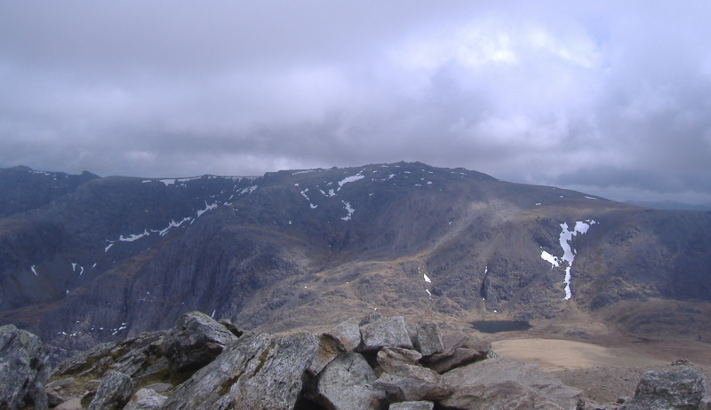
Of more immediate interest is the view to the south east of Glyder Fawr and the ridge across to Glyder Fâch. This is Glyder Fawr, and Glyder Fâch is just on the left hand edge of the picture.
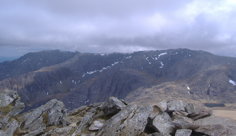
Here is the ridge between Glyder Fawr and Glyder Fâch.
A bit further round, and you get Tryfan on the left and Glyder Fâch on the right.
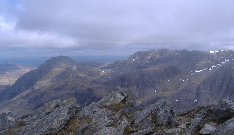
Both Tryfan and Glyder Fâch have quite steep north ridges. In these two pictures they look quite dramatic. They would be quite at home in the Cuillins, and it looks as if they could be quite good scrambling.
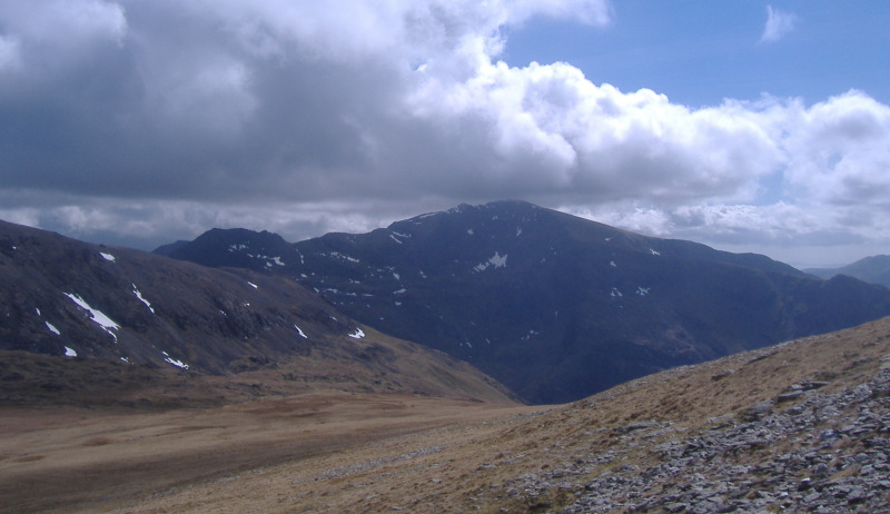
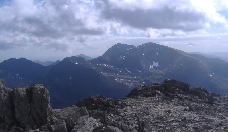
When I was halfway down to the coll between Y Garn and Glyder Fawr, Snowdon escaped from the cloud and showed itself, though still rather dark in deep shade.
Up to the summit of Glyder Fawr, and Carnedd Dafydd has also now escaped from the cloud.
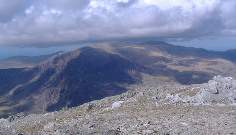
This is looking back to Y Garn and beyond.
Snowden is a bit clearer now.
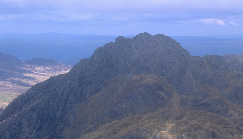
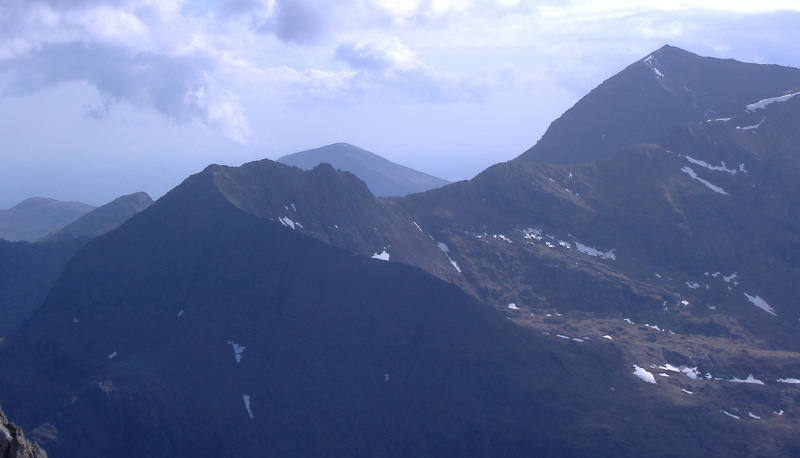
This is a close up of the fascinating looking ridge Crib Goch than runs up towards Garnedd Ugain, a subsidary peak of Snowdon.
It is on my "must do" list.
It was time to go back down, so I headed back down to the coll between Glyder Fawr and Y Garn, then descended down towards the Devil`s Kitchen.
Originally known as Twll Du, or the Black Hole, the Devil`s Kitchen is a deep gash in the side of the coll, however at this point I can`t remember whether the path comes down through the gash, or comes down somewhere off to the side.
Whichever way it goes, it is a very steep route down, and you are constantly climbing down over boulders. A simple trip would have serious consequences. It is hard work, and makes for very slow going.
The contour lines are rather close together on my map, but it looks like the coll is at 750 metres or so, and the lake is at about 400 metres or so, so the drop down is about 350 metres.
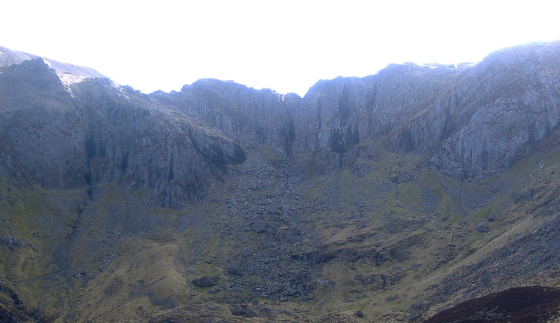
This is a picture of it taken from somewhere down nearer Llyn Idwal - the Devil`s Kitchen is the gash right in the centre of the picture above the line of boulders running down the lower slopes.
At least,I think that that is the case - some websites seem to refer to the whole line of cliffs as the Devil`s Kitchen.
That`s the trouble with the internet - loads of information, but you don`t know what is correct and what isn`t.
It is not the best of pictures, it was by now early evening, the Devil`s Kitchen was in deep shade, and the sky to the south west was quite bright, so rather over-exposed.
From Lyn Idwal back down to the car park was quite straight forward. An excellent day out, a good introduction to the mountains in Snowdonia, and my first two Firths in Wales.
website design by ron-t
website hosting by netnerd.com
© 2025 Ron Turner
![]()
![]()