Munros + Corbetts - 2010
Binnein an Fhidhleir - 12 February 2010
This is one of the corbetts in the Arrochar Alps - its over the Rest and Be Thankful, and on the right as you join Glen Kinglass, just after the bridge over the Kinglass Water. It forms a wall along the side of the lower glen.
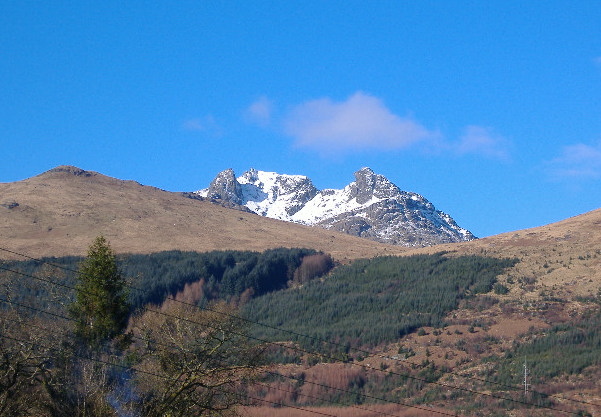
One of the joys of going to this area is "the view" - how could you ever tire of it, as you drive down into Arrochar -
Binnein an Fhidhleir is actually a rather discontinuous ridge, with two summits about 1.5 km`s apart.
The climb up from the roadside is, I`m afraid, just a long continuous slog, which is a bit too steep for comfort. I headed for the peak at the east end, as the OS map shows that as the highest peak, at 817 metres. Apart from the slog, it was quite pleasant, as the south facing slope was catching the full sun, and being south facing, all the snow was gone. Just below the summit I met the snow, but it didn`t cause too many problems.
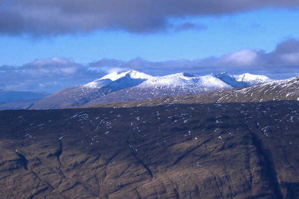
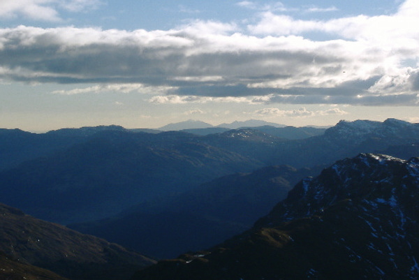
As it is right on the NE edge of the Arrochar Alps, it provides some good views, and the visibility was fairly good. Cruachan was looking quite splendid in the sunshine.
There was a good range of islands to be seen - round a bit from Cruachan was Mull -
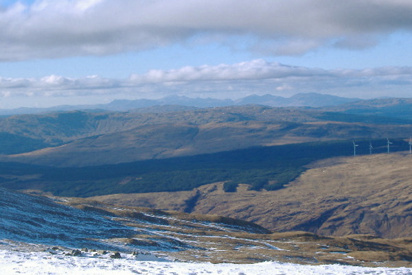
Further round was Jura, and probably a bit of Islay -
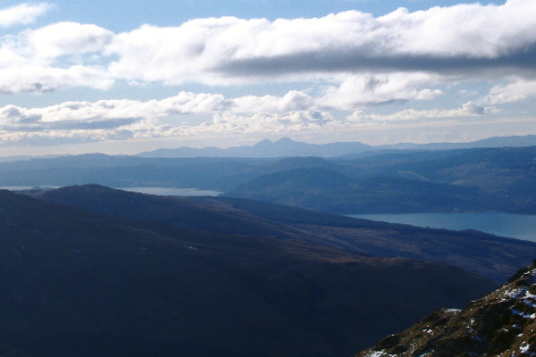
And right down to the south, I think we are seeing Arran in the distance.
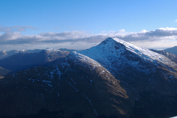
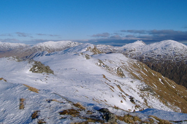
Round a bit more, and the Arrochar Alps come into view. Beinn an Lochain presents quite a formidable sight from there - and beyond it to the left is another corbett that still awaits me, Ben Donach.
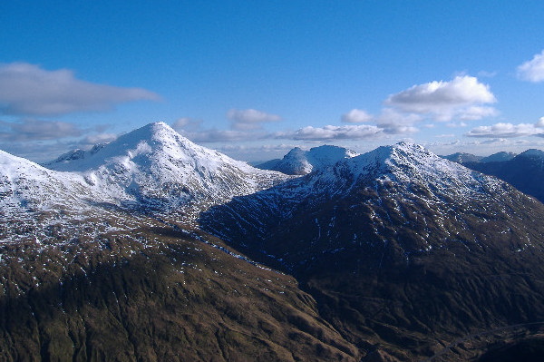
Across the A83, and Beinnn Ime dominates the skyline - with its neighbouring corbett Beinn Luibhean, to the right, in this picture. The interesting thing about this picture is the shape of the dip between Beinn Ime and Beinn Luibhean - when I was up on Beinn Luibhean a few weeks before, I looked down to the coll that was separating me from Beinn Ime, and it looked really steep and rocky - yet this photograph shows quite an easy slope between them. So I don`t quite understand that.
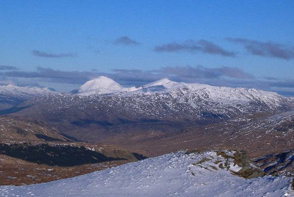
A way up to the north east, Ben More seems to be a very distinct lump, as seen from from Beinn an Fhidhleir. Stob Binnein and its long south ridge looks quite small compared to Ben More. If you have never done it, that south ridge up to Stob Binnein from Inverlochlarig is a great ridge walk - easily the best way to climb Stob Binnein.
Finally, here is the west summit of Binnein an Fhidhleir, looking across from the east summit. The west summit is quite a distinctive summit.
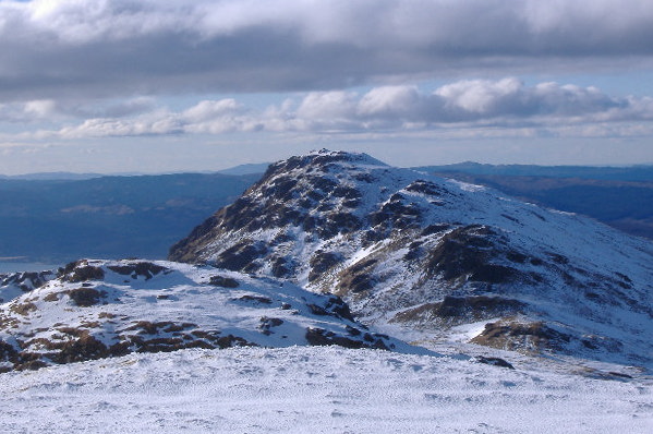
It barely counts as a ridge walk across to the west summit, it just undulates up and down. Looking back, the east peak may be the higher of the two, but it has no character compared to the west peak. I think that is Ben Vane in the background to the right.
The descent back down to the road is an even worse slog than the climb up - it is just too steep for comfort, and you are having to step carefully all the way down - no nice downhill walk. It`s not the most exciting of hills, and not the nicest climb or descent, but the views out to the islands certainly make it a bit more interesting.
website design by ron-t
website hosting by netnerd.com
© 2025 Ron Turner
![]()
![]()