Munros + Corbetts - 2009
08 November 2009 ........ Beinn Doarin + Beinn an Dothaidh
A weak ridge of high pressure brought a day of better weather - so I headed across towards Tyndrum. I had a couple of possibiities in mind - a corbett in Glencoe, or another corbett not far from Kinlochleven. In the end, by the time I got to Bridge of Orchy, Beinn Dorain was in sunshine, and further north looked grey and uninviting. So I headed off for Beinn Dorain and Beinn an Dothaidh.
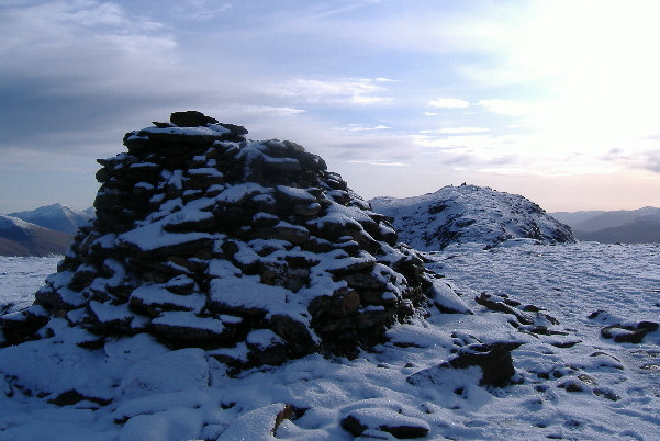
There is a good path up from Bridge of Orchy station, and you can cover ground quite fast. However I decided against following the path all the way up to the coll, headed off to the right, and climbed up the quite steep slope diagonally to the right winding my way around the craggy bits, to get up on to the ridge. It is then a straightforward trek up the ridge to the first summit. Be aware, if you are ever up Beinn Dorain in cloud, there are two quite distinct summits, and the false summit has the bigger cairn. Here is the cairn on the first summit, looking further south across to the second summit, which is the higher of the two.
After some food, time to head off - and here is what is to come - looking across from Ben Dorain to Beinn an Dothaidh, and further round to the right, Beinn Achaladaor. The intermediate top Meall Bhuidhe is just in view on the right, but Beinn a Chreachain didn`t make it into the picture.
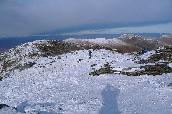
The shadow of me taking the picture is recorded for posterity. I`ve no idea who the other climber is - there were a lot of people wandering around on the summit. A bit further round and Beinn a Chreachain appears, along with the other munro in that area, Beinn Mhanach. I did this a while ago, by half cycling and half swimming up the track that criss-crosses the river Allt Kinglass about 8 or 10 times - it was a nightmare - don`t ever do it in wet weather.
As I headed down towards the coll, I got below the snow line, but the last few hundred metres before the coll are quite steep and were quite icy, so it made for somewhat slow going. Once down on the coll. and the start of the climb up to Beinn an Dothaidh was quite dry. However this didn`t last, and quite soon it turned into a major bog climbing experience. The route from the coll up to Beinn Dorain is a good path, and easy going. The route from the coll up to Beinn an Dothaidh is quite the opposite - it`s minging. After a while I headed off to the left to see if I could find a better way - which eventually I did - I headed straight up onto the ridge, and found another path which was a bit better.
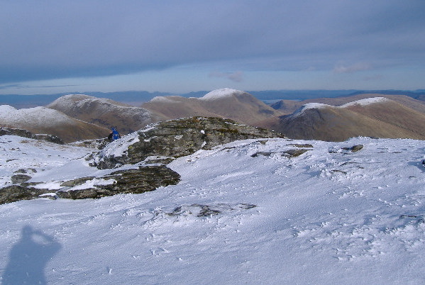
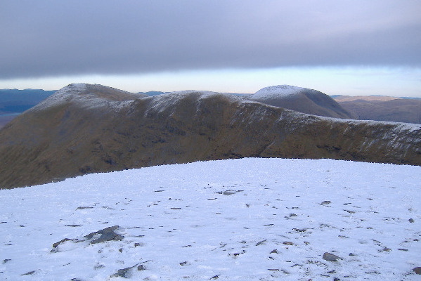
Beinn an Dothaidh would be even more confusing that Beinn Dorain in cloud - it`s got four summits. It is really a ridge, with quite a steep north side. This photograph was taken from the most south-easterly summit, looking north-west at the other three summits. The highest summit is the nearest one, but according to the OS map, there is only 2 metres of a difference.
Looking north-east from Beinn an Dothaidh you get a good view of the long south ridge of Beinn Achaladaor - it would be a very nice ridge walk, but the only way to get to it would be either from the coll below Beinn an Dothaidh, or from that same infamous track that keeps crossing the Allt Kinglass.
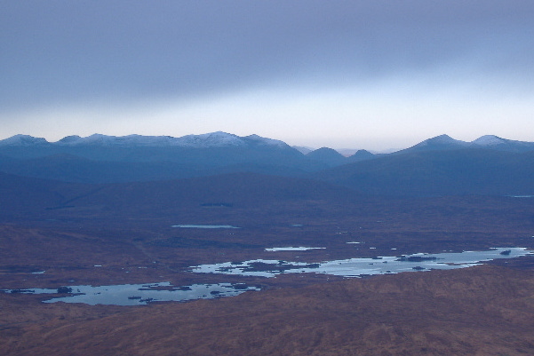
Looking north from Beinn an Dothaidh you get a good view across Rannoch Moor to the Grey Corries, Stob Ban, the corbett Sgurr Innse, and the twin munros of Stob Coire Easain and Stob a Choire Mheadoin.
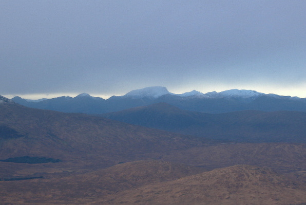
A bit further round to the left, you got a clear view of the huge bulk of Ben Nevis dominating the skyline, with the big lump of grey clag that hung over Lochaber all day, and beyond it, clear sky and sunshine. Creag Meagaidh was in sunshine, and so were the peaks round to the west.
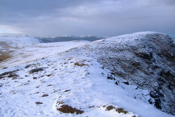
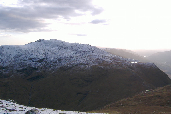
Lastly, Beinn Dorain isn`t the most photogenic of mountains when viewed from Beinn an Dothaidh, but here it is anyway. The coll between Beinn Dorain and Beinn an Dothaidh is hidden down on the right side of the picture.
I didn`t fancy the trek back down through the bog back down to the coll, so I headed west from Beinn an Dothaidh, and ended up going down a very long steep slope that was half scree and half overgrown scree - so it was quite hard and slow going. Then I traversed round to the left, and joined onto the track about half way up. Perhaps not the best way down, but it was a bit drier than the bog. Looking from the bottom, there was perhaps a slightly better way, by zig-zagging round the various crags, then coming down the long slope just above the river. However I don`t think there would have been much in it.
A very pleasant day, with just enough daylight - it was more than half dark by the time I got down to the station. The daylight disappears very fast now - up on Beinn an Dothaidh it was mid afternoon, by the time I got down it was almost dark. Only another 6 weeks, and the days will start getting longer again.
website design by ron-t
website hosting by netnerd.com
© 2025 Ron Turner
![]()
![]()