Munros + Corbetts - 2009
17 October 2009 ......... Stob a Choire Mheadhoin + Stob Coire Easain
These two munros lie just across Loch Treig from my last two munros, and they are looking just across to the Grey Corries. They can be accessed from either side - last time I did them, I cycled down from Corriechoille, just along from Spean Bridge. So this time I did them from the Fersit side - I reckoned it would be a good idea to cycle down to the end of the track at NN 343 760, then climb up the flank of Meall Cian Dearg onto the ridge, then head up the top of the ridge.
Well it seemed like a good idea at the time - it turned out that it wasn`t - I ended up climbing up some very steep slopes that were a mixture of rock slabs and grass and heather - it got steeper and steeper the higher I climbed, and got more and more unpleasant. But I was committed - there was no way I could have gone back down, so I just had to keep going. Eventually I got above it and onto the ridge, but I think it was probably one of the worst climbs I have ever done. Give me the Cuillins any day - they are a breeze compared to that climb.
However the walk up the ridge was much nicer, you can see the top, and you just head upwards and onwards to the top.
Except it wasn`t the top - it was a false summit - the real top is another half kilometre away and another few hundred feet or so higher.
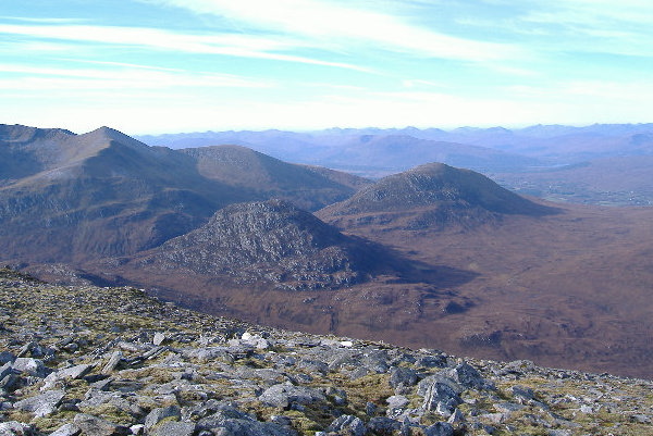
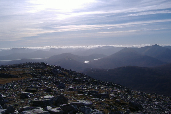
However once you are there, the whole world opens up before you, with great views in every direction. One of them was of the two corbetts Sgur Innse and Cruach Innse which are down below you, between Stob a Choire Mheadhoin and the Grey Corries. These two corbetts have proved to be quite elusive to get a decent picture of - so I finally got them.
Sitting on top of Stob a Choire Mheadhoin was very pleasant - I sat for quite a time in just a pair of shorts. However it was soon time to move on to Stob Coire Easain - heading down towards the coll you certainly get a good view of the steep north eastern side of Stob Coire Easain - it`s quite impressive.
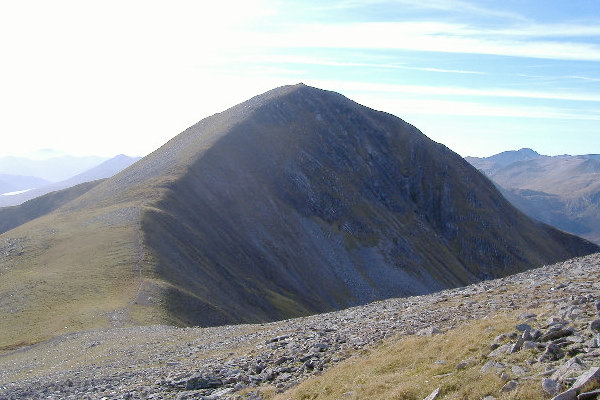
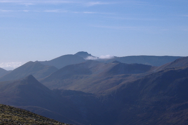
Its quite a stiff climb up, but there is a well defined path which winds its way up - it`s a constant gradient all the way, and suddenly you`re at the cairn. More great views. Looking across to the Grey Corries, with Ben Nevis dominating the skyline at the back -
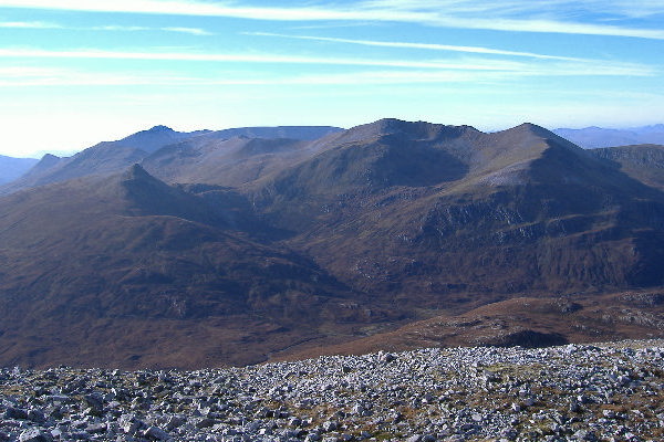
It looks like there is a good circular climb up from the bothy in Lairig Leacach at NN 283 737 - up Stob Ban, across and up to Stob Choire Claurigh, then round to Stob Coire na Ceannain, and back down the ridge to the east, curve down to the south, then down the valley back to the bothy. You can`t see it in the photograph, but the bothy is down in that low bit just right of centre. Last time I did the Grey Corries, I did the 4 munros in one go, and it was just too far, I was really struggling by the end. So I`m going to split them up this time - however the clocks change this weekend, so the longer trips are over for this year. Very sad !
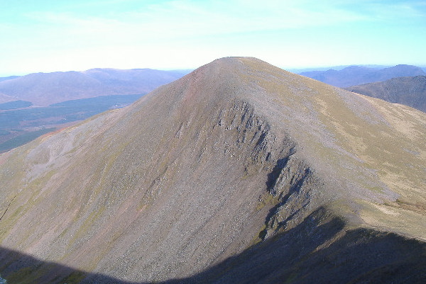
Looking back to Stob a Choire Mheadhoin, and you see that Stob a Choire Mheadhoin has got quite a spectacular west side - you just don`t see it at all when you are coming down to the coll from its summit.
Before leaving Stob Coire Easain, down to the south there was a bank of cloud which never shifted all day - and it produced the same kind of odd lighting that I had had a couple of weeks before -
Some of the peaks in the Glencoe area had cloud on them all day, and it wasn`t always the highest peaks - it was a bit strange.
By the time I got back to the summit of Stob a Choire Mheadhoin, there was a really cold wind, and there were odd patches of cloud forming in odd places - the Grey Corries had a miniature hat on them - or is it Carn Mor Dearg that has the hat ?
Further to the north and west, banks of cloud were forming around 2500 feet, so you couldn`t see the middle of the mountains, but the tops were clear.
And so back down. I wasn`t going back the same way I came up, it was far too steep, so the plan was to stay on the ridge for much longer, then walk back up the track to get my bike. It all went according to plan until - the ridge came to an abrupt end. It just ended in almost a precipice, and I stared down it in amazement. What now ?
However there is a path down all the way - it`s not for the faint hearted, its pretty steep, but it winds it way down. Looking at the map, it looks as if the drop is about 250-300 metres. It is certainly a big drop, and it takes a long time to get down, but it was safer that the way I came up.
Eventually I got down to more level ground, and was looking down on the place where my bike was - and it looked fairly straightforward. However the challenges weren`t over yet - I kept on meeting more precipices - not big ones, but they stretched for quite a long way round the side of the hill, so I spent a lot of time traversing round the side of the hill looking for ways to get down them.
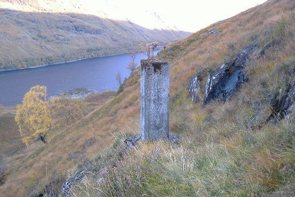
After a while I came across a concrete pillar sitting on a rock, with a metal plate on top. I`ve no idea why it was built - was it some sort of survey point for building the dam at the end of Loch Treig ? I noticed that there was another one further up the hill, and quite a bit further round.
Eventually I got back to my bike, and headed off. It was a good day, but it didn`t half throw some unexpected challenges at me. I think they are supposed to be character building !
website design by ron-t
website hosting by netnerd.com
© 2025 Ron Turner
![]()
![]()