Munros + Corbetts - 2009
10 September 2009 ......... Gairich
The plan was to go up to Loch Quoich with my sea kayak, paddle across Loch Quoich, and do the two munros and the corbett on the south side of the loch - two trips on two consecutive days.
The weather forecast was for a high pressure area to bring some good weather for a change, but the north west was maybe not going to get the best of the weather.
When I got up to the dam, I looked across to Gairich, and wondered whether to head along the loch, and canoe across as planned, or else to walk up from the dam. The walk up the ridge to Bac nam Foid looked a promising route, and the map showed a path all the way across to the ridge. So that is what I set off to do.
However it was a big mistake - the ground was so saturated with water, that within 200 metres of leaving the dam, my boots were absolutely sodden. I wondered whether to abort the trip, and go back, but by then I was sort of committed, I really wouldn`t have had enough time to go back, and do it by boat. So I had to carry on.
That was my second mistake - it didn`t get any better, the path was so wet it was impossible to walk on it. I tried walking along the beach, but it wasn`t much better. The beach is nothing but a layer of stones on top of bog, so it was unpleasant as well.
By then I`d completely lost the path, so I just hacked through the bog, and eventually climbed up the flank of the ridge.
Far from being a nice ridge walk, the ridge is just more bog, so not much improvement there either.
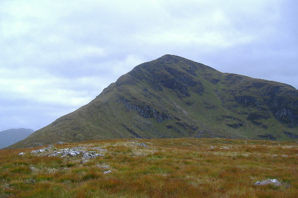
Eventually I squelched my way up to Bac nam Foid, and from there, the summit of Gairich is quite impressive -
I set off for it, and as I started to climb up, it started to rain. So much for the weather forecast that said there was no chance of rain !
It is quite a steep climb, and there is a path which zig-zags its way upwards, so it`s just climb, climb, climb.
However there is one bit of joy - the path goes up a rock wall about 3 metres high - so just briefly you get a nice scramble.
Eventually I got to the top - by which time the cloud had descended, so I saw nothing but grey.
And so back down again. This time I followed the path all the way down to the dam. In places it wasn`t too bad, in places it was awash.
I find it odd that the estate seems to do nothing to maintain the path - in several places where there is just saturated quagmire, just a few strokes with a spade would allow the water to drain off. In places the path is now over 4 or 5 metres wide, where people are trying to avoid the water. Paths like this are part of the infrastructure of the estate, and yet they are letting them get into a state where they are unusable. Strange !
Do estate workers spend their time sitting in cats now ?
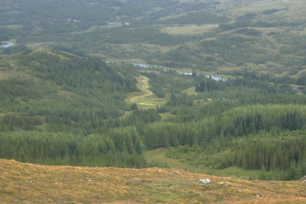
After all that, I can say that walking up from the dam is the worst possible way to get to Gairich, it is nothing but bog. One alternative route would be to cycle up through the wood towards the end of the track, say about NN 056 985, and walk up through the trees on to the ridge. The map shows the wood as continuous, but it isn`t - this picture is looking down from the ridge through the wood to nearly the end of the track - and you can clearly see all the breaks in the trees.
Of course, the best way to get to Gairich is by boat. And if you haven`t got a boat, swim across the loch, it`s drier than walking up from the dam.
By the end of the day, I was wishing I had stayed at home and played with my computers, it would have been more fun.
website design by ron-t
website hosting by netnerd.com
© 2025 Ron Turner
![]()
![]()